|
Tiled Web Map
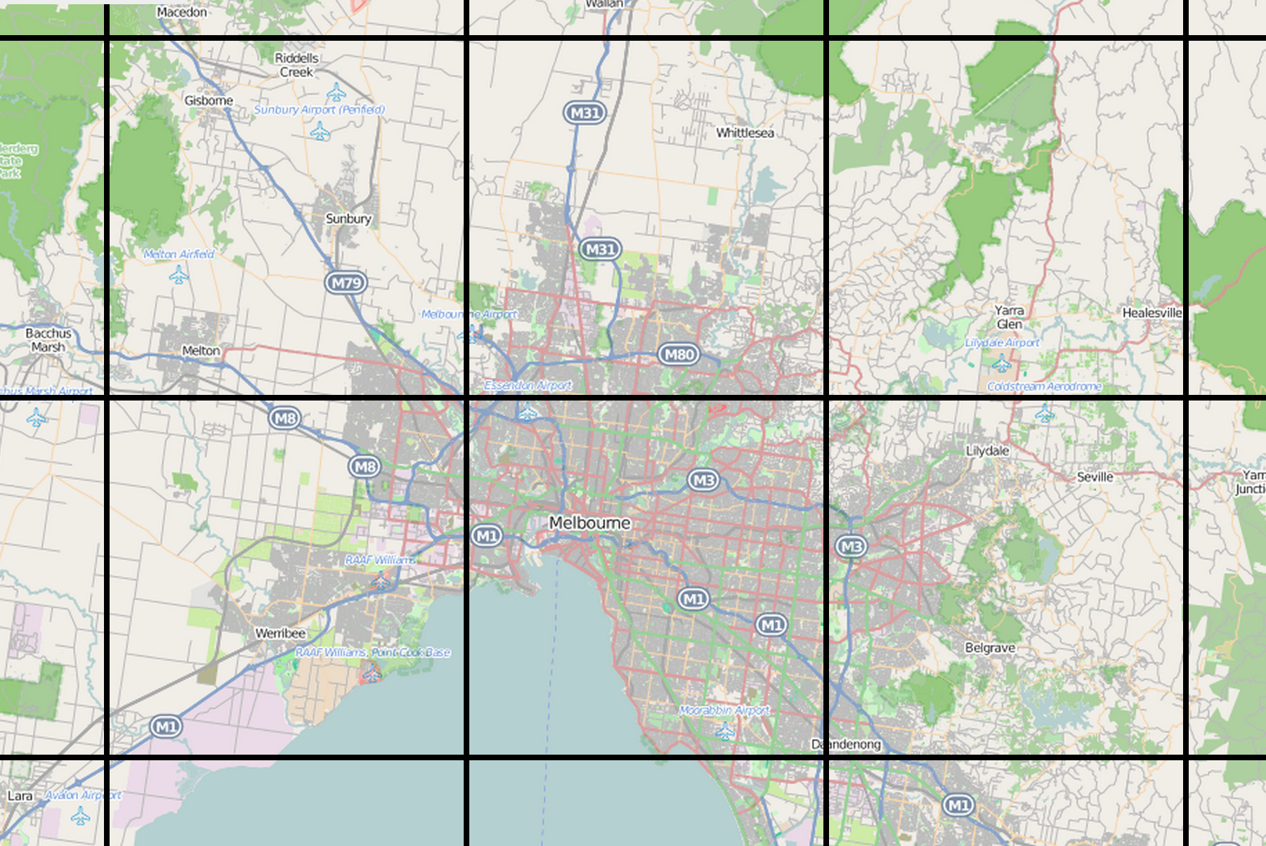
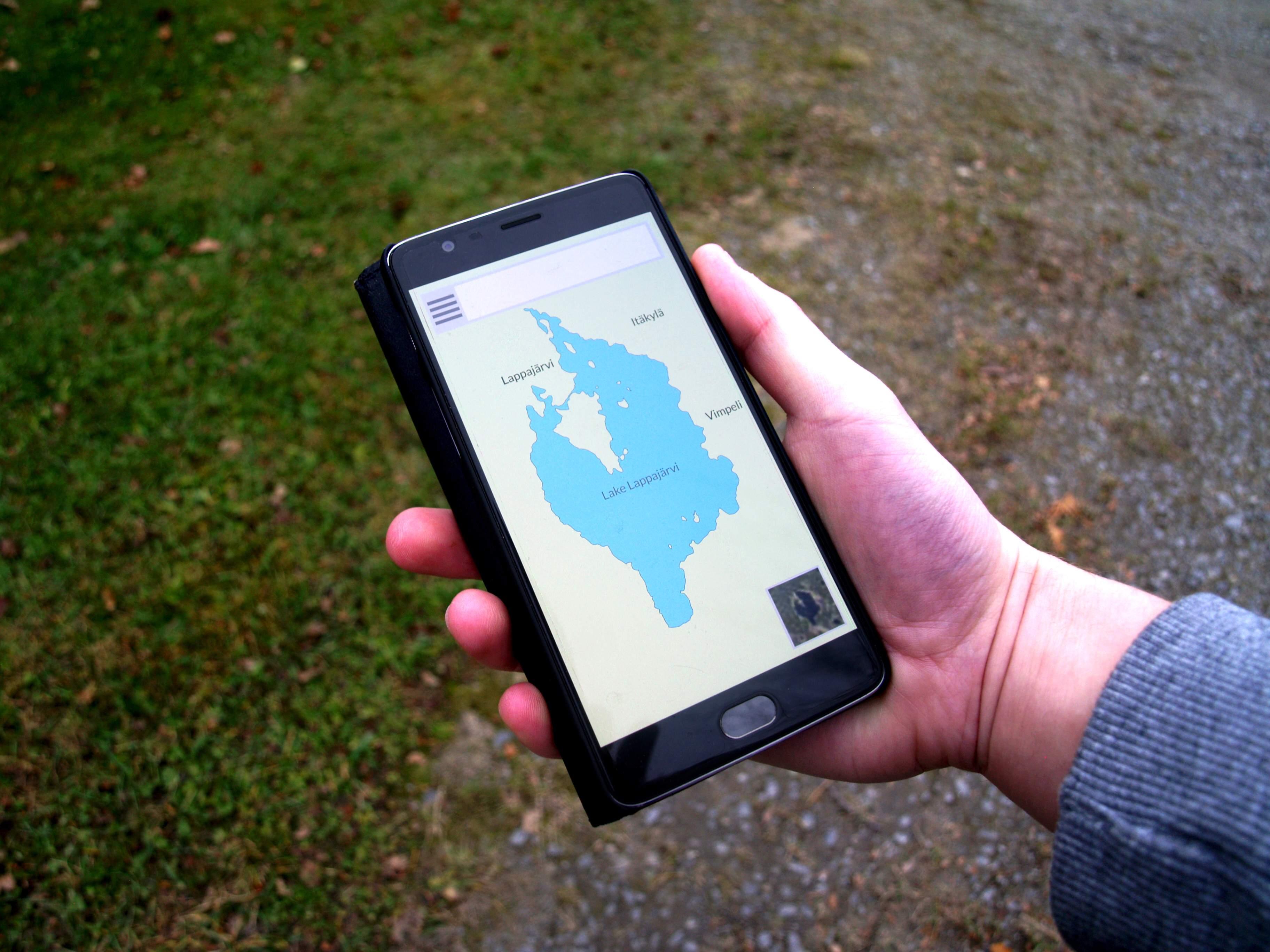
A tiled web map, slippy map (in OpenStreetMap terminology) or tile map is a map displayed in a web browser by seamlessly joining dozens of individually requested image or vector data files. It is the most popular way to display and navigate maps, replacing other methods such as Web Map Service (WMS) which typically display a single large image, with arrow buttons to navigate to nearby areas. Google Maps was one of the first major mapping sites to use this technique. The first tiled web maps used Raster graphics, raster tiles, before the emergence of vector tiles. There are several advantages to tiled maps. Each time the user pans, most of the tiles are still relevant, and can be kept displayed, while new tiles are fetched. This greatly improves the user experience, compared to fetching a single map image for the whole viewport. It also allows individual tiles to be pre-computed, a task easy to parallelize. Also, displaying rendered images served from a web server is less computatio ... [...More Info...] [...Related Items...] OR: [Wikipedia] [Google] [Baidu] |
Tile Map Service
Tile Map Service or TMS, is a specification for tiled web maps, developed by the Open Source Geospatial Foundation. The definition generally requires a URI structure which attempts to fulfill REST principles. The TMS protocol fills a gap between the very simple standard used by OpenStreetMap and the complexity of the Web Map Service standard, providing simple urls to tiles while also supporting alternate spatial referencing system. Support TMS is most widely supported by web mapping clients and servers; although there is some desktop support, the Web Map Service protocol is more widespread for enterprise mapping applications. The OpenLayers JavaScript library supports TMS natively, while the Google Maps API allows URL templating, which makes support possible for developers. TileCache is one of the most popular supporting servers, while other servers like mod tile and TileLite focus on the de facto OpenStreetMap standard. WMTS TMS served as the basis for the OpenGIS Web Map T ... [...More Info...] [...Related Items...] OR: [Wikipedia] [Google] [Baidu] |
Google Maps API
Google Maps is a web mapping platform and consumer application offered by Google. It offers satellite imagery, aerial photography, street maps, 360° interactive panoramic views of streets ( Street View), real-time traffic conditions, and route planning for traveling by foot, car, bike, air (in beta) and public transportation. , Google Maps was being used by over 1 billion people every month around the world. Google Maps began as a C++ desktop program developed by brothers Lars and Jens Rasmussen at Where 2 Technologies. In October 2004, the company was acquired by Google, which converted it into a web application. After additional acquisitions of a geospatial data visualization company and a real-time traffic analyzer, Google Maps was launched in February 2005. The service's front end utilizes JavaScript, XML, and Ajax. Google Maps offers an API that allows maps to be embedded on third-party websites, and offers a locator for businesses and other organizations in numerous ... [...More Info...] [...Related Items...] OR: [Wikipedia] [Google] [Baidu] |
Web Mapping
Web mapping or an online mapping is the process of using maps, usually created through geographic information systems (GIS), on the Internet, more specifically in the World Wide Web (WWW). A web map or an online map is both served and consumed, thus web mapping is more than just web cartography, it is a service by which consumers may choose what the map will show. Web GIS emphasizes geodata processing aspects more involved with design aspects such as data acquisition and server software architecture such as data storage and algorithms, than it does the end-user reports themselves. The terms ''web GIS'' and ''web mapping ''remain somewhat synonymous. Web GIS uses web maps, and end users who are ''web mapping'' are gaining analytical capabilities. The term ''location-based services'' refers to ''web mapping'' consumer goods and services. Web mapping usually involves a web browser or other user agent capable of client-server interactions. Questions of quality, usability, social ben ... [...More Info...] [...Related Items...] OR: [Wikipedia] [Google] [Baidu] |
Mapbox
Mapbox is an American provider of custom online maps for websites and applications such as Foursquare, Lonely Planet, the ''Financial Times'', The Weather Channel, Instacart Inc. and Snapchat. Since 2010, it has rapidly expanded the niche of custom maps, as a response to the limited choice offered by map providers such as Google Maps. Mapbox is the creator of, or a significant contributor to, some open source mapping libraries and applications, including the Mapbox GL-JS JavaScript library (open source before version 2), the TileMill cartography IDE, the Leaflet JavaScript library, and the CartoCSS map styling language and parser. As of October 2020, Mapbox had a valuation of $1 billion. History The startup was created as a part of Development Seed in order to offer map customization for non-profit customers, in 2010. It was bootstrapped until a 2013 $10 million Series A funding round by Foundry Group. In June 2015, Mapbox announced it had raised $52.55 million in a Series ... [...More Info...] [...Related Items...] OR: [Wikipedia] [Google] [Baidu] |
JSON
JSON (JavaScript Object Notation, pronounced ; also ) is an open standard file format and data interchange format that uses human-readable text to store and transmit data objects consisting of attribute–value pairs and arrays (or other serializable values). It is a common data format with diverse uses in electronic data interchange, including that of web applications with servers. JSON is a language-independent data format. It was derived from JavaScript, but many modern programming languages include code to generate and parse JSON-format data. JSON filenames use the extension .json. Any valid JSON file is a valid JavaScript (.js) file, even though it makes no changes to a web page on its own. Douglas Crockford originally specified the JSON format in the early 2000s. He and Chip Morningstar sent the first JSON message in April 2001. Naming and pronunciation The 2017 international standard (ECMA-404 and ISO/IEC 21778:2017) specifies "Pronounced , as in 'Jason and The ... [...More Info...] [...Related Items...] OR: [Wikipedia] [Google] [Baidu] |
Open Geospatial Consortium
The Open Geospatial Consortium (OGC), an international voluntary consensus standards organization for geospatial content and location-based services, sensor web and Internet of Things, GIS data processing and data sharing. It originated in 1994 and involves more than 500 commercial, governmental, nonprofit and research organizations in a consensus process encouraging development and implementation of open standards. History A predecessor organization, OGF, the Open GRASS Foundation, started in 1992. From 1994 to 2004 the organization also used the name Open GIS Consortium. The OGC website gives a detailed history of the OGC. Standards Most of the OGC standards depend on a generalized architecture captured in a set of documents collectively called the ''Abstract Specification'', which describes a basic data model for representing geographic features. Atop the Abstract Specification members have developed and continue to develop a growing number of specifications, or ''stand ... [...More Info...] [...Related Items...] OR: [Wikipedia] [Google] [Baidu] |
Web Map Tile Service
A Web Map Tile Service (WMTS) is a standard protocol for serving pre-rendered or run-time computed georeferenced map tiles over the Internet. The specification was developed and first published by the Open Geospatial Consortium in 2010. History The Open Geospatial Consortium (OGC) became involved in developing standards for web mapping after a paper was published in 1997 by Allan Doyle, outlining a "WWW Mapping Framework". The oldest and most popular standard for web mapping is WMS. However, the properties of this standard proved to be difficult to implement for situations where short response times were important. For most WMS services it is not uncommon to require 1 or more CPU seconds to produce a response. For massive parallel use cases, such a CPU-intensive service is not practical. To overcome the CPU intensive on-the-fly rendering problem, application developers started using pre-rendered map tiles. Several open and proprietary schemes were invented to organize and address ... [...More Info...] [...Related Items...] OR: [Wikipedia] [Google] [Baidu] |
OpenLayers
OpenLayers is an open-source (provided under the 2-clause BSD License) JavaScript library for displaying map data in web browsers as slippy maps. It provides an API for building rich web-based geographic applications similar to Google Maps and Bing Maps. Features OpenLayers supports GeoRSS, KML (Keyhole Markup Language), Geography Markup Language (GML), GeoJSON and map data from any source using OGC-standards as Web Map Service (WMS) or Web Feature Service (WFS). History The library was originally based on the Prototype JavaScript Framework. OpenLayers was created by MetaCarta after the O'Reilly Where 2.0 conference of June 29–30, 2005, and released as open source software before the Where 2.0 conference of June 13–14, 2006, bMetaCarta Labs Two other open-source mapping tools released by MetaCarta are FeatureServer and TileCache. Since November 2007, OpenLayers has been an Open Source Geospatial Foundation The Open Source Geospatial Foundation (OSGeo), is a non-pro ... [...More Info...] [...Related Items...] OR: [Wikipedia] [Google] [Baidu] |
Quadtree
A quadtree is a tree data structure in which each internal node has exactly four children. Quadtrees are the two-dimensional analog of octrees and are most often used to partition a two-dimensional space by recursively subdividing it into four quadrants or regions. The data associated with a leaf cell varies by application, but the leaf cell represents a "unit of interesting spatial information". The subdivided regions may be square or rectangular, or may have arbitrary shapes. This data structure was named a quadtree by Raphael Finkel and J.L. Bentley in 1974. A similar partitioning is also known as a ''Q-tree''. All forms of quadtrees share some common features: * They decompose space into adaptable cells * Each cell (or bucket) has a maximum capacity. When maximum capacity is reached, the bucket splits * The tree directory follows the spatial decomposition of the quadtree. A tree-pyramid (T-pyramid) is a "complete" tree; every node of the T-pyramid has four child nodes excep ... [...More Info...] [...Related Items...] OR: [Wikipedia] [Google] [Baidu] |
OpenStreetMap
OpenStreetMap (OSM) is a free, open geographic database updated and maintained by a community of volunteers via open collaboration. Contributors collect data from surveys, trace from aerial imagery and also import from other freely licensed geodata sources. OpenStreetMap is freely licensed under the Open Database License and as a result commonly used to make electronic maps, inform turn-by-turn navigation, assist in humanitarian aid and data visualisation. OpenStreetMap uses its own topology to store geographical features which can then be exported into other GIS file formats. The OpenStreetMap website itself is an online map, geodata search engine and editor. In 2004, OpenStreetMap was created by Steve Coast in response to the Ordnance Survey, the United Kingdom's national mapping agency, failing to release its data to the public and under free licences. Initially, maps were created only via GPS traces, but it was quickly populated by importing public domain geographical ... [...More Info...] [...Related Items...] OR: [Wikipedia] [Google] [Baidu] |


