|
River Geirionydd
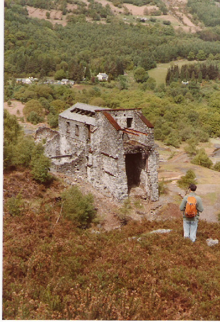
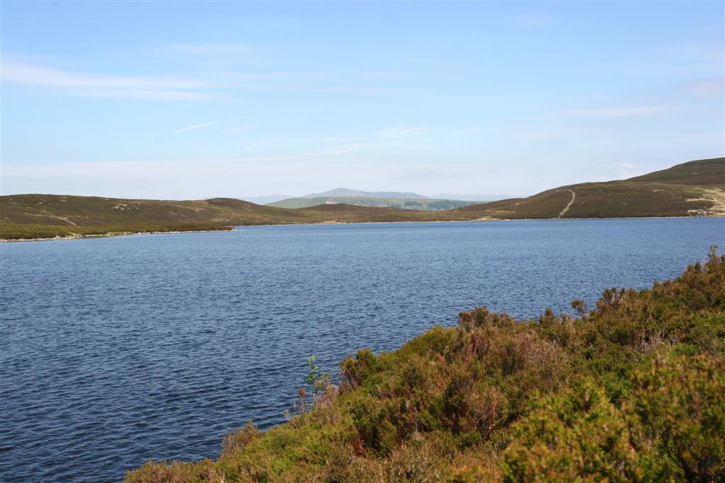
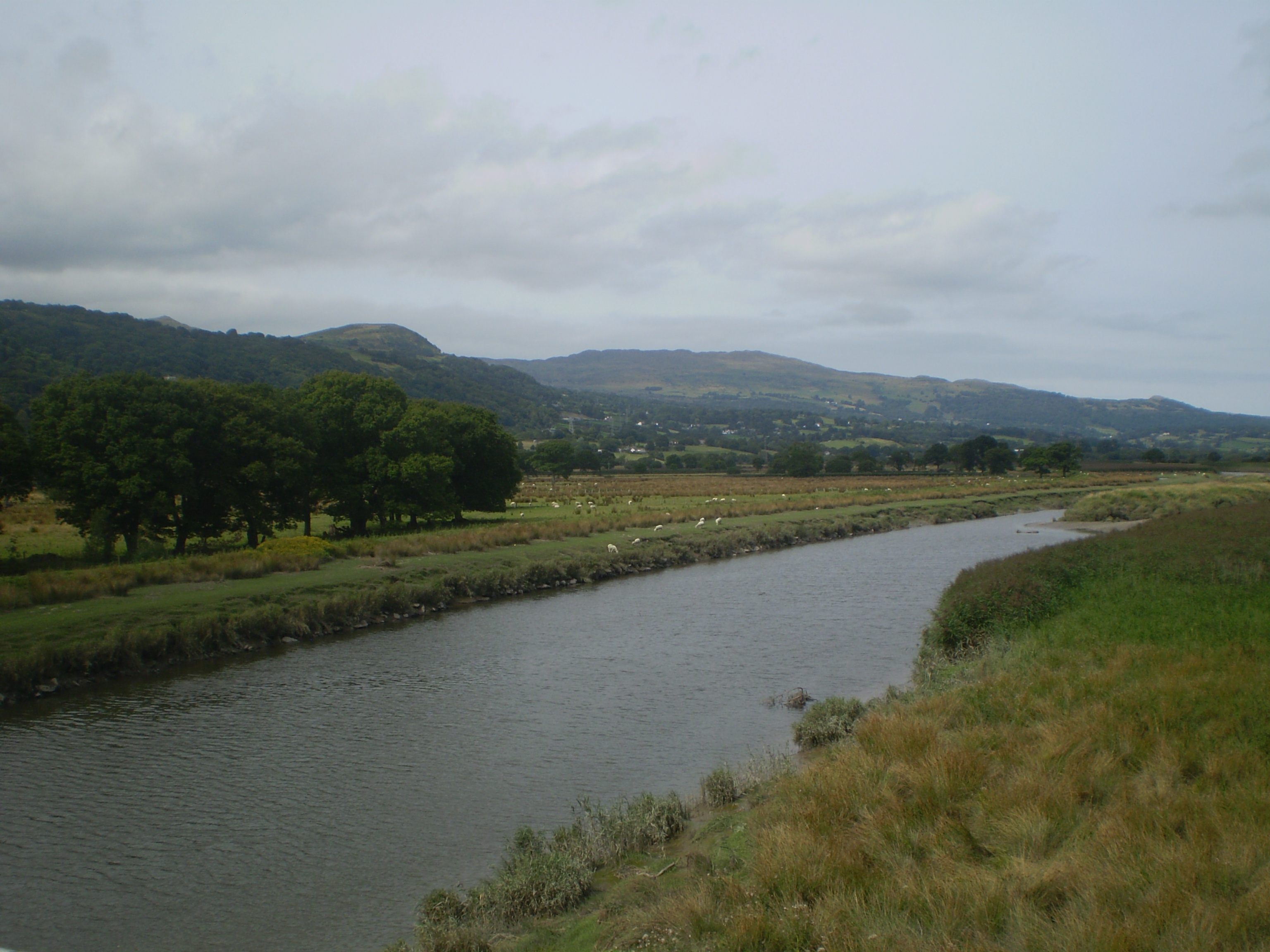
The River Geirionydd (''Afon Geirionydd'' in Welsh) is a river in Snowdonia, North Wales. It is a tributary of the River Crafnant (''Afon Crafnant''), which flows over the Fairy Falls waterfall in Trefriw, and thence on into the River Conwy (''Afon Conwy''), which is the main river of the Conwy valley. It flows from Llyn Geirionydd down a steep gorge before joining the river Crafnant. It is less than a mile in length. The river passes the former Klondyke mill Klondyke Mill was an ore processing mill on the edge of the Gwydir Forest, near Trefriw, north Wales. Constructed in 1900, the mill was built to receive lead ore (and some zinc ore) from Pandora mine, some 2 miles away – with which its hist ..., which used its waters. Klondyke was a mining and milling complex connected with some of the metal mines of the Gwydir Forest by means of an old tramway which ran alongside Llyn Geirionydd. From above the mill wagons used to enter the building via an aerial ropeway. ... [...More Info...] [...Related Items...] OR: [Wikipedia] [Google] [Baidu] |
Wales
Wales ( cy, Cymru ) is a Countries of the United Kingdom, country that is part of the United Kingdom. It is bordered by England to the Wales–England border, east, the Irish Sea to the north and west, the Celtic Sea to the south west and the Bristol Channel to the south. It had a population in 2021 of 3,107,500 and has a total area of . Wales has over of coastline and is largely mountainous with its higher peaks in the north and central areas, including Snowdon (), its highest summit. The country lies within the Temperateness, north temperate zone and has a changeable, maritime climate. The capital and largest city is Cardiff. Welsh national identity emerged among the Celtic Britons after the Roman withdrawal from Britain in the 5th century, and Wales was formed as a Kingdom of Wales, kingdom under Gruffydd ap Llywelyn in 1055. Wales is regarded as one of the Celtic nations. The Conquest of Wales by Edward I, conquest of Wales by Edward I of England was completed by 1283, th ... [...More Info...] [...Related Items...] OR: [Wikipedia] [Google] [Baidu] |
Gorge
A canyon (from ; archaic British English spelling: ''cañon''), or gorge, is a deep cleft between escarpments or cliffs resulting from weathering and the erosion, erosive activity of a river over geologic time scales. Rivers have a natural tendency to cut through underlying surfaces, eventually wearing away rock layers as sediments are removed downstream. A river bed will gradually reach a baseline elevation, which is the same elevation as the body of water into which the river drains. The processes of weathering and erosion will form canyons when the river's River source, headwaters and estuary are at significantly different elevations, particularly through regions where softer rock layers are intermingled with harder layers more resistant to weathering. A canyon may also refer to a rift between two mountain peaks, such as those in ranges including the Rocky Mountains, the Alps, the Himalayas or the Andes. Usually, a river or stream carves out such splits between mountains. Examp ... [...More Info...] [...Related Items...] OR: [Wikipedia] [Google] [Baidu] |
Klondyke Lead Mine Ruins - Geograph
Klondyke may refer to: Places * Klondyke, Ontario, Canada *The Klondyke, a causeway connecting Coley's Point and Bay Roberts, Newfoundland and Labrador, Canada *the former name for Hazelridge, Manitoba, Canada *an area south of Vang, Bornholm, Denmark *Klondyke Pit, the colloquial name for the former Newcraighall Colliery in Edinburgh, Scotland *Klondyke mill and mine, near Trefriw in north Wales United States * Klondyke, Arizona ** Klondyke School District * Klondyke, Indiana *Klondyke, Parke County, Indiana * Klondyke, Louisiana, the north end of Louisiana Highway 55 *Klondyke, Minnesota *a neighbourhood of Asheville, North Carolina *the former spelling for Klondike, Dawson County, Texas People * Klondyke Kate (born c. 1962), English professional wrestler * Klondyke Raaff (1879–1949), South African international rugby union player *a ring name for Sirelda, a Canadian professional wrestler Other uses *a nickname used for GNR Class C1 (small boiler), a class of steam locomoti ... [...More Info...] [...Related Items...] OR: [Wikipedia] [Google] [Baidu] |
Evan Evans (Ieuan Glan Geirionydd)
Evan Evans (20 April 1795 – 21 January 1855), was a Welsh clergyman, poet, hymnwriter, journalist, translator and devotional writer, who was three times chaired at the National Eisteddfod. His works were almost all written in the Welsh language, the poems being published under his bardic name, Ieuan Glan Geirionydd. Seven of his poems are included in ''The Oxford Book of Welsh Verse''. His best-known poems are perhaps ''Ysgoldy Rhad Llanrwst'', ''Glan Geirionydd'' and ''Cyflafan Morfa Rhuddlan'', and his hymns include ''Rwy'n sefyll ar dymhestlog lan'' and ''Mae 'nghyfeillion adre'n myned''. Youth Evan Evans was born at Tan-y-Celyn, a farmhouse near the village of Trefriw, Caernarfonshire. His parents were educated people, and indeed his father was a poet; they were among the first Calvinist Methodists in their village. Young Evan received his education at the village church school, then at the free grammar school in Llanrwst. He then began working on his parents' ... [...More Info...] [...Related Items...] OR: [Wikipedia] [Google] [Baidu] |
Aerial Ropeway
A material ropeway, ropeway conveyor (or aerial tramway in the US) is a subtype of gondola lift, from which containers for goods rather than passenger cars are suspended. Description Material ropeways are typically found around large mining concerns, and can be of considerable length. The COMILOG Cableway, which ran from Moanda in Gabon to Mbinda in the Republic of the Congo, was over in length. The Norsjö aerial tramway in Sweden had a length of . Conveyors can be powered by a wide variety of forms of energy, such as electricity, engines, or gravity (particularly in mountainous mining concerns, or where running water is available). Gravity-driven conveyors may qualify as zip-lines, as no electricity is used to operate them, instead relying on the weight of carts going down providing propulsion for empty carts going up. Double-rope (bi-cable) ropeways, have a carrying rope that supports the buckets and a separate hauling rope that controls their movement. Single-rope (mono ... [...More Info...] [...Related Items...] OR: [Wikipedia] [Google] [Baidu] |
Waggonway
Wagonways (also spelt Waggonways), also known as horse-drawn railways and horse-drawn railroad consisted of the horses, equipment and tracks used for hauling wagons, which preceded steam-powered railways. The terms plateway, tramway, dramway, were used. The advantage of wagonways was that far bigger loads could be transported with the same power. Ancient systems The earliest evidence is of the 6 to 8.5 km long ''Diolkos'' paved trackway, which transported boats across the Isthmus of Corinth in Greece from around 600 BC. Wheeled vehicles pulled by men and animals ran in grooves in limestone, which provided the track element, preventing the wagons from leaving the intended route. The Diolkos was in use for over 650 years, until at least the 1st century AD. Paved trackways were later built in Roman Egypt. Wooden rails Such an operation was illustrated in Germany in 1556 by Georgius Agricola (image right) in his work De re metallica. This line used "Hund" carts wit ... [...More Info...] [...Related Items...] OR: [Wikipedia] [Google] [Baidu] |
Gwydir Forest
Gwydir Forest, also spelled Gwydyr, is located in Conwy county borough and the Snowdonia National Park in Wales. It takes its name from the ancient Gwydir Estate, established by the Sir John Wynn, 1st Baronet, John Wynn family of Gwydir Castle, which owned this area. Natural Resources Wales uses the alternative spelling (i.e. Gwydyr Forest, Coedwig Gwydyr). Certainly as early as 1536, Leland wrote: "Gwydir lieth two bowshots above the River Conwy. It is a pretty place." Geography of the forest The forest broadly encircles the village of Betws-y-Coed, and much of its midsection lies within the parish. It reaches northwards to the village of Trefriw, and southwards to the village of Penmachno. It covers an area of over , including of productive woodland. Certainly there would have been a certain amount of natural tree growth on these hills thousands of years ago. More recently, records from the 18th century refer to the rafting of timber down the River Conwy. In the 19 ... [...More Info...] [...Related Items...] OR: [Wikipedia] [Google] [Baidu] |
Metal Mining In Wales
Mining in Wales provided a significant source of income to the economy of Wales throughout the nineteenth century and early twentieth century. It was key to the Industrial Revolution. Wales was famous for its coal mining, in the Rhondda Valley, the South Wales Valleys and throughout the South Wales coalfield and by 1913 Barry had become the largest coal exporting port in the world, with Cardiff as second, as coal was transported down by rail. Northeast Wales also had its own coalfield and Tower Colliery (closed January 2008) near Hirwaun is regarded by many as the oldest open coal mine and one of the largest in the world. Wales has also had a significant history of mining for slate, gold and various metal ores. History There had been small-scale mining in Wales in the pre-Roman British Iron Age, but it would be undertaken on an industrial scale under the Romans, who completed their conquest of Wales in AD 78. Substantial quantities of gold, copper, and lead were extracted, al ... [...More Info...] [...Related Items...] OR: [Wikipedia] [Google] [Baidu] |
Klondyke Mill
Klondyke Mill was an ore processing mill on the edge of the Gwydir Forest, near Trefriw, north Wales. Constructed in 1900, the mill was built to receive lead ore (and some zinc ore) from Pandora mine, some 2 miles away – with which its history is inextricably linked – this ore travelling along a tramway which followed the eastern shore of Llyn Geirionydd. The mill saw little usage; Pandora mine was never profitable after construction of the mill, and the mine ceased operation in 1905. Klondyke mill itself closed in 1911 after having a short succession of optimistic owners. In the 1920s, the mill achieved notoriety as the scene of an elaborate money-making scam, when investors were sought for the Klondyke mine, which was allegedly rich in silver. It is this scam which gives the mill its current name; during its years of operation it was initially known as Geirionydd Mill, then as the New Pandora Lead Works. Today the mill lies in a ruined state, a tribute to the false opt ... [...More Info...] [...Related Items...] OR: [Wikipedia] [Google] [Baidu] |
Conwy Valley
, name_etymology = , image = Boats in River Conwy.jpg , image_size = 300 , image_caption = Boats in the river estuary at Conwy , map = , map_size = , map_caption = , pushpin_map = , pushpin_map_size = , pushpin_map_caption= , subdivision_type1 = Country , subdivision_name1 = Wales , subdivision_type2 = , subdivision_name2 = , subdivision_type3 = , subdivision_name3 = , subdivision_type4 = District , subdivision_name4 = County Borough of Conwy , subdivision_type5 = City , subdivision_name5 = Conwy , length = , width_min = , width_avg = , width_max = , depth_min = , depth_avg = , depth_max = , discharge1_location= Cwm Llanerch , discharge1_min = , discharge1_avg = , discharge1_max = , source1 = , source1_location = Migneint moor where a number of small s ... [...More Info...] [...Related Items...] OR: [Wikipedia] [Google] [Baidu] |
Llyn Geirionydd
Llyn Geirionydd lies in a valley in northern Wales where the northern edge of the Gwydyr Forest meets the lower slopes of the Carneddau mountains. The lake is almost a mile long and covers an area of , but is never any deeper than according to Jehu's survey. The lake can be reached by car from Trefriw or Llanrwst in the Conwy valley, the lane passing through the hamlet of Llanrhychwyn, or from the road through the Gwydir Forest. Access is not particularly easy by either route, but this has not stopped the lake being the only one designated in Snowdonia to permit power boats and water skiing. Many visitors also walk to the lake from the village of Trefriw (it is on one of the Trefriw Trail routes) or from the neighbouring lake of Llyn Crafnant, which runs parallel to it, but a mile distant, the two being separated by Mynydd Deulyn, “mountain of the two lakes”. The lake has a car park (with toilets) and the location is very popular in the summer. This car park was once a ... [...More Info...] [...Related Items...] OR: [Wikipedia] [Google] [Baidu] |
River Conwy
, name_etymology = , image = Boats in River Conwy.jpg , image_size = 300 , image_caption = Boats in the river estuary at Conwy , map = , map_size = , map_caption = , pushpin_map = , pushpin_map_size = , pushpin_map_caption= , subdivision_type1 = Country , subdivision_name1 = Wales , subdivision_type2 = , subdivision_name2 = , subdivision_type3 = , subdivision_name3 = , subdivision_type4 = District , subdivision_name4 = County Borough of Conwy , subdivision_type5 = City , subdivision_name5 = Conwy , length = , width_min = , width_avg = , width_max = , depth_min = , depth_avg = , depth_max = , discharge1_location= Cwm Llanerch , discharge1_min = , discharge1_avg = , discharge1_max = , source1 = , source1_location = Migneint moor where a number of small s ... [...More Info...] [...Related Items...] OR: [Wikipedia] [Google] [Baidu] |


