|
Model Output Statistics
In weather forecasting, model output statistics (MOS) is a multiple linear regression technique in which predictands, often near-surface quantities (such as two-meter-above-ground-level air temperature, horizontal visibility, and wind direction, speed and gusts), are related statistically to one or more predictors. The predictors are typically forecasts from a numerical weather prediction (NWP) model, climatic data, and, if applicable, recent surface observations. Thus, output from NWP models can be transformed by the MOS technique into sensible weather parameters that are familiar to a layperson. Background Output directly from the NWP model's lowest layer(s) generally is not used by forecasters because the actual physical processes that occur within the Earth's boundary layer are crudely approximated in the model (i.e., physical parameterizations) along with its relatively coarse horizontal resolution. Because of this lack of fidelity and its imperfect initial state, forecasts ... [...More Info...] [...Related Items...] OR: [Wikipedia] [Google] [Baidu] |
Weather Forecasting
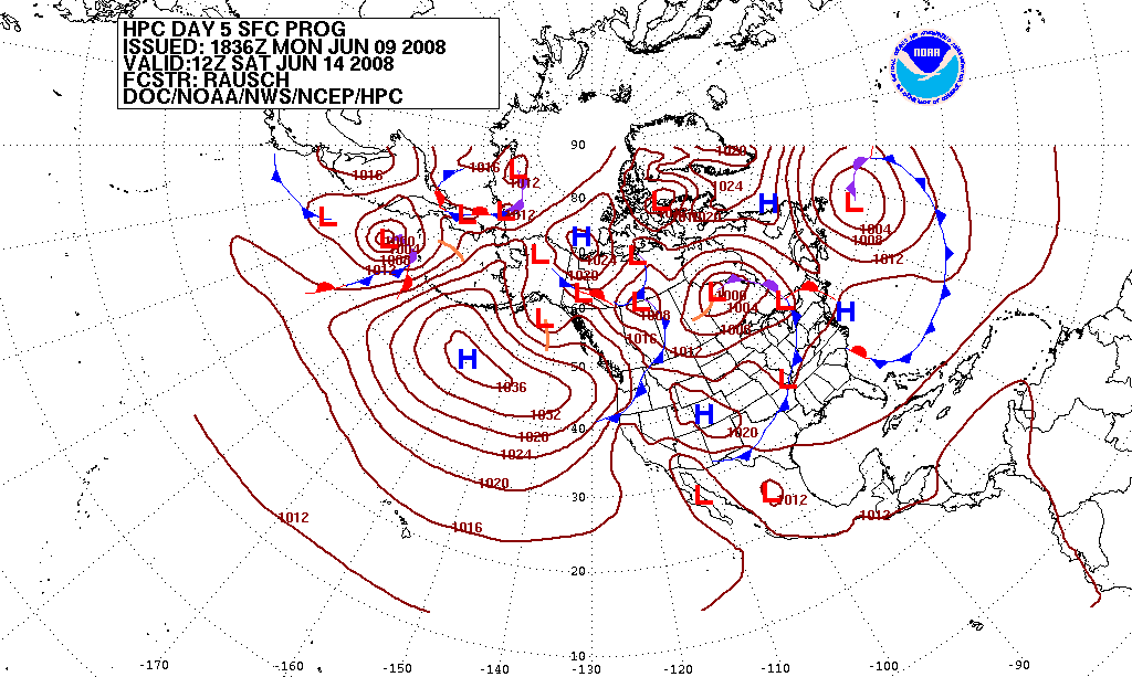
Weather forecasting or weather prediction is the application of science and technology forecasting, to predict the conditions of the Earth's atmosphere, atmosphere for a given location and time. People have attempted to predict the weather informally for thousands of years and formally since the 19th century. Weather forecasts are made by collecting quantitative data about the current state of the atmosphere, land, and ocean and using meteorology to project how the atmosphere will change at a given place. Once calculated manually based mainly upon changes in atmospheric pressure, barometric pressure, current weather conditions, and sky conditions or cloud cover, weather forecasting now relies on numerical weather prediction, computer-based models that take many atmospheric factors into account. Human input is still required to pick the best possible model to base the forecast upon, which involves pattern recognition skills, teleconnections, knowledge of model performance, and kn ... [...More Info...] [...Related Items...] OR: [Wikipedia] [Google] [Baidu] |
Integrated Forecast System
The Integrated Forecasting System (IFS) is a global numerical weather prediction system jointly developed and maintained by the European Centre for Medium-Range Weather Forecasts (ECMWF) based in Reading, England, and Météo-France based in Toulouse. The version of the IFS run at ECMWF is often referred to as the "ECMWF" or the "European model" in North America, to distinguish it from the American Global Forecast System. Mechanism It comprises a spectral atmospheric model with a terrain-following vertical coordinate system coupled to a 4D-Var data assimilation system. In 1997 the IFS became the first operational forecasting system to use 4D-Var. Both ECMWF and Météo-France use the IFS to make operational weather forecasts, but using a different configuration and resolution (the Météo-France configuration is referred to as ARPEGE). It is one of the predominant global medium-range models in general use worldwide; its most prominent rivals in the 6–10 day medium range i ... [...More Info...] [...Related Items...] OR: [Wikipedia] [Google] [Baidu] |
Overcast
Overcast or overcast weather, as defined by the World Meteorological Organization, is the meteorological condition of clouds obscuring at least 95% of the sky. However, the total cloud cover must not be entirely due to obscuring phenomena near the surface, such as fog. Overcast, written as "OVC" in the METAR observation, is reported when the cloud cover is observed to equal eight oktas (eighths). An overcast sky may be explicitly identified as thin (mostly transparent), but otherwise considered opaque—which always constitutes a ceiling in aviation meteorology. Sometimes clouds can be of different colors such as black or white, but overcast usually refers to darker skies.''Oxford English Dictionary'', 3rd ed. (website), s.v. “overcast," 2a and 2b. http://www.oed.com/view/Entry/134377#eid32922408 (Accessed September 7, 2016). In some cases, it can be characterized by almost zero distinction of borders of clouds. Or the sky may be covered by a single type of cloud, such as ... [...More Info...] [...Related Items...] OR: [Wikipedia] [Google] [Baidu] |
Thunderstorm
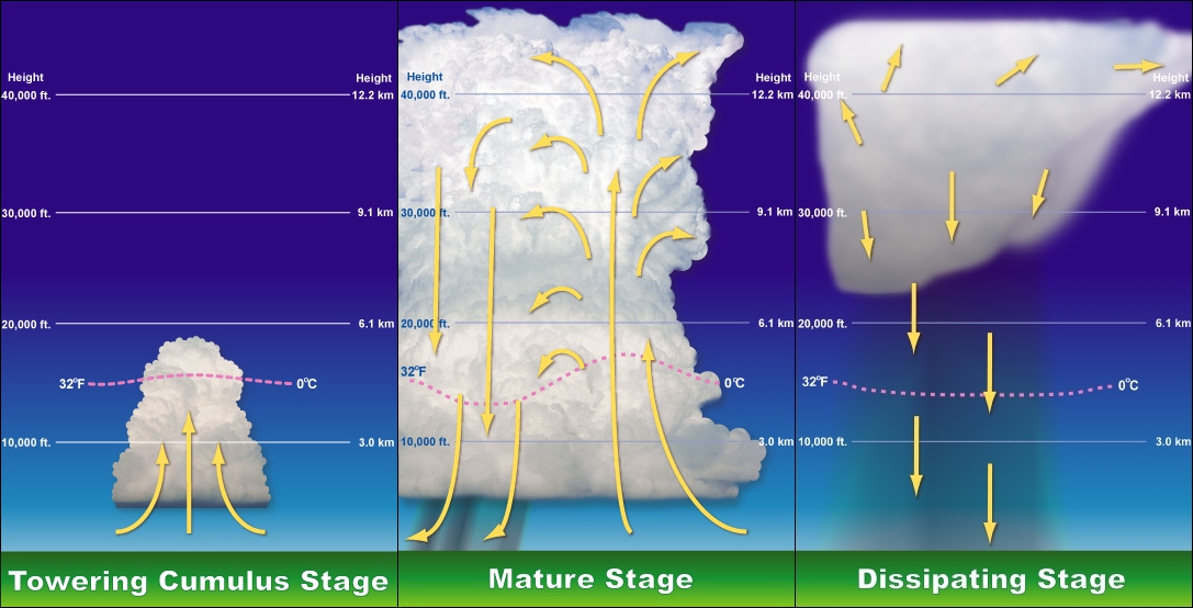
A thunderstorm, also known as an electrical storm or a lightning storm, is a storm characterized by the presence of lightning and its acoustics, acoustic effect on the Earth's atmosphere, known as thunder. Relatively weak thunderstorms are sometimes called thundershowers. Thunderstorms occur in cumulonimbus clouds. They are usually accompanied by strong winds and often produce Heavy rain (meteorology), heavy rain and sometimes Thundersnow, snow, Ice pellets, sleet, or hail, but some thunderstorms can produce little or Dry thunderstorm, no precipitation at all. Thunderstorms may thunderstorm training, line up in a series or become a rainband, known as a squall line. Strong or #Severe thunderstorms, severe thunderstorms include some of the most dangerous weather phenomena, including large hail, strong winds, and tornadoes. Some of the most persistent severe thunderstorms, known as supercells, rotate as do cyclones. While most thunderstorms move with the mean wind flow thr ... [...More Info...] [...Related Items...] OR: [Wikipedia] [Google] [Baidu] |
Probability Of Precipitation
Probability of precipitation (PoP) is a commonly used term referring to the likelihood of precipitation falling in a particular area over a defined period of time, which is commonly a day, half day, or hour. The PoP measure is meaningless unless it is associated with an interval of time. Forecasts commonly use PoP defined over 12-hour periods (PoP12), though 6-hour periods (PoP6) and other measures are also published. A "daytime" PoP12 means from 6 am to 6 pm. Probabilities are often calculated by ensemble forecasting and represents the number of simulations that show rain occurred. PoPs are generally not statistically independent. A good example of an event that has a strongly dependent hour-to-hour PoP is a hurricane. In that case, there may be a 1 in 5 chance of the hurricane hitting a given stretch of coast, but if it does arrive there will be rain for several hours, with the effect that a one-hour PoP for the same region and period would be similar: about 1 in 5. Localized ... [...More Info...] [...Related Items...] OR: [Wikipedia] [Google] [Baidu] |
Ceiling (cloud)
In aviation, ceiling is a measurement of the height of the base of the lowest clouds (not to be confused with cloud base which has a specific definition) that cover more than half of the sky (more than 4 oktas) relative to the ground. Ceiling is not specifically reported as part of the METAR (METeorological Aviation Report) used for flight planning by pilots worldwide, but can be deduced from the lowest height with broken (BKN) or overcast (OVC) reported. A ceiling listed as "unlimited" means either that the sky is mostly free of cloud cover, or that the clouds are high enough not to impede visual flight rules (VFR) operation. Definitions ; ICAO The International Civil Aviation Organization (ICAO ) is a specialized agency of the United Nations that coordinates the principles and techniques of international air navigation, and fosters the planning and development of international sch ... : The height above the ground or water of the base of the lowest layer of cloud be ... [...More Info...] [...Related Items...] OR: [Wikipedia] [Google] [Baidu] |
Weather
Weather is the state of the atmosphere, describing for example the degree to which it is hot or cold, wet or dry, calm or stormy, clear or cloud cover, cloudy. On Earth, most weather phenomena occur in the lowest layer of the planet's atmosphere of Earth, atmosphere, the troposphere, just below the stratosphere. Weather refers to day-to-day temperature, precipitation, and other atmospheric conditions, whereas climate is the term for the averaging of atmospheric conditions over longer periods of time. When used without qualification, "weather" is generally understood to mean the weather of Earth. Weather is driven by atmospheric pressure, air pressure, temperature, and moisture differences between one place and another. These differences can occur due to the effect of Sun angle on climate, Sun's angle at any particular spot, which varies with latitude. The strong temperature contrast between polar and tropical air gives rise to the largest scale atmospheric circulations: the ... [...More Info...] [...Related Items...] OR: [Wikipedia] [Google] [Baidu] |
Mesonet
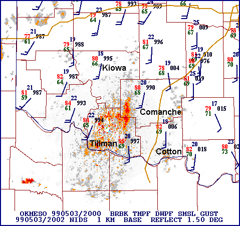
In meteorology and climatology, a mesonet, portmanteau of mesoscale network, is a network of automated weather and, often also including environmental monitoring stations, designed to observe mesoscale meteorological phenomena and/or microclimates. Dry lines, squall lines, and sea breezes are examples of phenomena observed by mesonets. Due to the space and time scales associated with mesoscale phenomena and microclimates, weather stations comprising a mesonet are spaced closer together and report more frequently than synoptic scale observing networks, such as the WMO Global Observing System (GOS) and US ASOS. The term mesonet refers to the collective group of these weather stations, which are usually owned and operated by a common entity. Mesonets generally record in situ surface weather observations but some involve other observation platforms, particularly vertical profiles of the planetary boundary layer (PBL). Other environmental parameters may include insolation and vario ... [...More Info...] [...Related Items...] OR: [Wikipedia] [Google] [Baidu] |
Global Forecast System
The Global Forecast System (GFS) is a global numerical weather prediction system containing a global computer model and variational analysis run by the United States' National Weather Service (NWS). Operation The mathematical model is run four times a day, and produces forecasts for up to 16 days in advance, but with decreased spatial resolution after 10 days. The forecast skill generally decreases with time (as with any numerical weather prediction model) and for longer term forecasts, only the larger scales retain significant accuracy. It is one of the predominant synoptic scale medium-range models in general use. Principles The GFS model has a finite volume cubed sphere (FV3) dynamical core with an approximate horizontal resolution of 28 km between grid points, which drops to 70 km between grid points for forecasts between one and two weeks. In the vertical, the model is divided into 127 layers and extends to the mesopause (roughly ~80 km). It produces forec ... [...More Info...] [...Related Items...] OR: [Wikipedia] [Google] [Baidu] |
METAR
METAR is a format for reporting weather information. A METAR weather report is predominantly used by aircraft pilots, and by meteorologists, who use aggregated METAR information to assist in weather forecasting. Raw METAR is highly standardized through the International Civil Aviation Organization (ICAO), which enables it to be understood throughout most of the world. Report names In its publication the '' Aeronautical Information Manual'' (''AIM''), the United States Federal Aviation Administration (FAA) describes the report as ''aviation routine weather report'', while the international authority for the code form, the World Meteorological Organization (WMO), describes it as the ''aerodrome routine meteorological report.'' The National Oceanic and Atmospheric Administration (part of the United States Department of Commerce) and the United Kingdom's Met Office both employ the definition used by the FAA. METAR is also known as ''Meteorological Terminal Aviation Routine Weathe ... [...More Info...] [...Related Items...] OR: [Wikipedia] [Google] [Baidu] |
Nested Grid Model
The Nested Grid Model (usually known as NGM for short) was a numerical weather prediction model run by the National Centers for Environmental Prediction, a division of the National Weather Service, in the United States. The NGM was, as its name suggested, derived from two levels of grids: a hemispheric-scale grid and a synoptic scale meteorology, synoptic-scale grid, the latter of which had a resolution of approximately 90 kilometers. Its most notable feature was that it assumed the hydrostatic equation.NCEP Nested Grid Model Overview National Weather Service Southern Region Headquarters. Retrieved 2010-05-15. The NGM debuted in 1987, directly replacing the limited-area fine mesh (LFM) model, which was immediately halted upon the NGM's debut. The NGM was also used to create model output statistics. [...More Info...] [...Related Items...] OR: [Wikipedia] [Google] [Baidu] |


