|
List Of Ferry Quays In Istanbul
There are 50 passenger ferry quays in Istanbul, of which 37 are in active service in Bosphorus, Golden Horn and the Sea of Marmara. As of the 2017 Summer season, the ferry quays are served at 600 voyages daily by 28 traditional passenger ferry boats on 17 lines operated by the ''Şehir Hatları'' ("City Lines") company. Quays Following is the list of active ferry quays: See also * Ferries in Istanbul *Public transport in Istanbul ] Public transport in Istanbul comprises a bus network, various rail systems, funiculars, and maritime services to serve the more than 18 million inhabitants of the city spread over an area of 5712 km2. History Public road transpor ... References {{Public transport in Istanbul Ferry piers in Istanbul, * Transport in Istanbul Bosphorus Golden Horn Sea of Marmara Ferry terminals in Turkey Istanbul-related lists ... [...More Info...] [...Related Items...] OR: [Wikipedia] [Google] [Baidu] |
Istanbul
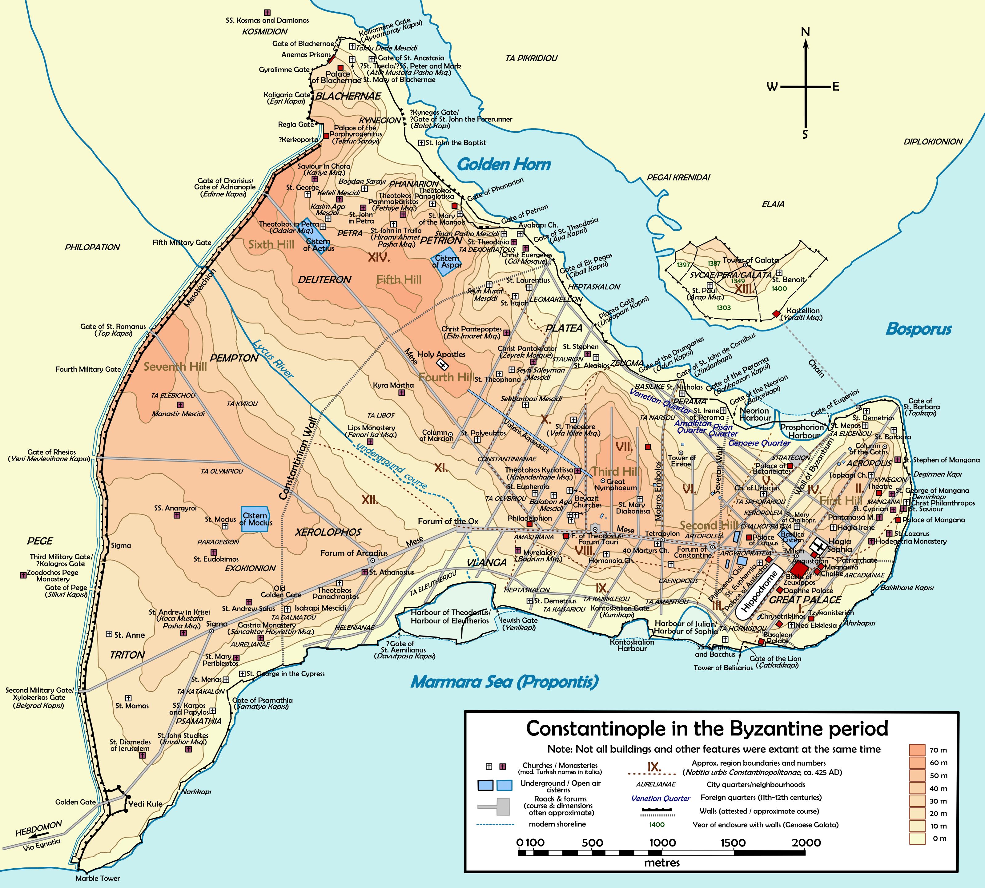
Istanbul ( , ; tr, İstanbul ), formerly known as Constantinople ( grc-gre, Κωνσταντινούπολις; la, Constantinopolis), is the List of largest cities and towns in Turkey, largest city in Turkey, serving as the country's economic, cultural and historic hub. The city straddles the Bosporus strait, lying in both Europe and Asia, and has a population of over 15 million residents, comprising 19% of the population of Turkey. Istanbul is the list of European cities by population within city limits, most populous European city, and the world's List of largest cities, 15th-largest city. The city was founded as Byzantium ( grc-gre, Βυζάντιον, ) in the 7th century BCE by Ancient Greece, Greek settlers from Megara. In 330 CE, the Roman emperor Constantine the Great made it his imperial capital, renaming it first as New Rome ( grc-gre, Νέα Ῥώμη, ; la, Nova Roma) and then as Constantinople () after himself. The city grew in size and influence, eventually becom ... [...More Info...] [...Related Items...] OR: [Wikipedia] [Google] [Baidu] |
Beykoz
Beykoz (), also known as Beicos and Beikos, is a district in Istanbul, Turkey at the northern end of the Bosphorus on the Anatolian side. The name is believed to be a combination of the words bey and ''kos'', which means "village" in Farsi. Beykoz includes an area from the streams of Küçüksu and Göksu (just before Anadoluhisarı) to the opening of the Bosphorus into the Black Sea, and the villages in the hinterland as far as the Riva creek. The mayor is Murat Aydın ( AKP). History The mouth of the Bosphorus in ancient times was used as a place of sacrifice, specifically to petition Zeus and Poseidon for a safe journey across the Black Sea, without which no one would venture into those stormy waters. The first people to settle the upper-Bosphorus were Thracians and Greeks and the ancient name for the area was Amikos (Αμικός in Greek) or Amnicus (Αμνικός), named after a Thracian king. However, the area has changed hands many times since. As well as being a str ... [...More Info...] [...Related Items...] OR: [Wikipedia] [Google] [Baidu] |
Emirgan Pier
Emirgan Pier ( tr, Emirgan İskelesi) is a historic passenger ferryboat pier located in Emirgan neighborhood of Sarıyer district in Istanbul Province, Turkey. It serves ferries in Istanbul running between Çengelköy and İstinye on Bosphorus. The pier went into service in 1851 as the most of the piers on Bosphorus. The pier, which as situated at that times in front of the Emirgan Mosque, underwent an essential reparation in 1897. In 1900, a new pier was built a little bit south of it by the new owner of the ferryboat line, the Ottoman Empire, Ottoman company "Şirket-i Hayriye", and the original pier was removed. Even though the pier was called sometimes "Mirgün Pier" and then "Uluköy Pier", it held its current name. The pier was closed down in March 1989, and demolished remaining inaccessible 12 years long during the widening works of the Bosphorus coastal street. After construction of a new pier building again in wood on deep foundation, piles that began in June 2001, it was ... [...More Info...] [...Related Items...] OR: [Wikipedia] [Google] [Baidu] |
Eminönü - Panoramio - HALUK COMERTEL (2)
Eminönü is a predominantly commercial waterfront area of Istanbul within the Fatih district near the confluence of the Golden Horn with the southern entrance of the Bosphorus strait and the Sea of Marmara. It is connected to Karaköy (historic Galata) via the Galata Bridge across the Golden Horn. It was administered as part of the Sultanahmet district from 1928 to 2009 when Sultanahmet was absorbed into Fatih. Eminönü's busy main square is overlooked by the New Mosque (Yeni Cami in Turkish) and the Spice Bazaar (Mısır Çarşısı in Turkish). Eminönü is an important transport hub. Several ferries have terminals along the Eminönü waterfront and the T1 tram has a stop here. To the southeast Eminönü runs into Sirkeci, while to the northwest it merges with the shopping areas of Tahtakale and Küçükpazar. Inland from Emiõnü is another shopping district, Mahmutpaşa. In Turkish, Eminönü means 'in front of justice' ('emin' meaning 'justice' and 'önü' me ... [...More Info...] [...Related Items...] OR: [Wikipedia] [Google] [Baidu] |
Eminönü
Eminönü is a predominantly commercial waterfront area of Istanbul within the Fatih district near the confluence of the Golden Horn with the southern entrance of the Bosphorus strait and the Sea of Marmara. It is connected to Karaköy (historic Galata) via the Galata Bridge across the Golden Horn. It was administered as part of the Sultanahmet district from 1928 to 2009 when Sultanahmet was absorbed into Fatih. Eminönü's busy main square is overlooked by the New Mosque (Yeni Cami in Turkish) and the Spice Bazaar (Mısır Çarşısı in Turkish). Eminönü is an important transport hub. Several ferries have terminals along the Eminönü waterfront and the T1 tram has a stop here. To the southeast Eminönü runs into Sirkeci, while to the northwest it merges with the shopping areas of Tahtakale and Küçükpazar. Inland from Emiõnü is another shopping district, Mahmutpaşa. In Turkish, Eminönü means 'in front of justice' ('emin' meaning 'justice' and 'önü' meaning ... [...More Info...] [...Related Items...] OR: [Wikipedia] [Google] [Baidu] |
Çubuklu
Çubuklu is a neighbourhood in Beykoz district on the Anatolian side of the Bosphorus in İstanbul, Turkey. It was called Katangion (Κατάγγιον in Greek) in Byzantine times when it was a recreational area. During the Ottoman era, some sultans such as Selim I (r. 1494–1511), Suleiman the Magnificent (r. 1520–1566), Ahmed I (r. 1603–1617) and Ahmed III (r. 1703–1730) were particularly interested in Çubuklu. The grand vizier Nevşehirli Damat Ibrahim Pasha (in office 1718–1730) and some other high officials in the 19th century also contributed to its development. In the 19th century, Çubuklu became a popular residential area. Grand vizier Halil Rifat Pasha (i.o. 1895–1901) built five yalıs (waterfront mansions) here for his sons. Abbas II of Egypt (r. 1892–1914), the last Khedive ( Ottoman viceroy) of Egypt and Sudan, built the Khedive Palace on top of a hill overlooking Çubuklu. The Underwater Search and Rescue Command, which trains frogmen and d ... [...More Info...] [...Related Items...] OR: [Wikipedia] [Google] [Baidu] |
Çengelköy
Çengelköy is a neighborhood in the Üsküdar district on the Asian shore of the Bosphorus strait in Istanbul, Turkey, between the neighborhoods of Beylerbeyi and Kuleli. It is mainly a residential district. Many mansions were built there in the Ottoman period. From the 6th century, the port of Çengelköy was called ''Sophianai'' because of the palace Justin II built nearby for his consort Sophia. The name ''Çengelköy'' means "hook village" and indeed the village is nestled around a sharp turn of the Bosphorus shoreline, but the origin of the name is uncertain. One story put forward is that the village is named after the 19th-century Ottoman admiral Çengeloğlu Tahir Pasha, who had a waterside mansion built there (and there is a Çengeloğlu Street in Çengelköy). Another story derives the name from the Persian word ''çenkar'', "crab," because of the abundance of seafood in the Bosphorus there. A 16th-century Ottoman document apparently refers to the place as "Çenge ... [...More Info...] [...Related Items...] OR: [Wikipedia] [Google] [Baidu] |
Büyükdere, Sarıyer
Büyükdere is a neighbourhood of Sarıyer district in Istanbul, Turkey. It is situated on the European shore of the Bosphorus strait about southwest of Sarıyer. Its name means 'big stream' in Turkish, in reference to the river that used to flow into the Bosphorus here. A major road, Büyükdere Avenue, starts south of Büyükdere, and runs inland as far as Şişli. In the 19th century Büyükdere, like neighbouring Tarabya, was a popular summer retreat for members of Istanbul's foreign and diplomatic community and it still has several churches and embassy buildings dating back to that period. There was then a Büyükdere ferry terminal but although it has been restored it has not been put back into use (partly because of the road that was built in front of it on reclaimed land), meaning that most access to the neighbourhood is by bus along the coast road. Places of interest The Sadberk Hanım Museum, a private archaeology and ethnography museum, is housed in what started li ... [...More Info...] [...Related Items...] OR: [Wikipedia] [Google] [Baidu] |
Adalar 5540
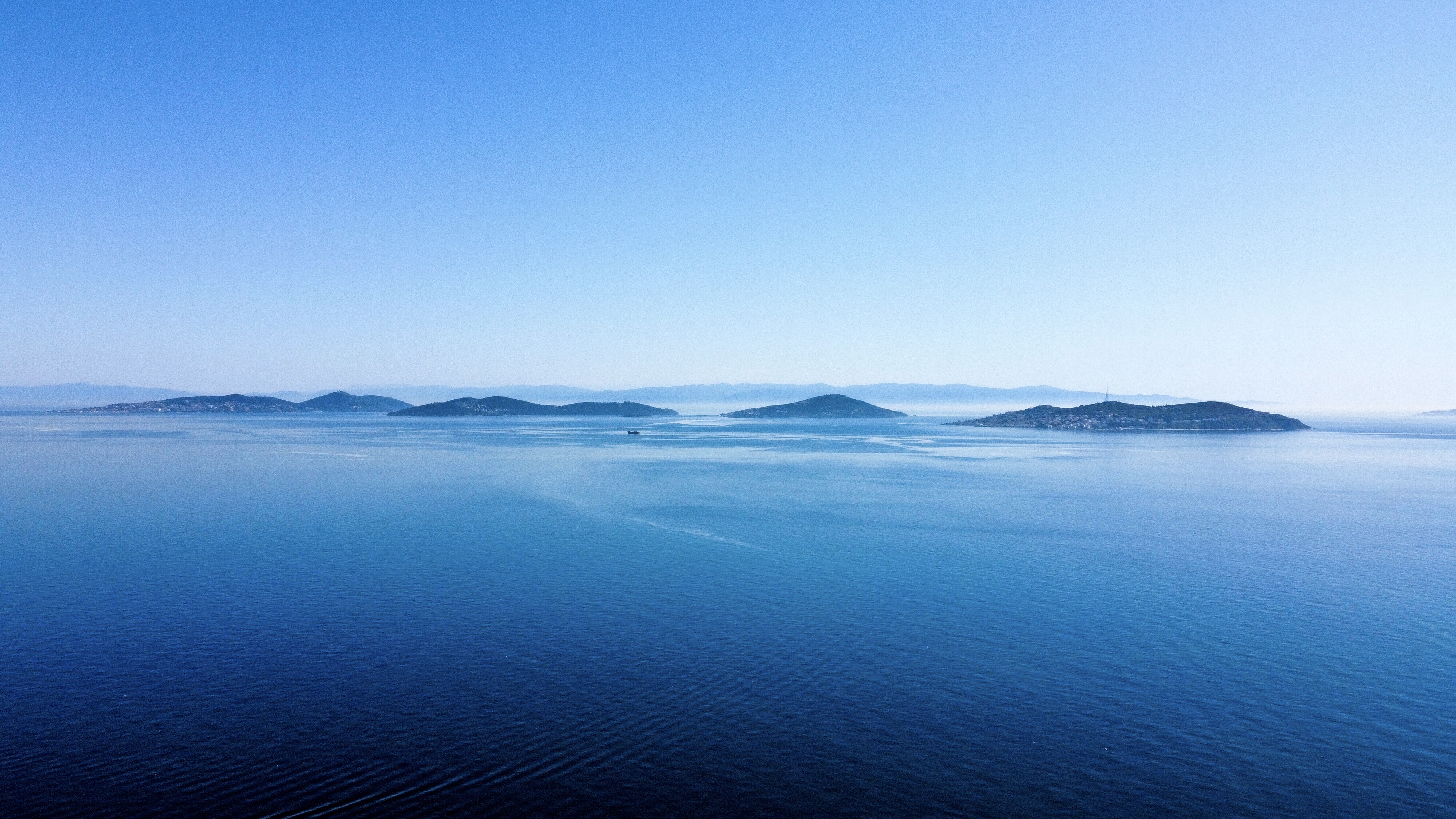
The Princes' Islands ( tr, Prens Adaları; the word "princes" is plural, because the name means "Islands of the Princes", el, Πριγκηπονήσια, ''Pringiponisia''), officially just Adalar ( en, Islands); alternatively the Princes' Archipelago; is an archipelago off the coast of Istanbul, Turkey, in the Sea of Marmara. The islands constitute the Adalar district of Istanbul Province. With a total land area of , it is the eighth smallest List of districts of Istanbul, district in Istanbul, and with a permanent population of 16,372 (2021), it is by far the least populous district in Istanbul. They consist of four larger islands, Büyükada ("Big Island") with an area of , Heybeliada ("Saddlebag Island") with an area of , Burgazada ("Fortress Island") with an area of , Kınalıada ("Henna Island") with an area of , and five much smaller ones, Sedef Adası ("Mother-of-Pearl Island") with an area of , Yassıada ("Flat Island") with an area of , Sivriada ("Sharp Island") with ... [...More Info...] [...Related Items...] OR: [Wikipedia] [Google] [Baidu] |
Büyükada
Büyükada ( el, Πρίγκηπος or Πρίγκιπος, rendered ''Prinkipos'' or ''Prinkipo''), meaning "Big Island" in Turkish, is the largest of the Princes' Islands in the Sea of Marmara, near Istanbul, with an area of about . It is officially a neighbourhood in the Adalar (''Islands'') district of Istanbul Province, Turkey. During the first half of the 20th century, the island was popular with prosperous Greeks, Jews and Armenians as a refuge from the summer heat of Istanbul. Nowadays the island is almost as solidly Turkish as any suburb of mainland Istanbul. Historically, many residents of Büyükada were fishermen. However, by the late 2010s tourism to Büyükada swelled enormously as it became a favourite day-trip destination for visitors from greenery-starved Arab countries in particular. The surge in tourism was a major factor in bringing to an end the tradition of using phaetons as the only transport on the island in 2020. Visitors have been writing about Büy� ... [...More Info...] [...Related Items...] OR: [Wikipedia] [Google] [Baidu] |
Burgazada
Burgazada, or Burgaz Adası (Burgaz for short), is the third largest of the Princes' Islands in the Sea of Marmara, near Istanbul, Turkey. It is officially a neighbourhood of the Adalar district of Istanbul. In the past it was called Antigoni ( el, Αντιγόνη) after Antigonus I Monophthalmus, the father of Demetrius I of Macedon, one of the Diadochi (Successors) of Alexander the Great, who built a fort (Greek: ''Pyrgos'' for fort/tower) here. The name Burgas is thought to be derived from Pyrgos. The island covers and area of 1.5 sqm and is dominated by a single hill, Bayraktepe (Flag Hill, 170m/558ft), also known as Hristos Tepesi (Christ Hill). In 2003 a terrible fire wrote off most of its woodland. Visible just off shore is tiny uninhabited Kaşıkadası (Spoon Island). There are great views back towards the mainland from the remote Kalpazankaya - the name means 'Counterfeiters' Rock' in Turkish. Historically, the island was mainly inhabited Greeks and in the 20th cent ... [...More Info...] [...Related Items...] OR: [Wikipedia] [Google] [Baidu] |


.jpg)

.jpg)


