|
Limited Traffic Zone
Limited traffic zone (LTZ) is type of restricted traffic area found in many historic European city centres where non-residents and unauthorized vehicles are prohibited from driving at certain times. These areas are relatively abundant in Italy, where they are called (ZTL), but they also exist in Spain, Portugal, France and Poland with different names. Around 350 Italian cities have LTZs, and 250 have low-emission zones (LEZs), usually enforced with camera surveillance. They help protect historic city centres from excessive traffic, which would otherwise make the city less attractive. They can also be aimed at limiting pollution levels or at increasing administrative revenue by paying an urban toll. In most Italian LTZs (ZTLs), vehicles transporting people with disability are allowed when displaying the appropriate badge. As Article 47 of the Italian Traffic Code () defines bicycles as vehicles, cycling is only allowed if specified on the road sign. Unauthorized movement of vehic ... [...More Info...] [...Related Items...] OR: [Wikipedia] [Google] [Baidu] |
Italian Traffic Signs - Zona Traffico Limitato
Italian(s) may refer to: * Anything of, from, or related to the people of Italy over the centuries ** Italians, an ethnic group or simply a citizen of the Italian Republic or Italian Kingdom ** Italian language, a Romance language *** Regional Italian, regional variants of the Italian language ** Languages of Italy, languages and dialects spoken in Italy ** Italian culture, cultural features of Italy ** Italian cuisine, traditional foods ** Folklore of Italy, the folklore and urban legends of Italy ** Mythology of Italy, traditional religion and beliefs Other uses * Italian dressing, a vinaigrette-type salad dressing or marinade * Italian or Italian-A, alternative names for the Ping-Pong virus, an extinct computer virus See also * * * Italia (other) * Italic (other) * Italo (other) * The Italian (other) * Italian people (other) Italian people may refer to: * in terms of ethnicity: all ethnic Italians, in and outside of Ital ... [...More Info...] [...Related Items...] OR: [Wikipedia] [Google] [Baidu] |
Nantes
Nantes (, , ; Gallo: or ; ) is a city in Loire-Atlantique on the Loire, from the Atlantic coast. The city is the sixth largest in France, with a population of 314,138 in Nantes proper and a metropolitan area of nearly 1 million inhabitants (2018). With Saint-Nazaire, a seaport on the Loire estuary, Nantes forms one of the main north-western French metropolitan agglomerations. It is the administrative seat of the Loire-Atlantique department and the Pays de la Loire region, one of 18 regions of France. Nantes belongs historically and culturally to Brittany, a former duchy and province, and its omission from the modern administrative region of Brittany is controversial. Nantes was identified during classical antiquity as a port on the Loire. It was the seat of a bishopric at the end of the Roman era before it was conquered by the Bretons in 851. Although Nantes was the primary residence of the 15th-century dukes of Brittany, Rennes became the provincial capital after th ... [...More Info...] [...Related Items...] OR: [Wikipedia] [Google] [Baidu] |
Traffic Calming
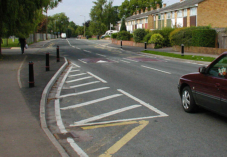
Traffic calming uses physical design and other measures to improve safety for motorists, pedestrians and bicycle-friendly, cyclists. It has become a tool to combat speeding and other unsafe behaviours of drivers in the neighbourhoods. It aims to encourage safer, more responsible driving and potentially reduce traffic flow. Urban planners and Traffic engineering (transportation), traffic engineers have many strategies for traffic calming, including narrowed roads and speed humps. Such measures are common in Australia and Europe (especially Northern Europe), but less so in North America. Traffic calming is a calque (literal translation) of the German word ''Verkehrsberuhigung'' – the term's first published use in English was in 1985 by Carmen Hass-Klau. History In its early development in the UK in the 1930s, traffic calming was based on the idea that residential areas should be protected from through-traffic. Subsequently, it became valued for its ability to improve pedest ... [...More Info...] [...Related Items...] OR: [Wikipedia] [Google] [Baidu] |
Environment Of Italy
Italy ( it, Italia ), officially the Italian Republic, ) or the Republic of Italy, is a country in Southern Europe. It is located in the middle of the Mediterranean Sea, and its territory largely coincides with the Italy (geographical region), homonymous geographical region. Italy is also considered part of Western Europe, and shares List of countries and territories by land borders, land borders with France, Switzerland, Austria, Slovenia and the Enclave and exclave, enclaved European microstates, microstates of Vatican City and San Marino. It has a territorial Enclave and exclave, exclave in Switzerland, Campione d'Italia, Campione. Italy covers an area of , with a population of over 60 million. It is the List of European Union member states by population, third-most populous member state of the European Union, the List of European countries by population, sixth-most populous country in Europe, and the List of European countries by area, tenth-largest country in the continent ... [...More Info...] [...Related Items...] OR: [Wikipedia] [Google] [Baidu] |
Road Transport In Italy
A road is a linear way for the conveyance of traffic that mostly has an improved surface for use by vehicles (motorized and non-motorized) and pedestrians. Unlike streets, the main function of roads is transportation. There are many types of roads, including parkways, avenues, controlled-access highways (freeways, motorways, and expressways), tollways, interstates, highways, thoroughfares, and local roads. The primary features of roads include lanes, sidewalks (pavement), roadways (carriageways), medians, shoulders, verges, bike paths (cycle paths), and shared-use paths. Definitions Historically many roads were simply recognizable routes without any formal construction or some maintenance. The Organization for Economic Co-operation and Development (OECD) defines a road as "a line of communication (travelled way) using a stabilized base other than rails or air strips open to public traffic, primarily for the use of road motor vehicles running on their own wheels", which i ... [...More Info...] [...Related Items...] OR: [Wikipedia] [Google] [Baidu] |
Road Space Rationing
Road space rationing, also known as alternate-day travel, driving restriction and no-drive days ( es, restricción vehicular; pt, rodízio veicular; french: circulation alternée), is a travel demand management strategy aimed to reduce the negative externalities generated by urban air pollution or peak urban travel demand in excess of available supply or road capacity, through artificially restricting demand (vehicle travel) by rationing the scarce common good road capacity, especially during the peak periods or during peak pollution events. This objective is achieved by restricting traffic access into an urban cordon area, city center (CBD), or district based upon the last digits of the license number on pre-established days and during certain periods, usually, the peak hours. The practical implementation of this traffic restraint policy is common in Latin America, and in many cases, the road rationing has as a main goal the reduction of air pollution, such as the cases of M� ... [...More Info...] [...Related Items...] OR: [Wikipedia] [Google] [Baidu] |
Pedestrian Zone
Pedestrian zones (also known as auto-free zones and car-free zones, as pedestrian precincts in British English, and as pedestrian malls in the United States and Australia) are areas of a city or town reserved for pedestrian-only use and in which most or all automobile traffic is prohibited. Converting a street or an area to pedestrian-only use is called ''pedestrianisation''. Pedestrianisation usually aims to provide better accessibility and mobility for pedestrians, to enhance the amount of shopping and other business activities in the area or to improve the attractiveness of the local environment in terms of aesthetics, air pollution, noise and crashes involving motor vehicle with pedestrians. However, pedestrianisation can sometimes lead to reductions in business activity, property devaluation, and displacement of economic activity to other areas. In some cases, traffic in surrounding areas may increase, due to displacement, rather than substitution of car traffic. None ... [...More Info...] [...Related Items...] OR: [Wikipedia] [Google] [Baidu] |
Low Traffic Neighbourhood
A Low Traffic Neighbourhood (LTN) is a scheme implemented to reduce through traffic in residential areas through the use of filtered permeability and traffic calming. LTNs can be implemented through the use of barriers such as bollards, boom barriers and planters, though can also be implemented virtually through the use of automatic number-plate recognition cameras and road signs, which can allow residential motor access while prohibiting passing motor traffic. There is evidence to show that LTNs lead to a decrease in car use, increase in walking and cycling and a decrease in street crime, violent crime and sexual assaults. History Prior to the COVID-19 pandemic, there were already at least 25,000 modal filters across the UK. Low-traffic neighbourhoods have been a common policy in designing new towns and communities in the UK since the 1960s. During the COVID-19 pandemic of 2020–21, 72 low-traffic neighbourhoods with modal filters were rolled out under emergency legislati ... [...More Info...] [...Related Items...] OR: [Wikipedia] [Google] [Baidu] |
Congestion Pricing
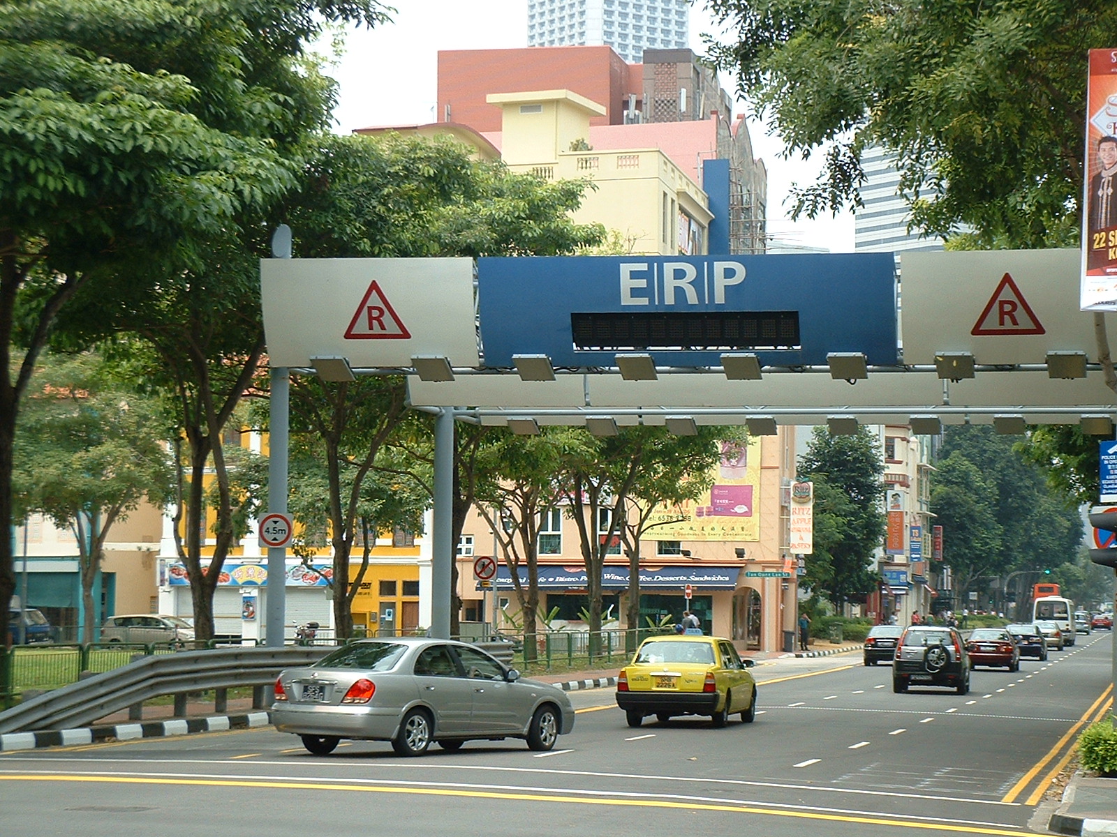
Congestion pricing or congestion charges is a system of surcharging users of public goods that are subject to congestion through excess demand, such as through higher peak charges for use of bus services, electricity, metros, railways, telephones, and road pricing to reduce traffic congestion; airlines and shipping companies may be charged higher fees for slots at airports and through canals at busy times. Advocates claim this pricing strategy regulates demand, making it possible to manage congestion without increasing supply. According to the economic theory behind congestion pricing, the objective of this policy is the use of the price mechanism to make users conscious of the costs that they impose upon one another when consuming during the peak demand, and that they should pay for the additional congestion they create, thus encouraging the redistribution of the demand in space or in time, and forcing them to pay for the negative externalities they create, making users ... [...More Info...] [...Related Items...] OR: [Wikipedia] [Google] [Baidu] |
Car-free Movement
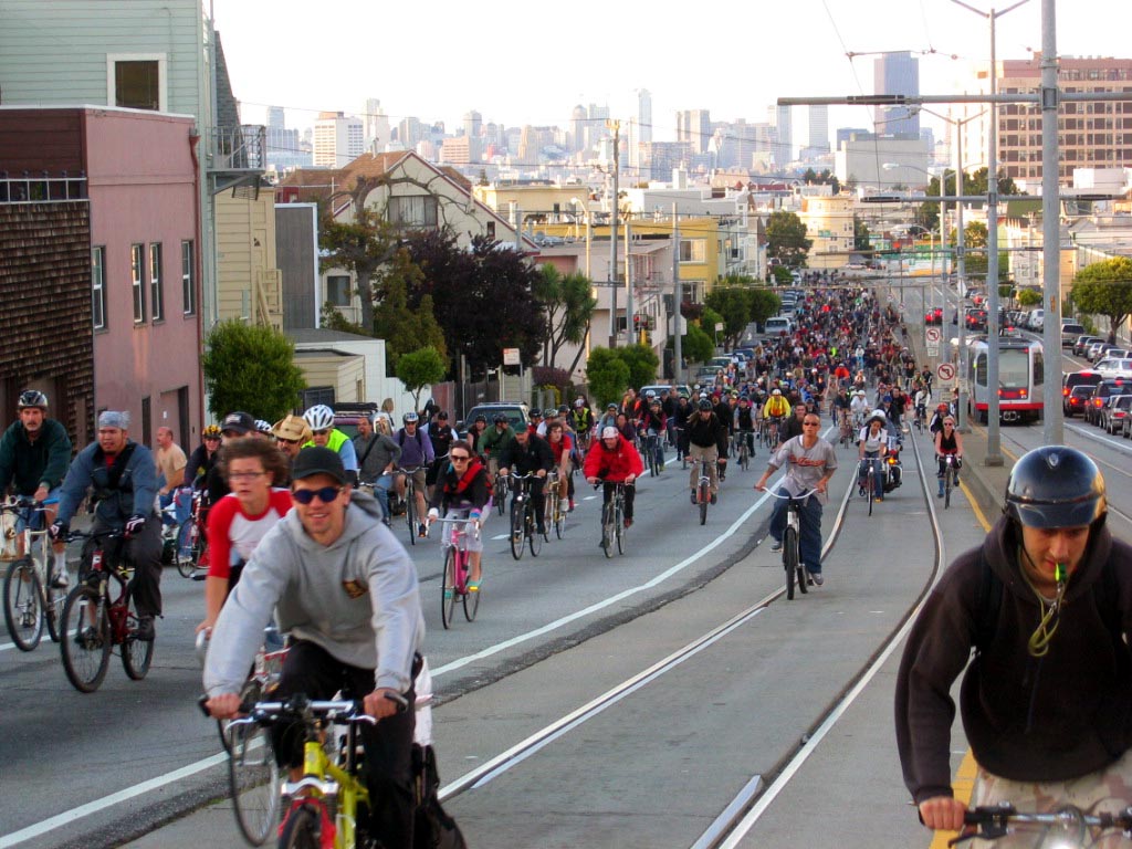
The car-free movement is a broad, informal, emergent network of individuals and organizations, including social activists, urban planners, transportation engineers, environmentalists and others, brought together by a shared belief that large and/or high-speed motorized vehicles (cars, trucks, tractor units, motorcycles, etc.) are too dominant in most modern cities. The goal of the movement is to create places where motorized vehicle use is greatly reduced or eliminated, by converting road and parking space to other public uses and rebuilding compact urban environments where most destinations are within easy reach by other means, including walking, cycling, public transport, personal transporters, and mobility as a service. Context Before the twentieth century, cities and towns were normally compact, containing narrow streets busy with human activity. In the early twentieth century, many of these settlements were adapted to accommodate the car with wider roads, more car parki ... [...More Info...] [...Related Items...] OR: [Wikipedia] [Google] [Baidu] |
Satellite Navigation Software
Satellite navigation software or GPS navigation software usually falls into one of the following two categories: # Navigation with route calculation and directions from the software to the user of the route to take, based on a vector-based map, normally for motorized vehicles with some motorized forms added on as an afterthought. # Navigation tracking, often with a map "picture" in the background, but showing where you have been, and allowing "routes" to be preprogrammed, giving a line you can follow on the screen. This type can also be used for geocaching. Terminology Track A track is a trace of somewhere that you have actually been (often called a "breadcrumb trail"). The GPS unit (external or internal) periodically sends details of the location which are recorded by the software, either by taking a reading based on a set time interval, based on a set distance, based on a change in direction by more than a certain angle, or a combination of these. Each point is stored toge ... [...More Info...] [...Related Items...] OR: [Wikipedia] [Google] [Baidu] |
School Streets
School Streets is an scheme in the United Kingdom, Germany, Czechia Austria and other countries, to suspend motor traffic access to roads outside schools, during drop-off and pick-up times. One of the first schools in the UK to trial the scheme was Gayhurst Community School in Hackney in 2018. As of November 2020, Transport for London has funded 430 new school streets. Legislatively, the scheme is achieved by restricting access to motor vehicles at certain times. Nearly two-thirds of UK teachers are in favour of roads around schools being closed. A study has shown that School Streets reduce Nitrogen Dioxide levels by up to 23 per cent during morning drop-off. The scheme aims to: * reduce traffic volume near schools * improve air quality and reduce air pollution from engine idling * increase walking and cycling to school * reduce car travel and inconsiderate parking * promote social distancing during the COVID-19 pandemic The programme is supported by Sustrans, a sustainab ... [...More Info...] [...Related Items...] OR: [Wikipedia] [Google] [Baidu] |


