|
Linear Park
A linear park is a type of park that is significantly longer than it is wide. These linear parks are strips of public land running along canals, rivers, streams, defensive walls, electrical lines, or highways and shorelines. Examples of linear parks include everything from wildlife corridors to riverways to trails, capturing the broadest sense of the word. Other examples include rail trails ("rails to trails"), which are disused railroad beds converted for recreational use by removing existing structures. Commonly, these linear parks result from the public and private sectors acting on the dense urban need for open green space. Linear parks stretch through urban areas, coming through as a solution for the lack of space and need for urban greenery. They also effectively connect different neighborhoods in dense urban areas as a result, and create places that are ideal for activities such as jogging or walking. Linear parks may also be categorized as greenways. In Australia ... [...More Info...] [...Related Items...] OR: [Wikipedia] [Google] [Baidu] |
Urban Green Space
In land-use planning, urban green space is open-space areas reserved for parks and other "green spaces", including plant life, water features -also referred to as blue spaces- and other kinds of natural environment. Most urban open spaces are green spaces, but occasionally include other kinds of open areas. The landscape of urban open spaces can range from playing fields to highly maintained environments to relatively natural landscapes. Generally considered open to the public, urban green spaces are sometimes privately owned, such as higher education campuses, neighborhood/community parks/gardens, and institutional or corporate grounds. Areas outside city boundaries, such as state and national parks as well as open space in the countryside, are not considered urban open space. Streets, piazzas, plazas and urban squares are not always defined as urban open space in land use planning. Urban green spaces have wide reaching positive impacts on the health of individuals and c ... [...More Info...] [...Related Items...] OR: [Wikipedia] [Google] [Baidu] |
Muddy River, Massachusetts
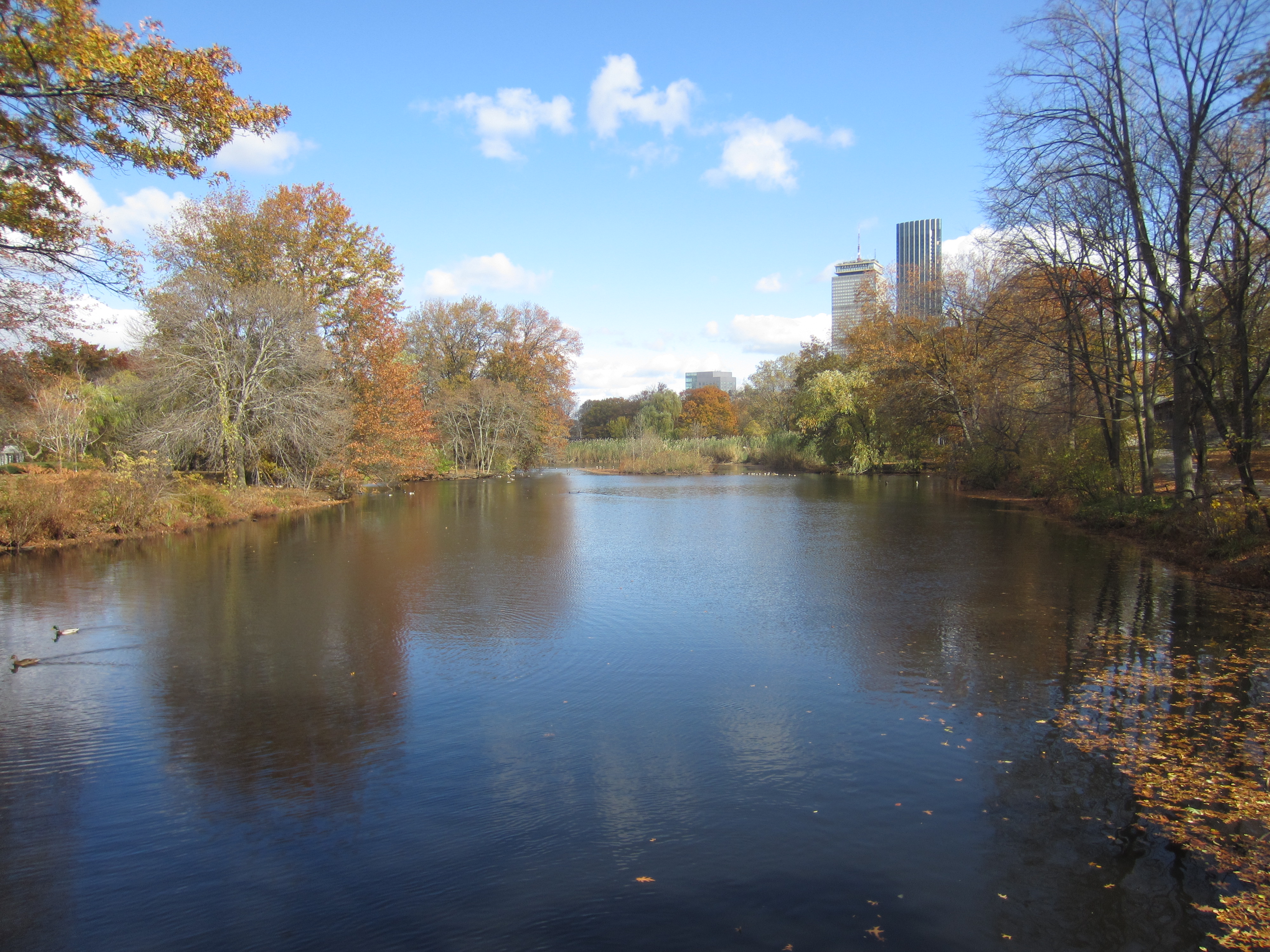
The Muddy River is a series of brooks and ponds that runs through sections of Boston's Emerald Necklace, including along the south boundary of Brookline, Massachusetts (a town that went by the name of Muddy River Hamlet before it was incorporated in 1705). The river, which is narrower than most waterways designated as rivers in the United States, is a protected public recreation area surrounded by parks and hiking trails, managed by the Massachusetts Department of Conservation and Recreation. The river flows from Jamaica Pond through Olmsted Park's Wards Pond, Willow Pond, and Leverett Pond. It then flows through a conduit under Route 9 and into a narrow park called the Riverway, from which it flows through three culverts: the Riverway Culvert, the Brookline Avenue Culvert, and the Avenue Louis Pasteur Culvert. The Muddy River continues from the Fens toward its connection with the Charles River via the Charlesgate area, running through a stone-paved channel surrounded by a narr ... [...More Info...] [...Related Items...] OR: [Wikipedia] [Google] [Baidu] |
Back Bay Fens
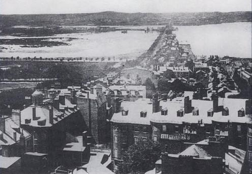
The Back Bay Fens, often called The Fens, is a parkland and urban wild in Boston, Massachusetts, in the United States. It was established in 1879. Designed by Frederick Law Olmsted to serve as a link in the Emerald Necklace park system, the Fens gives its name to the Fenway-Kenmore neighborhood. History The Fens is a large picturesque park that forms part of Boston's Emerald Necklace. It is essentially an ancient spot of saltwater marshland that has been surrounded by dry land, disconnected from the tides of the Atlantic Ocean, and landscaped into a park with fresh water within. The park is also known as the Fens or the Fenway. The latter term can also refer to either the surrounding neighborhood or the parkway on its southern border. When Boston was settled in the early 17th century the Shawmut Peninsula on which it was built was connected to Roxbury by a spit of sandy ground called " The Neck." The adjacent area of marshland to the west was a tidal flat of the Charl ... [...More Info...] [...Related Items...] OR: [Wikipedia] [Google] [Baidu] |
Back Bay
Back Bay is an officially recognized neighborhood of Boston, Massachusetts, built on reclaimed land in the Charles River basin. Construction began in 1859, as the demand for luxury housing exceeded the availability in the city at the time, and the area was fully built by around 1900. It is most famous for its rows of Victorian brownstone homes—considered one of the best preserved examples of 19th-century urban design in the United States—as well as numerous architecturally significant individual buildings, and cultural institutions such as the Boston Public Library, and Boston Architectural College. Initially conceived as a residential-only area, commercial buildings were permitted from around 1890, and Back Bay now features many office buildings, including the John Hancock Tower, Boston's tallest skyscraper. It is also considered a fashionable shopping destination (especially Newbury and Boylston Streets, and the adjacent Prudential Center and Copley Place malls) and hom ... [...More Info...] [...Related Items...] OR: [Wikipedia] [Google] [Baidu] |
Franklin Park (Boston)
Franklin Park, a partially wooded parkland in the Jamaica Plain, Roxbury, and Dorchester neighborhoods of Boston, Massachusetts, is maintained by the City of Boston Parks and Recreation Department. It is Boston's biggest park and the site of Franklin Park Zoo. It was designated a Boston Landmark by the Boston Landmarks Commission in August 1980. General description Considered a country park when it was formed in the 19th century, Franklin Park is the largest and last component of the Emerald Necklace created by Frederick Law Olmsted. Although often neglected in the past, it is considered the "crown jewel" of Olmsted's work in Greater Boston. It is bordered primarily by Forest Hills St., Walnut Ave., Seaver St., Blue Hill Ave., Walk Hill St., and the American Legion Highway. Franklin Park, previously known as West Roxbury Park, was renamed in honor of Boston-born patriot Benjamin Franklin, who documented in his will that he wished for a portion of his estate to be given t ... [...More Info...] [...Related Items...] OR: [Wikipedia] [Google] [Baidu] |
Public Garden (Boston)
The Public Garden, also known as Boston Public Garden, is a large park in the heart of Boston, Massachusetts, adjacent to Boston Common. It is a part of the Emerald Necklace system of parks, and is bounded by Charles Street and Boston Common to the east, Beacon Street and Beacon Hill to the north, Arlington Street and Back Bay to the west, and Boylston Street to the south. The Public Garden was the first public botanical garden in America. History Boston's Back Bay, including the land the garden sits on, was mudflats until filling began in the early 1800s. The land of the Public Garden was the earliest filled, as the area that is now Charles Street had been used as a ropewalk since 1796. The town of Boston granted ropemakers use of the land on July 30, 1794, after a fire had destroyed the ropewalks in a more populated area of the city. As a condition of its use, the ropewalk's proprietors were required to build a seawall and fill in the land which is now Charles Street and th ... [...More Info...] [...Related Items...] OR: [Wikipedia] [Google] [Baidu] |
Boston Common
The Boston Common (also known as the Common) is a public park in downtown Boston, Massachusetts. It is the oldest city park in the United States. Boston Common consists of of land bounded by Tremont Street (139 Tremont St.), Park Street, Beacon Street, Charles Street, and Boylston Street. The Common is part of the Emerald Necklace of parks and parkways that extend from the Common south to Franklin Park in Jamaica Plain, Roxbury, and Dorchester. The visitors' center for the city of Boston is located on the Tremont Street side of the park. The Central Burying Ground is on the Boylston Street side of Boston Common and contains the graves of the artist Gilbert Stuart and the composer William Billings. Also buried there are Samuel Sprague and his son, Charles Sprague, one of America's earliest poets. Samuel Sprague was a participant in the Boston Tea Party and fought in the Revolutionary War. The Common was designated as a Boston Landmark by the Boston Landmarks C ... [...More Info...] [...Related Items...] OR: [Wikipedia] [Google] [Baidu] |
Frederick Law Olmsted
Frederick Law Olmsted (April 26, 1822August 28, 1903) was an American landscape architect, journalist, social critic, and public administrator. He is considered to be the father of landscape architecture in the USA. Olmsted was famous for co-designing many well-known urban parks with his partner Calvert Vaux. Olmsted and Vaux's first project was Central Park, which led to many other urban park designs, including Prospect Park in what was then the City of Brooklyn (now the Borough of Brooklyn in New York City) and Cadwalader Park in Trenton, New Jersey. He headed the preeminent landscape architecture and planning consultancy of late nineteenth-century America, which was carried on and expanded by his sons, Frederick Jr. and John C., under the name Olmsted Brothers. Other projects that Olmsted was involved in include the country's first and oldest coordinated system of public parks and parkways in Buffalo, New York; the country's oldest state park, the Niagara Reservation in ... [...More Info...] [...Related Items...] OR: [Wikipedia] [Google] [Baidu] |
Brookline, Massachusetts
Brookline is a town in Norfolk County, Massachusetts, in the United States, and part of the Boston metropolitan area. Brookline borders six of Boston's neighborhoods: Brighton, Allston, Fenway–Kenmore, Mission Hill, Jamaica Plain, and West Roxbury. The city of Newton lies to the west of Brookline. Brookline was first settled in 1638 as a hamlet in Boston, known as Muddy River; it was incorporated as a separate town in 1705. At the time of the 2020 United States Census, the population of the town was 63,191. It is the most populous municipality in Massachusetts to have a town (rather than city) form of government. History Once part of Algonquian territory, Brookline was first settled by European colonists in the early 17th century. The area was an outlying part of the colonial settlement of Boston and known as the hamlet of Muddy River. In 1705, it was incorporated as the independent town of Brookline. The northern and southern borders of the town were marked by t ... [...More Info...] [...Related Items...] OR: [Wikipedia] [Google] [Baidu] |
Parkway
A parkway is a landscaped thoroughfare.''"parkway."''Webster's Third New International Dictionary, Unabridged. Merriam-Webster, 2002. http://unabridged.merriam-webster.com (14 Apr. 2007). The term is particularly used for a roadway in a park or connecting to a park from which trucks and other heavy vehicles are excluded. Over the years, many different types of roads have been labeled parkways. The term may be used to describe city streets as narrow as 2 lanes with a landscaped median, wide landscaped setbacks, or both. The term has also been applied to scenic highways and to limited-access roads more generally. Many parkways originally intended for scenic, recreational driving have evolved into major urban and commuter routes. United States Scenic roads The first parkways in the United States were developed during the late 19th century by landscape architects Frederick Law Olmsted and Calvert Vaux as roads that separated pedestrians, bicyclists, equestrians, and horse c ... [...More Info...] [...Related Items...] OR: [Wikipedia] [Google] [Baidu] |


