|
Geoglyphs
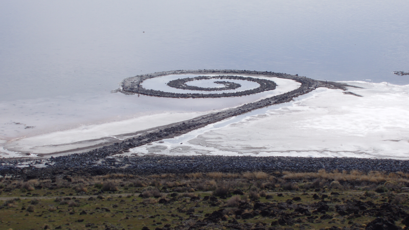
A geoglyph is a large design or motif (generally longer than 4 metres) produced on the ground by durable elements of the landscape, such as stones, stone fragments, gravel, or earth. A positive geoglyph is formed by the arrangement and alignment of materials on the ground in a manner akin to petroforms, while a negative geoglyph is formed by removing part of the natural ground surface to create differently coloured or textured ground in a manner akin to petroglyphs. Geoglyphs are generally a type of land art, and sometimes rock art. A hill figure is created on a slope, so that it can be seen from a distance. Ancient Perhaps the most famous geoglyphs are the Nazca lines in Peru. The cultural significance of these geoglyphs for their creators remains unclear, despite many hypotheses. The "Works of the Old Men" in Arabia, "stone-built structures that are far more numerous than (the) Nazca Lines, far more extensive in the area that they cover, and far older," have been describ ... [...More Info...] [...Related Items...] OR: [Wikipedia] [Google] [Baidu] |
Nazca Lines
The Nazca Lines are a group of geoglyphs made in the soil of the Nazca Desert in southern Peru. They were created between 500 BCE and 500 CE by people making depressions or shallow incisions in the desert floor, removing pebbles and leaving differently colored dirt exposed. There are two major phases of the Nazca lines, Paracas phase, from 400 to 200 BCE, and Nazca phase, from 200 BCE to 500 CE. In the years leading up to 2020, between 80 and 100 new figures had been found with the use of drones, and archaeologists believe that there are more to be found. Most lines run straight across the landscape, but there are also figurative designs of animals and plants. The individual figurative geoglyph designs measure between across. The combined length of all the lines is more than , and the group covers an area of about . The lines are typically deep. They were made by removing the top layer of reddish-brown iron oxide-coated pebbles to reveal a yellow-grey subsoil. The ... [...More Info...] [...Related Items...] OR: [Wikipedia] [Google] [Baidu] |
Megaliths In The Urals
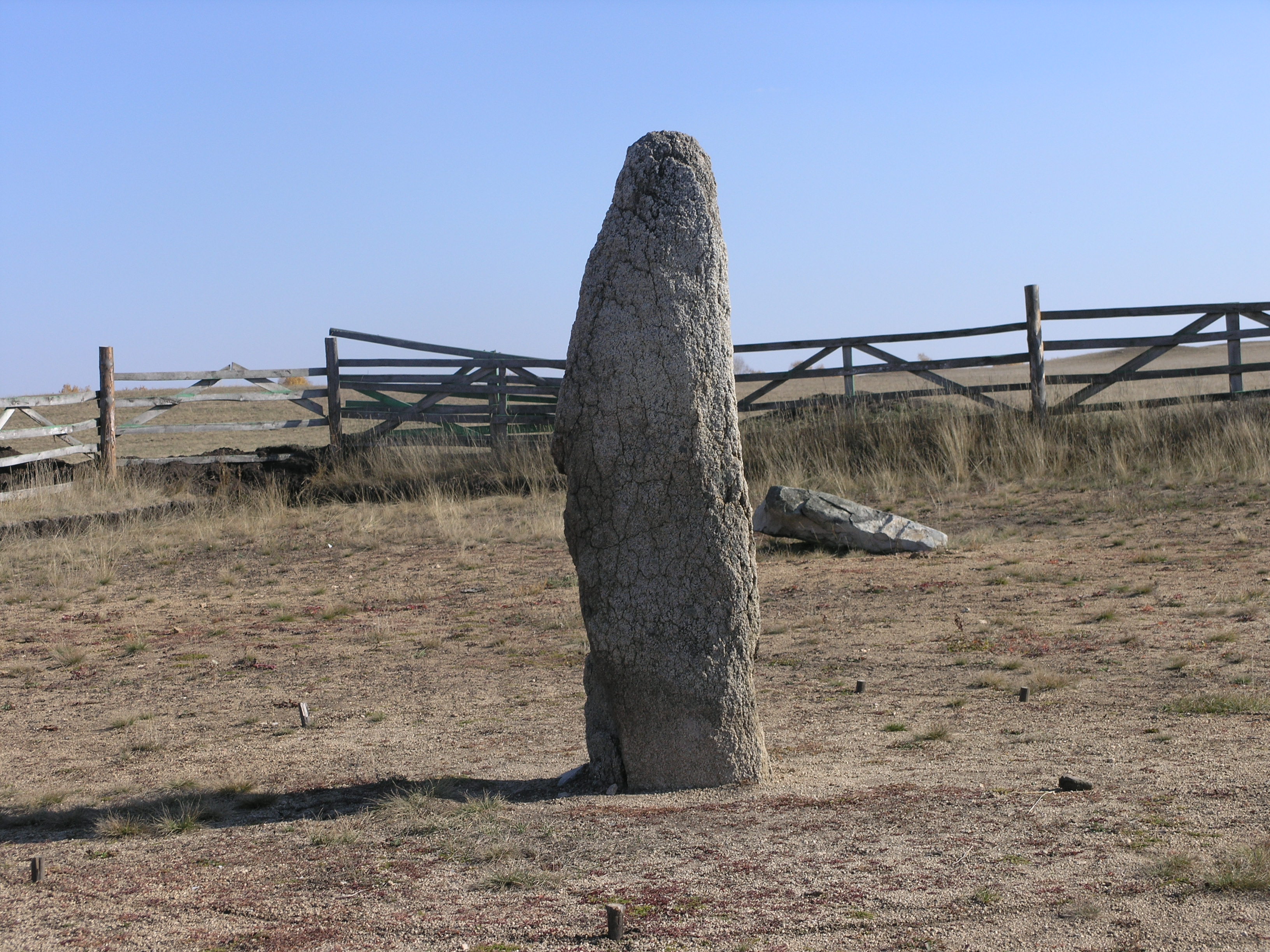
In recent years, many megaliths have been discovered in the Urals: dolmens, menhirs and a large megalithic cultic complex on Vera Island. Dolmens of the Middle Urals At present, more than 200 dolmens have been discovered in the Sverdlovsk Oblast. Specificity of the dolmens in the Middle Urals is their relatively small size (width and length no more than 1.5 - 2.5 m) and original constructions. Based on differences in their construction, it is possible to distinguish two main types of dolmen: :1. dolmens of stone plates and mound; :2. boulder dolmens. Dolmens of stone plates are structures consisting of a mound of stones and soil, with a stone chamber attached to it. Usually there is a square court in front of such dolmens. Sometimes such a court is surrounded by stones. The boulder dolmens had been made of massive boulders forming a chamber. From above the chamber is covered by either one or several flat boulders. Despite the differences of form and size of their chambers, all t ... [...More Info...] [...Related Items...] OR: [Wikipedia] [Google] [Baidu] |
Hill Figure
A hill figure is a large visual representation created by cutting into a steep hillside and revealing the underlying geology. It is a type of geoglyph usually designed to be seen from afar rather than above. In some cases trenches are dug and rubble made from material brighter than the natural bedrock is placed into them. The new material is often chalk, a soft and white form of limestone, leading to the alternative name of chalk figure for this form of art. Hill figures cut in grass are a phenomenon especially seen in England, where examples include the Cerne Abbas Giant, the Uffington White Horse, and the Long Man of Wilmington, as well as the "lost" carvings at Cambridge, Oxford and Plymouth Hoe. From the 18th century onwards, many further ones were added. Many figures long thought to be ancient have been found to be relatively recent when subjected to modern archaeological scrutiny, at least in their current form. Only the Uffington White Horse appears to retain a prehistori ... [...More Info...] [...Related Items...] OR: [Wikipedia] [Google] [Baidu] |
Rock Art
In archaeology, rock art is human-made markings placed on natural surfaces, typically vertical stone surfaces. A high proportion of surviving historic and prehistoric rock art is found in caves or partly enclosed rock shelters; this type also may be called cave art or parietal art. A global phenomenon, rock art is found in many culturally diverse regions of the world. It has been produced in many contexts throughout human history. In terms of technique, the four main groups are: * cave paintings, * petroglyphs, which are carved or scratched into the rock surface, * sculpted rock reliefs, and * geoglyphs, which are formed on the ground. The oldest known rock art dates from the Upper Palaeolithic period, having been found in Europe, Australia, Asia, and Africa. Anthropologists studying these artworks believe that they likely had magico-religious significance. The archaeological sub-discipline of rock art studies first developed in the late-19th century among Francophone scholar ... [...More Info...] [...Related Items...] OR: [Wikipedia] [Google] [Baidu] |
Hill Figure
A hill figure is a large visual representation created by cutting into a steep hillside and revealing the underlying geology. It is a type of geoglyph usually designed to be seen from afar rather than above. In some cases trenches are dug and rubble made from material brighter than the natural bedrock is placed into them. The new material is often chalk, a soft and white form of limestone, leading to the alternative name of chalk figure for this form of art. Hill figures cut in grass are a phenomenon especially seen in England, where examples include the Cerne Abbas Giant, the Uffington White Horse, and the Long Man of Wilmington, as well as the "lost" carvings at Cambridge, Oxford and Plymouth Hoe. From the 18th century onwards, many further ones were added. Many figures long thought to be ancient have been found to be relatively recent when subjected to modern archaeological scrutiny, at least in their current form. Only the Uffington White Horse appears to retain a prehistori ... [...More Info...] [...Related Items...] OR: [Wikipedia] [Google] [Baidu] |
Marree Man
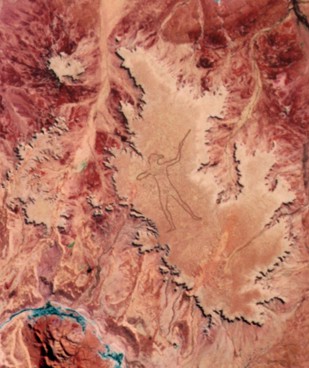
The Marree Man, or Stuart's Giant, is a modern geoglyph discovered in 1998. It appears to depict an Indigenous Australian man hunting with a boomerang or stick. It lies on a plateau at Finnis Springs west of the township of Marree in central South Australia, approximately 12 km north-west of Callanna. It is just outside the Woomera Prohibited Area. The figure is tall with a perimeter of , extending over an area of about . Although it is one of the largest geoglyphs in the world (arguably second to the Sajama Lines), its origin remains a mystery, with no one claiming responsibility for its creation nor any eye-witness having been found, notwithstanding the scale of the operation required to form the outline on the plateau floor. The description "Stuart's Giant" was used in anonymous faxes sent to media as "Press Releases" in July 1998, in a reference to the explorer John McDouall Stuart. It was discovered fortuitously by a charter pilot in an overflight on 26 June 1998. Sh ... [...More Info...] [...Related Items...] OR: [Wikipedia] [Google] [Baidu] |
Amazon Rainforest
The Amazon rainforest, Amazon jungle or ; es, Selva amazónica, , or usually ; french: Forêt amazonienne; nl, Amazoneregenwoud. In English, the names are sometimes capitalized further, as Amazon Rainforest, Amazon Forest, or Amazon Jungle. or Amazonia is a Tropical and subtropical moist broadleaf forests, moist broadleaf tropical rainforest in the Amazon biome that covers most of the Amazon basin of South America. This basin encompasses , of which are covered by the rainforest. This region includes territory belonging to nine nations and 3,344 formally acknowledged Indigenous territory (Brazil), indigenous territories. The majority of the forest is contained Amazônia Legal, within Brazil, with 60% of the rainforest, followed by Peruvian Amazonia, Peru with 13%, Amazon natural region, Colombia with 10%, and with minor amounts in Bolivia, Ecuador, French Guiana, Guyana, Suriname, and Venezuela. Four nations have "Amazonas (other), Amazonas" as the name of one of th ... [...More Info...] [...Related Items...] OR: [Wikipedia] [Google] [Baidu] |
Acre (state)
Acre () is a state located in the west of the North Region of Brazil and the Amazonia Legal. Located in the westernmost part of the country, at a two-hour time difference from Brasília, Acre is bordered clockwise by the Brazilian states of Amazonas and Rondônia to the north and east, the Bolivian department of Pando to the southeast, and the Peruvian regions of Madre de Dios, Ucayali and Loreto to the south and west. The state, which has 0.42% of the Brazilian population, generates 0.2% of the Brazilian GDP. Its capital and largest city is Rio Branco. Other important places include Cruzeiro do Sul, Sena Madureira, Tarauacá and Feijó. Intense extractive activity in the rubber industry, which reached its height in the early 20th century, attracted Brazilians from many regions to the state. From the mixture of sulista, southeastern Brazil, nordestino, and indigenous traditions arose a diverse cuisine. It combines sun-dried meat (carne-de-sol) with pirarucu, a typic ... [...More Info...] [...Related Items...] OR: [Wikipedia] [Google] [Baidu] |
Land Art
Land art, variously known as Earth art, environmental art, and Earthworks, is an art movement that emerged in the 1960s and 1970s, largely associated with Great Britain and the United StatesArt in the modern era: A guide to styles, schools, & movements. Abrams, 2002. (U.S. edition of Styles, Schools and Movements, by Amy Dempsey) but that also includes examples from many countries. As a trend, "land art" expanded boundaries of art by the materials used and the siting of the works. The materials used were often the materials of the Earth, including the soil, rocks, vegetation, and water found on-site, and the sites of the works were often distant from population centers. Though sometimes fairly inaccessible, photo documentation was commonly brought back to the urban art gallery.http://www.land-arts.com Land art. Concerns of the art mov ... [...More Info...] [...Related Items...] OR: [Wikipedia] [Google] [Baidu] |
Sápmi (area)
(, smj, Sábme / Sámeednam, sma, Saepmie, sju, Sábmie, , , sjd, Са̄мь е̄ммьне, Saam' jiemm'n'e) is the cultural region traditionally inhabited by the Sámi people. Sápmi is in Northern and Eastern Europe and includes the northern parts of Fennoscandia, also known as the "Cap of the North". The region stretches over four countries: Norway, Sweden, Finland, and Russia. On the north it is bounded by the Barents Sea, on the west by the Norwegian Sea, and on the east by the White Sea."Lapland." Encyclopædia Britannica. ''Encyclopædia Britannica Online. Encyclopædia Britannica'', 2009. Web. 24 November 2009 http://search.eb.com/eb/article-9047170. The area is historically referred to as Lapland () in English, although the term "Lapp" for its inhabitants is now considered pejorative.; ; Norwegian Sápmi was historically called ''Finnmǫrk'', a name used for the former county Finnmark, now Troms og Finnmark. Sápmi refers to the areas where the Sámi people h ... [...More Info...] [...Related Items...] OR: [Wikipedia] [Google] [Baidu] |
Chalk
Chalk is a soft, white, porous, sedimentary carbonate rock. It is a form of limestone composed of the mineral calcite and originally formed deep under the sea by the compression of microscopic plankton that had settled to the sea floor. Chalk is common throughout Western Europe, where deposits underlie parts of France, and steep cliffs are often seen where they meet the sea in places such as the Dover cliffs on the Kent coast of the English Channel. Chalk is mined for use in industry, such as for quicklime, bricks and builder's putty, and in agriculture, for raising pH in soils with high acidity. It is also used for " blackboard chalk" for writing and drawing on various types of surfaces, although these can also be manufactured from other carbonate-based minerals, or gypsum. Description Chalk is a fine-textured, earthy type of limestone distinguished by its light color, softness, and high porosity. It is composed mostly of tiny fragments of the calcite shells or skeletons ... [...More Info...] [...Related Items...] OR: [Wikipedia] [Google] [Baidu] |
Iceland
Iceland ( is, Ísland; ) is a Nordic island country in the North Atlantic Ocean and in the Arctic Ocean. Iceland is the most sparsely populated country in Europe. Iceland's capital and largest city is Reykjavík, which (along with its surrounding areas) is home to over 65% of the population. Iceland is the biggest part of the Mid-Atlantic Ridge that rises above sea level, and its central volcanic plateau is erupting almost constantly. The interior consists of a plateau characterised by sand and lava fields, mountains, and glaciers, and many glacial rivers flow to the sea through the lowlands. Iceland is warmed by the Gulf Stream and has a temperate climate, despite a high latitude just outside the Arctic Circle. Its high latitude and marine influence keep summers chilly, and most of its islands have a polar climate. According to the ancient manuscript , the settlement of Iceland began in 874 AD when the Norwegian chieftain Ingólfr Arnarson became the first p ... [...More Info...] [...Related Items...] OR: [Wikipedia] [Google] [Baidu] |


%2C_Western_Negev%2C_Israel.jpg)