|
Finger Lake
A finger lake, also known as a fjord lake or trough lake, is "a narrow linear body of water occupying a Overdeepening, glacially overdeepened valley and sometimes impounded by a Terminal moraine, morainic dam."Kotlyakov and Komarova (2007), 255. Where one end of a finger lake is drowned by the sea, it becomes a fjord or sea-loch. Examples New Zealand * Lake Wakatipu, Otago, South Island. United Kingdom England * Many of the lakes of the Lake District are finger lakes. Scotland * Many lochs of Scotland are finger lakes. Some like Loch Broom and Loch Maree form fjord and finger lake systems. Wales * Many of the Welsh llyns. United States * Finger Lakes, New York State See also * ''Zungenbecken'' * References Literature *Hamblin, P.F. and Carmack, E.C., 1978. ''River‐induced currents in a Fjord Lake.'' Journal of Geophysical Research: Oceans, 83(C2), pp. 885–899. * Kotlyakov, Vladimir and Anna Komarova, ''Elsevier's Dictionary of Geography: ... [...More Info...] [...Related Items...] OR: [Wikipedia] [Google] [Baidu] |
Finger Lakes
The Finger Lakes are a group of eleven long, narrow, roughly north–south lakes located south of Lake Ontario in an area called the ''Finger Lakes region'' in New York, in the United States. This region straddles the northern and transitional edge, known as the Finger Lakes Uplands and Gorges ecoregion, of the Northern Allegheny Plateau and the Ontario Lowlands ecoregion of the Great Lakes Lowlands.Bryce, S.A., Griffith, G.E., Omernik, J.M., Edinger, G., Indrick, S., Vargas, O., and Carlson, D., 2010''Ecoregions of New York'' Reston, Virginia, U.S. Geological Survey, map scale 1:1,250,000. The geological term '' finger lake'' refers to a long, narrow lake in an overdeepened glacial valley, while the proper name ''Finger Lakes'' goes back to the late 19th century.Mullins, H.T., Hinchey, E.J., Wellner, R.W., Stephens, D.B., Anderson, W.T., Dwyer, T.R. and Hine, A.C., 1996. ''Seismic stratigraphy of the Finger Lakes: a continental record of Heinrich event H-1 and Laurentide ice ... [...More Info...] [...Related Items...] OR: [Wikipedia] [Google] [Baidu] |
Overdeepening
Overdeepening is a characteristic of basins and valleys eroded by glaciers. An overdeepened valley profile is often eroded to depths which are hundreds of metres below the deepest continuous line (the thalweg) along a valley or watercourse. This phenomenon is observed under modern day glaciers, in salt-water fjords and fresh-water lakes remaining after glaciers melt, as well as in tunnel valleys which are partially or totally filled with sediment. When the channel produced by a glacier is filled with debris, the subsurface geomorphic structure is found to be erosionally cut into bedrock and subsequently filled by sediments. These overdeepened cuts into bedrock structures can reach a depth of several hundred metres below the valley floor. Overdeepened fjords and lakes have significant economic value as harbours and fisheries. Overdeepened basins and valleys filled with sediment (termed tunnel valleys) are of particular interest to engineers, petroleum geologists, and hydrologists; ... [...More Info...] [...Related Items...] OR: [Wikipedia] [Google] [Baidu] |
Terminal Moraine
A terminal moraine, also called end moraine, is a type of moraine that forms at the terminal (edge) of a glacier, marking its maximum advance. At this point, debris that has accumulated by plucking and abrasion, has been pushed by the front edge of the ice, is driven no further and instead is deposited in an unsorted pile of sediment. Because the glacier acts very much like a conveyor belt, the longer it stays in one place, the greater the amount of material that will be deposited. The moraine is left as the marking point of the terminal extent of the ice. Formation As a glacier moves along its path, the surrounding area is continuously eroding. Loose rock and pieces of bedrock are constantly being picked up and transported with the glacier. Fine sediment and particles are also incorporated into the glacial ice. The accumulation of these rocks and sediment together form what is called glacial till when deposited. Push moraines are formed when a glacier retreats from a previo ... [...More Info...] [...Related Items...] OR: [Wikipedia] [Google] [Baidu] |
Fjord
In physical geography, a fjord or fiord () is a long, narrow inlet with steep sides or cliffs, created by a glacier. Fjords exist on the coasts of Alaska, Antarctica, British Columbia, Chile, Denmark, Förden and East Jutland Fjorde, Germany, Greenland, the Faroe Islands, Iceland, Ireland, Kamchatka, the Kerguelen Islands, Labrador, Newfoundland (island), Newfoundland, New Zealand, Norway, Novaya Zemlya, Nunavut, Quebec, the Patagonia region of Argentina and Chile, Russia, South Georgia Island, Tasmania, United Kingdom, and Washington (state), Washington state. Norwegian coastline, Norway's coastline is estimated to be long with its nearly 1,200 fjords, but only long coastline paradox, excluding the fjords. Formation A true fjord is formed when a glacier cuts a U-shaped valley by ice segregation and Abrasion (geology), abrasion of the surrounding bedrock. According to the standard model, glaciers formed in pre-glacial valleys with a gently sloping valley floor. The work o ... [...More Info...] [...Related Items...] OR: [Wikipedia] [Google] [Baidu] |
Sea-loch
''Loch'' () is the Scottish Gaelic, Scots and Irish word for a lake or sea inlet. It is cognate with the Manx lough, Cornish logh, and one of the Welsh words for lake, llwch. In English English and Hiberno-English, the anglicised spelling lough is commonly found in place names; in Lowland Scots and Scottish English, the spelling "loch" is always used. Many loughs are connected to stories of lake-bursts, signifying their mythical origin. Sea-inlet lochs are often called sea lochs or sea loughs. Some such bodies of water could also be called firths, fjords, estuaries, straits or bays. Background This name for a body of water is Insular CelticThe current form has currency in the following languages: Scottish Gaelic, Irish, Manx, and has been borrowed into Lowland Scots, Scottish English, Irish English and Standard English. in origin and is applied to most lakes in Scotland and to many sea inlets in the west and north of Scotland. The word comes from Proto-Indo ... [...More Info...] [...Related Items...] OR: [Wikipedia] [Google] [Baidu] |
Lake Wakatipu And Remarkable Mountains
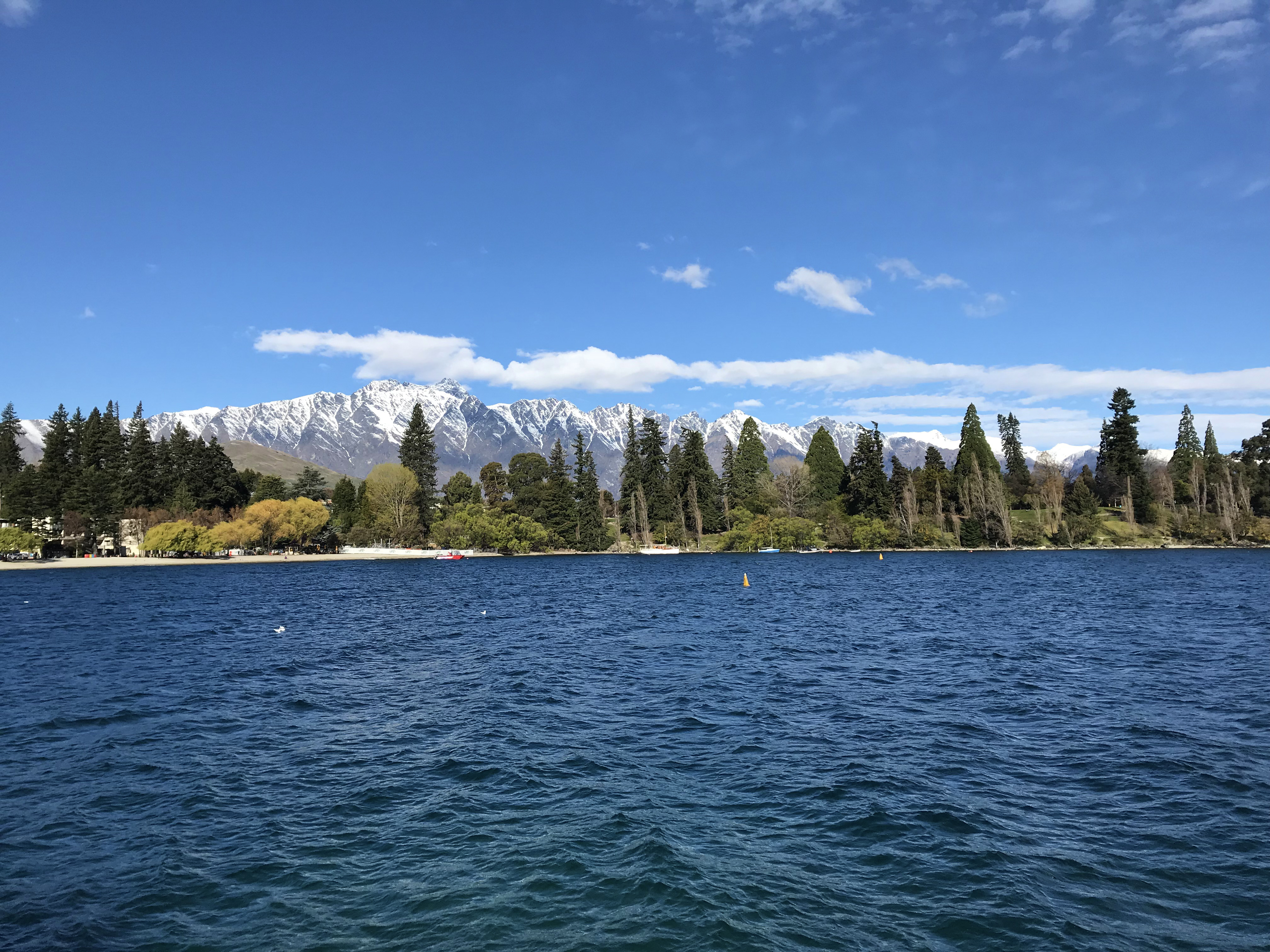
A lake is an area filled with water, localized in a basin, surrounded by land, and distinct from any river or other outlet that serves to feed or drain the lake. Lakes lie on land and are not part of the ocean, although, like the much larger oceans, they do form part of the Earth's water cycle. Lakes are distinct from lagoons, which are generally coastal parts of the ocean. Lakes are typically larger and deeper than ponds, which also lie on land, though there are no official or scientific definitions. Lakes can be contrasted with rivers or streams, which usually flow in a channel on land. Most lakes are fed and drained by rivers and streams. Natural lakes are generally found in mountainous areas, rift zones, and areas with ongoing glaciation. Other lakes are found in endorheic basins or along the courses of mature rivers, where a river channel has widened into a basin. Some parts of the world have many lakes formed by the chaotic drainage patterns left over from the last ic ... [...More Info...] [...Related Items...] OR: [Wikipedia] [Google] [Baidu] |
Lake Wakatipu
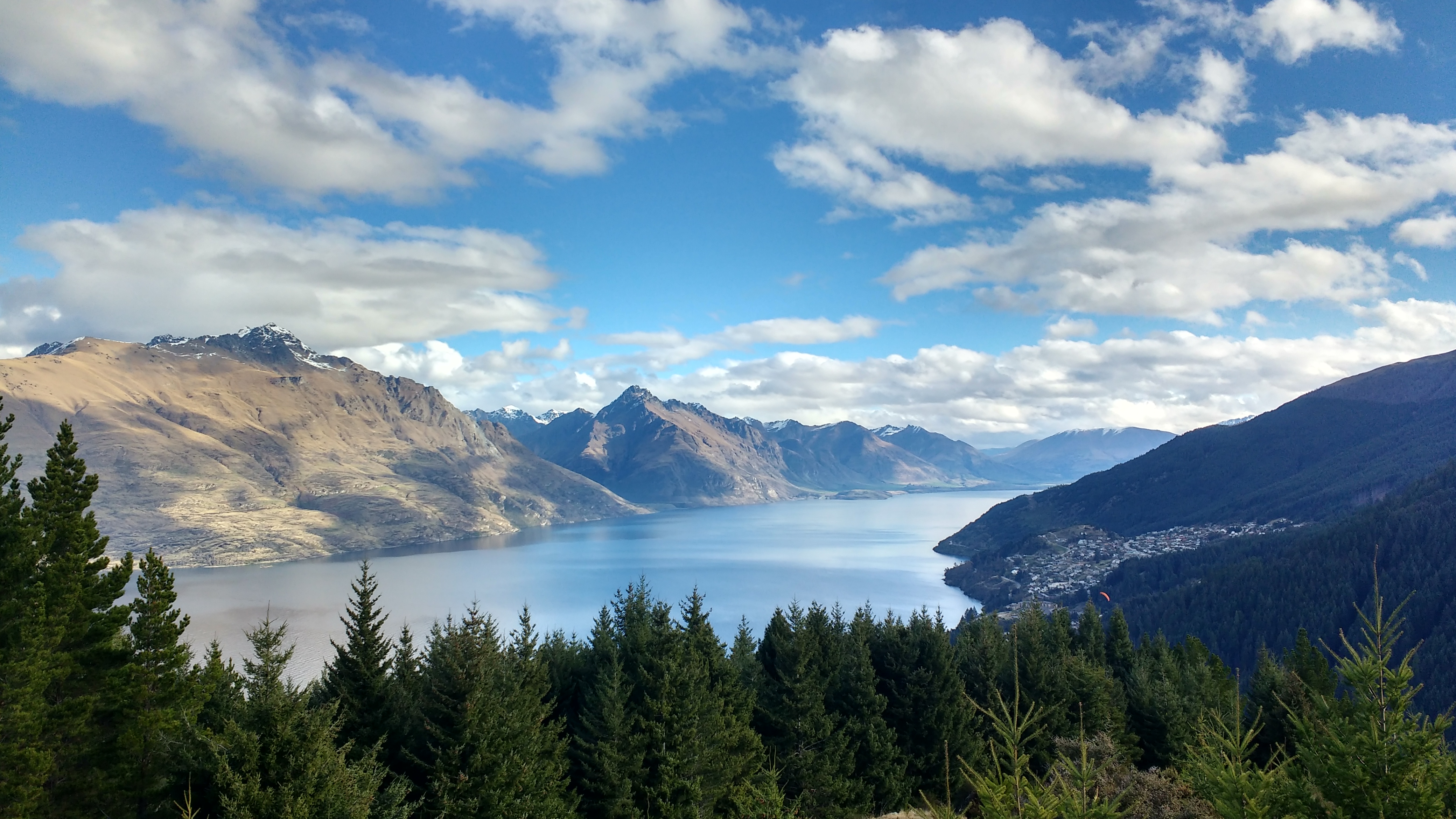
Lake Wakatipu ( mi, Whakatipu Waimāori) is an inland lake ( finger lake) in the South Island of New Zealand. It is in the southwest corner of the Otago region, near its boundary with Southland. ''Lake Wakatipu'' comes from the original Māori name . With a length of , it is New Zealand's longest lake, and, at , its third largest. The lake is also very deep, its floor being below sea level, with a maximum depth of . It is at an altitude of , towards the southern end of the Southern Alps / Kā Tiritiri o te Moana. The general topography is a reversed "N" shape or "dog leg". The Dart River / Te Awa Whakatipu flows into the northern end, the lake then runs south for 30 kilometres before turning abruptly to the east. Twenty kilometres (12.4 mi) further along, it turns sharply to the south, reaching its southern end further south, near Kingston. The lake is drained by the Kawarau River, which flows out from the lake's only arm, the Frankton Arm, east of Queenstown. Unti ... [...More Info...] [...Related Items...] OR: [Wikipedia] [Google] [Baidu] |
Lake District
The Lake District, also known as the Lakes or Lakeland, is a mountainous region in North West England. A popular holiday destination, it is famous for its lakes, forests, and mountains (or '' fells''), and its associations with William Wordsworth and other Lake Poets and also with Beatrix Potter and John Ruskin. The Lake District National Park was established in 1951 and covers an area of . It was designated a UNESCO World Heritage Site in 2017. The Lake District is today completely within Cumbria, a county and administrative unit created in 1974 by the Local Government Act 1972. However, it was historically divided between three English counties (Cumberland, Westmorland and Lancashire), sometimes referred to as the Lakes Counties. The three counties met at the Three Shire Stone on Wrynose Pass in the southern fells west of Ambleside. All the land in England higher than above sea level lies within the National Park, including Scafell Pike, the highest mountain in England. ... [...More Info...] [...Related Items...] OR: [Wikipedia] [Google] [Baidu] |
Loch Maree
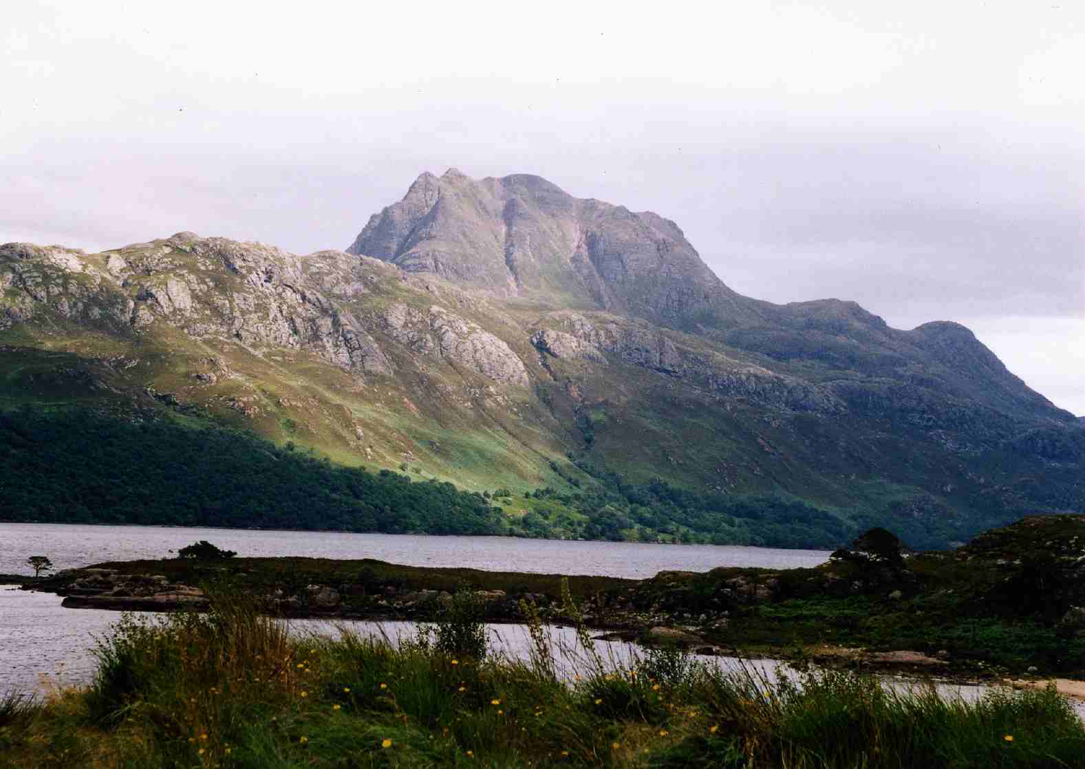
Loch Maree ( gd, Loch Ma-ruibhe) is a loch in Wester Ross in the Northwest Highlands of Scotland. At long and with a maximum width of , it is the fourth-largest freshwater loch in Scotland; it is the largest north of Loch Ness. Its surface area is . Loch Maree contains five large wooded islands and over 60 smaller ones, many of which have their own lochans. The largest island, Eilean Sùbhainn, contains a loch that itself contains an island,Ordnance Survey. 1:25000 ''Explorer'' map. Sheet 433, Torridon - Beinn Eighe & Liathach. a situation that occurs nowhere else in Great Britain. Isle Maree holds the remains of a chapel believed to be the 8th century hermitage of Saint Máel Ruba (d. 722), who founded the monastery of Applecross in 672. It is after him that Loch Maree is named; prior to the saint's arrival in the area the loch is believed to have been named Loch Ewe, as evidenced by the name of the village of Kinlochewe ( gd, Ceann Loch Iù, meaning "Head of Loch Ewe") ... [...More Info...] [...Related Items...] OR: [Wikipedia] [Google] [Baidu] |
Lochs Of Scotland
This list of lochs in Scotland includes the majority of bodies of standing freshwater named as lochs but only a small selection of the generally smaller, and very numerous, lochans. This list does not currently include the reservoirs of Scotland except where these are modifications of pre-existing lochs and retain the name "loch" or "lochan". It has been estimated that there are at least 31,460 freshwater lochs (including lochans) in Scotland, and more than 7,500 in the Western Isles alone."Botanical survey of Scottish freshwater lochs" SNH Information and Advisory Note Number 4. Retrieved 1 January 2010. Whilst lochs are widespread throughout the country, they are most numerous within the |
Loch Broom
Loch Broom ( gd, Lochbraon, "loch of rain showers") is a sea loch located in northwestern Ross and Cromarty, in the former parish of Lochbroom, on the west coast of Scotland. The small town of Ullapool lies on the eastern shore of the loch. Little Loch Broom Its sister loch, Little Loch Broom ( gd, An Loch Beag, "the little loch"), lies just to the west, at the foot of An Teallach and opening into the Minch. The village of Dundonnell is located at the mouth of the loch, linked by the A832 coast road to Camusnagaul on the eastern shore, midway up the loch, and Badcaul further north. The loch is an important wildlife habitat, and a population of cormorants often bask on the rocks jutting out of the water. Geography Loch Broom Loch Broom is fed by the River Broom which rises in the Dirrie mountains, issuing from two lochs: Loch Bhraoin and Loch Droma. Loch Broom feeds the River Cuileig, which is joined by the Allt Breabaig stream that rises in Sgùrr Breac to the south. ... [...More Info...] [...Related Items...] OR: [Wikipedia] [Google] [Baidu] |


.jpg)


