|
Fortifications Of The Cape Peninsula
Dozens of fortifications were built in Cape Town and the Cape Peninsula between the 1650s and the 1940s. Most have gone, but a few still stand. List of fortifications Entries in bold indicate that the building still stands, either intact or in ruins. Dutch colonial period (1652–1795) 17th century * Fort de Goede Hoop (1652–1674) – Table Bay (present Grand Parade) * Tranenborg (1652–?) – Table Bay (Salt River mouth) * Duynhoop (1654–1672) – Table Bay (Salt River mouth) * :af:Coornhoop (1657–1662) – present-day Mowbray * Kyckuyt (1659–1670s) – present-day Paarden Eiland * Keert de Koe (1659–1670s) – present-day Maitland * Houdt den Bul (1659–1663) – present-day Bishopscourt * Ruyterwacht (1659–1660s) – present-day Rondebosch * Santhoop (1661–?) – Table Bay (near Salt River mouth) * Castle of Good Hope (born 1674) – Table Bay 18th century * Chavonnes Battery (1726–1860) – Table Bay * Fort De Knokke (1744–1926) – Table Bay * Sea ... [...More Info...] [...Related Items...] OR: [Wikipedia] [Google] [Baidu] |
Cape Town
Cape Town ( af, Kaapstad; , xh, iKapa) is one of South Africa's three capital cities, serving as the seat of the Parliament of South Africa. It is the legislative capital of the country, the oldest city in the country, and the second largest (after Johannesburg). Colloquially named the ''Mother City'', it is the largest city of the Western Cape province, and is managed by the City of Cape Town metropolitan municipality. The other two capitals are Pretoria, the executive capital, located in Gauteng, where the Presidency is based, and Bloemfontein, the judicial capital in the Free State, where the Supreme Court of Appeal is located. Cape Town is ranked as a Beta world city by the Globalization and World Cities Research Network. The city is known for its harbour, for its natural setting in the Cape Floristic Region, and for landmarks such as Table Mountain and Cape Point. Cape Town is home to 66% of the Western Cape's population. In 2014, Cape Town was named the best place ... [...More Info...] [...Related Items...] OR: [Wikipedia] [Google] [Baidu] |
Lion's Head (Cape Town)
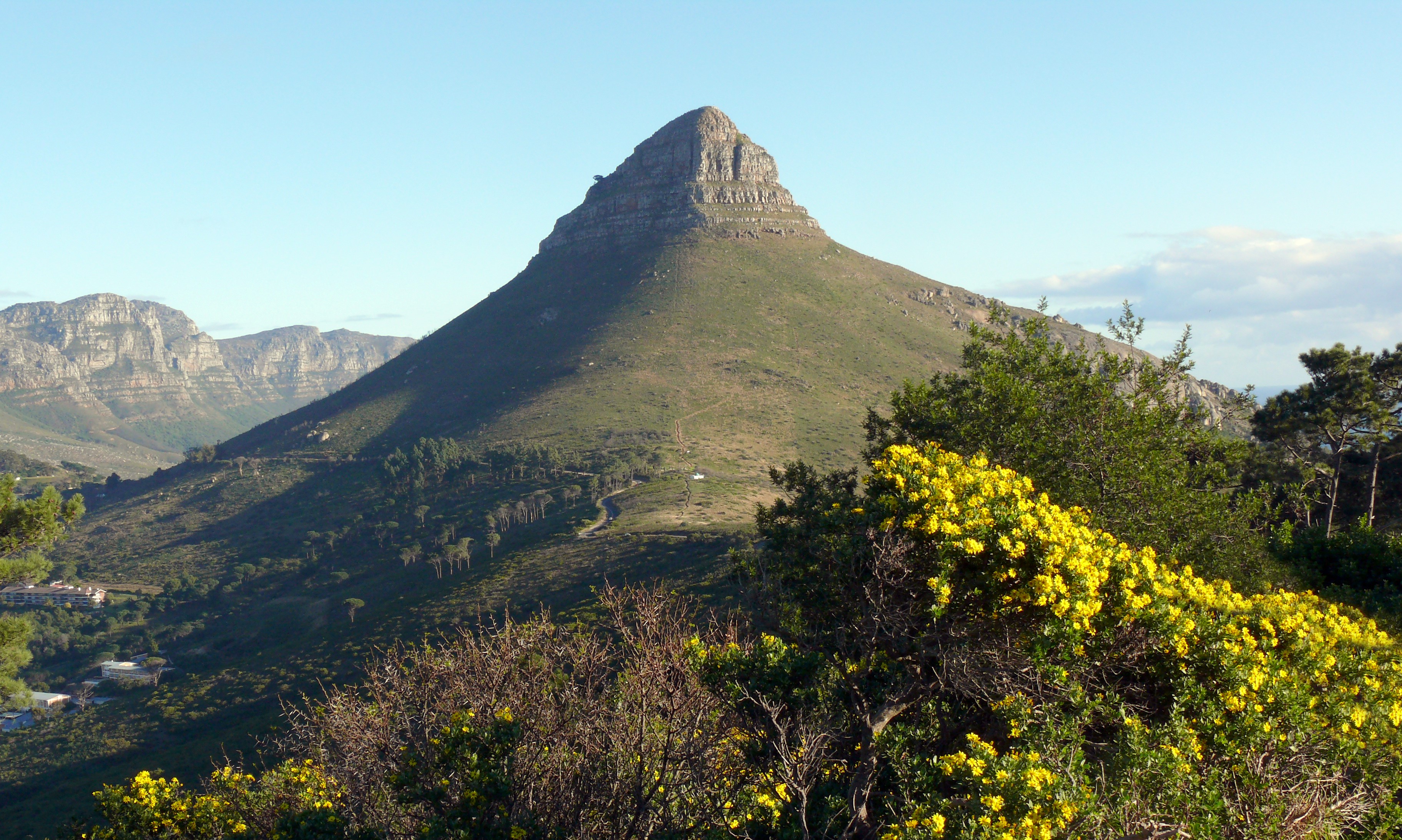
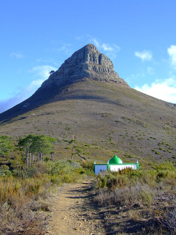
Lion's Head is a mountain in Cape Town, South Africa, between Table Mountain and Signal Hill. Lion's Head peaks at above sea level. The peak forms part of a dramatic backdrop to the city of Cape Town and is part of the Table Mountain National Park. Surrounding The suburbs of the city surround the peak and Signal Hill on almost all sides, but strict management by city authorities has kept development of housing off the higher ground. The area is significant to the Cape Malay community, who historically lived in the Bo-Kaap quarter close to Lion's Head. There are a number of historic graves and shrines (''kramat''s) of Malay leaders on the lower slopes and on Signal Hill. History In the 17th century the peak was known as ''Leeuwen Kop'' (Lion's Head) by the Dutch, and Signal Hill was known as ''Leeuwen Staart'' (Lion's Tail), as the shape resembles a crouching lion or a sphinx. The English in the 17th Century called the peak Sugar Loaf. In 1897 gold was discovered on Lion' ... [...More Info...] [...Related Items...] OR: [Wikipedia] [Google] [Baidu] |
Robben Island
Robben Island ( af, Robbeneiland) is an island in Table Bay, 6.9 kilometres (4.3 mi) west of the coast of Bloubergstrand, north of Cape Town, South Africa. It takes its name from the Dutch word for seals (''robben''), hence the Dutch/Afrikaans name ''Robbeneiland'', which translates to ''Seal(s) Island''. Robben Island is roughly oval in shape, long north–south, and wide, with an area of . It is flat and only a few metres above sea level, as a result of an ancient erosion event. It was fortified and used as a prison from the late-seventeenth century until 1996, after the end of apartheid. Political activist and lawyer Nelson Mandela was imprisoned on the island for 18 of the 27 years of his imprisonment before the fall of apartheid and introduction of full, multi-racial democracy. He was later awarded the Nobel Peace Prize and was elected in 1994 as President of South Africa, becoming the country's first black president and serving one term from 1994–1999. In additio ... [...More Info...] [...Related Items...] OR: [Wikipedia] [Google] [Baidu] |
Llandudno, Cape Town
Llandudno is a seaside suburb of Cape Town on the Atlantic seaboard of the Cape Peninsula in the Western Cape, South Africa. There are no street lights, shops or commercial activities, and the town has some of the most expensive residential property in South Africa. Llandudno Beach is one of the Cape's most naturally diverse beaches, surrounded by large granite boulders and overlooked by mountains. It is a popular surfing spot, but the swimming can be treacherous, with rough seas and extremely cold water. Llandudno has lifeguards on duty during the summer season, operated by the Llandudno Surf Lifesaving club. It is also the access point for the walk to Sandy Bay, an isolated beach still popular with nudists. On 26 September 1903 the valley was declared a township and named Llandudno after the North Wales seaside resort of Llandudno, which means "Parish of Saint Tudno" in the Welsh language Welsh ( or ) is a Celtic language family, Celtic language of the Brittonic lan ... [...More Info...] [...Related Items...] OR: [Wikipedia] [Google] [Baidu] |
Milnerton
Milnerton is a seaside suburb on Table Bay and is located north of central Cape Town in South Africa. It is located 11 kilometres to the north of the city's centre. Suburbs Suburbs/neighbourhoods of the greater Milnerton area include: * Bothasig * Brooklyn * Century City * Edgemead * Joe Slovo Park * Lagoon Beach * Marconi Beam * Metro Industrial Township * Milnerton Ridge * Montague Gardens * Monte Vista * Paarden Eiland * Phoenix * Plattekloof Glen * Rugby * Sanddrift * Summer Greens * Sunset Beach * Sunset Links * Tijgerhof * Woodbridge Island Milnerton lagoon One of the most identifiable features of Milnerton is its lagoon, formed where the Diep River enters the sea, with palm trees adorning the lagoon banks. Woodbridge Island Woodbridge Island is not actually an island, but rather the area south of Milnerton Golf Club on the peninsula separating the lagoon from the ocean. Two bridges join Woodbridge Island to the mainland of Milnerton proper. The wooden bridge ... [...More Info...] [...Related Items...] OR: [Wikipedia] [Google] [Baidu] |
Robben Island Battery 1
Robben is both a given name and a patronymic surname with origins in North Brabant, Drenthe and Emsland. at the Database of Surnames in The Netherlands People with the name include: ;Surname: * (born 1984), Dutch former professional footballer * Jaap Robben (born 1984), Dutch author and playwright * Jens Robben (born 1983), German football midfielder * (born 1984), Dutch handball player, sister of Miranda * (born 1986), Dutch handball player, sister of Jolanda Given name: * |
Signal Hill (Cape Town)
Signal Hill ( af, Seinheuwel), or Lion's Rump, is a landmark flat-topped hill located in Cape Town, next to Lion's Head and Table Mountain. The hill was also known as "The Lion's Flank", a term now obsolete. Together with Lion's Head, Signal Hill looks like a lion sphinx. Signals Signal flags were used to communicate weather warnings as well as anchoring instructions to visiting ships in order to ensure that they prepared adequately for stormy weather while in the bay. Similarly, ships could use flags to signal for assistance if, for example, an anchor line parted during a storm. It is known for the Noon Gun that is operated there by the South African Navy and South African Astronomical Observatory. In 1836, a time ball was set up at the Cape Town observatory, however it was not visible to ships in the harbour, so a second time ball was erected on Signal Hill in order to relay the precise moment of 1pm Cape Mean Time. In this way ships in the bay were able to check their m ... [...More Info...] [...Related Items...] OR: [Wikipedia] [Google] [Baidu] |
Three Anchor Bay
Three Anchor Bay is a suburb of Cape Town in the Western Cape province of South Africa. Small anchorage in Table Bay. The name, first encountered in 1661, possibly refers to anchors securing chains stretched as defence across the bay. The form Drieankerbaai is preferred for official purposes. Afrikaans language author and poet Ingrid Jonker drowned herself at the nearby beach on July 19, 1965. The National Sea Rescue Institute is headquartered there. In the period May 2020 through February 2021 there were 25 apartments sold in the suburb at an average price of R 34361 / m² References 4Lance Real Estate Three Anchor Bay Property Review {{Authority control Suburbs of Cape Town ... [...More Info...] [...Related Items...] OR: [Wikipedia] [Google] [Baidu] |
Mouille Point
Mouille Point ("Mu-lee") is an affluent suburb of Cape Town, situated between the Victoria & Alfred Waterfront, Victoria and Alfred Waterfront and Granger Bay to the east, Green Point, Cape Town, Green Point to the south and the Atlantic Ocean to the north and west. The suburb hugs the coastline and is dominated by high-end apartment blocks. It is a very small suburb, having only two major roads (Beach Road and Bay Road). It is home to the Mouille Point promenade, a paved promenade on the coast that is used daily by thousands of Capetonians. Behind it lies the Green Point Common, where numerous playing fields and a golf course are situated. The new Green Point Common, Green Point Urban Park & Biodiversity Garden is just behind Mouille Point and has an entrance on Bay Road. The name "Mouille" comes from the French word for an anchoring ground. In the early 18th century ships were often swept ashore in Table Bay and the then governor decided that a breakwater (mouille in French) was ... [...More Info...] [...Related Items...] OR: [Wikipedia] [Google] [Baidu] |
Table Mountain-Kings Blockhouse-001
* The Table (other)
* Table Mountain (other)
* Table Rock ...
Table may refer to: * Table (furniture), a piece of furniture with a flat surface and one or more legs * Table (landform), a flat area of land * Table (information), a data arrangement with rows and columns * Table (database), how the table data arrangement is used within databases * Calligra Tables, a spreadsheet application * Mathematical table * Table (parliamentary procedure) * Tables (board game) * Table, surface of the sound board (music) of a string instrument * ''Al-Ma'ida'', the fifth ''surah'' of the Qur'an, usually translated as “The Table” * Water table See also * Spreadsheet, a computer application * Table cut, a type of diamond cut A diamond cut is a style or design guide used when shaping a diamond for polishing such as the brilliant cut. Cut does not refer to shape (pear, oval), but the symmetry, proportioning and polish of a diamond. The cut of a diamond greatly affects ... [...More Info...] [...Related Items...] OR: [Wikipedia] [Google] [Baidu] |


