|
Flatwood
Flatwood is a soil series with impaired drainage that occurs in the southeastern United States. Flatwood soils are upland soils formed from marine sediments. A shallow water table plays a role in soil formation; typically the water table is only a few feet deep and fluctuates during the year. Flatwood soils are classified in USDA soil taxonomy as fine, mixed, semiactive, mesic Aquic Hapludults. See also *Ultisols
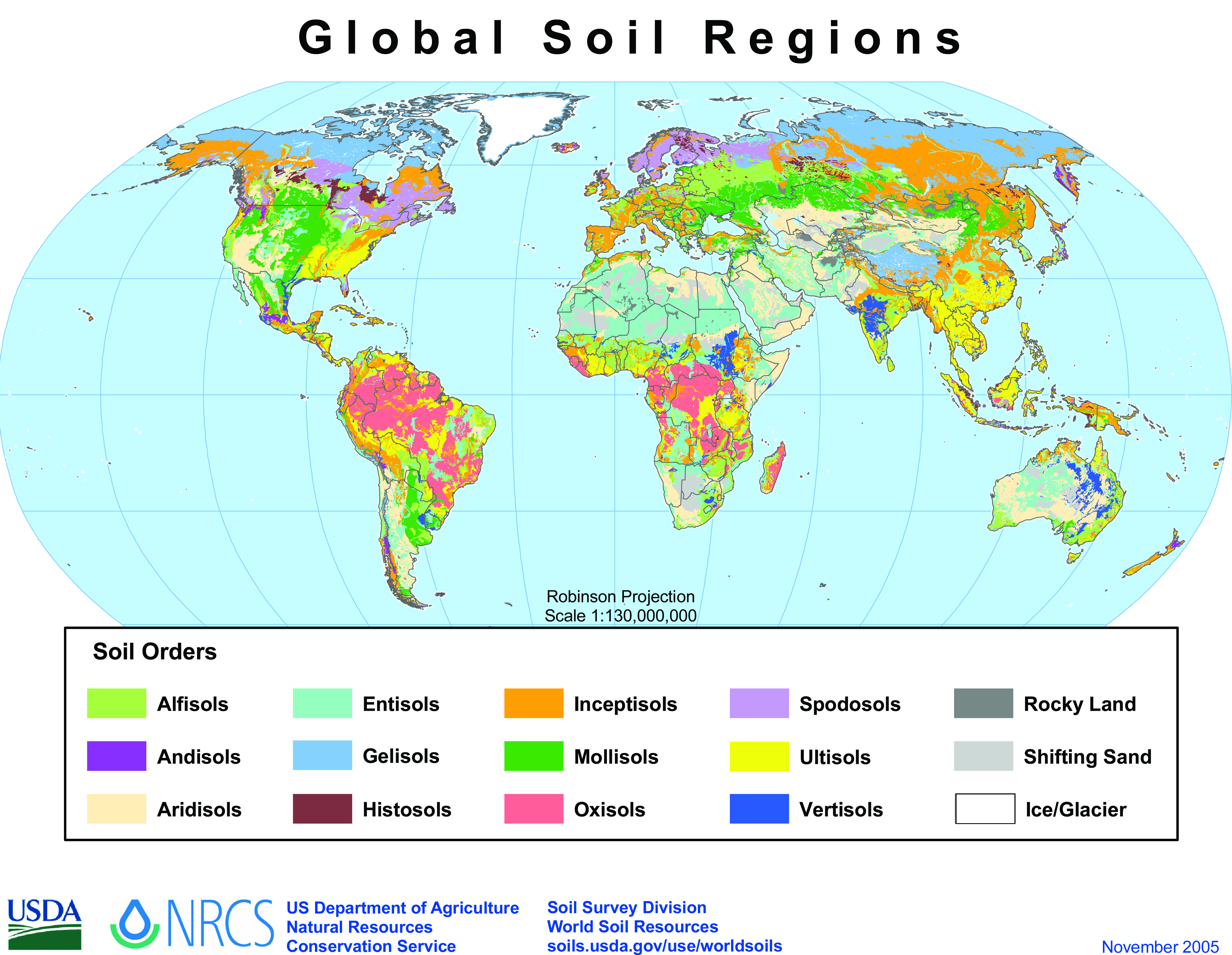
Ultisols, commonly known as red clay soils, are one of twelve soil orders in the United States Department of Agriculture soil taxonomy. ...
[...More Info...] [...Related Items...] OR: [Wikipedia] [Google] [Baidu] |
Soil
Soil, also commonly referred to as earth or dirt, is a mixture of organic matter, minerals, gases, liquids, and organisms that together support life. Some scientific definitions distinguish ''dirt'' from ''soil'' by restricting the former term specifically to displaced soil. Soil consists of a solid phase of minerals and organic matter (the soil matrix), as well as a porous phase that holds gases (the soil atmosphere) and water (the soil solution). Accordingly, soil is a three-state system of solids, liquids, and gases. Soil is a product of several factors: the influence of climate, relief (elevation, orientation, and slope of terrain), organisms, and the soil's parent materials (original minerals) interacting over time. It continually undergoes development by way of numerous physical, chemical and biological processes, which include weathering with associated erosion. Given its complexity and strong internal connectedness, soil ecologists regard soil as an ecosystem. Most ... [...More Info...] [...Related Items...] OR: [Wikipedia] [Google] [Baidu] |
Water Table
The water table is the upper surface of the zone of saturation. The zone of saturation is where the pores and fractures of the ground are saturated with water. It can also be simply explained as the depth below which the ground is saturated. The water table is the surface where the water pressure head is equal to the atmospheric pressure (where gauge pressure = 0). It may be visualized as the "surface" of the subsurface materials that are saturated with groundwater in a given vicinity. The groundwater may be from precipitation or from groundwater flowing into the aquifer. In areas with sufficient precipitation, water infiltrates through pore spaces in the soil, passing through the unsaturated zone. At increasing depths, water fills in more of the pore spaces in the soils, until a zone of saturation is reached. Below the water table, in the phreatic zone (zone of saturation), layers of permeable rock that yield groundwater are called aquifers. In less permeable soils, such as ... [...More Info...] [...Related Items...] OR: [Wikipedia] [Google] [Baidu] |
Soil Formation
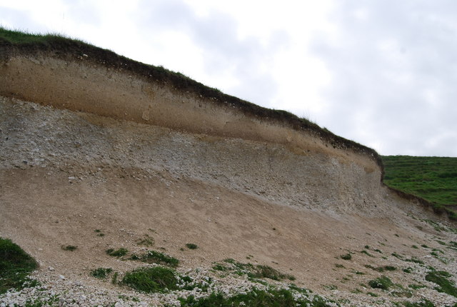
Soil formation, also known as pedogenesis, is the process of soil genesis as regulated by the effects of place, environment, and history. Biogeochemical processes act to both create and destroy order (anisotropy) within soils. These alterations lead to the development of layers, termed soil horizon, distinguished by differences in color, structure, texture, and chemistry. These features occur in patterns of soil type distribution, forming in response to differences in soil forming factors. Pedogenesis is studied as a branch of pedology, the study of soil in its natural environment. Other branches of pedology are the study of soil morphology, and soil classification. The study of pedogenesis is important to understanding soil distribution patterns in current ( soil geography) and past (paleopedology) geologic periods. Overview Soil develops through a series of changes. The starting point is weathering of freshly accumulated parent material. A variety of soil microbes (bacteria, ar ... [...More Info...] [...Related Items...] OR: [Wikipedia] [Google] [Baidu] |
Soil Classification
Soil classification deals with the systematic categorization of soils based on distinguishing characteristics as well as criteria that dictate choices in use. Overview Soil classification is a dynamic subject, from the structure of the system, to the definitions of classes, to the application in the field. Soil classification can be approached from the perspective of soil as a material and soil as a resource. Inscriptions at the temple of Horus at Edfu outline a soil classification used by Tanen to determine what kind of temple to build at which site. Ancient Greek scholars produced a number of classification based on several different qualities of the soil. Engineering Geotechnical engineers classify soils according to their engineering properties as they relate to use for foundation support or building material. Modern engineering classification systems are designed to allow an easy transition from field observations to basic predictions of soil engineering properties and ... [...More Info...] [...Related Items...] OR: [Wikipedia] [Google] [Baidu] |
USDA Soil Taxonomy
USDA soil taxonomy (ST) developed by the United States Department of Agriculture and the National Cooperative Soil Survey provides an elaborate classification of soil types according to several parameters (most commonly their properties) and in several levels: ''Order'', ''Suborder'', ''Great Group'', ''Subgroup'', ''Family'', and ''Series''. The classification was originally developed by Guy Donald Smith, former director of the U.S. Department of Agriculture's soil survey investigations. Discussion A taxonomy is an arrangement in a systematic manner; the USDA soil taxonomy has six levels of classification. They are, from most general to specific: order, suborder, great group, subgroup, family and series. Soil properties that can be measured quantitatively are used in this classification system – they include: depth, moisture, temperature, texture, structure, cation exchange capacity, base saturation, clay mineralogy, organic matter content and salt content. There are 12 soil ... [...More Info...] [...Related Items...] OR: [Wikipedia] [Google] [Baidu] |
Ultisols
Ultisols, commonly known as red clay soils, are one of twelve soil orders in the United States Department of Agriculture soil taxonomy. The word "Ultisol" is derived from "ultimate", because Ultisols were seen as the ultimate product of continuous weathering of minerals in a humid, temperate climate without new soil formation via glaciation. They are defined as mineral soils which contain no calcareous ( calcium carbonate containing) material anywhere within the soil, have less than 10% weatherable minerals in the extreme top layer of soil, and have less than 35% base saturation throughout the soil. Ultisols occur in humid temperate or tropical regions. While the term is usually applied to the red clay soils of the Southern United States, Ultisols are also found in regions of Africa, Asia, and South America. In the World Reference Base for Soil Resources (WRB), most Ultisols are known as Acrisols and Alisols. Some belong to the Retisols or to the Nitisols. Aquults are typically ... [...More Info...] [...Related Items...] OR: [Wikipedia] [Google] [Baidu] |
Pedology
Pedology (from Greek: πέδον, ''pedon'', "soil"; and λόγος, ''logos'', "study") is a discipline within soil science which focuses on understanding and characterizing soil formation, evolution, and the theoretical frameworks for modeling soil bodies, often in the context of the natural environment. Pedology is often seen as one of two main branches of soil inquiry, the other being edaphology which is traditionally more agronomically oriented and focuses on how soil properties influence plant communities (natural or cultivated). In studying the fundamental phenomenology of soils, e.g. soil formation (aka pedogenesis), pedologists pay particular attention to observing soil morphology and the geographic distributions of soils, and the placement of soil bodies into larger temporal and spatial contexts. In so doing, pedologists develop systems of soil classification, soil maps, and theories for characterizing temporal and spatial interrelations among soils . There are a few note ... [...More Info...] [...Related Items...] OR: [Wikipedia] [Google] [Baidu] |
Types Of Soil
Type may refer to: Science and technology Computing * Typing, producing text via a keyboard, typewriter, etc. * Data type, collection of values used for computations. * File type * TYPE (DOS command), a command to display contents of a file. * Type (Unix), a command in POSIX shells that gives information about commands. * Type safety, the extent to which a programming language discourages or prevents type errors. * Type system, defines a programming language's response to data types. Mathematics * Type (model theory) * Type theory, basis for the study of type systems * Arity or type, the number of operands a function takes * Type, any proposition or set in the intuitionistic type theory * Type, of an entire function ** Exponential type Biology * Type (biology), which fixes a scientific name to a taxon * Dog type, categorization by use or function of domestic dogs Lettering * Type is a design concept for lettering used in typography which helped bring about modern textual printin ... [...More Info...] [...Related Items...] OR: [Wikipedia] [Google] [Baidu] |


