|
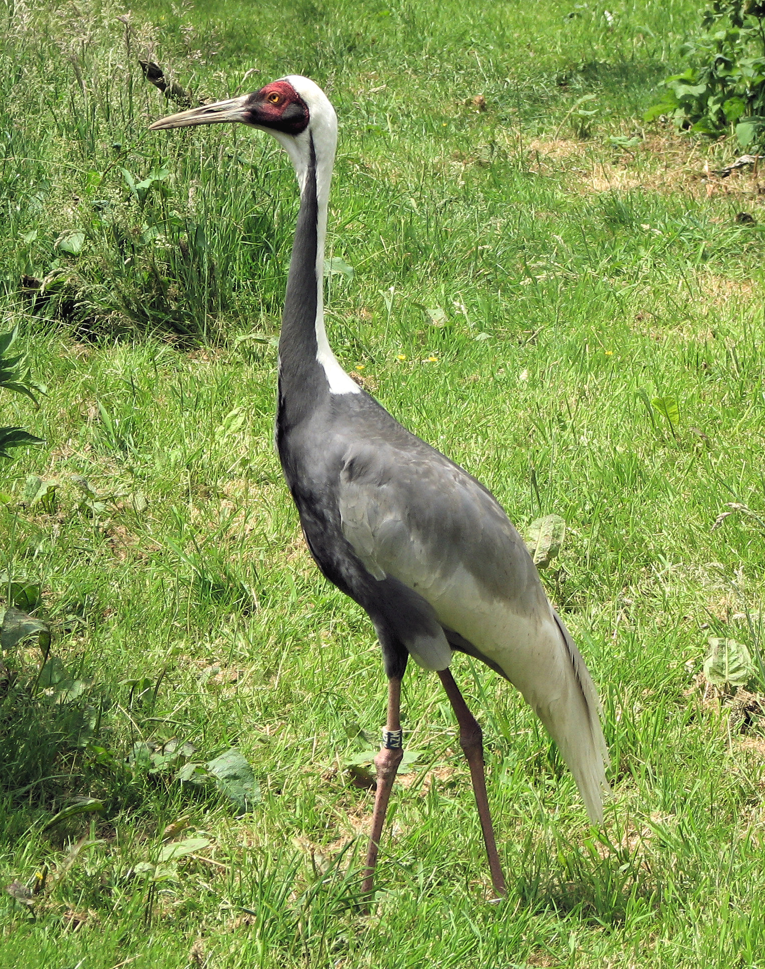
Fauna Of Mongolia
The wildlife of Mongolia consists of flora, fauna and funga found in the harsh habitats dictated by the diverse climatic conditions found throughout the country. In the north, there are salty marshes and fresh-water sources. The centre has desert steppes. In the south, there are semi deserts as well as the hot Gobi desert in the south, the fifth-largest desert in the world. About 90% of the landlocked country is covered by deserts or pastures with extreme climatic conditions. Fauna in the wild includes 139 mammal species, 448 bird species (331 of which are migratory and 119 are resident), 76 fish species, 22 reptile species and 6 amphibian species. Grassland and shrubland covers 55 percent of the country. In the steppe zone, forest covers only 6 percent while 36 percent is covered by desert vegetation, and only 1 percent is used for human habitation and agriculture. The vegetation in the eastern steppe region is grassland (the largest of its type in the world). Geography Topograp ... [...More Info...] [...Related Items...] OR: [Wikipedia] [Google] [Baidu] |
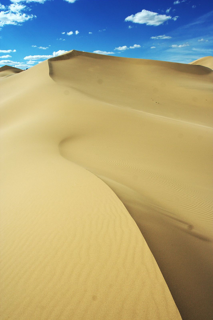
Dunes In Gobi Gurvansaikhan National Park
A dune is a landform composed of wind- or water-driven sand. It typically takes the form of a mound, ridge, or hill. An area with dunes is called a dune system or a dune complex. A large dune complex is called a dune field, while broad, flat regions covered with wind-swept sand or dunes with little or no vegetation are called '' ergs'' or ''sand seas''. Dunes occur in different shapes and sizes, but most kinds of dunes are longer on the stoss (upflow) side, where the sand is pushed up the dune, and have a shorter ''slip face'' in the lee side. The valley or trough between dunes is called a ''dune slack''. Dunes are most common in desert environments, where the lack of moisture hinders the growth of vegetation that would otherwise interfere with the development of dunes. However, sand deposits are not restricted to deserts, and dunes are also found along sea shores, along streams in semiarid climates, in areas of glacial outwash, and in other areas where poorly cemented sa ... [...More Info...] [...Related Items...] OR: [Wikipedia] [Google] [Baidu] |
Steppe
In physical geography, a steppe () is an ecoregion characterized by grassland plains without trees apart from those near rivers and lakes. Steppe biomes may include: * the montane grasslands and shrublands biome * the temperate grasslands, savannas and shrublands biome A steppe may be semi-arid or covered with grass or with shrubs or with both, depending on the season and latitude. The term " steppe climate" denotes the climate encountered in regions too dry to support a forest but not dry enough to be a desert. Steppe soils are typically of the chernozem type. Steppes are usually characterized by a semi-arid or continental climate. Extremes can be recorded in the summer of up to and in winter, . Besides this major seasonal difference, fluctuations between day and night are also very great. In both the highlands of Mongolia and northern Nevada, can be reached during the day with sub-freezing readings at night. Mid-latitude steppes feature hot summers and cold wint ... [...More Info...] [...Related Items...] OR: [Wikipedia] [Google] [Baidu] |
Otgon Tenger
Otgontenger ( mn, Отгонтэнгэр, , "youngest sky") is the highest peak in the Khangai Mountains in Mongolia. Its summit is currently calculated to reach an elevation of 4,008 meters above mean sea level (some earlier topographic maps record a maximum elevation of 4,021 m). The mountain is located in Zavkhan Province and is the only peak in the Khangai range that is capped with a permanent glacier. The south face of Mount Otgontenger is the most extensive granite wall in Mongolia. Since the introduction of Buddhism, traditional Mongolian beliefs have held that wrathful deities inhabit many of Mongolia's sacred mountains. Ochirvaani is particularly associated with Otgontenger. Accidents In August 1963, an Ilyushin 14 aircraft crashed into the side of the mountain while on route. In October 2017, 27 hikers climbed the mountain and only 10 of them came back. They requested the rescue team a day after the other 17 went missing. The rescue operation took about 4 ... [...More Info...] [...Related Items...] OR: [Wikipedia] [Google] [Baidu] |
Khan Khentii Strictly Protected Area
The Khan Khentii Strictly Protected Area is a government administered Strictly Protected Area in the Khentii aimag (province) in Eastern Mongolia. Strictly Protected Areas are regions of land designated by the Mongolian government as wildlife preservation areas. Herding and tourism are tightly controlled, and hunting and mining are prohibited. However, the budget for maintaining and protecting these areas is quite small. The Khan Khentii Strictly Protected Area is located in the Khentii Mountains, and includes the sacred Burkhan Khaldun mountain. This is considered to be the birthplace of Genghis Khan ''Chinggis Khaan'' ͡ʃʰiŋɡɪs xaːŋbr />Mongol script: ''Chinggis Qa(gh)an/ Chinggis Khagan'' , birth_name = Temüjin , successor = Tolui (as regent)Ögedei Khan , spouse = , issue = , house = Borjigin , ..., as well as one of the rumored locations of his tomb. References External links Nature Conservation- Ecological Research Statio ... [...More Info...] [...Related Items...] OR: [Wikipedia] [Google] [Baidu] |
Otgon Tenger Uul 2009
Otgon ( mn, Отгон, The young) is a sum Sum most commonly means the total of two or more numbers added together; see addition. Sum can also refer to: Mathematics * Sum (category theory), the generic concept of summation in mathematics * Sum, the result of summation, the additio ... of Zavkhan Province in western Mongolia. In 2005, its population was 3,478.Zavkhan Aimag''Сумдын Танилцуулга'' (''Introduction to the Sums'') References Districts of Zavkhan Province {{Mongolia-geo-stub ... [...More Info...] [...Related Items...] OR: [Wikipedia] [Google] [Baidu] |
Man And The Biosphere Programme
Man and the Biosphere Programme (MAB) is an intergovernmental scientific program, launched in 1971 by UNESCO, that aims to establish a scientific basis for the improvement of relationships between people and their environments. MAB's work engages fully with the international development agenda—specially with the Sustainable Development Goals and the Post 2015 Development Agenda—and addresses challenges linked to scientific, environmental, societal and development issues in diverse ecosystems; from mountain regions to marine, coastal and island areas; from tropical forests to dry lands and urban areas. MAB combines the natural and social sciences, economics and education to improve human livelihoods and the equitable sharing of benefits, and to safeguard natural and managed ecosystems, thus promoting innovative approaches to economic development that are socially and culturally appropriate, and environmentally sustainable. The MAB program provides a unique platform for coop ... [...More Info...] [...Related Items...] OR: [Wikipedia] [Google] [Baidu] |
Khustain Nuruu National Park
Hustai National Park (), located in the Khustai Mountains (, lit. ''Birch Mountains'') of Töv Province (Aimag), is a national park of Mongolia. It is also known as Khustain Nuruu National Park. The Tuul River runs through the park. History The Mongolian Government declared Hustai National Park as a Specially Protected Area in 1993, one year after the initiation of the reintroduction project of the Takhi (Przewalski's horse) to the Hustain Nuruu. The HNP extends through the Khentii Mountains and includes the western edge of the Mongolian steppe at the boundaries of Altanbulag, Argalant and Bayankhangai Soums of Töv Province. The park is about 100 km from the capital city of Ulaanbaatar to the west. The HNP covers 50,600 ha land which is home to 459 species of vascular plants, 85 species of lichens, 90 species of moss and 33 species of mushrooms. 44 species of mammals have been recorded, including Altai wapiti, Mongolian gazelle, roe deer, wild boar, wild sheep, ibex, ... [...More Info...] [...Related Items...] OR: [Wikipedia] [Google] [Baidu] |
Dornod Mongol Biosphere Reserve
Mongol Daguur Biosphere Reserve is a nature reserve in the Dornod Aimag (Province) in eastern Mongolia, preserved as an example of one of the largest areas of intact grassland in the world. It covers and was designated as a UNESCO Biosphere Reserve in 2005. Together with Ugtam Nature refuge and Daursky Nature Reserve in Russia it constitutes a World Heritage Site named "The Landscapes of Dauria". History Mongol Daguur was declared a biosphere reserve by UNESCO in 2005. A biosphere reserve aims to preserve the environment while allowing local communities to be involved in sustainable development. The core area of a biosphere reserve is strictly protected, the buffer zone is used for research and similar activities, and the transition zone allows the local communities to undertake ecologically sustainable activities. Description Mongol Daguur has a total area of and is located between 46°06' to 46°52'N and 116°11' to 118°27'E. Its altitudinal range is between above sea lev ... [...More Info...] [...Related Items...] OR: [Wikipedia] [Google] [Baidu] |
Ubsunur Hollow
Uvs Lake Basin (also Uvs Nuur Basin or Ubs Nuur Basin; mn, Увс нуурын хотгор, Uws nuuriin hotgor) is an endorheic basin located on the territorial border of Mongolia and Tuva, a republic of the Russian Federation. The basin is part of the Central Asian Internal Drainage Basin and is named after Uvs Lake (Uvs Nuur, Ubsu Nur), a large saline lake situated in the western part of its drainage basin and is one of the last remnants of the mammoth steppes. Uvs Lake is a shallow lake with an area of . Its entire basin, which includes several smaller lakes, is . Uvs Lake Basin may also refer to Ubsunur Hollow (Russian: Убсунурская котловина, ''Ubsunorskaya Kotlovina''), which is the western part of the drainage basin, or to over of protected areas covering the lake and its surroundings. The hollow forms the northern part of the Great Lakes Depression, which has a surface of over . The hollow, and most of the drainage basin, are situated in the Khövsg ... [...More Info...] [...Related Items...] OR: [Wikipedia] [Google] [Baidu] |
Great Gobi B Strictly Protected Area
Great Gobi B Strictly Protected Area is a nature reserve in Gobi desert, situated in the south-western part of Mongolia at the border with China. A similar reserve in a drier part of the Gobi exists further to the east - the Great Gobi A Strictly Protected Area. Landscape The reserve was established in 1975 and declared an International Biosphere Reserve in 1991. It comprises about 9000 km2 of desert steppe, arid mountains, deserts and semi deserts. Temperatures can fall to -40 °C in winter and rise to +40 °C in the summer. Average snow cover lasts 97 days per year. There are low mountains in the east of the reserve and rolling hills in the west. The lowest parts are about 1000 m above sea level, the highest point is reached at the Chinese border at about 2840 m.Petra Kaczensky, Namtar Enkhsaikhan, Oyunsaikhan Ganbaatar, and Chris Walzer: ''The Great Gobi B Strictly Protected Area in Mongolia - refuge or sink for wolves Canis lupus in the Gobi''. ... [...More Info...] [...Related Items...] OR: [Wikipedia] [Google] [Baidu] |


