|
External Border Of The European Union
The border of the European Union consists of the land and sea borders that member states of the EU share with foreign states adjacent to the union. Border status and cooperation In 2004 the European Union developed the European Neighbourhood Policy (ENP) for the promotion of cooperation between the EU and its neighbours to the east and south of the European territory of the EU (i.e., excluding its outermost regions outside of Europe), which, in part, includes the Cross-Border Cooperation programme aimed at the promotion of economic development in border areas and ensuring border security. External border control The Border and Coast Guard Agency, more commonly known as Frontex, was established in 2004. Its main task is external border control of the Schengen Area. Most of its activities are coordinated with the coast and border guards of member states. List of bilateral land borders Current borders De facto borders # Cyprus–Northern Cyprus border ( Green Line) Former bord ... [...More Info...] [...Related Items...] OR: [Wikipedia] [Google] [Baidu] |
EU27-2020 European Union Map
The European Union (EU) is a supranational political and economic union of member states that are located primarily in Europe. The union has a total area of and an estimated total population of about 447million. The EU has often been described as a ''sui generis'' political entity (without precedent or comparison) combining the characteristics of both a federation and a confederation. Containing 5.8per cent of the world population in 2020, the EU generated a nominal gross domestic product (GDP) of around trillion in 2021, constituting approximately 18per cent of global nominal GDP. Additionally, all EU states but Bulgaria have a very high Human Development Index according to the United Nations Development Programme. Its cornerstone, the Customs Union, paved the way to establishing an internal single market based on standardised legal framework and legislation that applies in all member states in those matters, and only those matters, where the states have agreed to act ... [...More Info...] [...Related Items...] OR: [Wikipedia] [Google] [Baidu] |
Akrotiri And Dhekelia
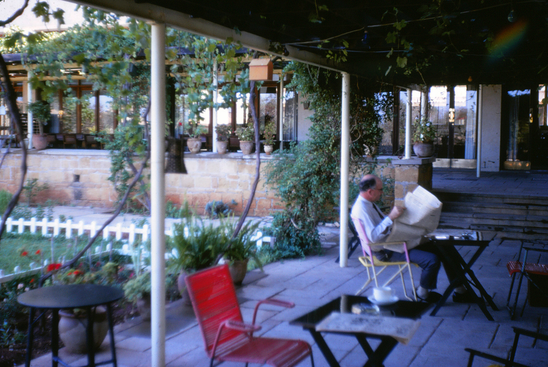
Akrotiri and Dhekelia, officially the Sovereign Base Areas of Akrotiri and Dhekelia (SBA),, ''Periochés Kyríarchon Váseon Akrotiríou ke Dekélias''; tr, Ağrotur ve Dikelya İngiliz Egemen Üs Bölgeleri is a British Overseas Territory on the island of Cyprus. The areas, which include British military bases and installations, as well as other land, were retained by the British under the 1960 treaty of independence, signed by the United Kingdom, Greece, Turkey and representatives from the Greek and Turkish Cypriot communities, which granted independence to the (then) Crown colony of Cyprus. The territory serves an important role as a station for signals intelligence and provides a vital strategic part of the United Kingdom surveillance-gathering network in the Mediterranean and the Middle East. History The Sovereign Base Areas were created in 1960 by the London and Zürich Agreements, when Cyprus achieved independence from the British Empire, as recorded by the Uni ... [...More Info...] [...Related Items...] OR: [Wikipedia] [Google] [Baidu] |
Border Crossings Of Albania
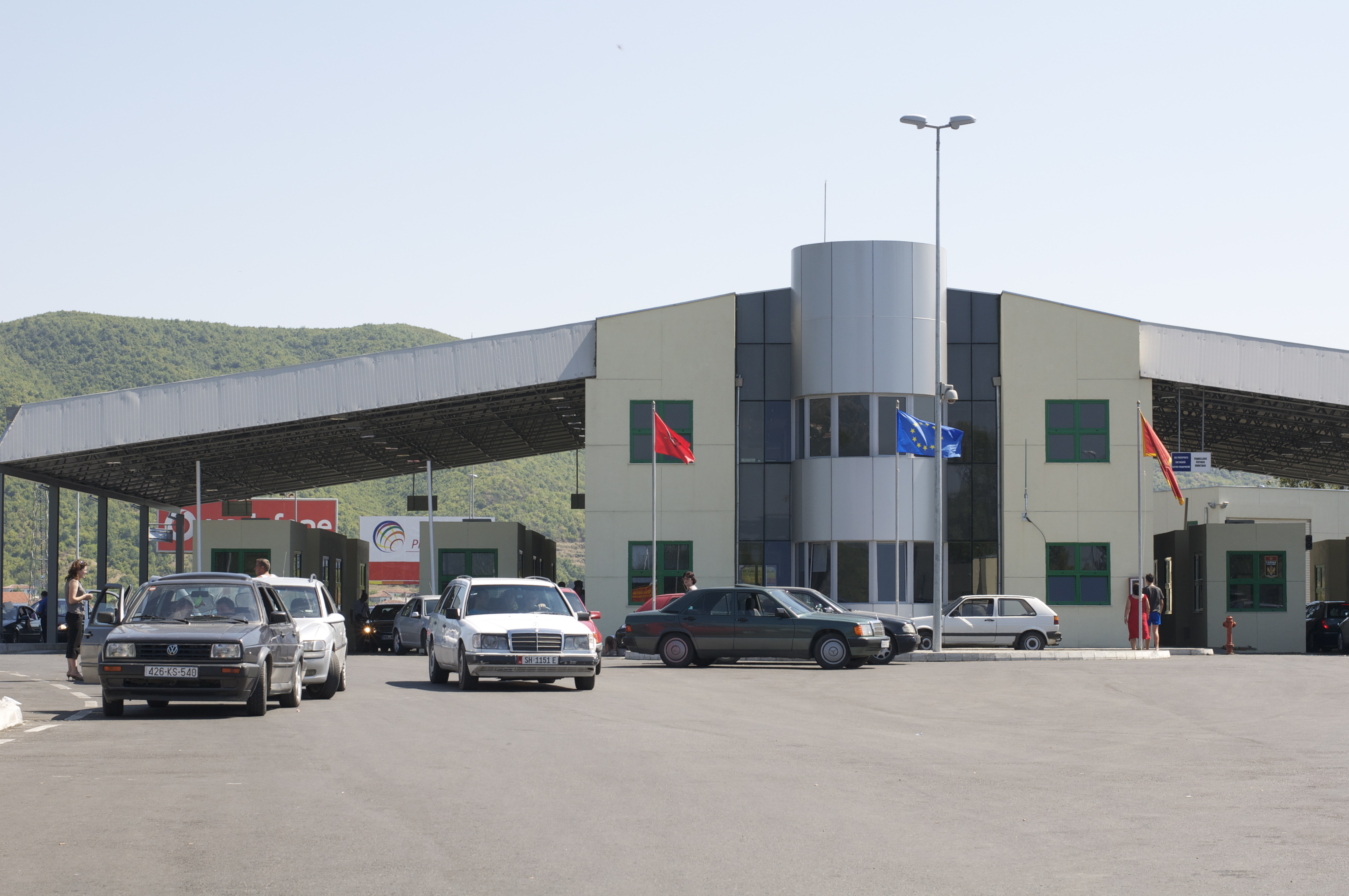
Border crossings ( sq, Vendkalimet kufitare) in the Republic of Albania are defined as boundary checkpoints that serve to control the flow of people and goods from neighbouring countries to and from Albania. These checkpoints are administered by the border police authorities that record the entry and exit of each person and vehicle followed by the customs authorities that record the entry and exit of goods and cash. Albania currently has 22 operational land border crossings and shares borders with Montenegro, Kosovo (116.3 km), North Macedonia (186.1 km), and Greece. This article outlines a complete list of Albania's international border crossings, including land, sea and air entry points. History During the communist period in Albania, very few people were allowed to leave the country (usually only diplomats) and would also be required to have written permission to do so. Visitors entering the country from outside for any reason, tourism or otherwise, were immediately suspect ... [...More Info...] [...Related Items...] OR: [Wikipedia] [Google] [Baidu] |
Germany–Switzerland Border
The border between the modern states of Germany and Switzerland extends to , mostly following the High Rhine between Lake Constance and Basel. Much of the border is within the sphere of the Zurich metropolitan area and there is substantial traffic, both for commuting and for shopping across the border, with the S22 line of the suburban Zürich S-Bahn running across German territory. The Swiss municipality of Kreuzlingen forms part of the conurbation of German Konstanz. Similarly, the Trinational Eurodistrict of Basel includes territory in both France and Germany. History The High Rhine has had the character of the northern border of the Old Swiss Confederacy since the Swabian War and the accession of Basel in 1499–1501, dividing the Swiss Confederacy from the Swabian Circle of the Holy Roman Empire; with the Peace of Westphalia of 1648, the border acquired the status of an international border ''de jure''. With minor changes (such as the acquisition of Rafzerfeld in 16 ... [...More Info...] [...Related Items...] OR: [Wikipedia] [Google] [Baidu] |
France–Switzerland Border
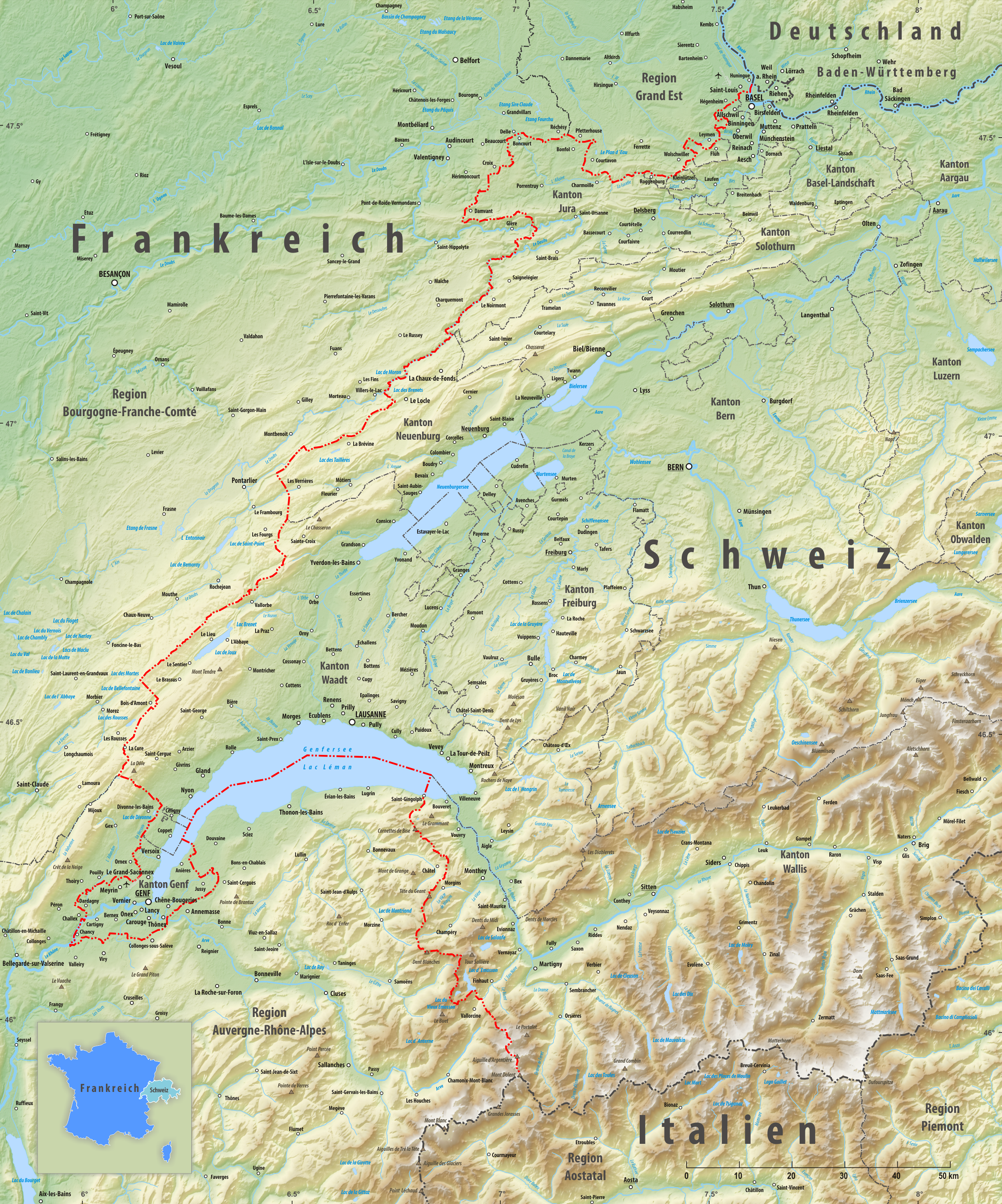
The France–Switzerland border is long. Its current path is mostly the product of the Congress of Vienna of 1815, with the accession of Geneva, Neuchâtel and Valais to the Swiss Confederation, but it has since been modified in detail, the last time being in 2002. Although most of the border, marked with border stones, is unguarded, several checkpoints remain staffed, most notably on busy roads. Detailed path The tripoint where the border meets the Germany–Switzerland border and France–Germany border is on the river Rhine (at ) north of Basel. A monument has been built near it, known as the Dreiländereck. The border runs south of EuroAirport Basel Mulhouse Freiburg and then towards the southwest, separating the villages of Schönenbuch (Switzerland), Neuwiller (France), Leymen (France) and Rodersdorf (Switzerland). It then enters the Jura chain, rising above 800 metres of altitude before meeting the La Lucelle river at 460 m, between Roggenburg, Basel-Country and K ... [...More Info...] [...Related Items...] OR: [Wikipedia] [Google] [Baidu] |
Franco-Dutch Treaty On Saint Martin Border Controls
The Franco-Dutch treaty on Saint Martin border controls, sometimes shortened to the Franco-Dutch treaty and in full the Treaty between the Kingdom of the Netherlands and the French Republic on the control of persons entering Saint Martin through the airports (french: Traité entre le Royaume des Pays-Bas et la République française sur le contrôle des personnes entrant dans Saint Martin sur les aéroports; nl, Verdrag tussen het Koninkrijk der Nederlanden en de Franse Republiek inzake personencontrole op de luchthavens op Sint Maarten), is a treaty between France and the Netherlands aimed at improving border controls at the two airports on the divided island of Saint Martin. The island is divided into French Saint-Martin (at the time a part of Guadeloupe) and Dutch Sint Maarten (at the time a part of the Netherlands Antilles). The airports concerned are Princess Juliana International Airport and L'Espérance Airport. History The treaty was signed on 17 May 1994 in Paris, an ... [...More Info...] [...Related Items...] OR: [Wikipedia] [Google] [Baidu] |
France–Monaco Border
The France–Monaco border is the line that limits the territories of France and Monaco. The border is located between the French department of Alpes-Maritimes in the French region of Provence-Alpes-Côte d'Azur and the entire land territory of Monaco. It is in length and is the only land border Monaco possesses. The French port A port is a maritime facility comprising one or more wharves or loading areas, where ships load and discharge cargo and passengers. Although usually situated on a sea coast or estuary, ports can also be found far inland, such as ... of Cap d'Ail borders Monaco to the southwest. The highest point in Monaco, Chemin des Révoires (161 meters or 528 feet above sea level), is located on the border, on the side of Mont Agel. The peak of Mont Agel lies on the French side. References France–Monaco relations European Union external borders Borders of France Geography of Monaco Provence-Alpes-Côte d'Azur International borde ... [...More Info...] [...Related Items...] OR: [Wikipedia] [Google] [Baidu] |
Brazil–France Border
The Brazil–France border is the line, located in the Amazon Rainforest, that limits the territories of Brazil and France. The border is located between the Brazilian state of Amapá and the French region of Guyane. It is in length. It is the longest border France shares with another country, despite not being located in mainland France. The second longest is the one with Spain, at . The Oyapock River defines part of the border, and is spanned by the Oyapock River Bridge, the only bridge crossing the border, which connects the towns of Saint-Georges (Guyane) and Oiapoque Oiapoque () is a municipality in the north of the state of Amapá, Brazil. Its population is 27,906 and its area is . Oiapoque is also a major river in the same state, forming the international border with French Guiana. The Oyapock River Bridge, ... (Brazil). References Brazil–France relations Borders of Brazil Borders of France French Guiana International borders {{AmapáBR-g ... [...More Info...] [...Related Items...] OR: [Wikipedia] [Google] [Baidu] |
Andorra–France Border
The Andorra–France border extends for in southern France ( Ariège and Pyrenees-Orientales départements) and northern and north-eastern Andorra. The border is France's third-shortest, after its borders with Monaco and the Netherlands (the latter on the Caribbean island of Saint Martin). Specifications The border's western extremity starts at the western Andorra–Spain–France tripoint, located at the summit of the Pic de Médécourbe (42°36'13"N 1°26'33" E). It then follows a general north-east direction before switching south-eastwards to the eastern Andorra–Spain–France tripoint 42°30'09"N 1°43'33" E). Most of the Franco-Andorran border is determined by custom – there is no international treaty formally fixing the course of the border, except for the cases below. In 2001, a bilateral treaty between France and Andorra rectified and amended the border slightly. It provided for the exchange of two equal plots of land of 15,925 m² each, to enable Andorra to c ... [...More Info...] [...Related Items...] OR: [Wikipedia] [Google] [Baidu] |


