|
Culnady
Culnady (named after the townland of Culnady) is a small village near Maghera in County Londonderry, Northern Ireland. In the 2001 Census it had a population of 144 people. It is situated within Mid-Ulster District. History *Dunglady fort is a Ringfort located less than a mile from the village of Culnady variously dated from around 100 AD, to as early as 2000 BC.It is 110m in diameter with three banks and three ditches (up to 5m. deep) with a straight entrance. A legendary home of the Celtic Kings, it is the earliest known instance of residence in the Culnady area.The fort was occupied by tribes during the earliest periods of Irish history, until the arrival of the plantations (c.17th century) in Ireland, at which time settlers began to live in the low-lying areas surrounding the Clady river, using it for farming, and thus the village of Culnady was born. Rivers The Grillagh River which is an artery of the Clady River along with the Knockoneil River flows through the ... [...More Info...] [...Related Items...] OR: [Wikipedia] [Google] [Baidu] |
Culnady Presbyterian Church - Geograph
Culnady (named after the townland of Culnady) is a small village near Maghera in County Londonderry, Northern Ireland. In the 2001 Census it had a population of 144 people. It is situated within Mid-Ulster District. History *Dunglady fort is a Ringfort located less than a mile from the village of Culnady variously dated from around 100 AD, to as early as 2000 BC.It is 110m in diameter with three banks and three ditches (up to 5m. deep) with a straight entrance. A legendary home of the Celtic Kings, it is the earliest known instance of residence in the Culnady area.The fort was occupied by tribes during the earliest periods of Irish history, until the arrival of the plantations (c.17th century) in Ireland, at which time settlers began to live in the low-lying areas surrounding the Clady river, using it for farming, and thus the village of Culnady was born. Rivers The Grillagh River which is an artery of the Clady River along with the Knockoneil River flows through the to ... [...More Info...] [...Related Items...] OR: [Wikipedia] [Google] [Baidu] |
Culnady (townland)
Culnady () is a townland lying within the civil parish of Maghera, County Londonderry, Northern Ireland. It lies in the north-east of the parish and is bounded in the north-east by the Grillagh river. It is also bounded by the townlands of Ballymacilcurr, Crew, Curragh, Drummuck, Tirgarvil, and Tirnageeragh. It was apportioned to the Vintners company and Crown freeholds. The townland in 1926 was part of Upperland district electoral division of Magherafelt Rural District. As part of Maghera civil parish, Culnady also lies within the historic barony of Loughinsholin. See also *Maghera Maghera (pronounced , ) is a small town at the foot of the Glenshane Pass in County Londonderry, Northern Ireland. Its population was 4,220 in the 2011 Census, increasing from 3,711 in the 2001 Census. It is situated within Mid-Ulster Distric ... References Townlands of County Londonderry Civil parish of Maghera {{Londonderry-geo-stub ... [...More Info...] [...Related Items...] OR: [Wikipedia] [Google] [Baidu] |
Clady River
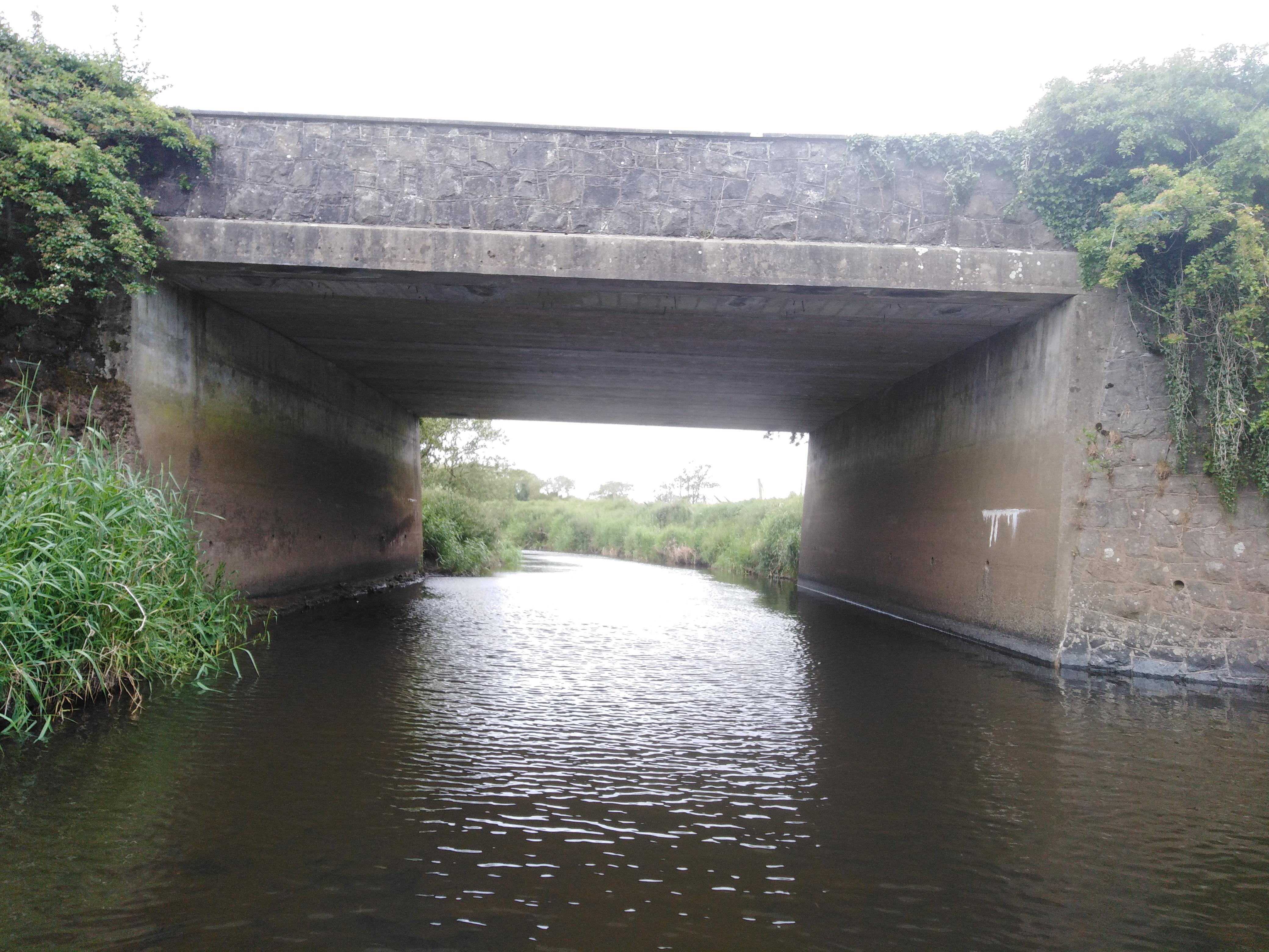
The River Clady is a mid-scale river in County Londonderry, Northern Ireland, a tributary of the Lower Bann. It forms from the confluence of the Grillagh River and Knockoneil River. Course The river flows through the flatlands outside Culnady for some miles and this area often floods during peak flows. The first bridge to span the river is Eden Bridge, also known as Drumnacannon Bridge. The river was originally 2 to 3 times its current width, until around the mid 20th century, when the river underwent a major dredging operation, including up the Clady and Knockoneil, to control the mass amount of floodwater not only from the hills of Slaughtneil but also William Clark & Sons of Upperlands, coming from the sluice gates and flood gates. This work damaged the river as it was left like a canal, only half its original width and twice its original depth, with parts over 10 feet deep. The river continues in similar form until it reaches Clady, where it widens even more up to 3 ... [...More Info...] [...Related Items...] OR: [Wikipedia] [Google] [Baidu] |
Knockoneil River
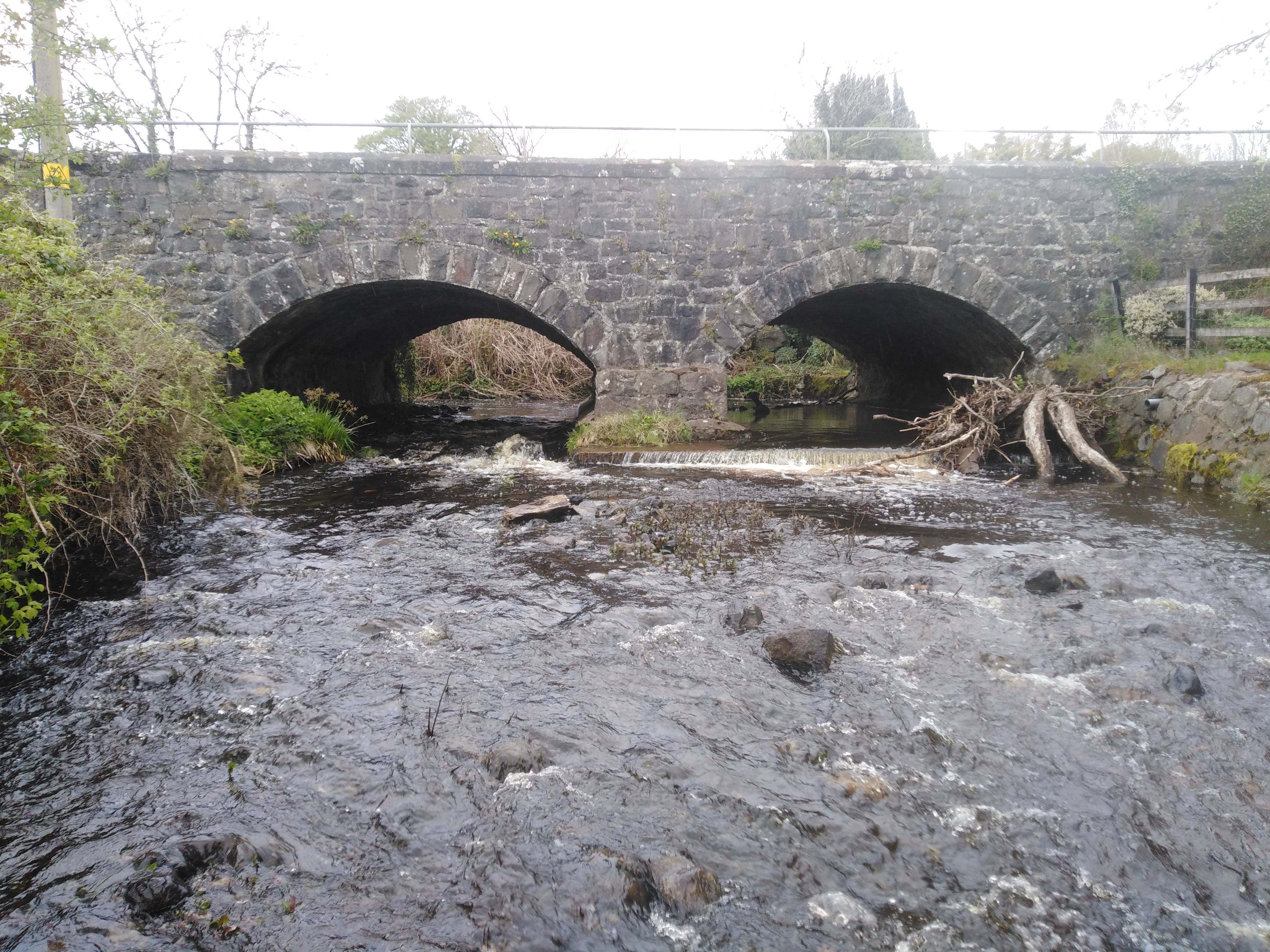
The Knockoneil River sometimes spelled Knockoneill and is even called Clady River this river is a small to medium sized river in Northern Ireland located near Maghera and is a major artery river which merges with the Grillagh River to form the Clady River. It flows eastwards towards Swatragh , Knockoneil is a townland in the rural area of Slaughtneil and is the townland the rivers named after .The Knockoneil starts its course and it is only about 10 to 15 feet wide at this point after this the river widens as it passes through Swatragh and onwards to Upperlands where a lot of hydro energy from the river is used for Clarke's mill. It flows onwards outside Culnady Culnady (named after the townland of Culnady) is a small village near Maghera in County Londonderry, Northern Ireland. In the 2001 Census it had a population of 144 people. It is situated within Mid-Ulster District. History *Dunglady fo ... where it widens quite drastically round the old Dunglady Bridge ... [...More Info...] [...Related Items...] OR: [Wikipedia] [Google] [Baidu] |
List Of Towns In Northern Ireland
This is an alphabetical list of towns and villages in Northern Ireland. For a list sorted by population, see the list of settlements in Northern Ireland by population. The towns of Armagh, Lisburn and Newry are also classed as cities (see city status in the United Kingdom). The Northern Ireland Statistics and Research Agency (NISRA) uses the following definitions: * Town – population of 4,500 or more ** Small Town – population between 4,500 and 10,000 ** Medium Town – population between 10,000 and 18,000 ** Large Town – population between 18,000 and 75,000 * Intermediate settlement – population between 2,250 and 4,500 * Village – population between 1,000 and 2,250 * Small villages or hamlets – population of less than 1,000 Towns are listed in bold. __NOTOC__ A Acton, Aghacommon, Aghadowey, Aghadrumsee, Aghagallon, Aghalee, Ahoghill, Aldergrove, Altamuskin, Altishane, Altmore, Annaclone, Annaghmore, Annahilt, Annahugh, Annalong, Annsborough, Antrim, Ardboe, Ar ... [...More Info...] [...Related Items...] OR: [Wikipedia] [Google] [Baidu] |
List Of Villages In Northern Ireland
This is an alphabetical list of towns and villages in Northern Ireland. For a list sorted by population, see the list of settlements in Northern Ireland by population. The towns of Armagh, Lisburn and Newry are also classed as cities (see city status in the United Kingdom). The Northern Ireland Statistics and Research Agency (NISRA) uses the following definitions: * Town – population of 4,500 or more ** Small Town – population between 4,500 and 10,000 ** Medium Town – population between 10,000 and 18,000 ** Large Town – population between 18,000 and 75,000 * Intermediate settlement – population between 2,250 and 4,500 * Village – population between 1,000 and 2,250 * Small villages or hamlets – population of less than 1,000 Towns are listed in bold. __NOTOC__ A Acton, Aghacommon, Aghadowey, Aghadrumsee, Aghagallon, Aghalee, Ahoghill, Aldergrove, Altamuskin, Altishane, Altmore, Annaclone, Annaghmore, Annahilt, Annahugh, Annalong, Annsborough, Antrim, Ardboe, Ar ... [...More Info...] [...Related Items...] OR: [Wikipedia] [Google] [Baidu] |
Grillagh River
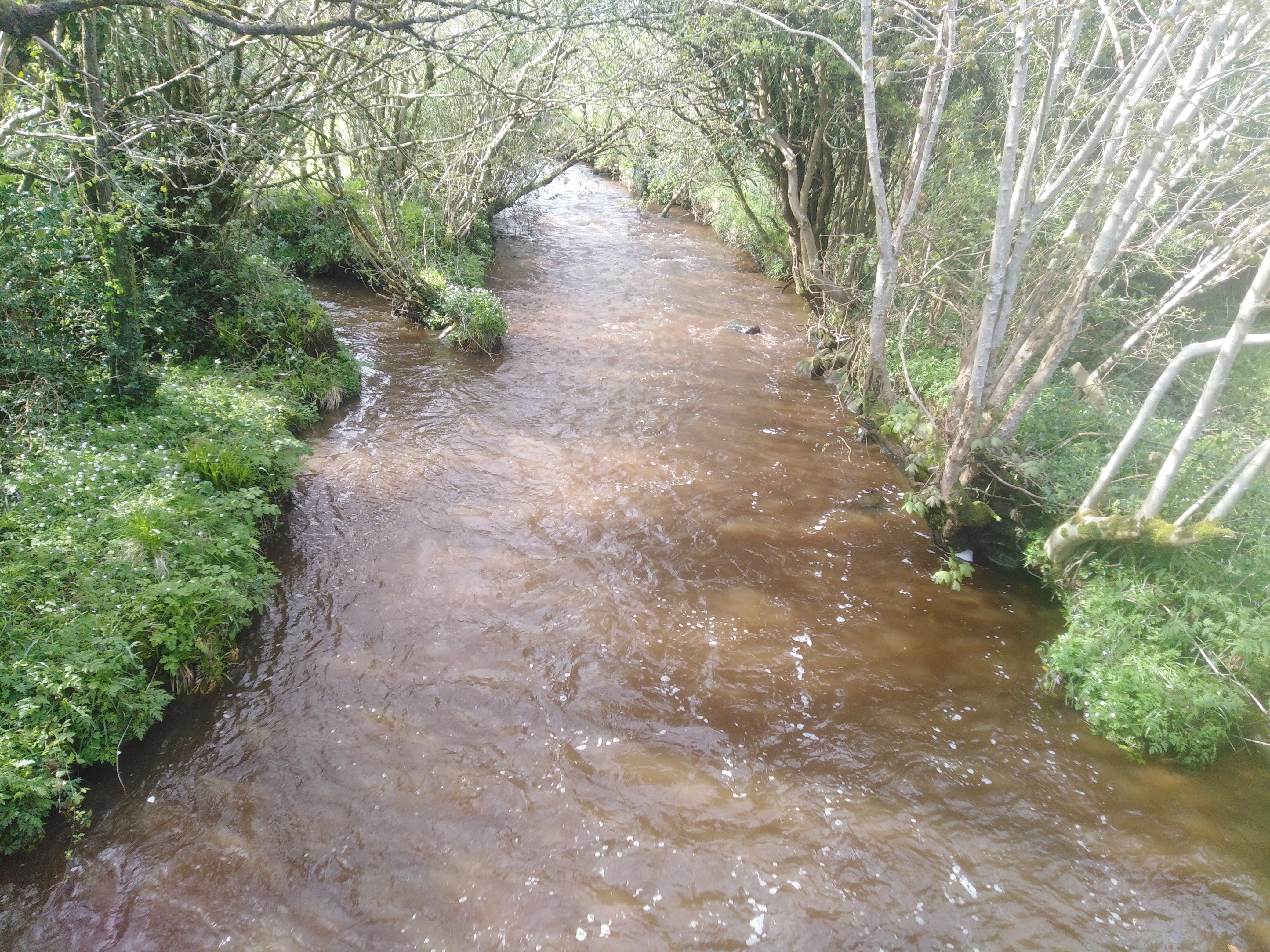
The Grillagh River is a small river located outside Maghera, County Londonderry, Northern Ireland. It starts in Slaughtneil a rural area northwest of Maghera southwest of Swatragh south of Glenullin and north of Glen. Slaughtneil means Nialls Gravestone and Grillagh River Means The Muddy River. Four Arterys Meaning Headstreams start the main river. The Altkeeran Burn at the foot of Carntogher Mountain is the origins of the Grillagh River meaning Glen of the rowan trees burn this is the main artery and the largest of the mountain burns .which is where most late Autumn Salmon Return to spawn the burn starts on the west side of Carntogher and flows eastward merging with the Carn Burn then flows on passing under Altkeeran Bridge then merging with the Pollan Water Burn ullykeeran Burnand finally the Backparks Burn before formally forming the Grillagh River upstream from Slaughtneil Bridge. The Carn Burn is another stream meaning Carntogher Burn which starts in the centre of the ... [...More Info...] [...Related Items...] OR: [Wikipedia] [Google] [Baidu] |
County Londonderry
County Londonderry ( Ulster-Scots: ''Coontie Lunnonderrie''), also known as County Derry ( ga, Contae Dhoire), is one of the six counties of Northern Ireland, one of the thirty two counties of Ireland and one of the nine counties of Ulster. Before the partition of Ireland, it was one of the counties of the Kingdom of Ireland from 1613 onward and then of the United Kingdom after the Acts of Union 1800. Adjoining the north-west shore of Lough Neagh, the county covers an area of and today has a population of about 247,132. Since 1972, the counties in Northern Ireland, including Londonderry, have no longer been used by the state as part of the local administration. Following further reforms in 2015, the area is now governed under three different districts; Derry and Strabane, Causeway Coast and Glens and Mid-Ulster. Despite no longer being used for local government and administrative purposes, it is sometimes used in a cultural context in All-Ireland sporting and cultural even ... [...More Info...] [...Related Items...] OR: [Wikipedia] [Google] [Baidu] |
Northern Ireland
Northern Ireland ( ga, Tuaisceart Éireann ; sco, label= Ulster-Scots, Norlin Airlann) is a part of the United Kingdom, situated in the north-east of the island of Ireland, that is variously described as a country, province or region. Northern Ireland shares an open border to the south and west with the Republic of Ireland. In 2021, its population was 1,903,100, making up about 27% of Ireland's population and about 3% of the UK's population. The Northern Ireland Assembly (colloquially referred to as Stormont after its location), established by the Northern Ireland Act 1998, holds responsibility for a range of devolved policy matters, while other areas are reserved for the UK Government. Northern Ireland cooperates with the Republic of Ireland in several areas. Northern Ireland was created in May 1921, when Ireland was partitioned by the Government of Ireland Act 1920, creating a devolved government for the six northeastern counties. As was intended, Northern Ireland ... [...More Info...] [...Related Items...] OR: [Wikipedia] [Google] [Baidu] |
Portglenone
Portglenone (from ga, Port Chluain Eoghain , meaning 'landing place of Eoghan's meadow') is a village and civil parish in County Antrim, Northern Ireland. It lies 8.5 miles (14 km) west of Ballymena. It had a population of 1,174 people in the 2011 Census. Portglenone is beside the smaller village of Glenone (in County Londonderry), from which it is separated by the River Bann. History In 1197, a castle was built there for Norman invader John de Courcy. Places of interest Portglenone Forest Portglenone Forest Park, just outside the village, is classified as an 'Ancient Woodland', and has well marked nature trails, with the River Bann flowing through the forest. There is also a memorial to the United States servicemen stationed there during World War II. The foundations of their Nissen huts can still be seen throughout the wood. Portglenone Abbey Portglenone Abbey Church, Our Lady Of Bethlehem Cistercian Monastery, occupies a Georgian mansion (Portglenone House) in the v ... [...More Info...] [...Related Items...] OR: [Wikipedia] [Google] [Baidu] |
Orange Order
The Loyal Orange Institution, commonly known as the Orange Order, is an international Protestant fraternal order based in Northern Ireland and primarily associated with Ulster Protestants, particularly those of Ulster Scots heritage. It also has lodges in England, Scotland and the Republic of Ireland, as well as in parts of the Commonwealth of Nations, Togo and the United States. The Orange Order was founded by Ulster Protestants in County Armagh in 1795, during a period of Protestant–Catholic sectarian conflict, as a fraternity sworn to maintain the Protestant Ascendancy in Ireland. It is headed by the Grand Orange Lodge of Ireland, established in 1798. Its name is a tribute to the Dutch-born Protestant king William of Orange, who defeated Catholic king James II in the Williamite–Jacobite War (16881691). The order is best known for its yearly marches, the biggest of which are held on or around 12 July (The Twelfth), a public holiday in Northern Ireland. The Orange O ... [...More Info...] [...Related Items...] OR: [Wikipedia] [Google] [Baidu] |
Swatragh
Swatragh () is a small village and townland in County Londonderry, Northern Ireland. Swatragh is on the main A29 road north of Maghera, and is situated within Mid-Ulster District. The population was 438 in the 2011 Census. The village has three churches: one Roman Catholic, one Church of Ireland, and one Presbyterian. The Catholic and Church of Ireland churches are listed buildings. St John's is the local primary school. Swatragh's name in Irish, ''an Suaitreach'', is derived from a shortened form of ''Baile an tSuaitrigh'' meaning "townland of the billeted soldier". Sport Swatragh is home to Michael Davitt Gaelic Athletic Club. Several of the club's Gaelic football players have represented Derry GAA. There is also a boxing club located within the village. People * Anthony Tohill - Gaelic footballer * Terry McFlynn - professional association football player Rivers The Knockoneil River flows through the village and is leased by the Clady And District Angling Club. The ri ... [...More Info...] [...Related Items...] OR: [Wikipedia] [Google] [Baidu] |


