|
Cittaslow
Cittaslow is an organisation founded in Italy and inspired by the slow food movement. Cittaslow's goals include improving the quality of life in towns by slowing down its overall pace, especially in a city's use of spaces and the flow of life and traffic through them. History Cittaslow was founded in Italy in October 1999, following a meeting organised by the mayor of Greve in Chianti, Tuscany. A 54-point charter was developed, encouraging high quality local food and drink, general conviviality and the opposition to cultural standardisation. In 2001, 28 Italian towns were signed up to the pledge, certified by trained operatives of Cittaslow. The first Slow City in the English-speaking world was Ludlow, England, in 2003. The movement expanded broadly beyond Italy and, by 2006, national Cittaslow networks existed in Germany, Norway and the United Kingdom. By mid-2009, fourteen countries had at least one officially accredited Cittaslow community. In July 2009, the small seaside vil ... [...More Info...] [...Related Items...] OR: [Wikipedia] [Google] [Baidu] |
Mold, Flintshire
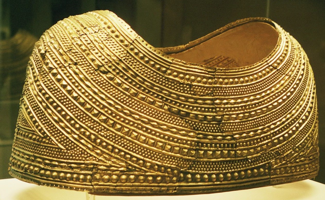
Mold ( cy, Yr Wyddgrug) is a town and community in Flintshire, Wales, on the River Alyn. It is the county town and administrative seat of Flintshire County Council, as it was of Clwyd from 1974 to 1996. According to the 2011 UK Census, it had a population of 10,058. A 2019 estimate puts it at 10,123. Origin of the name The original Welsh-language place name, ''Yr Wyddgrug'' was recorded as ''Gythe Gruc'' in a document of 1280–1281, and means "The Mound of the Tomb/Sepulchre". The name "Mold" originates from the Norman-French ''mont-hault'' ("high hill"). The name was originally applied to the site of Mold Castle in connection with its builder Robert de Montalt, an Anglo-Norman lord. It is recorded as ''Mohald'' in a document of 1254. History A mile west of the town is Maes Garmon, ("The Field of Germanus"), the traditional site of the "Alleluia Victory" by a force of Romano-Britons led by Germanus of Auxerre against the invading Picts and Scots, which occurred shortly af ... [...More Info...] [...Related Items...] OR: [Wikipedia] [Google] [Baidu] |
Goolwa, South Australia
Goolwa is a historic river port on the Murray River near the Murray Mouth in South Australia, and joined by a bridge to Hindmarsh Island. The name "Goolwa" means "elbow" in Ngarrindjeri, the local Aboriginal language, and the area was known as "The Elbow" to the early settlers. Goolwa is approximately 85 km south of Adelaide, and is the seat of the Alexandrina Council. It is in the state electoral district of Hammond and the federal Division of Mayo. At the 2011 census, the state suburb of Goolwa (excluding Goolwa Beach, Goolwa North and Goolwa South) had a population of 2,201. At June 2018, the estimated urban population for Goolwa together with nearby Victor Harbor was 26,532, Estimated resident population, 30 June 2018. having increased at an average annual rate of 1.07% year-on-year over the preceding five years. The portion of this combined urban area residing in Goolwa is 11,578. History Before 1837 the area was briefly considered for the site of the colony's cap ... [...More Info...] [...Related Items...] OR: [Wikipedia] [Google] [Baidu] |
Ludlow
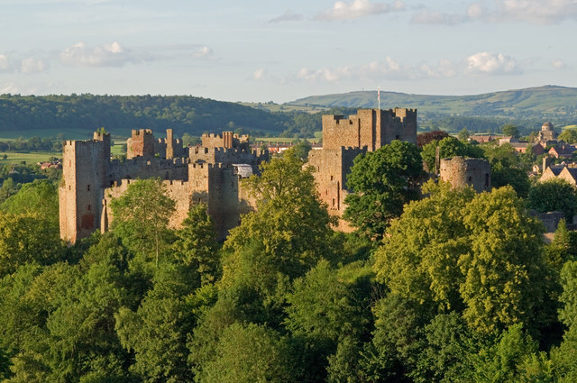
Ludlow () is a market town in Shropshire, England. The town is significant in the history of the Welsh Marches and in relation to Wales. It is located south of Shrewsbury and north of Hereford, on the A49 road which bypasses the town. The town is near the confluence of the rivers Corve and Teme. The oldest part is the medieval walled town, founded in the late 11th century after the Norman conquest of England. It is centred on a small hill which lies on the eastern bank of a bend of the River Teme. Situated on this hill are Ludlow Castle and the parish church, St Laurence's, the largest in the county. From there the streets slope downward to the rivers Corve and Teme, to the north and south respectively. The town is in a sheltered spot beneath Mortimer Forest and the Clee Hills, which are clearly visible from the town. Ludlow has nearly 500 listed buildings, including examples of medieval and Tudor-style half-timbered buildings. The town was described by Sir John Betjeman ... [...More Info...] [...Related Items...] OR: [Wikipedia] [Google] [Baidu] |
Orvieto
Orvieto () is a city and ''comune'' in the Province of Terni, southwestern Umbria, Italy, situated on the flat summit of a large butte of volcanic tuff. The city rises dramatically above the almost-vertical faces of tuff cliffs that are completed by defensive walls built of the same stone, called ''tufa''. History Etruscan era The ancient city (''urbs vetus'' in Latin, whence "Orvieto"), populated since Etruscan times, has usually been associated with Etruscan Velzna, but some modern scholars differ. Orvieto was certainly a major centre of Etruscan civilization; the archaeological museum (Museo Claudio Faina e Museo Civico) houses some of the Etruscan artifacts that have been recovered in the immediate area. A tomb in the Orvieto Cannicella necropolis bears the inscription ''mi aviles katacinas'', "I am of Avile Katacina"; the tomb's occupant thus bore an Etruscan-Latin first name, Aulus, and a family name that is believed to be of Celtic origin (derived from "Catacos"). Th ... [...More Info...] [...Related Items...] OR: [Wikipedia] [Google] [Baidu] |
Cowichan Bay
Cowichan Bay () is a bay and community located on the east coast of southern Vancouver Island near Duncan, in British Columbia. The mouth of the Cowichan River is near Cowichan Bay. Mount Tzouhalem and its hiking trails and ecological reserve stands to the north. The bay is known for its fishing and scenic value. The area's main industries are fishing and tourism. The area is served by the nearby coast-spanning Island Highway and Island Rail Corridor. First Nation history For many thousands of years Cowichan Bay was home to First Nations people who harvested the wealth of salmon and shellfish found in its many coves, tidal flats and swiftly flowing rivers. A rare steatite anthropomorphic bowl was discovered on Cowichan Bay in the late nineteenth century. One of only about 50 so far found and estimated to originate from the Marpole Culture (400 BC-400 AD), it is now in the British Museum's collection. European settlement Cowichan Bay was the gateway for European settlement of ... [...More Info...] [...Related Items...] OR: [Wikipedia] [Google] [Baidu] |
Wolfville
Wolfville is a Canadian town in the Annapolis Valley, Kings County, Nova Scotia, located about northwest of the provincial capital, Halifax. The town is home to Acadia University and Landmark East School. The town is a tourist destination due to its views of Cape Blomidon, the Bay of Fundy and Gaspereau Valley, as well as its wine industry. The downtown portion of Wolfville is home to pubs, bars, cafes and shops. Wolfville is also home to the Acadia Cinema Cooperative, a non-profit organization that runs the local movie/performance house. In the past few years, several Victorian houses in Wolfville have been converted to bed and breakfast establishments. History First Nations From ancient times, the area of Wolfville was a hunting ground for First Nations peoples, including the Clovis, Laurentian, Bear River, and Shields Archaic groups. They were attracted by the salmon in the Gaspereau River and the agate stone at Cape Blomidon, with which they could make stone tools. Ma ... [...More Info...] [...Related Items...] OR: [Wikipedia] [Google] [Baidu] |
Katoomba, New South Wales
Katoomba is the chief town of the City of Blue Mountains in New South Wales, Australia, and the administrative headquarters of Blue Mountains City Council. The council's understanding is that Katoomba is located on the lands of the Dharug and Gundungurra Aboriginal peoples. Katoomba is situated on the Great Western Highway west of Sydney and south-east of Lithgow. Katoomba railway station is on the Main Western line. Katoomba is a base for bush and nature walks in the surrounding Blue Mountains. At the 2016 census, Katoomba had a population of 7,964 people. Etymology Kedumba or Katta-toon-bah is an Aboriginal term for "shining falling water" or "water tumbling over hill" and takes its name from a waterfall that drops into the Jamison Valley below the Harrys Amphitheatre escarpment. Previously, the site was known as William's Chimney and Collett's Swamp. In 1874 the locality was named The Crushers after the name of the railway station that served a nearby quarry. The name K ... [...More Info...] [...Related Items...] OR: [Wikipedia] [Google] [Baidu] |
Yaxi, Jiangsu
Yaxi Subdistrict () is a subdistrict in Gaochun District, Nanjing, Jiangsu province, China. , it administers the following ten residential neighborhoods and twelve villages: ;Neighborhoods *Yaxi Community *Zhaocun Community () *Yuejin Community () *Yongqing Community () *Jingshan Community () *Lanxi Community () *Qiaoli Community () *Gulong Community () *Yaodang Community () *Xuhe Community () ;Villages *Anle Village () *Guanwei Village () *Guanxi Village () *Shangyi Village () *Mujiazhuang Village () *Xintang Village () *Xingwang Village () *Zhendong Village () *Huayi Village () *Hanqiao Village () *Zhennan Village () *Xinqiang Village () Yaxi is China's first member of the Cittaslow movement. See also * List of township-level divisions of Jiangsu This is a list of township-level divisions of the province of Jiangsu, People's Republic of China (PRC). After province, prefecture, and county-level divisions, township-level divisions constitute the formal fourth-level adminis ... [...More Info...] [...Related Items...] OR: [Wikipedia] [Google] [Baidu] |
Slow Food
Slow Food is an organization that promotes local food and traditional cooking. It was founded by Carlo Petrini in Italy in 1986 and has since spread worldwide. Promoted as an alternative to fast food, it strives to preserve traditional and regional cuisine and encourages farming of plants, seeds, and livestock characteristic of the local ecosystem. It promotes local small businesses and sustainable foods. It also focuses on food quality, rather than quantity. It was the first established part of the broader slow movement. It speaks out against overproduction and food waste. It sees globalization as a process in which small and local farmers and food producers should be simultaneously protected from and included in the global food system. Organization Slow Food began in Italy with the founding of its forerunner organization, Arcigola, in 1986 to resist the opening of a McDonald's near the Spanish Steps in Rome.Carlo Petrini, William McCuaig (trans.), Alice Waters (foreword). ... [...More Info...] [...Related Items...] OR: [Wikipedia] [Google] [Baidu] |
Horn, Austria
Horn () is a small town in the Waldviertel in Lower Austria, Austria and the capital of the district of the same name. Population Sport 2008 Austrian Cup The Austrian Cup (german: ÖFB-Cup), known as UNIQA ÖFB Cup for sponsorship purposes, is an annual football competition held by the Austrian Football Association, the ÖFB. During the 2008–09 season, Austria Wien won the tournament for 27th t ... winner SV Horn is the local football club. References External links Cities and towns in Horn District Horn District {{LowerAustria-geo-stub ... [...More Info...] [...Related Items...] OR: [Wikipedia] [Google] [Baidu] |
Naramata
Naramata is an unincorporated community in the Okanagan region of south central British Columbia. On the eastern shore of southern Lake Okanagan, the locality is by road about north of Penticton. Name origin In November 1906, John Moore Robinson purchased land. Over the following nine months, the name changed from Nine Mile Point to East Summerland, to Brighton Beach, and finally to Naramata. Robinson claimed the name came in a séance, but more likely, he knew the value of a good story in promoting the sale of home sites and orchard lots. Alternative theories have suggested the name derives from a First Nations word or an Australian Aboriginal one, but supporting evidence is lacking. First Nations The Syilx name for the area is “Citxws Peqlqin," or "Eagle's House." The Naramata bench provided a seasonal camp site for elk hunting and food gathering. Early community Robinson advertised and sold parcels of land to people from other parts of Canada as well as the British Isles ... [...More Info...] [...Related Items...] OR: [Wikipedia] [Google] [Baidu] |


.jpg)

