|
Baie Des Chaleurs
frame, Satellite image of Chaleur Bay (NASA). Chaleur Bay is the large bay in the centre of the image; the Gaspé Peninsula is to the north and the Gulf of St. Lawrence is seen to the east.">Gulf_of_St._Lawrence.html" ;"title="Gaspé Peninsula is to the north and the Gulf of St. Lawrence">Gaspé Peninsula is to the north and the Gulf of St. Lawrence is seen to the east. Chaleur Bay, also Chaleurs Bay, baie of Chaleur (in ), is an arm of the Gulf of Saint Lawrence located between Quebec and New Brunswick, Canada. The name of the bay is attributed to explorer Jacques Cartier (Baie des Chaleurs). It translates into English as "bay of warmth" or "bay of torrid weather". Chaleur Bay is the 31st member of the Most Beautiful Bays of the World Club. Chaleur Bay is host to an unusual visual phenomenon, the Fireship of Chaleur Bay, an apparition of sorts resembling a ship on fire which has reportedly appeared at several locations in the bay. It is possibly linked to similar sighting ... [...More Info...] [...Related Items...] OR: [Wikipedia] [Google] [Baidu] |
Dalhousie, New Brunswick
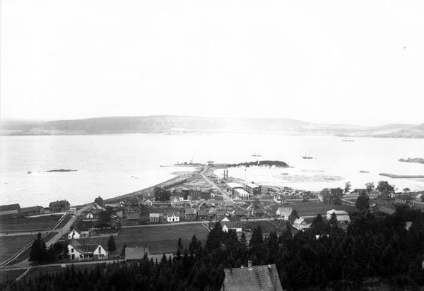
Dalhousie ( ) is a formerly incorporated town, located in Restigouche County, New Brunswick. New Brunswick's northernmost point of land is situated in Dalhousie, where the Restigouche River meets Chaleur Bay. On 1 January 2023, Dalhousie merged with the village of Charlo and several local service districts (LSDs) to form the new town of Heron Bay – French name ''Baie-des-Hérons''. Dalhousie remains in use by the province's 911 system. History Dalhousie is the shire town of Restigouche County and dates European settlement to 1800. The Town of Dalhousie has been through some very distinct periods between its founding in 1825 and today. Prior to 1825, few showed much interest in the northern part of the province, but in that year the Great Miramichi Fire raged through central New Brunswick and into Maine, destroying the forests that were the mainstay of the province's economy. Lumbermen looked north to the great pine stands of the Nipisiguit and the Restigouche. Dalhous ... [...More Info...] [...Related Items...] OR: [Wikipedia] [Google] [Baidu] |
Rivière Du Petit Pabos
Rivière, La Rivière, or Les Rivières (French for "river") may refer to: Places Belgium * Rivière, Profondeville, a village Canada * La Rivière, Manitoba, a community * Les Rivières (Quebec City), a borough France * La Rivière, Gironde * Rivière, Indre-et-Loire * La Rivière, Isère * Rivière, Pas-de-Calais * La Rivière, Réunion, home of the SS Rivière Sport football club Other uses * Rivière, a style of necklace or bracelet * "Riviere", a 2006 song by Deftones from ''Saturday Night Wrist'' People with the surname * Anna Riviere (1810-1884) opera singer known by her married name of Anna Bishop * Beatrice Rivière, French applied mathematician * Briton Rivière (1840–1920), British artist * Charles Marie Rivière (1845–?), French botanist abbreviated C.Rivière * Daniel Riviere (1780-1846) artist and father of a family of noted artists and singers * Émile Rivière (1835-1922), French archaeologist * Emmanuel Rivière (born 1990), French fo ... [...More Info...] [...Related Items...] OR: [Wikipedia] [Google] [Baidu] |
Grand Pabos River
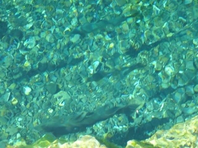
The Grand Pabos River or Pabos North River is a river in the Gaspé Peninsula of Quebec, Canada, which has its source at Lake of the North (Lac du Nord in French), fed by streams of the Chic-Choc Mountains. The river is about long. Its name comes from the Mi'kmaq word ''pabog'' meaning "tranquility waters". Salmon fishing The Grand Pabos River is known for its Atlantic Salmon (''salmo salar'') fishing in clear water and deep forest with no human presence. The river has long been a renowned salmon river from 1880 to 1950. Overfished, the salmons were almost completely annihilated in 1984 and the river was closed to fisherman. It has been reopened since 2003. Access and administration The river is accessible via Quebec Route 132 and is managed by an organisation that administrates salmon fishing on the 3 Pabos Rivers. It is easy to fish the Grand Pabos West River and the Petit Pabos River on the same fishing trip. See also *List of rivers of Quebec This is a list of river ... [...More Info...] [...Related Items...] OR: [Wikipedia] [Google] [Baidu] |
Bonaventure River
The Bonaventure River is a river in the Gaspé Peninsula of Quebec, Canada. It rises in the Chic-Choc Mountains and flows south to empty into Baie des Chaleurs near the town of Bonaventure, Quebec. The river is about long. The indigenous Mi'kmaq called the river ''Wagamet'', meaning "clear water". The river is still noted for its clear, cold water, making it well known as a great place for Atlantic Salmon fishing and recreational canoeing. The origin of the river's name is uncertain. It may come from the French ''bonne aventure'' (meaning "good fortune"); or named in honour of Simon-Pierre Denys de Bonaventure; or named after the ship ''Bonaventure'' of Lord La Court de Pré-Ravillon et de Granpré who entered the Gulf of Saint Lawrence in 1591. In any case, this name was already in use in 1697 when Governor Louis de Buade de Frontenac and Superintendent Jean Bochart de Champigny granted both sides of the river as the Seignory of the Bonavanture River to Charles-Henry de La Cr ... [...More Info...] [...Related Items...] OR: [Wikipedia] [Google] [Baidu] |
Cascapédia River
The Cascapédia River is a river in the Gaspé Peninsula of Quebec, Canada, which has its source at Lake Cascapedia, fed by streams of the Chic-Choc Mountains, and empties into Cascapedia Bay (''Baie de la Cascapédia''), a small bay of Chaleur Bay. The river is about long. At times, it is also called Grand Cascapédia River to differentiate it from the Little Cascapédia River which empties into the same bay just to the east. The Cascapedia is known for its Atlantic salmon (''salmo salar'') fishing. With average catches of and a record catch of , caught in 1886, the river has long been recognized as one of Quebec's richest salmon rivers. Already back in 1835, surveyor Joseph Hamel noted the abundance of fish, including trout, salmon, carp, and whitefish. Several Governors General of Canada, including The Marquess of Lansdowne and Lord Stanley, had summer homes along this river. The river is accessible via Quebec Route 299 that follows the river's course for . Almost its enti ... [...More Info...] [...Related Items...] OR: [Wikipedia] [Google] [Baidu] |
Matapédia River
The Matapedia River (french: Rivière Matapédia) is a river in the Matapedia Valley in the province of Quebec, Canada. It runs on from Matapedia Lake down to the village of Matapédia where it empties into the left bank of Restigouche River on the provincial border of New Brunswick. This freshwater course forms a natural border between the administrative regions of Bas-Saint-Laurent and Gaspésie-Îles-de-la-Madeleine. The river is a North South divide in the Notre Dame Mountains that characterize the relief of the Gaspé Peninsula. The Matapedia River basin drains an area of about . Matapedia River is often called the '' Salmon Capital ''. From the South side of Matapedia Lake and going to the South, the route 132 along the river goes on its entire length by the East bank. The Canadian National Railway passes South of Matapedia Lake continues on the West bank of the river in Causapscal where the bridge at South of the village made the railway cross on the East b ... [...More Info...] [...Related Items...] OR: [Wikipedia] [Google] [Baidu] |
Piping Plover
The piping plover (''Charadrius melodus'') is a small sand-colored, sparrow-sized shorebird that nests and feeds along coastal sand and gravel beaches in North America. The adult has yellow-orange-red legs, a black band across the forehead from eye to eye, and a black stripe running along the breast line. This chest band is usually thicker in males during the breeding season, and it is the only reliable way to tell the sexes apart. The bird is difficult to see when it is standing still, as it blends well with open, sandy beach habitats. It typically runs in short, quick spurts and then stops. There are two subspecies of piping plovers: the eastern population is known as ''Charadrius melodus melodus'' and the mid-west population is known as ''C. m. circumcinctus''. The bird's name is derived from its plaintive bell-like whistles which are often heard before the bird is visible. Total population is currently estimated to be between 7600 - 8400 individuals. Intensive conservation ef ... [...More Info...] [...Related Items...] OR: [Wikipedia] [Google] [Baidu] |
Charlo, New Brunswick
Charlo ( ; 2016 population: 1,310) is a former Canadian incorporated village in Restigouche County, New Brunswick. History Situated on the south shore of Chaleur Bay, the community was first settled by Acadians in 1799 (except for the Thompson family who emigrated from Ireland through the port of New York who settled 1784-1790 and was granted land by the crown in 1824 next to the church property) and incorporated in 1966. River Charlo is one of its neighbourhoods. The Charlo Airport, the only airport in the region, offered scheduled air service between 1963-2001. In October 2012, Provincial Airlines began trial flights at the Charlo Airport. In January 2013, after deeming that there was sufficient demand, they made the trial flights permanent. They currently provide direct flights between Charlo, New Brunswick and Wabush, Newfoundland and Halifax, Nova Scotia. Demographics In the 2021 Census of Population conducted by Statistics Canada, Charlo had a population of living ... [...More Info...] [...Related Items...] OR: [Wikipedia] [Google] [Baidu] |
Eel River Bar
Eel River Bar First Nation, or Ugpi'ganjig is a Mi'gmaq First Nation located in Northern New Brunswick. It has a registered population of 757 people, of which 346 live on reserve. The total number of people living on the reserve is 415 as of 2016. Location Eel River Bar is situated on the Bay of Chaleur at the mouth of the Eel River, in Northern New Brunswick New Brunswick (french: Nouveau-Brunswick, , locally ) is one of the thirteen provinces and territories of Canada. It is one of the three Maritime provinces and one of the four Atlantic provinces. It is the only province with both English and .... It is approximately 3 km from Dalhousie, and about 20 km from Campbellton, the nearest city. Route 11 is the nearest highway, and Route 134 is a secondary road running through the community. References Indian reserves in New Brunswick Mi'kmaq in Canada {{FirstNations-stub ... [...More Info...] [...Related Items...] OR: [Wikipedia] [Google] [Baidu] |
Barachois
A barachois is a term used in Atlantic Canada, Saint Pierre and Miquelon, Réunion and Mauritius Island to describe a coastal lagoon partially or totally separated from the ocean by a sand or shingle bar. Sometimes the bar is constructed of boulders, as is the case at Freshwater Bay near St. John’s, Newfoundland. Salt water may enter the barachois during high tide. The bar often is formed as a result of sediment deposited in the delta region of a river or – as is the case in Miquelon – by a tombolo. Name The English term comes from the French language, where the word is pronounced . The term comes from a Basque word, ''barratxoa'', meaning ''little bar''. The popular derivation from the French ''barre à choir'' is without historical merit. In Newfoundland English, the word has become pronounced (and sometimes written) as ''barrasway''. Examples * Dark Harbour, Grand Manan, New Brunswick (photo) * Barachois de Malbaie on the tip of the Gaspé Peninsula, fed by one ... [...More Info...] [...Related Items...] OR: [Wikipedia] [Google] [Baidu] |


