|
Azalai
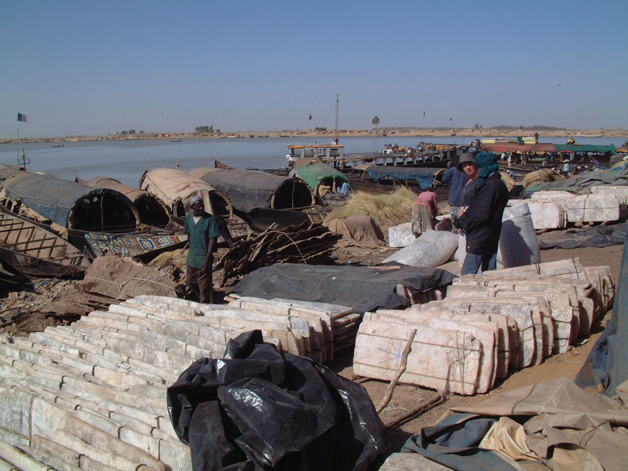
The Azalai (Tamasheq, var. Azalay) is a semi-annual salt caravan route practiced by Tuareg traders in the Sahara desert between Timbuktu and the Taoudenni salt mine in Mali, or the act of traveling with a caravan along that route. The other major West African salt caravan route, heading from around Agadez to Fachi and Bilma in Niger, is called Taghlamt (in Tamasheq, or Taglem or Tagalem in Hausa language). The two are among the last caravan routes in the Sahara that are still in use. Both caravans have largely been replaced by unpaved truck routes. Timbuktu-Taoudenni At one time the caravan route from Timbuktu extended through Taoudenni to Taghaza, another salt-mining site, and on to the lands north of the Sahara on the Mediterranean Sea. Caravans with up to 10,000 camels carried gold and slaves north, returning with manufactured goods and salt from Taghaza and Taoudenni. Until the 1940s, the Taoudenni caravans were made up of thousands of camels, departing Timbuktu at the be ... [...More Info...] [...Related Items...] OR: [Wikipedia] [Google] [Baidu] |
Timbuktu
Timbuktu ( ; french: Tombouctou; Koyra Chiini: ); tmh, label=Tuareg, script=Tfng, ⵜⵏⴱⴾⵜ, Tin Buqt a city in Mali, situated north of the Niger River. The town is the capital of the Tombouctou Region, one of the eight administrative regions of Mali and one town of Songhai people. It had a population of 54,453 in the 2009 census. Timbuktu began as a seasonal settlement and became a permanent settlement early in the 12th century. After a shift in trading routes, particularly after the visit by Mansa Musa around 1325, Timbuktu flourished from the trade in salt, gold, ivory and slaves. It gradually expanded as an important Islamic city on the Saharan trade route and attracted many scholars and traders. It became part of the Mali Empire early in the 14th century. In the first half of the 15th century, the Tuareg people took control of the city for a short period until the expanding Songhai Empire absorbed the city in 1468. A Moroccan army defeated the Songhai in 159 ... [...More Info...] [...Related Items...] OR: [Wikipedia] [Google] [Baidu] |
Taoudenni
ar, تودني , nickname = , settlement_type = , total_type = , motto = , translit_lang1= , translit_lang1_type= , translit_lang1_info= , translit_lang1_type1= , translit_lang1_info1= , translit_lang1_type2= , translit_lang1_info2= , image_skyline = , imagesize = , image_caption = , image_flag = , flag_size = , image_seal = , seal_size = , image_shield = , shield_size = , image_blank_emblem = , blank_emblem_type = , blank_emblem_size = , image_map = , mapsize = , map_caption = , image_map1 = , mapsize1 = , map_caption1 = , image_dot_map = , dot_mapsize = , dot_map_caption = , dot_x = , dot_y = , pushpin_map = Mali , pushpin_label_position = , pushpin_map_caption =Location within Mali , ... [...More Info...] [...Related Items...] OR: [Wikipedia] [Google] [Baidu] |
Ténéré
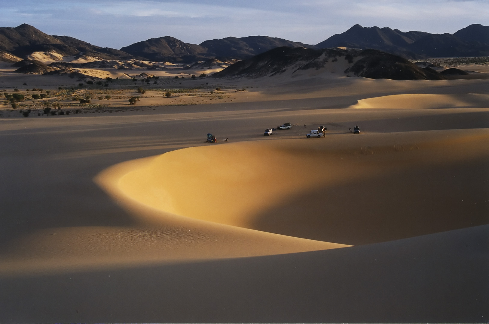
The Ténéré (Tuareg: Tenere, literally: "desert") is a desert region in the south central Sahara. It comprises a vast plain of sand stretching from northeastern Niger into western Chad, occupying an area of over . The Ténéré's boundaries are said to be the Aïr Mountains in the west, the Hoggar Mountains in the north, the Djado Plateau in the northeast, the Tibesti Mountains in the east, and the basin of Lake Chad in the south. The central part of the desert, the Erg du Bilma, is centred at approximately . It is the locus of the Neolithic Tenerian culture. Name The name ''Ténéré'' comes from the Tuareg language, meaning "desert", in much the same way that the Arabic word for "desert", ''Sahara'', came to be applied to the region as a whole. Climate The Ténéré has a hot desert climate (Köppen climate classification ''BWh''), typical of the large Sahara Desert. The climate is hyper-arid, extremely hot, sunny and dry year-round and there is virtually no plant life. The av ... [...More Info...] [...Related Items...] OR: [Wikipedia] [Google] [Baidu] |
Mopti
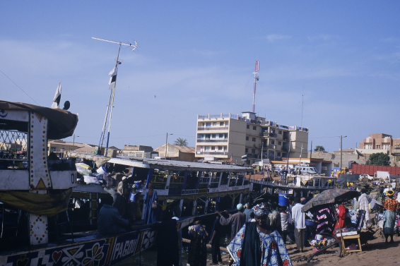
Mopti ( Bambara: ߡߏߕߌ tr. Moti) is a town and an urban commune in the Inner Niger Delta region of Mali. The town is the capital of the Mopti Cercle and the Mopti Region. Situated 630 km northeast of Bamako, the town lies at the confluence of the Niger and the Bani Rivers and is linked by an elevated causeway to the town of Sévaré. The urban commune, which includes both Mopti and Sévaré, had a population of 114,296 in the 2009 census. Geography Mopti lies on the right bank of the Bani River, a few hundred meters upstream of the confluence of the Bani with the Niger River. Between August and December when the rivers flood the Inner Niger Delta, the town becomes a series of islands connected by raised causeways. During this period the only road access to the town is along a 12 km causeway that links Mopti to Sévaré. Mopti lies to the west of the Dogon Plateau and is 66 km northwest of Bandiagara and 76 km north-northeast of Djenné. The town is the ca ... [...More Info...] [...Related Items...] OR: [Wikipedia] [Google] [Baidu] |
Kel Ayr
Kel Ayr (also spelled Kel Aïr) was a semi-nomadic Tuareg tribal confederation. It ruled an area centered on the Aïr Mountains (Aïr Massif) in what is today Niger. Forming sometime after the 11th century CE, the Kel Ayr were one of the earlier Tuareg groups to arrive in the Aïr. They pushed out the Hausa, who later became identified with Gobir (the Gobirawa) and other states to the south. Kel Ayr controlled the sedentary populations of the trading and farming centers in Assodé, Agadez, In-Gall, Timia and Iferouane. The Songhai Empire seized Agadez, Ingall, and centers to the south and west in 1500, but lost control before the end of the century. Along with the Kel Gres, Tesen and Issandalan confederations, the Kel Ayr controlled the region and helped found the Sultanate in Agadez. In 1740 the large Kel Owey destroyed the town of Assodé, sacked Agadez, placed the Sultanate of Agadez under their control, and dispersed the Kel Ayer to the south and west. The confederation was th ... [...More Info...] [...Related Items...] OR: [Wikipedia] [Google] [Baidu] |
Kel Owey
The Kel Awey (var. Kel Owi, Kel Ewey form ''People of the Bull'') are a Tuareg clan confederation. From the 18th century until the advent of French colonial rule at the beginning of the 20th century, they were a dominant power in the Aïr Mountains of north central Niger. History The Kel Awey have, like many Tuareg confederations, been both a sub-group of other confederations and the dominant power over other clans. In 1740 the Kel Awey moved south from modern Algeria and destroyed the town of Assodé, sacked Agadez, placed the Sultanate of Agadez under their control, and dispersed the Kel Ayr to the south and west. The confederation was then under the direct suzerainty of the Anastafidet, lord of the Kel Awey. Heinrich Barth passed through the Aouderas valley with a Kel Awey trans-Saharan caravan in 1850, and reported that it was only recently that the Kel Awey had pushed the Kel Gres and Kel Itesen Tuareg south and west out of the valley. When the French appeared in force in th ... [...More Info...] [...Related Items...] OR: [Wikipedia] [Google] [Baidu] |
Kel Gress
Kel Gres is a tribal confederation of Tuareg clans (or "''Drum-groups''"). In the modern era, they have mostly lived in south central Niger, although they are known to have inhabited the Aïr Mountains prior to the 17th century. As pastoralists, the Kel Gress also have a tradition seasonal transhumance cycle which takes them far from their more settled communities in the Zinder and Tahoua Regions. See also *Tuareg **Kel Adagh **Kel Ahaggar **Kel Ajjer **Kel Ayr **Kel Owey **Aulliminden The Iwellemmedan (''Iwəlləmədǎn''), also spelled Iullemmeden, Aulliminden, Ouilliminden, Lullemmeden, and Iwellemmeden, are one of the seven major Tuareg tribal or clan confederations (called "''Drum groups''"). Their communities are histori ...: Kel Ataram (west) and Kel Dinnik (east) References Portions of this article were translated from the French language Wikipedia article :fr:Kel Gress, 2008-08-26. {{authority control Tuareg confederations Ethnic groups in Niger ... [...More Info...] [...Related Items...] OR: [Wikipedia] [Google] [Baidu] |
Hausaland
The Hausa ( autonyms for singular: Bahaushe ( m), Bahaushiya ( f); plural: Hausawa and general: Hausa; exonyms: Ausa; Ajami: ) are the largest native ethnic group in Africa. They speak the Hausa language, which is the second most spoken language after Arabic in the Afro-Asiatic language family. The Hausa are a diverse but culturally homogeneous people based primarily in the Sahelian and the sparse savanna areas of southern Niger and northern Nigeria respectively, numbering around 83 million people with significant indigenized populations in Benin, Cameroon, Ivory Coast, Chad, Sudan, Central African Republic, Republic of the Congo, Togo, Ghana, Eritrea, Equatorial Guinea, Gabon, Senegal and the Gambia. Predominantly Hausa-speaking communities are scattered throughout West Africa and on the traditional Hajj route north and east traversing the Sahara, with an especially large population in and around the town of Agadez. Other Hausa have also moved to large coastal cities in the regi ... [...More Info...] [...Related Items...] OR: [Wikipedia] [Google] [Baidu] |
Kaouar
The Kaouar (or Kawar) is a series of ten oases in the southern Sahara in northeast Niger, covering about from north to south, and east to west. They are on the eastern edge of the Ténéré desert, between the Tibesti Mountains in the east and the Aïr Mountains in the west and between the Fezzan in the north and Lake Chad in the south. They lie on the leeward side of a 100-meter-high north–south escarpment and easterly winds striking the escarpment provide easy access to groundwater for the oases. Running south to north, Bilma, Dirkou, Aney and Séguédine are the largest towns. The Kaouar oases are famous for salt and date production, and were along the route of the great Bornu to Fezzan caravan trail. This was the major point of contact between the African Sahel and the Mediterranean civilisations until the 19th century. Numerous archeological sites and rock paintings attest to human habitation here reaching back some 10,000 years to when the area was surrounded by l ... [...More Info...] [...Related Items...] OR: [Wikipedia] [Google] [Baidu] |
Salt Evaporation Pond
A salt evaporation pond is a shallow artificial salt pan designed to extract salts from sea water or other brines. The Salt pans are shallow and large of size because it will be easier for sunlight to travel and reach the sea water. Natural salt pans are geological formations that are also created by water evaporating and leaving behind salts. Some salt evaporation ponds are only slightly modified from their natural version, such as the ponds on Great Inagua in the Bahamas, or the ponds in Jasiira, a few kilometres south of Mogadishu, where seawater is trapped and left to evaporate in the sun. The seawater or brine is fed into large ponds and water is drawn out through natural evaporation which allows the salt to be subsequently harvested. The ponds also provide a productive resting and feeding ground for many species of waterbirds, which may include endangered species. The ponds are commonly separated by levees. Salt evaporation ponds may also be called salterns, salt works or ... [...More Info...] [...Related Items...] OR: [Wikipedia] [Google] [Baidu] |
Natron
Natron is a naturally occurring mixture of sodium carbonate decahydrate ( Na2CO3·10H2O, a kind of soda ash) and around 17% sodium bicarbonate (also called baking soda, NaHCO3) along with small quantities of sodium chloride and sodium sulfate. Natron is white to colourless when pure, varying to gray or yellow with impurities. Natron deposits are sometimes found in saline lake beds which arose in arid environments. Throughout history natron has had many practical applications that continue today in the wide range of modern uses of its constituent mineral components. In modern mineralogy the term ''natron'' has come to mean only the sodium carbonate decahydrate (hydrated soda ash) that makes up most of the historical salt. Etymology The English and German word ''natron'' is a French cognate derived from the Spanish ''natrón'' through Latin ''natrium'' and Greek ''nitron'' (). This derives from the Ancient Egyptian word ''nṯrj''. ''Natron'' refers to Wadi El Natrun or Natr ... [...More Info...] [...Related Items...] OR: [Wikipedia] [Google] [Baidu] |


