|
Zuytdorp Cliffs
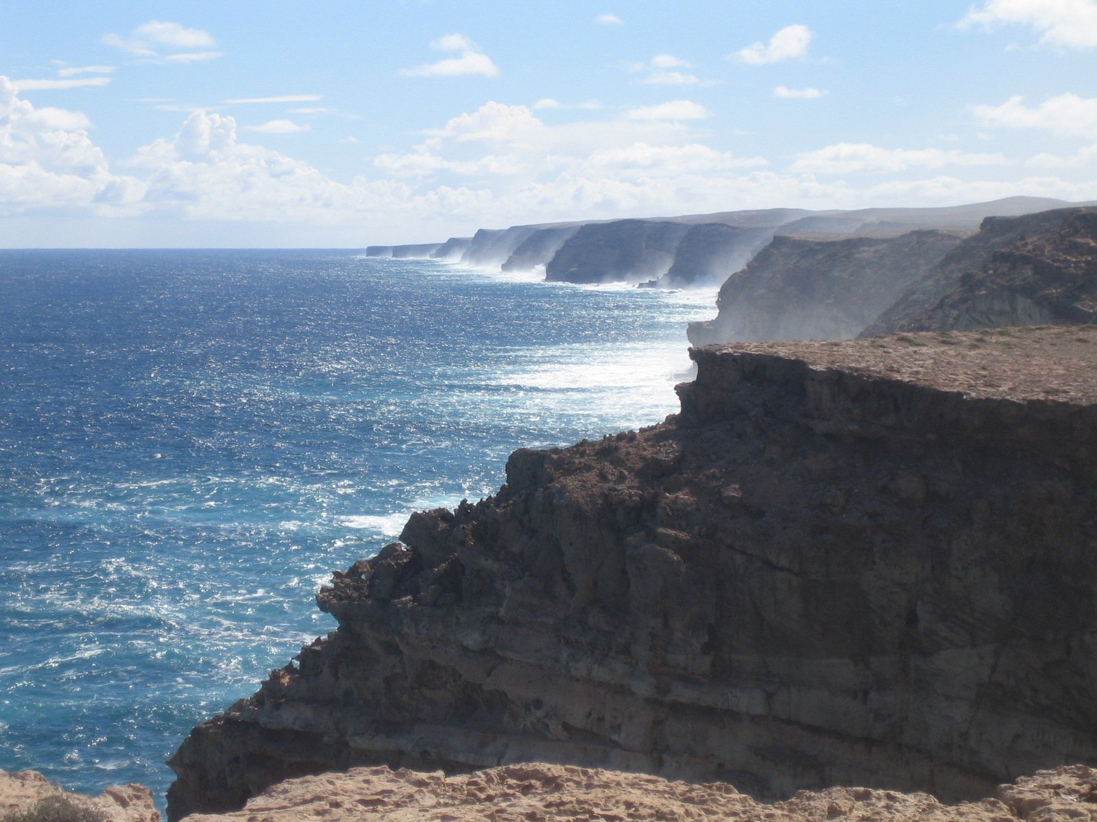
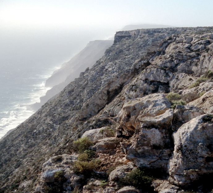
The Zuytdorp Cliffs extend for about along a rugged, spectacular and little visited segment of the Western Australian Indian Ocean coast. The cliffs extend from just south of the mouth of the Murchison River, Western Australia, Murchison River at Kalbarri, Western Australia, Kalbarri, to Pepper Point south of Steep Point, Western Australia, Steep Point. The cliffs are situated in both the Gascoyne (Western Australia), Gascoyne and Mid West (Western Australia), Mid West regions of the state. At the highest point, near Womerangee Hill, the top of the cliffs are above the sea. They are named after a trading ship of the Dutch East India Company, the ''Zuytdorp'', that was wrecked against the cliffs in 1712. Geology The Zuytdorp Cliffs are composed of Pleistocene aged limestone, a formation called the Tamala Limestone. This limestone formed by the cementation of ancient calcareous sand dunes that accumulated near the coast during episodes of the last ice age. It has been inferred ... [...More Info...] [...Related Items...] OR: [Wikipedia] [Google] [Baidu] |
Zuytdorp
''Zuytdorp'', also ''Zuiddorp'' (meaning "South Village", after Zuiddorpe, an extant village in the south of Zeeland in the Netherlands, near the Belgian border) was an 18th-century trading ship of the Dutch East India Company (Vereenigde Oost-Indische Compagnie, commonly abbreviated VOC). On 1 August 1711, ''Zuytdorp'' was dispatched from the Netherlands to the trading port of Batavia (now Jakarta, Indonesia) bearing a load of freshly minted silver coins. Many trading ships travelled the Brouwer Route, using the strong Roaring Forties winds to carry them across the Indian Ocean to within sight of the west coast of Australia (then called New Holland), whence they would turn north towards Batavia. ''Zuytdorp'' never arrived at its destination and was never heard from again. No search was undertaken, presumably because the VOC did not know whether or where the ship wrecked or if it was taken by pirates. Previous expensive attempts were made to search for other missing ships, but ... [...More Info...] [...Related Items...] OR: [Wikipedia] [Google] [Baidu] |
Fault (geology)
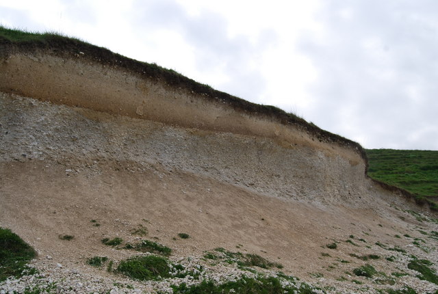
In geology, a fault is a planar fracture or discontinuity in a volume of rock across which there has been significant displacement as a result of rock-mass movements. Large faults within Earth's crust result from the action of plate tectonic forces, with the largest forming the boundaries between the plates, such as the megathrust faults of subduction zones or transform faults. Energy release associated with rapid movement on active faults is the cause of most earthquakes. Faults may also displace slowly, by aseismic creep. A ''fault plane'' is the plane that represents the fracture surface of a fault. A ''fault trace'' or ''fault line'' is a place where the fault can be seen or mapped on the surface. A fault trace is also the line commonly plotted on geologic maps to represent a fault. A ''fault zone'' is a cluster of parallel faults. However, the term is also used for the zone of crushed rock along a single fault. Prolonged motion along closely spaced faults can blur the ... [...More Info...] [...Related Items...] OR: [Wikipedia] [Google] [Baidu] |
Ice Age
An ice age is a long period of reduction in the temperature of Earth's surface and atmosphere, resulting in the presence or expansion of continental and polar ice sheets and alpine glaciers. Earth's climate alternates between ice ages and greenhouse periods, during which there are no glaciers on the planet. Earth is currently in the Quaternary glaciation. Individual pulses of cold climate within an ice age are termed ''glacial periods'' (or, alternatively, ''glacials, glaciations, glacial stages, stadials, stades'', or colloquially, ''ice ages''), and intermittent warm periods within an ice age are called '' interglacials'' or ''interstadials''. In glaciology, ''ice age'' implies the presence of extensive ice sheets in both northern and southern hemispheres. By this definition, Earth is currently in an interglacial period—the Holocene. The amount of anthropogenic greenhouse gases emitted into Earth's oceans and atmosphere is predicted to prevent the next glacial period for th ... [...More Info...] [...Related Items...] OR: [Wikipedia] [Google] [Baidu] |
Calcareous
Calcareous () is an adjective meaning "mostly or partly composed of calcium carbonate", in other words, containing lime or being chalky. The term is used in a wide variety of scientific disciplines. In zoology ''Calcareous'' is used as an adjectival term applied to anatomical structures which are made primarily of calcium carbonate, in animals such as gastropods, i.e., snails, specifically about such structures as the operculum, the clausilium, and the love dart. The term also applies to the calcium carbonate tests of often more or less microscopic Foraminifera. Not all tests are calcareous; diatoms and radiolaria have siliceous tests. The molluscs are calcareous, as are calcareous sponges ( Porifera), that have spicules which are made of calcium carbonate. In botany ''Calcareous grassland'' is a form of grassland characteristic of soils containing much calcium carbonate from underlying chalk or limestone rock. In medicine The term is used in pathology, for example i ... [...More Info...] [...Related Items...] OR: [Wikipedia] [Google] [Baidu] |
Tamala Limestone
Tamala Limestone is the geological name given to the widely occurring eolianite limestone deposits on the western coastline of Western Australia, between Shark Bay in the north and nearly to Albany in the south. The rock consists of calcarenite wind-blown shell fragments and quartz sand which accumulated as coastal sand dunes during the middle and late Pleistocene and early Holocene eras. As a result of a process of sedimentation and water percolating through the shelly sands, the mixture later lithified when the lime content dissolved to cement the grains together. Exposed limestone formations at The Pinnacles Desert near Cervantes clearly show the limestone formation through the sedimentary process. At its thickest, the Tamala Limestone comprises the massive Zuytdorp Cliffs, up to 250 m high, extending for 150 km between Kalbarri, Western Australia and south of Steep Point. Commercial uses Because of its ready availability, Tamala Limestone is used extensively for landscapi ... [...More Info...] [...Related Items...] OR: [Wikipedia] [Google] [Baidu] |
Limestone
Limestone ( calcium carbonate ) is a type of carbonate sedimentary rock which is the main source of the material lime. It is composed mostly of the minerals calcite and aragonite, which are different crystal forms of . Limestone forms when these minerals precipitate out of water containing dissolved calcium. This can take place through both biological and nonbiological processes, though biological processes, such as the accumulation of corals and shells in the sea, have likely been more important for the last 540 million years. Limestone often contains fossils which provide scientists with information on ancient environments and on the evolution of life. About 20% to 25% of sedimentary rock is carbonate rock, and most of this is limestone. The remaining carbonate rock is mostly dolomite, a closely related rock, which contains a high percentage of the mineral dolomite, . ''Magnesian limestone'' is an obsolete and poorly-defined term used variously for dolomite, for limes ... [...More Info...] [...Related Items...] OR: [Wikipedia] [Google] [Baidu] |
Pleistocene
The Pleistocene ( , often referred to as the ''Ice age'') is the geological Epoch (geology), epoch that lasted from about 2,580,000 to 11,700 years ago, spanning the Earth's most recent period of repeated glaciations. Before a change was finally confirmed in 2009 by the International Union of Geological Sciences, the cutoff of the Pleistocene and the preceding Pliocene was regarded as being 1.806 million years Before Present (BP). Publications from earlier years may use either definition of the period. The end of the Pleistocene corresponds with the end of the last glacial period and also with the end of the Paleolithic age used in archaeology. The name is a combination of Ancient Greek grc, label=none, πλεῖστος, pleīstos, most and grc, label=none, καινός, kainós (latinized as ), 'new'. At the end of the preceding Pliocene, the previously isolated North and South American continents were joined by the Isthmus of Panama, causing Great American Interchang ... [...More Info...] [...Related Items...] OR: [Wikipedia] [Google] [Baidu] |
Royal Western Australian Historical Society
Royal Western Australian Historical Society has for many decades been the main association for Western Australians to collectively work for adequate understanding and protection of the cultural heritage of Perth and Western Australia. It was founded in 1926. With membership including local historians and writers, it preceded the Western Australian branch of the National Trust and the History Council of Western Australia by decades. Based in Nedlands it holds many important objects and archives relative to Western Australian history. The RWAHS is a constituent member of the Federation of Australian Historical Societies. A significant number of Western Australian historians, writers and public figures have been involved with the society. Early days '' Early Days'' is the official journal and is published annually. It is one of the more lasting legacies of the society - a regular run of articles with a wide range of subjects concerning West Australian history. * ''Early days ... [...More Info...] [...Related Items...] OR: [Wikipedia] [Google] [Baidu] |
Dutch East India Company
The United East India Company ( nl, Verenigde Oostindische Compagnie, the VOC) was a chartered company established on the 20th March 1602 by the States General of the Netherlands amalgamating existing companies into the first joint-stock company in the world, granting it a 21-year monopoly to carry out trade activities in Asia. Shares in the company could be bought by any resident of the United Provinces and then subsequently bought and sold in open-air secondary markets (one of which became the Amsterdam Stock Exchange). It is sometimes considered to have been the first multinational corporation. It was a powerful company, possessing quasi-governmental powers, including the ability to wage war, imprison and execute convicts, negotiate treaties, strike its own coins, and establish colonies. They are also known for their international slave trade. Statistically, the VOC eclipsed all of its rivals in the Asia trade. Between 1602 and 1796 the VOC sent almost a million Eur ... [...More Info...] [...Related Items...] OR: [Wikipedia] [Google] [Baidu] |
Shire Of Shark Bay
The Shire of Shark Bay is a local government area of Western Australia in the Gascoyne region. It has an area of 25,423 km2 and a population of about 950. It is made up of two peninsulas, located at the westernmost point of Australia. There is one town in the Shire of Shark Bay, Denham, which is the administrative centre for the Shire. There are also a number of small communities; they are Useless Loop (a now-closed mining site), Monkey Mia (a popular resort where dolphins come in), Nanga and Hamelin Pool. The Overlander and The Billabong are roadhouses. History The Shark Bay Road District was gazetted on 13 May 1904. In 1951 the then current officials were dismissed. On 1 July 1961, it became a shire under the ''Local Government Act 1960'', which reformed all remaining road districts into shires. Wards The Shire is divided into three wards: * Denham Ward (five councillors) * Pastoral Ward (one councillor) * Useless Loop Ward (one councillor) Towns and localitie ... [...More Info...] [...Related Items...] OR: [Wikipedia] [Google] [Baidu] |


%2C_Hoorn.jpg)
