|
Zundert
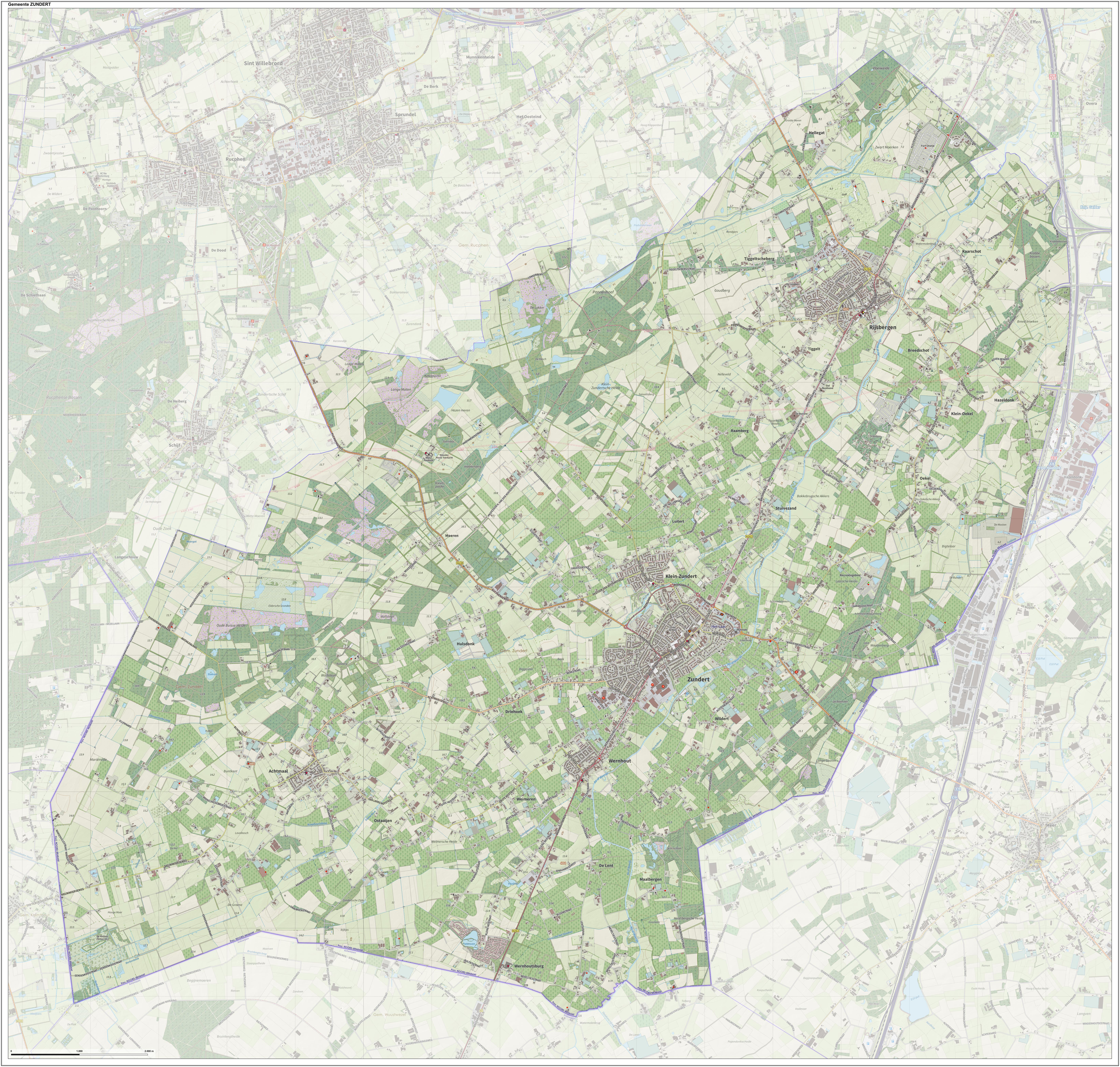
Zundert () is a Municipalities of the Netherlands, municipality and town in the south of the Netherlands bordering Belgium, in the province of North Brabant. Zundert is the birthplace of Post-impressionism, post-impressionist painter Vincent van Gogh. History The name of Zundert is first mentioned in a certificate dating from 1157, in which the Prince-Bishopric of Liège, Bishop of Liege confirms a donation from the place "Sunderda". This Sunderda actually relates to the current settlement of Klein-Zundert (Dutch for Small Zundert), one of the first settlements in the area. The local monks, besides their religious labour, were also involved in clearing the land, that was still rough territory, filled with swamps, peats and heath fields. The monks also assisted in improving agricultural methods. Zundert is still surrounded by a rural environment with nature areas, one of them is the "Buissche Heide", a heath area used for recreation and walking. The Kalmthoutse Heide, across th ... [...More Info...] [...Related Items...] OR: [Wikipedia] [Google] [Baidu] |
Vincent Van Gogh
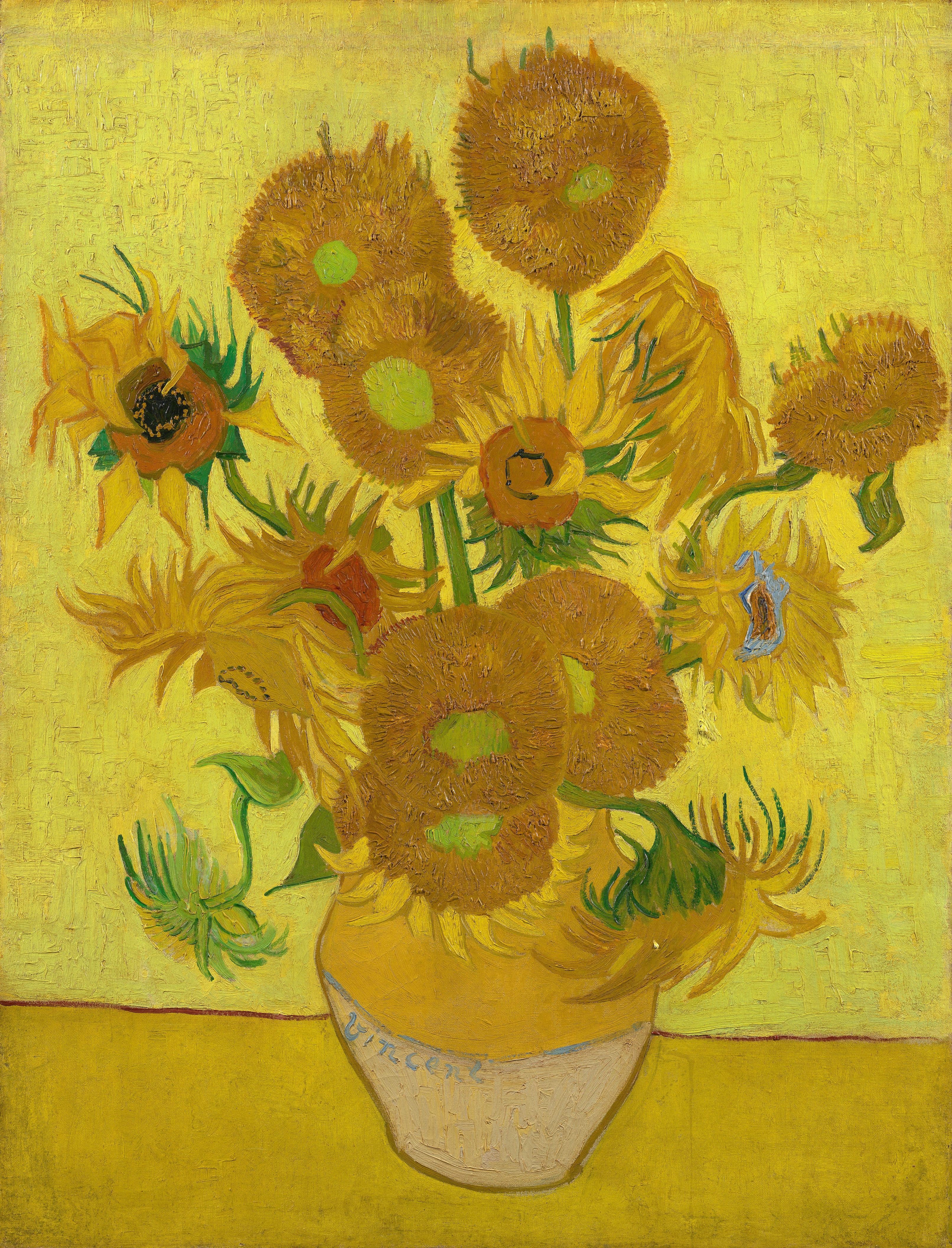
Vincent Willem van Gogh (; 30 March 185329 July 1890) was a Dutch Post-Impressionism, Post-Impressionist painter who posthumously became one of the most famous and influential figures in Western art history. In a decade, he created about 2,100 artworks, including around 860 oil paintings, most of which date from the last two years of his life. They include Trees and Undergrowth (Van Gogh series), landscapes, Still life paintings by Vincent van Gogh (Paris), still lifes, Portraits by Vincent van Gogh, portraits and Portraits of Vincent van Gogh, self-portraits, and are characterised by bold colours and dramatic, impulsive and expressive paintwork, brushwork that contributed to the foundations of modern art. Not commercially successful, he struggled with severe depression and poverty, eventually leading to his suicide at age thirty-seven. Born into an upper-middle class family, Van Gogh drew as a child and was serious, quiet, and thoughtful. As a young man, he worked as an ar ... [...More Info...] [...Related Items...] OR: [Wikipedia] [Google] [Baidu] |
Rijsbergen
Rijsbergen a town in the municipality of Zundert in the southern Netherlands. In the town used to be an AC (Aanmeldcentrum, i.e. Asylum Request Center). Until 1997 Rijsbergen was an independent municipality, after which it was added to Zundert. The skyline of Rijsbergen is dominated by the neo-Gothic Roman Catholic church of Saint Bavo, which was built in 1918 as a replacement of a smaller fourteenth-century church. The church is situated in the town centre and is flanked by the former town hall, which has been transformed into a museum. Furthermore, in the outskirts of Rijsbergen a successful Garden Centre can be found named: "De Bosrand". A deeply loved place by the locals. The countryside around Rijsbergen is dotted with eleven shrines devoted to the Virgin Mary. They were built after the Second World War World War II or the Second World War, often abbreviated as WWII or WW2, was a world war that lasted from 1939 to 1945. It involved the vast majority of the ... [...More Info...] [...Related Items...] OR: [Wikipedia] [Google] [Baidu] |
North Brabant
North Brabant ( nl, Noord-Brabant ; Brabantian: ; ), also unofficially called Brabant, is a province in the south of the Netherlands. It borders the provinces of South Holland and Gelderland to the north, Limburg to the east, Zeeland to the west, and the Flemish provinces of Antwerp and Limburg to the south. The northern border follows the Meuse westward to its mouth in the Hollands Diep strait, part of the Rhine–Meuse–Scheldt delta. North Brabant has a population of 2,562,566 as of November 2019. Major cities in North Brabant are Eindhoven (pop. 231,642), Tilburg (pop. 217,259), Breda (pop. 183,873) and its provincial capital 's-Hertogenbosch (pop. 154,205). History The Duchy of Brabant was a state of the Holy Roman Empire established in 1183 or 1190. It developed from the Landgraviate of Brabant and formed the heart of the historic Low Countries, part of the Burgundian Netherlands from 1430 and of the Habsburg Netherlands from 1482, until it was split up after th ... [...More Info...] [...Related Items...] OR: [Wikipedia] [Google] [Baidu] |
Achtmaal
Achtmaal is a village the south of the Netherlands. It is located in Zundert, North Brabant, near the border with Belgium. History The village was first mentioned in 1294 as "Gilberti de Achtmale", and is a combination of "reserved forest" and "court of justice". Achtmaal was home to 100 people in 1840. The St Cornelius Church was built in 1863. During World War II, the United States Army 104th Infantry Division, 415th Infantry Regiment, liberated Achtmaal. Operation Pheasant Operation Pheasant, also known as the Liberation of North Brabant, was a major operation to clear German troops from the province of North Brabant in the Netherlands during the fighting on the Western Front in the Second World War. This offensiv ... (code-name "Suitcase") started on the morning of Friday 20 October 1944 just after 7:00am. On 27 October 1944 the 3rd Battalion of the 415th Infantry entered the village and Lieutenant Colonel Kelleher was handed papers by the Dutch resistance. They pro ... [...More Info...] [...Related Items...] OR: [Wikipedia] [Google] [Baidu] |
104th Infantry Division (United States)
The 104th Infantry Division was an infantry division of the United States Army. Today, it is known as the 104th Training Division (Leader Training) and based at Fort Lewis, Washington, as a training unit of the United States Army Reserve. Activated in 1921 and deployed during World War II, the division saw almost 200 days of fighting in northwestern Europe as it fought through France, Netherlands, Belgium, and western Germany, fighting back several fierce German counterattacks as it advanced through the theater throughout late 1944 and 1945. This was the only combat duty that the 104th Infantry Division has served during its history. At the end of the fighting on 7 May 1945 (V-E Day), this division was in central Germany opposite the troops of its allies from the Soviet Army. After World War II, this division was reorganized primarily as a training division for Reserve forces. After several decades, the division then expanded its role to conducting entry-level training for so ... [...More Info...] [...Related Items...] OR: [Wikipedia] [Google] [Baidu] |
List Of Municipalities Of The Netherlands
As of 24 March 2022, there are 344 municipalities ( nl, gemeenten) and three special municipalities () in the Netherlands. The latter is the status of three of the six island territories that make up the Dutch Caribbean. Municipalities are the second-level administrative division, or public bodies (), in the Netherlands and are subdivisions of their respective provinces. Their duties are delegated to them by the central government and they are ruled by a municipal council that is elected every four years. Municipal mergers have reduced the total number of municipalities by two-thirds since the first official boundaries were created in the mid 19th century. Municipalities themselves are informally subdivided into districts and neighbourhoods for administrative and statistical purposes. These municipalities come in a wide range of sizes, Westervoort is the smallest with a land area of and Súdwest-Fryslân the largest with a land area of . Schiermonnikoog is both the least pop ... [...More Info...] [...Related Items...] OR: [Wikipedia] [Google] [Baidu] |
Municipalities Of The Netherlands
As of 24 March 2022, there are 344 municipalities ( nl, gemeenten) and three special municipalities () in the Netherlands. The latter is the status of three of the six island territories that make up the Dutch Caribbean. Municipalities are the second-level administrative division, or public bodies (), in the Netherlands and are subdivisions of their respective provinces. Their duties are delegated to them by the central government and they are ruled by a municipal council that is elected every four years. Municipal mergers have reduced the total number of municipalities by two-thirds since the first official boundaries were created in the mid 19th century. Municipalities themselves are informally subdivided into districts and neighbourhoods for administrative and statistical purposes. These municipalities come in a wide range of sizes, Westervoort is the smallest with a land area of and Súdwest-Fryslân the largest with a land area of . Schiermonnikoog is both the least pop ... [...More Info...] [...Related Items...] OR: [Wikipedia] [Google] [Baidu] |
Etten-Leur
Etten-Leur () is a municipality in the Dutch province North Brabant. Its name is a combination of the two villages from which the municipality originally acrose: Etten and Leur. History The villages were always part of one municipality, originally called "Etten c.a." (cum annexis), this later to change to "Etten en Leur". The current name was adopted in 1968. By that time, the villages had grown into one. Both villages, created in the Middle Ages, were relatively prosperous during the period of the Dutch Republic, the exception being the period of the Eighty Years' War in which the area was a major battleground. This prosperity was caused by the fact that Etten was a centre for the production of peat, and Leur was a local trading port, as it had a harbour. Decline in economic importance marked both villages during the nineteenth century. In 1836 Arnold Damen left Leur in order to work as a missionary in the United States. The painter Vincent van Gogh briefly lived in Etten, makin ... [...More Info...] [...Related Items...] OR: [Wikipedia] [Google] [Baidu] |
Breda
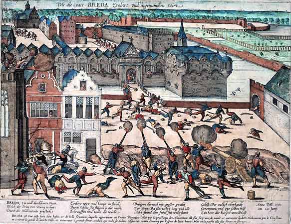
Breda () is a city and municipality in the southern part of the Netherlands, located in the province of North Brabant. The name derived from ''brede Aa'' ('wide Aa' or 'broad Aa') and refers to the confluence of the rivers Mark and Aa. Breda has 185,072 inhabitants on 13 September 2022 and is part of the Brabantse Stedenrij; it is the ninth largest city/municipality in the country, and the third largest in North Brabant after Eindhoven and Tilburg. It is equidistant between Rotterdam and Antwerp. As a fortified city, it was of strategic military and political significance. Although a direct Fiefdom of the Holy Roman Emperor, the city obtained a municipal charter; the acquisition of Breda, through marriage, by the House of Nassau ensured that Breda would be at the centre of political and social life in the Low Countries. Breda had a population of in ; the metropolitan area had a population of . History In the 11th century, Breda was a direct fief of the Holy Roman Emperor ... [...More Info...] [...Related Items...] OR: [Wikipedia] [Google] [Baidu] |
Operation Pheasant
Operation Pheasant, also known as the Liberation of North Brabant, was a major operation to clear German troops from the province of North Brabant in the Netherlands during the fighting on the Western Front in the Second World War. This offensive was conceived as a result of the failure of Operation Market Garden and the allied effort to capture the important port of Antwerp. It was conducted by the allied 21st Army Group between 20 October to 4 November 1944.Goddard p 89 After overcoming some German resistance, this operation liberated the cities of Tilburg, s-Hertogenbosch, Roosendaal, Bergen op Zoom, Willemstad and Breda. As a result, the offensive cleared much of Brabant; the German positions which had defended the region along its canals and rivers were broken.Buckley pp 244–47 Background In September 1944, the Allies had launched Operation Market Garden, a major offensive from the Dutch-Belgian border across the south of the Netherlands through Eindhoven and Nijmegen ... [...More Info...] [...Related Items...] OR: [Wikipedia] [Google] [Baidu] |
Hoogstraten
Hoogstraten () is a municipality located in the Belgian province of Antwerp. The municipality comprises Hoogstraten, Meer, Meerle, Meersel-Dreef, Minderhout and Wortel (Meersel-Dreef includes the northernmost point in Belgium). Hoogstraten (originally ''Hoogstraeten'') has a population of over 20,000, and lies in Flanders at the northern border of Belgium within an enclave surrounded on three sides by the Netherlands. Today, about 15% percent of the population consists of Dutch people. The town is named after the ''hoge straat'' or "high road" – a military highway that linked the old towns of Antwerp and 's-Hertogenbosch. In the town's early days, little trade existed. Villages and towns produced just enough for their own support, with little or no surplus to be 'sold' to other areas. Thus, most travelers along this high road were soldiers and armies. Today Hoogstraten is internationally known for its strawberries. Veiling Hoogstraten (auction) is one of the largest of the B ... [...More Info...] [...Related Items...] OR: [Wikipedia] [Google] [Baidu] |
Postal Codes In The Netherlands
Postal codes in the Netherlands, known as ''postcodes'', are alphanumeric, consisting of four digits followed by two uppercase letters. The letters 'F', 'I', 'O', 'Q', 'U' and 'Y' were originally not used for technical reasons, but almost all existing combinations are now used as these letters were allowed for new locations starting 2005. The letter combinations ' SS', ' SD' and ' SA' are not used because of their associations with the Nazi occupation of the Netherlands. The first two digits indicate a city and a region, the second two digits and the two letters indicate a range of house numbers, usually on the same street. Consequently, a postal address is uniquely defined by the postal code and the house number. On average, a Dutch postal code comprises eight single addresses. There are over 575,000 postal codes in the Netherlands . Stadsregio Amsterdam Postbus 626 1000 AP Amsterdam Caribbean Netherlands The three BES-islands, which became part of the country in 2010, do ... [...More Info...] [...Related Items...] OR: [Wikipedia] [Google] [Baidu] |


.jpg)
