|
Zosterisessor Ophiocephalus
The grass goby (''Zosterisessor ophiocephalus'') is a species of goby native to the Mediterranean Sea, the Sea of Azov and the Black Sea. It is currently the only known member of its genus. Characteristics Grass gobies can grow up to long. The head crown, nape, throat, belly, and bases of the pectoral fins are covered by cycloid scales and the gill covers are naked. The abdominal sucker has no blades and does not reach the anus. The mandibulae are protrusive, and the skin soft, with mucus. Their coloration is green-brown, patterned with merging brown spots. The cheeks have round light spots. The dorsal, caudal, and pectoral fins have longitudinal brown stripes on a light background; the anal and abdominal suckers are dark. Range Widespread in coastal waters of all seas of the Mediterranean basin, they are especially numerous in the northern Adriatic Sea, Venetian Lagoon, and Sète Lagoon (France) and in the Black Sea near all coasts, especially in lagoons and estuarie ... [...More Info...] [...Related Items...] OR: [Wikipedia] [Google] [Baidu] |
Gilbert Percy Whitley
Gilbert Percy Whitley (9 June 1903 – 18 July 1975) was a British-born Australian ichthyologist and malacologist who was Curator of Fishes at the Australian Museum in Sydney for about 40 years. He was born at Swaythling, Southampton, England, and was educated at King Edward VI School, Southampton and the Royal Naval College, Osborne. Whitley migrated with his family to Sydney in 1921 and he joined the staff of the Australian Museum in 1922 while studying zoology at Sydney Technical College and the University of Sydney. In 1925 he was formally appointed Ichthyologist (later Curator of Fishes) at the Museum, a position he held until retirement in 1964. During his term of office he doubled the size of the ichthyological collection to 37,000 specimens through many collecting expeditions. Whitley was also a major force in the Royal Zoological Society of New South Wales, of which he was made a Fellow in 1934 and where he served as president during 1940–41, 1959–60 and 1973–74. ... [...More Info...] [...Related Items...] OR: [Wikipedia] [Google] [Baidu] |
Mandibula
In anatomy, the mandible, lower jaw or jawbone is the largest, strongest and lowest bone in the human facial skeleton. It forms the lower jaw and holds the lower teeth in place. The mandible sits beneath the maxilla. It is the only movable bone of the skull (discounting the ossicles of the middle ear). It is connected to the temporal bones by the temporomandibular joints. The bone is formed in the fetus from a fusion of the left and right mandibular prominences, and the point where these sides join, the mandibular symphysis, is still visible as a faint ridge in the midline. Like other symphyses in the body, this is a midline articulation where the bones are joined by fibrocartilage, but this articulation fuses together in early childhood.Illustrated Anatomy of the Head and Neck, Fehrenbach and Herring, Elsevier, 2012, p. 59 The word "mandible" derives from the Latin word ''mandibula'', "jawbone" (literally "one used for chewing"), from '' mandere'' "to chew" and ''-bula'' (ins ... [...More Info...] [...Related Items...] OR: [Wikipedia] [Google] [Baidu] |
Varna Bay
The Gulf of Varna ( bg, Варненски залив, ''Varnenski zaliv'') is a gulf on the Bulgarian Black Sea coast. The length of the gulf is . Its maximum width is , and its depth ranges from . The Port of Varna and the major city of Varna Varna may refer to: Places Europe *Varna, Bulgaria, a city in Bulgaria **Varna Province **Varna Municipality ** Gulf of Varna **Lake Varna **Varna Necropolis *Vahrn, or Varna, a municipality in Italy *Varniai, a city in Lithuania * Varna (Šaba ... are located on the gulf. References * Географический энциклопедический словарь. Москва. «Советская энциклопедия». 1989. стор. 94 Gulfs of the Black Sea Bays of Bulgaria Landforms of Varna Province Varna, Bulgaria {{bulgaria-geo-stub ... [...More Info...] [...Related Items...] OR: [Wikipedia] [Google] [Baidu] |
Estuary
An estuary is a partially enclosed coastal body of brackish water with one or more rivers or streams flowing into it, and with a free connection to the open sea. Estuaries form a transition zone between river environments and maritime environments and are an example of an ecotone. Estuaries are subject both to marine influences such as tides, waves, and the influx of saline water, and to fluvial influences such as flows of freshwater and sediment. The mixing of seawater and freshwater provides high levels of nutrients both in the water column and in sediment, making estuaries among the most productive natural habitats in the world. Most existing estuaries formed during the Holocene epoch with the flooding of river-eroded or glacially scoured valleys when the sea level began to rise about 10,000–12,000 years ago. Estuaries are typically classified according to their geomorphological features or to water-circulation patterns. They can have many different names, such as bays, ... [...More Info...] [...Related Items...] OR: [Wikipedia] [Google] [Baidu] |
Lagoon
A lagoon is a shallow body of water separated from a larger body of water by a narrow landform, such as reefs, barrier islands, barrier peninsulas, or isthmuses. Lagoons are commonly divided into ''coastal lagoons'' (or ''barrier lagoons'') and ''atoll lagoons''. They have also been identified as occurring on mixed-sand and gravel coastlines. There is an overlap between bodies of water classified as coastal lagoons and bodies of water classified as estuaries. Lagoons are common coastal features around many parts of the world. Definition and terminology Lagoons are shallow, often elongated bodies of water separated from a larger body of water by a shallow or exposed shoal, coral reef, or similar feature. Some authorities include fresh water bodies in the definition of "lagoon", while others explicitly restrict "lagoon" to bodies of water with some degree of salinity. The distinction between "lagoon" and "estuary" also varies between authorities. Richard A. Davis Jr. restrict ... [...More Info...] [...Related Items...] OR: [Wikipedia] [Google] [Baidu] |
France
France (), officially the French Republic ( ), is a country primarily located in Western Europe. It also comprises of Overseas France, overseas regions and territories in the Americas and the Atlantic Ocean, Atlantic, Pacific Ocean, Pacific and Indian Oceans. Its Metropolitan France, metropolitan area extends from the Rhine to the Atlantic Ocean and from the Mediterranean Sea to the English Channel and the North Sea; overseas territories include French Guiana in South America, Saint Pierre and Miquelon in the North Atlantic, the French West Indies, and many islands in Oceania and the Indian Ocean. Due to its several coastal territories, France has the largest exclusive economic zone in the world. France borders Belgium, Luxembourg, Germany, Switzerland, Monaco, Italy, Andorra, and Spain in continental Europe, as well as the Kingdom of the Netherlands, Netherlands, Suriname, and Brazil in the Americas via its overseas territories in French Guiana and Saint Martin (island), ... [...More Info...] [...Related Items...] OR: [Wikipedia] [Google] [Baidu] |
Étang De Thau
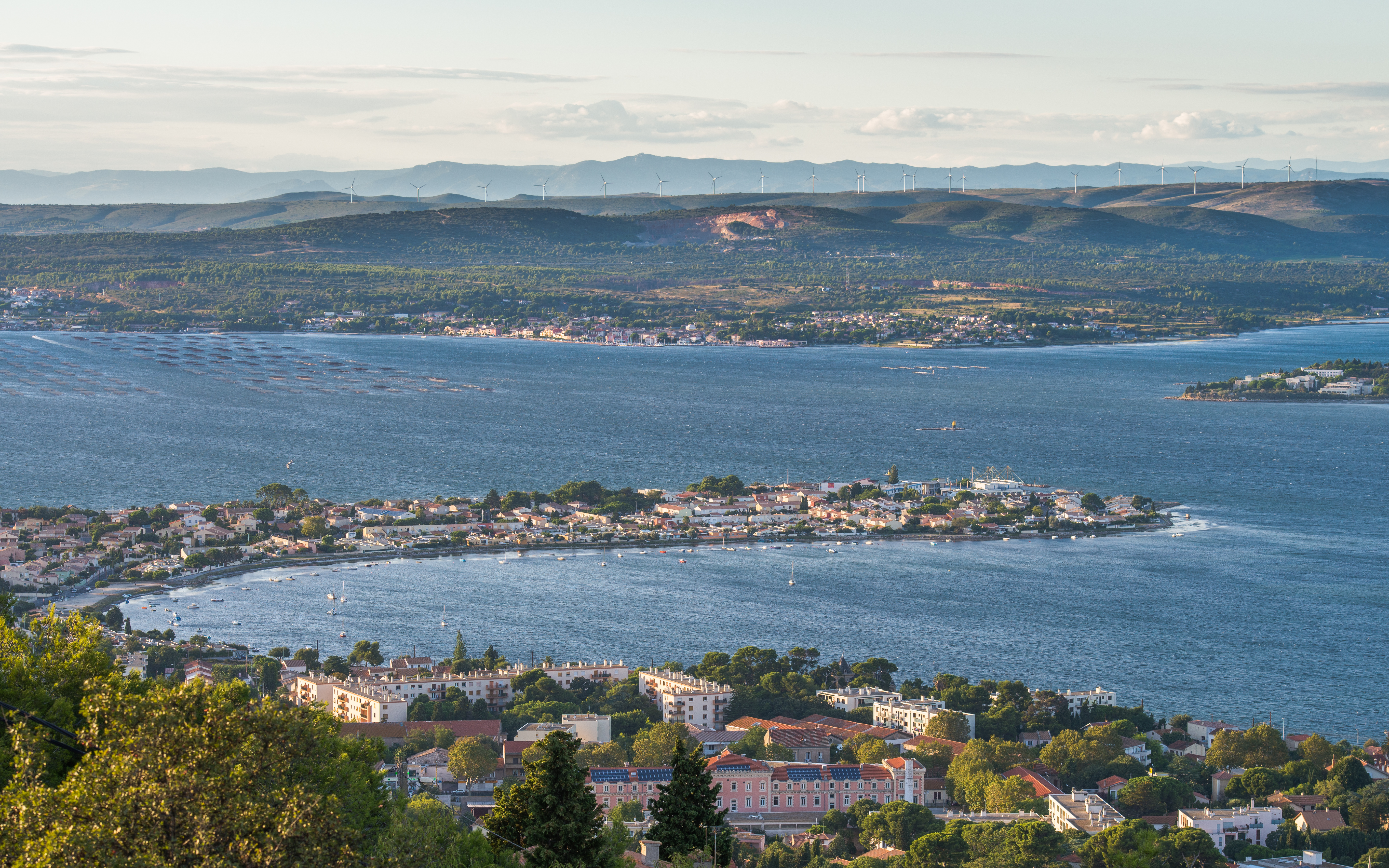
The Étang de Thau (; oc, Estanh de Taur) or Bassin de Thau is the largest of a string of lagoons (''étangs'') that stretch along the French coast from the Rhône river to the foothills of the Pyrenees and the border to Spain in the Languedoc-Roussillon. Although it has a high salinity, it is considered the second largest lake in France. Description It is about 21 km long and 8 km wide, with an area of . The mean depth of the lagoon is 4.5 m, but in the central navigation channel it can be 10 m deep. Near Bouzigues there is a 100-metre diameter depression of 30 metres. This 'Fosse de la Vise' is the source of a hot spring that feeds the spa in Balaruc. Its size and depth, which distinguish it from other lagoons of the region, is explained by the geomorphology of the region: it is the syncline formed from folding which produced the corresponding anticline of the Gardiole in the north east. Until relatively recently the lagoons from Marseillan to the Rhône wer ... [...More Info...] [...Related Items...] OR: [Wikipedia] [Google] [Baidu] |
Adriatic Sea
The Adriatic Sea () is a body of water separating the Italian Peninsula from the Balkan Peninsula. The Adriatic is the northernmost arm of the Mediterranean Sea, extending from the Strait of Otranto (where it connects to the Ionian Sea) to the northwest and the Po Valley. The countries with coasts on the Adriatic are Albania, Bosnia and Herzegovina, Croatia, Italy, Montenegro, and Slovenia. The Adriatic contains more than 1,300 islands, mostly located along the Croatian part of its eastern coast. It is divided into three basins, the northern being the shallowest and the southern being the deepest, with a maximum depth of . The Otranto Sill, an underwater ridge, is located at the border between the Adriatic and Ionian Seas. The prevailing currents flow counterclockwise from the Strait of Otranto, along the eastern coast and back to the strait along the western (Italian) coast. Tidal movements in the Adriatic are slight, although larger amplitudes are known to occur occasi ... [...More Info...] [...Related Items...] OR: [Wikipedia] [Google] [Baidu] |
Mediterranean Basin
In biogeography, the Mediterranean Basin (; also known as the Mediterranean Region or sometimes Mediterranea) is the region of lands around the Mediterranean Sea that have mostly a Mediterranean climate, with mild to cool, rainy winters and warm to hot, dry summers, which supports characteristic Mediterranean forests, woodlands, and scrub vegetation. Geography The Mediterranean Basin covers portions of three continents: Europe, Africa, and Asia. It is distinct from the drainage basin, which extends much further south and north due to major rivers ending in the Mediterranean Sea, such as the Nile and Rhône. Conversely, the Mediterranean Basin includes regions not in the drainage basin. It has a varied and contrasting topography. The Mediterranean Region offers an ever-changing landscape of high mountains, rocky shores, impenetrable scrub, semi-arid steppes, coastal wetlands, sandy beaches and a myriad islands of various shapes and sizes dotted amidst the clear blue sea. C ... [...More Info...] [...Related Items...] OR: [Wikipedia] [Google] [Baidu] |
Suction Cup
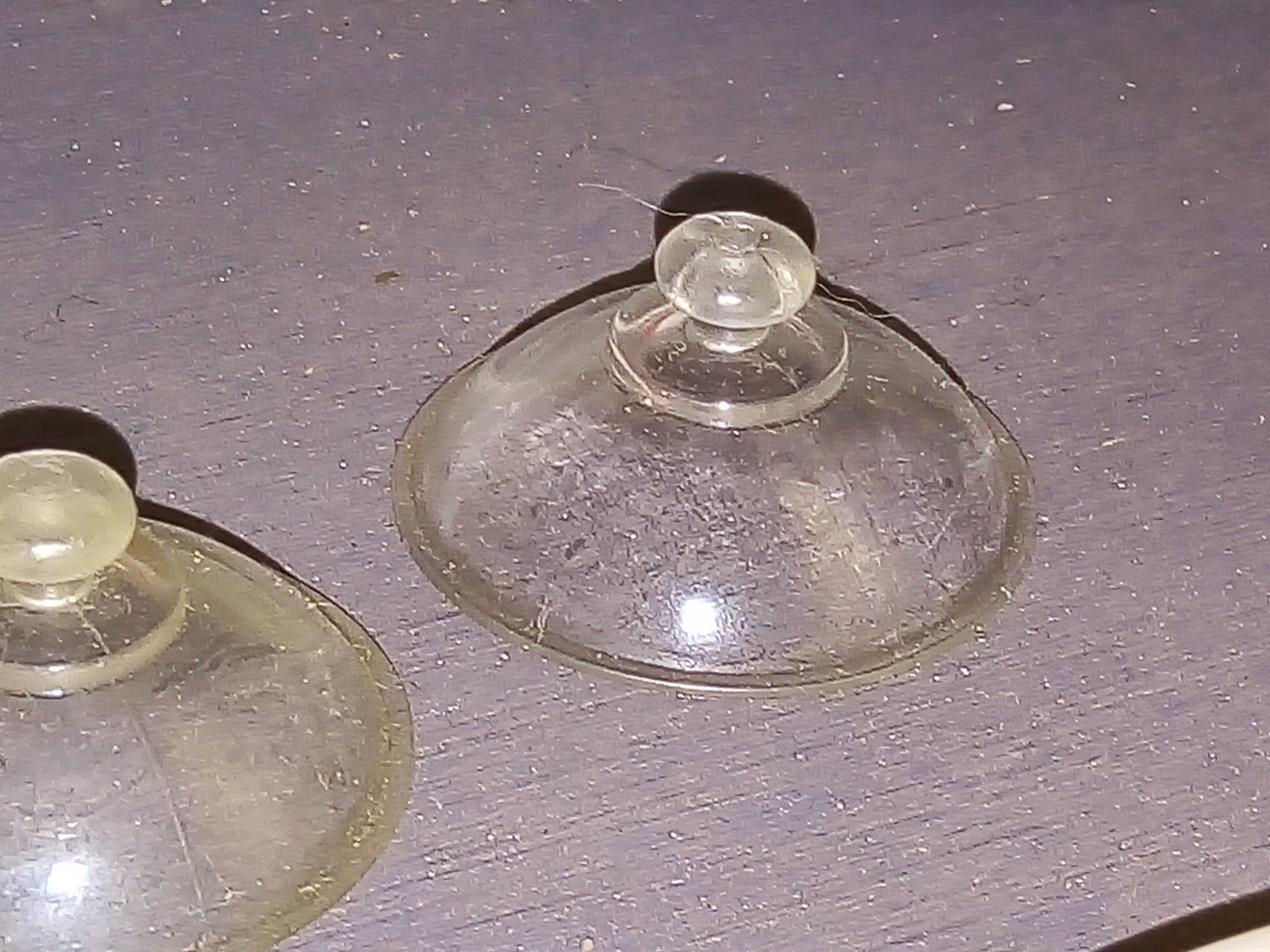
A suction cup, also known as a sucker, is a device or object that uses the negative fluid pressure of air or water to adhere to nonporous surfaces, creating a partial vacuum. Suction cups are peripheral traits of some animals such as octopuses and squids, and have been reproduced artificially for numerous purposes. Theory The working face of the suction cup is made of elastic, flexible material and has a curved surface. When the center of the suction cup is pressed against a flat, non-porous surface, the volume of the space between the suction cup and the flat surface is reduced, which causes the air or water between the cup and the surface to be expelled past the rim of the circular cup. The cavity which develops between the cup and the flat surface has little to no air or water in it because most of the fluid has already been forced out of the inside of the cup, causing a lack of pressure. The pressure difference between the atmosphere on the outside of the cup and the low ... [...More Info...] [...Related Items...] OR: [Wikipedia] [Google] [Baidu] |


.png)
