|
Zijtaart
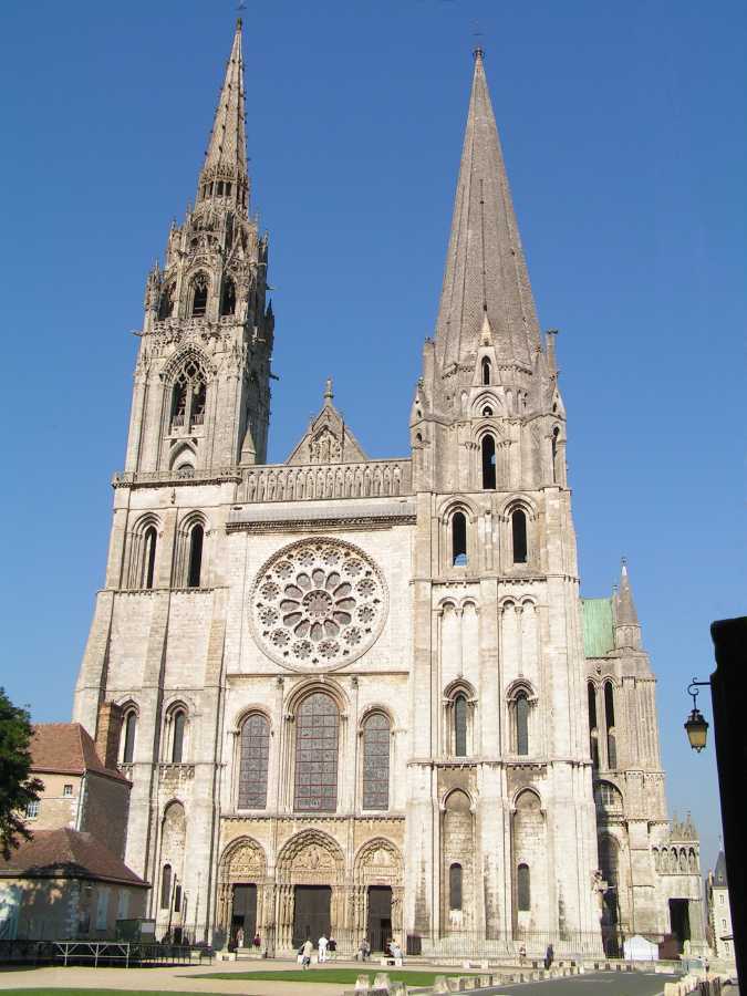
Zijtaart is a village in the south of the Netherlands. It is situated in the municipality of Meierijstad, North Brabant. As of January 2015 it has a population of 1,727. History Zijtaart as a ''church village'' was officially founded in 1872 when it split off as a separate parish from the St. Lambert Parish in Veghel. The church of the Zijtaart St. Lambert Parish still bears the original tower cross atop the spire, of the old St. Lambert Church of Veghel. The tower cross was presented as a gift by the St. Lambert Parish of Veghel in 1873, which would start the demolition of its old church that following year, because of the completion of a new and larger church. Gallery File:T.T Boerderij Pastoor Clerxstraat 76 Zijtaart (2).JPG, Farm in Zijtaart File:Zijtaart (N-Br, NL), former women monastery.JPG, Former women monastery A monastery is a building or complex of buildings comprising the domestic quarters and workplaces of monastics, monks or nuns, whether living in com ... [...More Info...] [...Related Items...] OR: [Wikipedia] [Google] [Baidu] |
Veghel
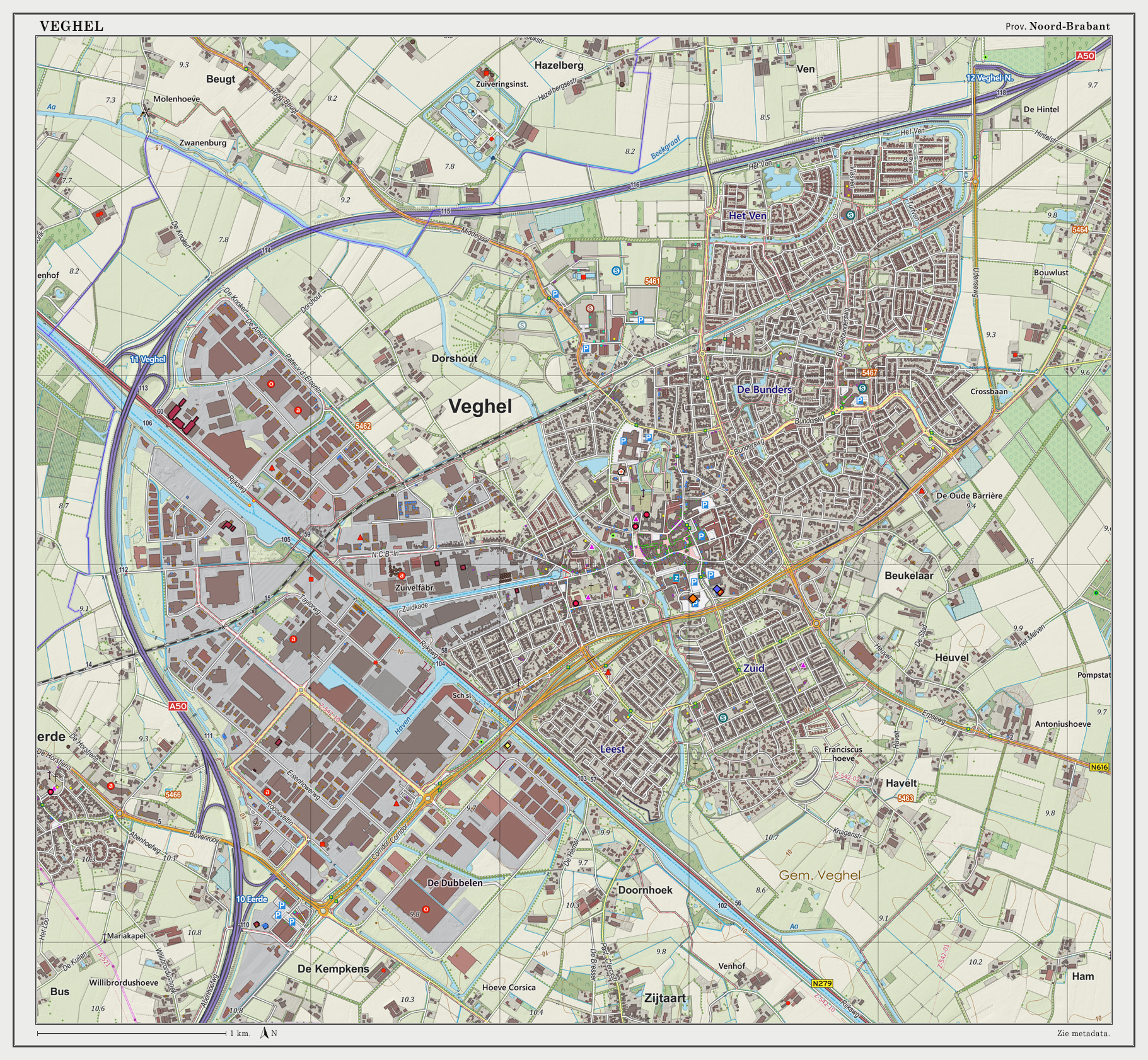
Veghel () is a town and a former municipality in the southern Netherlands. On 1 January 2017 Veghel, together with Schijndel and Sint-Oedenrode, merged into a new municipality called Meierijstad creating the largest municipality of the province North-Brabant in terms of land area. History The first settlements date back to Roman times and were established near the River Aa. The oldest written record of Veghel dates from 1225. It is a document of the Abbey of Berne, written in Latin on a piece of parchment, and describes several properties owned by the abbey. Among those is an estate located in the settlement of "Vehchele". In 1310, John II of Brabant granted the inhabitants the right to use common grounds. For some decades in the 16th and 17th century the municipality was ruled by the Lords Van Erp, residing at their castle of Frisselsteijn in Veghel. In 1648 Veghel became part of the Republic of the Seven United Netherlands. As a former part of the Duchy of Brabant, Ve ... [...More Info...] [...Related Items...] OR: [Wikipedia] [Google] [Baidu] |
Meierijstad
Meierijstad () is a municipality in the province of North Brabant. The municipality is the result of a merger between the municipalities Schijndel, Sint-Oedenrode and Veghel in 2017. After the merger it became the largest municipality in terms of land area of North Brabant (surpassed by Altena, North Brabant, Altena in 2019). The town of Veghel hosts the town hall, while the municipal council holds its meetings at the former town hall of Sint-Oedenrode. Population centres Topography ''Dutch topographic map of the municipality of Meierijstad, 2020'' Notable people * Hendrik Herp (died 1477) a Dutch or Flemish Franciscan and a writer on mysticism * Pieter de Josselin de Jong (1861 in Sint-Oedenrode – 1906) a Dutch painter from North Brabant * Lou Tellegen (born 1881 in Sint-Oedenrode – 1934) a Dutch stage and film actor, film director and screenwriter [...More Info...] [...Related Items...] OR: [Wikipedia] [Google] [Baidu] |
Village
A village is a clustered human settlement or community, larger than a hamlet but smaller than a town (although the word is often used to describe both hamlets and smaller towns), with a population typically ranging from a few hundred to a few thousand. Though villages are often located in rural areas, the term urban village is also applied to certain urban neighborhoods. Villages are normally permanent, with fixed dwellings; however, transient villages can occur. Further, the dwellings of a village are fairly close to one another, not scattered broadly over the landscape, as a dispersed settlement. In the past, villages were a usual form of community for societies that practice subsistence agriculture, and also for some non-agricultural societies. In Great Britain, a hamlet earned the right to be called a village when it built a church. [...More Info...] [...Related Items...] OR: [Wikipedia] [Google] [Baidu] |
Monastery
A monastery is a building or complex of buildings comprising the domestic quarters and workplaces of monastics, monks or nuns, whether living in communities or alone (hermits). A monastery generally includes a place reserved for prayer which may be a chapel, church, or temple, and may also serve as an oratory, or in the case of communities anything from a single building housing only one senior and two or three junior monks or nuns, to vast complexes and estates housing tens or hundreds. A monastery complex typically comprises a number of buildings which include a church, dormitory, cloister, refectory, library, balneary and infirmary, and outlying granges. Depending on the location, the monastic order and the occupation of its inhabitants, the complex may also include a wide range of buildings that facilitate self-sufficiency and service to the community. These may include a hospice, a school, and a range of agricultural and manufacturing buildings such as a barn, a fo ... [...More Info...] [...Related Items...] OR: [Wikipedia] [Google] [Baidu] |
Spire
A spire is a tall, slender, pointed structure on top of a roof of a building or tower, especially at the summit of church steeples. A spire may have a square, circular, or polygonal plan, with a roughly conical or pyramidal shape. Spires are typically made of stonework or brickwork, or else of timber structures with Cladding (construction), metal cladding, ceramic tile, ceramic tiling, roof shingles, or Slate roof, slates on the exterior. Since towers supporting spires are usually square, square-plan spires emerge directly from the tower's walls, but octagonal spires are either built for a pyramidal transition section called a ''Broach spire, broach'' at the spire's base, or else freed spaces around the tower's summit for decorative elements like pinnacles. The former solution is known as a ''broach spire''. Small or short spires are known as ''spikes'', ''spirelets'', or ''flèche (architecture), flèches''. Etymology This sense of the word spire is attested in English since ... [...More Info...] [...Related Items...] OR: [Wikipedia] [Google] [Baidu] |
Telephone Numbers In The Netherlands
Telephone numbers in the Netherlands are administered by the Ministry of Economic Affairs, Agriculture and Innovation of the Netherlands and may be grouped into three general categories: geographical numbers, non-geographical numbers, and numbers for public services. Geographical telephone numbers are sequences of 9 digits (0-9) and consist of an area code of two or three digits and a subscriber number of seven or six digits, respectively. When dialled within the country, the number must be prefixed with the trunk access code 0, identifying a destination telephone line in the Dutch telephone network. Non-geographical numbers have no fixed length, but also required the dialling of the trunk access code (0). They are used for mobile telephone networks and other designated service types, such as toll-free dialling, Internet access, voice over IP, restricted audiences, and information resources. In addition, special service numbers exist for emergency response, directory assistance ... [...More Info...] [...Related Items...] OR: [Wikipedia] [Google] [Baidu] |
A50 Motorway (Netherlands)
A50, the section of Rijksweg 50 that is constructed as controlled-access highway, is a north–south motorway in the Netherlands, running from Eindhoven in the province of North Brabant, northwards passing by the cities of Oss, Nijmegen, Arnhem and Apeldoorn, to its northern terminus in the province of Gelderland near the city of Zwolle. The highway is maintained by Rijkswaterstaat. Route description It passes the cities of Eindhoven, Oss, Nijmegen, Arnhem, Apeldoorn and Zwolle. History During the Second World War the Highway was known as Highway 69. Since 1969, it is known as N69 and has that name now only between the border of North Brabant North Brabant ( nl, Noord-Brabant ; Brabantian: ; ), also unofficially called Brabant, is a province in the south of the Netherlands. It borders the provinces of South Holland and Gelderland to the north, Limburg to the east, Zeeland to the we ... and European route E34. The highway was an important and only avenue of advance ... [...More Info...] [...Related Items...] OR: [Wikipedia] [Google] [Baidu] |
List Of Sovereign States
The following is a list providing an overview of sovereign states around the world with information on their status and recognition of their sovereignty. The 206 listed states can be divided into three categories based on membership within the United Nations System: 193 UN member states, 2 UN General Assembly non-member observer states, and 11 other states. The ''sovereignty dispute'' column indicates states having undisputed sovereignty (188 states, of which there are 187 UN member states and 1 UN General Assembly non-member observer state), states having disputed sovereignty (16 states, of which there are 6 UN member states, 1 UN General Assembly non-member observer state, and 9 de facto states), and states having a special political status (2 states, both in free association with New Zealand). Compiling a list such as this can be a complicated and controversial process, as there is no definition that is binding on all the members of the community of nations concerni ... [...More Info...] [...Related Items...] OR: [Wikipedia] [Google] [Baidu] |
List Of Postal Codes In The Netherlands
Postal codes in the Netherlands, known as ''postcodes'', are alphanumeric, consisting of four digits followed by two uppercase letters. The letters 'F', 'I', 'O', 'Q', 'U' and 'Y' were originally not used for technical reasons, but almost all existing combinations are now used as these letters were allowed for new locations starting 2005. The letter combinations ' SS', ' SD' and ' SA' are not used because of their associations with the Nazi occupation of the Netherlands. The first two digits indicate a city and a region, the second two digits and the two letters indicate a range of house numbers, usually on the same street. Consequently, a postal address is uniquely defined by the postal code and the house number. On average, a Dutch postal code comprises eight single addresses. There are over 575,000 postal codes in the Netherlands . Stadsregio Amsterdam Postbus 626 1000 AP Amsterdam Caribbean Netherlands The three BES-islands, which became part of the country in 2010, do ... [...More Info...] [...Related Items...] OR: [Wikipedia] [Google] [Baidu] |


