|
Zapporthorn
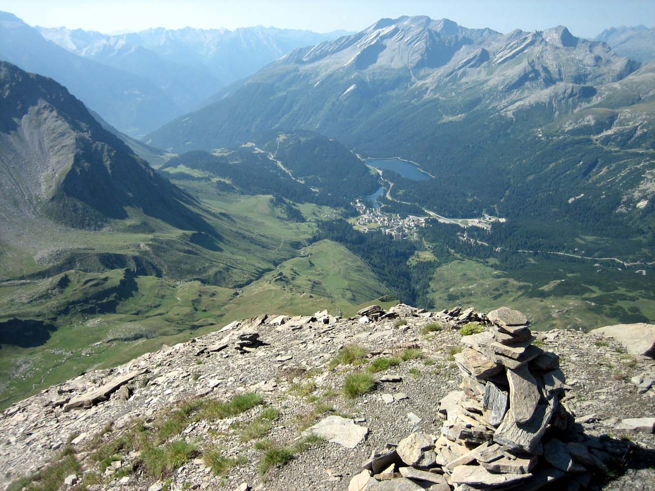
The Zapporthorn or Pizzo Zapport (3,152 m) is a mountain of the Swiss Lepontine Alps, overlooking San Bernardino Pass in Graubünden. Its summit is the tripoint between the valleys of Hinterrhein, Calanca and Mesolcina. The summit is located approximately two kilometres east from the Ticino Ticino (), sometimes Tessin (), officially the Republic and Canton of Ticino or less formally the Canton of Ticino,, informally ''Canton Ticino'' ; lmo, Canton Tesin ; german: Kanton Tessin ; french: Canton du Tessin ; rm, Chantun dal Tessin . ... border. The Pizzo Zapport is the highest summit on the ''Zapportgrat'', a ridge running from Piz de Stabi to the Marscholhorn. The Zapportgletscher lies on the north side, it is the largest glacier of the massif. References External linksZapporthorn on Summitpost [...More Info...] [...Related Items...] OR: [Wikipedia] [Google] [Baidu] |
Val Calanca
The Val Calanca is a valley of the Swiss Alps, located in the Lepontine Alps. The valley is drained by the ''Calancasca'', a tributary of the Moesa (Ticino basin), at Roveredo. The highest mountains surrounding the Val Calanca are the Puntone dei Fraciòn (3,202 metres) and the Zapporthorn (3,152 metres). The valley belongs to the Moesa District, in the Swiss canton of Graubünden. The main villages are (from north to south): Rossa, Cauco, Selma, Arvigo, Buseno and Santa Maria in Calanca Santa Maria in Calanca is a municipality in the Moesa Region in the Swiss canton of Graubünden. History Santa Maria in Calanca is first mentioned in 1219 as ''sancte Marie in Calanca''. Geography Santa Maria in Calanca has an area, , of . .... References * Swisstopo maps External links Val Calanca on MySwitzerland {{Coord, 46, 20, 09, N, 9, 07, 08, E, region:CH-GR_type:landmark_source:kolossus-dewiki, display=title Valleys of the Alps Valleys of Graubünden Lepontine Alp ... [...More Info...] [...Related Items...] OR: [Wikipedia] [Google] [Baidu] |
Marscholhorn
The Marscholhorn (also known as ''Piz Moesola'') is a mountain of the Swiss Lepontine Alps, overlooking the San Bernardino Pass in the canton of Graubünden. It lies at the eastern end of the range between the Hinterrhein valley and the Mesolcina, east of the Zapporthorn The Zapporthorn or Pizzo Zapport (3,152 m) is a mountain of the Swiss Lepontine Alps, overlooking San Bernardino Pass in Graubünden. Its summit is the tripoint between the valleys of Hinterrhein, Calanca and Mesolcina. The summit is located ap .... References External links Marscholhorn on Hikr Mountains of the Alps Mountains of Switzerland Mountains of Graubünden Lepontine Alps Two-thousanders of Switzerland Rheinwald {{Graubünden-mountain-stub ... [...More Info...] [...Related Items...] OR: [Wikipedia] [Google] [Baidu] |
San Bernardino Pass
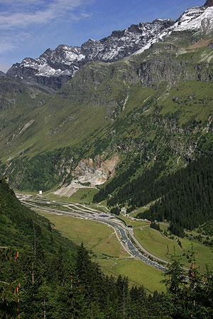
San Bernardino Pass ( it, Passo del San Bernardino, german: Bernhardinpass, ) is a high mountain pass in the Swiss Alps connecting the Hinterrhein and the Mesolcina (Misox) valleys between Thusis (canton of Graubünden) and Bellinzona ( canton of Ticino). Located in the far eastern side of the Western Alps it is not to be confused with the Great St Bernard Pass and the Little St Bernard Pass. The top of the pass represents both the Italo-German language frontier and the watershed (drainage divide) between the Po basin and the Rhine basin. Marscholsee is within the pass at an elevation of . The route first became important as a mule track in the fifteenth century when the route between Thusis and Splügen was known as the Via Mala. A road for wheeled vehicles was opened in 1770; this road was significantly improved between 1821 and 1823, financed in part by the Kingdom of Sardinia, keen to improve a trade route connecting Genoa and Piedmont to the Graubünden that was not di ... [...More Info...] [...Related Items...] OR: [Wikipedia] [Google] [Baidu] |
Swisstopo
Swisstopo is the official name for the Swiss Federal Office of Topography (in German language, German: ''Bundesamt für Landestopografie''; French language, French: ''Office fédéral de topographie''; Italian language, Italian: ''Ufficio federale di topografia''; Romansh language, Romansh: ''Uffizi federal da topografia''), Switzerland's national mapping agency. The current name was made official in 2002. It had been in use as the domain name for the institute's homepage, swisstopo.ch, since 1997. Maps The main class of products produced by Swisstopo are topographical maps on seven different Scale (map), scales. Swiss maps have been praised for their accuracy and quality. Regular maps * 1:25.000. This is the most detailed map, useful for many purposes. Those are popular with tourists, especially for famous areas like Zermatt and St. Moritz. These maps cost CHF 13.50 each (2004). 208 maps on this scale are published at regular intervals. The first map published on this scale ... [...More Info...] [...Related Items...] OR: [Wikipedia] [Google] [Baidu] |
Vogelberg
The Vogelberg is a 3,218 metres high mountain of the Lepontine Alps, located on the border between the Swiss cantons of Ticino and Graubünden. It is the highest summit of the Lepontine Alps south of the Rheinwaldhorn. The Vogelberg is a large glaciated massif consisting of several secondary summits: Pizzo Cramorino (3,134 metres) on the west side and Rheinquellhorn (3,200 metres) on the east. The northern flanks are covered by the Paradies Glacier at the source of the Hinterrhein. The southern side, overlooking the valley of Malvaglia Malvaglia is a former municipality in the district of Blenio in the canton of Ticino in Switzerland. Since 15 March 2011, it is part of the municipality Serravalle. The reservoir Bacino di Val Malvaglia is located above the village of Malvagli ... (Ticino) is steeper and has no glaciers. References External linksVogelberg on Hikr.org Mountains of the Alps Alpine three-thousanders Mountains of Switzerland Mountains of Ticino Mountain ... [...More Info...] [...Related Items...] OR: [Wikipedia] [Google] [Baidu] |
Switzerland
). Swiss law does not designate a ''capital'' as such, but the federal parliament and government are installed in Bern, while other federal institutions, such as the federal courts, are in other cities (Bellinzona, Lausanne, Luzern, Neuchâtel, St. Gallen a.o.). , coordinates = , largest_city = Zürich , official_languages = , englishmotto = "One for all, all for one" , religion_year = 2020 , religion_ref = , religion = , demonym = , german: Schweizer/Schweizerin, french: Suisse/Suissesse, it, svizzero/svizzera or , rm, Svizzer/Svizra , government_type = Federalism, Federal assembly-independent Directorial system, directorial republic with elements of a direct democracy , leader_title1 = Federal Council (Switzerland), Federal Council , leader_name1 = , leader_title2 = , leader_name2 = Walter Thurnherr , legislature = Fe ... [...More Info...] [...Related Items...] OR: [Wikipedia] [Google] [Baidu] |
Lepontine Alps
, topo_map= Swiss Federal Office of Topography swisstopo , photo=MonteLeone0001.jpg , photo_caption=Monte Leone , country_type= Countries , country= , subdivision1_type= Cantons, Regions , subdivision1= , parent= Western Alps , borders_on= , geology= , orogeny= Alpine orogeny , length_mi= , length_orientation= , width_mi= , width_orientation= , highest=Monte Leone , elevation_m=3553 , coordinates= , range_coordinates= , map_image=Alps locator map (Alpi Lepontini).png , map_caption=Lepontine Alps (red) The Lepontine Alps (german: Lepontinische Alpen, french: Alpes lépontines, it, Alpi Lepontine) are a mountain range in the north-western part of the Alps. They are located in Switzerland (Valais, Ticino, Uri and Graubünden) and Italy (Piedmont and Lombardy). The Simplon rail tunnel (from Brig to Domodossola) the Gotthard rail (from Erstfeld to Bodio) and Gotthard road tunnels (from Andermatt to Airolo) and the San Bernardino road tunnel are importa ... [...More Info...] [...Related Items...] OR: [Wikipedia] [Google] [Baidu] |
Mountain
A mountain is an elevated portion of the Earth's crust, generally with steep sides that show significant exposed bedrock. Although definitions vary, a mountain may differ from a plateau in having a limited Summit (topography), summit area, and is usually higher than a hill, typically rising at least 300 metres (1,000 feet) above the surrounding land. A few mountains are Monadnock, isolated summits, but most occur in mountain ranges. Mountain formation, Mountains are formed through Tectonic plate, tectonic forces, erosion, or volcanism, which act on time scales of up to tens of millions of years. Once mountain building ceases, mountains are slowly leveled through the action of weathering, through Slump (geology), slumping and other forms of mass wasting, as well as through erosion by rivers and glaciers. High elevations on mountains produce Alpine climate, colder climates than at sea level at similar latitude. These colder climates strongly affect the Montane ecosystems, ecosys ... [...More Info...] [...Related Items...] OR: [Wikipedia] [Google] [Baidu] |
Hinterrhein, Switzerland
Hinterrhein ( rm, Valragn) is a village and a former municipality in the Viamala Region in the Swiss canton of Graubünden. The village is located near the start of the river Hinterrhein/Rein Posteriur, one of the two initial tributaries of the Rhine. On 1 January 2019 the former municipalities of Hinterrhein, Nufenen and Splügen merged to form the new municipality of Rheinwald. History Hinterrhein is first mentioned in 1219 as ''de Reno''. Geography Hinterrhein has an area, , of . Of this area, 22.7% is used for agricultural purposes, while 7.6% is forested. Of the rest of the land, 1.2% is settled (buildings or roads) and the remainder (68.5%) is non-productive (rivers, glaciers or mountains). Before 2017, the municipality was located in the Rheinwald sub-district, of the Hinterrhine district, after 2017 it was part of the Viamala Region. It is a ''haufendorf'' (an irregular, unplanned and quite closely packed village, built around a central square) located on the norther ... [...More Info...] [...Related Items...] OR: [Wikipedia] [Google] [Baidu] |
Mesolcina
The ''Valle Mesolcina'', also known as the ''Val Mesolcina'' or ''Misox'' (German), is an alpine valley of the Grisons, Switzerland, stretching from the San Bernardino Pass to Grono where it joins the Calanca Valley. It is the valley formed by the river Moesa. Like the Val Bregaglia or the Val Poschiavo, the Valle Mesolcina is a valley lying south of the main ridge of the Alps. Although politically the Valle Mesolcina belongs to the Grisons, its population is predominantly Italian-speaking and culturally oriented towards the Ticino. The valley includes the Mesocco and Roveredo of the Moesa district, including: * Mesocco * Soazza * Lostallo * Verdabbio * Cama * Leggia * Grono * Roveredo Roveredo is a municipality in the Moesa Region in the canton of Graubünden in Switzerland. Geography Roveredo has an area, , of . Of this area, 8.6% is used for agricultural purposes, while 75% is forested. Of the rest of the land, 3.1% is ... * San Vittore External links * ... [...More Info...] [...Related Items...] OR: [Wikipedia] [Google] [Baidu] |
Ticino
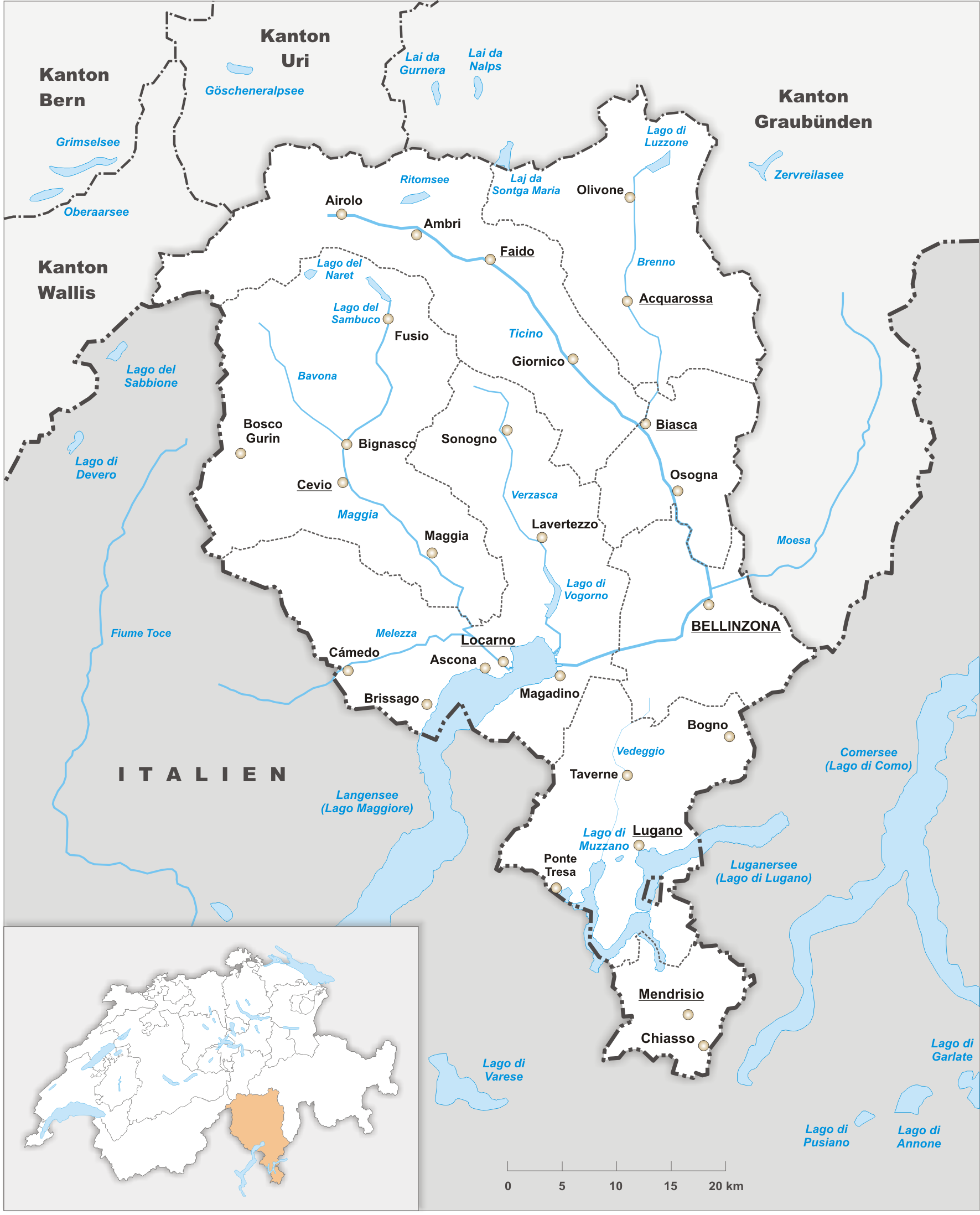
Ticino (), sometimes Tessin (), officially the Republic and Canton of Ticino or less formally the Canton of Ticino,, informally ''Canton Ticino'' ; lmo, Canton Tesin ; german: Kanton Tessin ; french: Canton du Tessin ; rm, Chantun dal Tessin . is one of the 26 cantons forming the Swiss Confederation. It is composed of eight districts and its capital city is Bellinzona. It is also traditionally divided into the Sopraceneri and the Sottoceneri, respectively north and south of Monte Ceneri. Red and blue are the colours of its flag. Ticino is the southernmost canton of Switzerland. It is one of the three large southern Alpine cantons, along with Valais and the Grisons. However, unlike all other cantons, it lies almost entirely south of the Alps, and has no natural access to the Swiss Plateau. Through the main crest of the Gotthard and adjacent mountain ranges, it borders the canton of Valais to the northwest, the canton of Uri to the north and the canton of Grisons to the northea ... [...More Info...] [...Related Items...] OR: [Wikipedia] [Google] [Baidu] |


