|
Youga
Youga is a village in the Zabré Department of Boulgou Province in south-eastern Burkina Faso, about 2 km north from border with Ghana. As of 2005, the village had a population of 1018, but due to discovery of gold in the vicinity and subsequent establishment of Youga Gold Mine, population is growing. The village does not have running water or electricity, and most economic activity is subsistence farming, and also a few primitive taverns that serve warm beer. Some people got jobs at Youga Gold Mine and the resulting newfound prosperity is reflected in a number of makeshift shops springing up by the sides of dusty roads. Burkina Mining Company, the owners of Youga Gold Mine, have built three additional classes to complete the primary school to six classes and renovated the clinic in the village, and Youga Power Project, designed and managed by South African company AMPCOR, is in its final stages of linking Youga Gold Mine and Youga village to the Ghanaian VRA electricity ... [...More Info...] [...Related Items...] OR: [Wikipedia] [Google] [Baidu] |
Zabré Department
Zabré is a department or commune of Boulgou Province in eastern Burkina Faso. Its capital is the town of Zabré. According to the 2019 census the department has a total population of 119,320. Towns and villages * Zabré (13 599 inhabitants) (capital) * Bangou (2 130 inhabitants) * Barganse Peulh (353 inhabitants) * Barganse (93 inhabitants) * Bassintare (152 inhabitants) * Beka Zourma (559 inhabitants) * Beka (3 579 inhabitants) * Benya Kipala (1 445 inhabitants) * Benya-Peulh (369 inhabitants) * Bissaya (4 720 inhabitants) * Bougre De Youga (460 inhabitants) * Bougreboko (1 360 inhabitants) * Bourma (956 inhabitants) * Doun (1 538 inhabitants) * Gassougou (3 671 inhabitants) * Gon (810 inhabitants) * Gonse (313 inhabitants) * Gourgou-Samandi (251 inhabitants) * Guirmogo (2 290 inhabitants) * Mangagou (1 030 inhabitants) * Moende (750 inhabitants) * Sambaregou (619 inhabitants) * Sampema (8 284 inhabitants) * Sangou (2 954 inhabitan ... [...More Info...] [...Related Items...] OR: [Wikipedia] [Google] [Baidu] |
Burkina Faso–Ghana Border
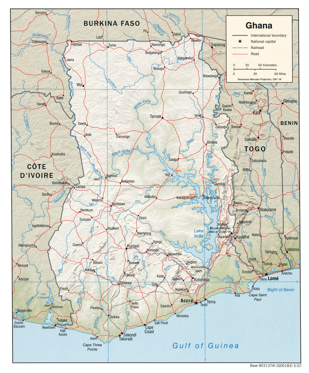
The Burkina Faso–Ghana border is 602 km (374 m) in length and runs from the tripoint with Ivory Coast in the west to the tripoint with Togo in the east. Description The border starts in the west at the tripoint with Ivory Coast on the Black Volta river; the border continues north along this river up to the 11th parallel north. The border then turns east, following this parallel until it reaches the Red Volta (though note that the border is not entirely straight in this sector, as at several points the boundary jogs north or south). The border follows the Red Volta briefly to the south-east, before turning to the north-east via a series of irregular overland lines. It then reaches the White Volta, following this river briefly, and then the Nouhao, before it turns to the south-east in a straight line down to the Togolese tripoint. History Europeans had begun exploring the coast of Ghana (then referred to as the Gold Coast) from the 15th century, and it became the centre of a ... [...More Info...] [...Related Items...] OR: [Wikipedia] [Google] [Baidu] |
Regions Of Burkina Faso
Per Law No.40/98/AN in 1998, Burkina Faso adhered to decentralization to provide administrative and financial autonomy to local communities. Most of these, according to their individual articles, were implemented on 2 July 2001. Burkina Faso is divided into 13 administrative regions. Each region is administered by a governor. These regions are divided into 45 provinces and subdivided into 351 communes. See also *List of regions of Burkina Faso by Human Development Index *Provinces of Burkina Faso *Departments of Burkina Faso, Departments/Communes of Burkina Faso *Geography of Burkina Faso *ISO 3166-2:BF References See also Regions of Burkina Faso at Statoids.com {{Burkina Faso topics Regions of Burkina Faso, Subdivisions of Burkina Faso Lists of administrative divisions, Burkina Faso, Regions Administrative divisions in Africa, Burkina Faso 1 First-level administrative divisions by country, Regions, Burkina Faso Burkina Faso geography-related lists ... [...More Info...] [...Related Items...] OR: [Wikipedia] [Google] [Baidu] |
Centre-Est Region
Centre-Est is one of Burkina Faso's 13 administrative regions. The population of Centre-Est was 1,578,075 in 2019. The region's capital is Tenkodogo. Three provinces—Boulgou, Koulpélogo, and Kouritenga, make up the region. , the population of the region was 1,578,075 with 53.5% females. The population in the region was 7.7% of the total population of the country. The child mortality rate was 39, infant mortality rate was 56 and the mortality of children under five was 93. As of 2007, the literacy rate in the region was 16.6%, compared with a national average of 28.3%. Geography Most of Burkino Faso is a wide plateau formed by riverine systems and is called falaise de Banfora. There are three major rivers, the Red Volta, Black Volta and White Volta, which cuts through different valleys. The climate is generally hot, with unreliable rains across different seasons. Gold and quartz are common minerals found across the country, while manganese deposits are also common. The dry ... [...More Info...] [...Related Items...] OR: [Wikipedia] [Google] [Baidu] |
Provinces Of Burkina Faso
The regions of Burkina Faso are divided into 45 administrative provinces. These 45 provinces are currently sub-divided into 351 departments or communes. List of provinces by region Here is a list of the provinces, with their capitals in parentheses: Central Burkina Faso Centre Region * Kadiogo (Ouagadougou) (#14 in map) Centre-Nord Region * Bam (Kongoussi) (#2 in map) * Namentenga (Boulsa) (#26 in map) * Sanmatenga (Kaya) (#34 in map) Centre-Sud Region * Bazèga (Kombissiri) (#4 in map) * Nahouri ( Pô) (#25 in map) * Zoundwéogo (Manga) (#45 in map) Plateau-Central Region * Ganzourgou (Zorgho) (#9 in map) * Kourwéogo (Boussé) (#21 in map) * Oubritenga (Ziniaré) (#29 in map) Eastern Burkina Faso Centre-Est Region * Boulgou (Tenkodogo) (#6 in map) * Koulpélogo ( Ouargaye) (#19 in map) * Kouritenga ( Koupéla) (#20 in map) Est Region * Gnagna (Bogandé) (#10 in map) * Gourma (Fada N'gourma) (#11 in map) * Komondjari (Gayéri) (#16 in map) * Kompienga ( Pam ... [...More Info...] [...Related Items...] OR: [Wikipedia] [Google] [Baidu] |
Boulgou Province
Boulgou is one of the 45 provinces of Burkina Faso and is in Centre-Est Region. The capital of Boulgou is Tenkodogo. The population of Boulgou in 2019 was 736,559.Citypopulation.de Population of regions in Burkina Faso Departments The province of Boulgou is divided into 13 departments. See also: * * *Communes of Burkina Faso
[...More Info...] [...Related Items...] OR: [Wikipedia] [Google] [Baidu] |
Departments Of Burkina Faso
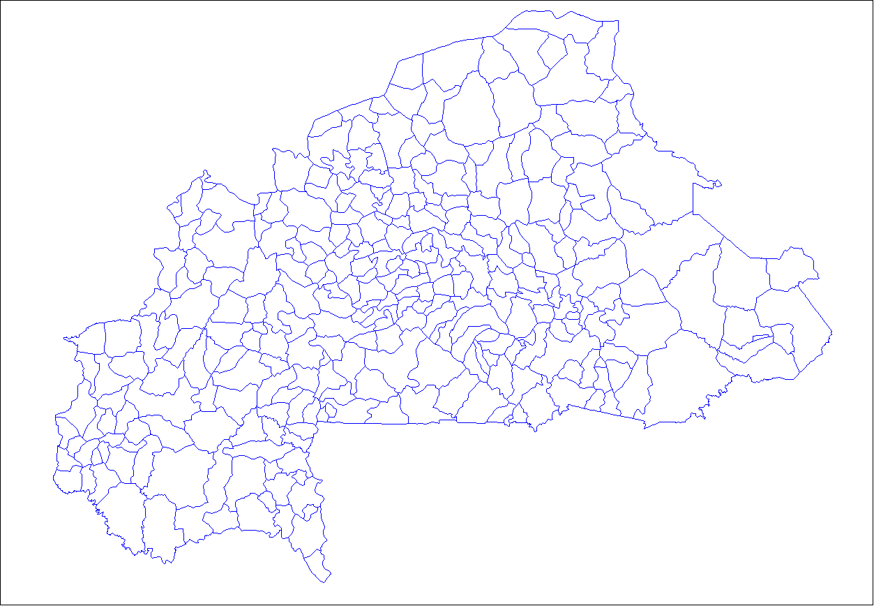
The provinces of Burkina Faso are divided into 351 departments (as of 2014 and since local elections of 2012), whose urbanized areas (cities, towns and villages) are grouped into the same commune (municipality) with the same name as the department. The department also covers rural areas (including national natural parks) that are not governed locally by the elected municipal council of the commune (presided by its mayor, with representants elected for each village or urban sector), but by the state represented at departmental level by a prefect (supervized by the haut-commissaire of its province, themself assisted by a general secretary and acting under the hierarchic authority the governor of its region, all of them being nominated by the national government). Status of communes The 351 communes (municipalities) created for each one of these departments have three kinds of status : * 49 urban communes are grouping their main city/town (subdivided into urban sectors) and all ... [...More Info...] [...Related Items...] OR: [Wikipedia] [Google] [Baidu] |
Burkina Faso
Burkina Faso (, ; , ff, 𞤄𞤵𞤪𞤳𞤭𞤲𞤢 𞤊𞤢𞤧𞤮, italic=no) is a landlocked country in West Africa with an area of , bordered by Mali to the northwest, Niger to the northeast, Benin to the southeast, Togo and Ghana to the south, and the Ivory Coast to the southwest. It has a population of 20,321,378. Previously called Republic of Upper Volta (1958–1984), it was renamed Burkina Faso by President Thomas Sankara. Its citizens are known as ''Burkinabè'' ( ), and its capital and largest city is Ouagadougou. The largest ethnic group in Burkina Faso is the Mossi people, who settled the area in the 11th and 13th centuries. They established powerful kingdoms such as the Ouagadougou, Tenkodogo, and Yatenga. In 1896, it was colonized by the French as part of French West Africa; in 1958, Upper Volta became a self-governing colony within the French Community. In 1960, it gained full independence with Maurice Yaméogo as president. Throughout the decades post in ... [...More Info...] [...Related Items...] OR: [Wikipedia] [Google] [Baidu] |
Volta River Authority
The Volta River Authority (VRA) is the main generator and supplier of electricity in Ghana. They are also the responsible for the maintenance of the hydro power supply plant. Establishment The VRA was established by the Volta River Development Act, Act 46 of the Republic of Ghana on 26 April 1961. The main purpose of the VRA is to generate and supply electricity for Ghana's needs. It is also responsible for managing the environmental impact of the creation of the Volta Lake on the towns and people bordering the lake. The VRA maintains a national energy supply grid and although it started with hydroelectric power, it is now branching into other types of energy such as thermal energy. The company represents Ghana in the West African Power Pool. Power generation *Akosombo Hydroelectric Project * Kpong Dam *Takoradi Power Station * Navrongo Solar Power Plant * Tema Power Station * Kpone Power Station Other projects *Schools *Health services *Environmental and Resettlement acti ... [...More Info...] [...Related Items...] OR: [Wikipedia] [Google] [Baidu] |
Bawku
Bawku is a town and is the capital of the Bawku Municipal District, district in the Upper East region of north Ghana, adjacent to the border with Burkina Faso. Bawku has a 2012 settlement Settlement may refer to: *Human settlement, a community where people live *Settlement (structural), the distortion or disruption of parts of a building * Closing (real estate), the final step in executing a real estate transaction *Settlement (fin ... population of 69,527 people. Cultural and Tourist Sites Naa Gbewaa Shrine The "tomb" of, Naa Gbewaa, the founder of the Mamprusi, Dagomba, and Nanumba tribes, is located just a few kilometres from Bawku in Pusiga in the Upper East Region of Ghana. Legend states that Naa Gbewaa never died but simply vanished into the ground. The shrine was thought to have been built in the 14th century in commemoration of Naa Gbewaa, and is today a place of spiritual reverence. References {{coord, 11, 03, N, 0, 14, W, region:GH_type:city_source:GNS-enwiki, d ... [...More Info...] [...Related Items...] OR: [Wikipedia] [Google] [Baidu] |
Zebila – 15 km south of Zebilla
Populated places in the Upper East Region
{{UpperEastRegion-geo-stub ...
Zebilla is a town and is the capital of Bawku West district, a district in the Upper East Region of north Ghana. References See also Binaba Binaba is a rural village in the Bawku West District of the Upper East Region in north Ghana. The village is 15 km south of the district capital Zebilla. [...More Info...] [...Related Items...] OR: [Wikipedia] [Google] [Baidu] |
Tenkodogo
Tenkodogo is the capital city of Boulgou Province and the Centre-Est Region of Burkina Faso with a population of 61,936 (2019). Economy The villages surrounding Tenkodogo are primarily based around animal husbandry. The main market takes place every 3 days. The Restaurant Patisserie Salon du Thé is known for its tea, yoghurt and pastries. The Le Rotisseur restaurant is known for its grilled chicken. Notable hotels include Hotel Djamou, Hotel Djamou Annexe, Hotel Laafi, and Auberge Riale. Politics On 29 January 2016, the king of Tenkodogo, Naba Saga, died while in Thailand for hospital care. He was the 28th king of Tenkodogo according to tradition and was inducted on 5 October 2001. He had taken the position after the death of his father, Naba Tigre, in September 2001. He was succeeded by Naba Guiguem-Pollé as king. Transport The town is connected to Koupéla and Bittou, along the N15 highway. Climate Köppen-Geiger climate classification system classifies its climate ... [...More Info...] [...Related Items...] OR: [Wikipedia] [Google] [Baidu] |


