|
Yerranderie
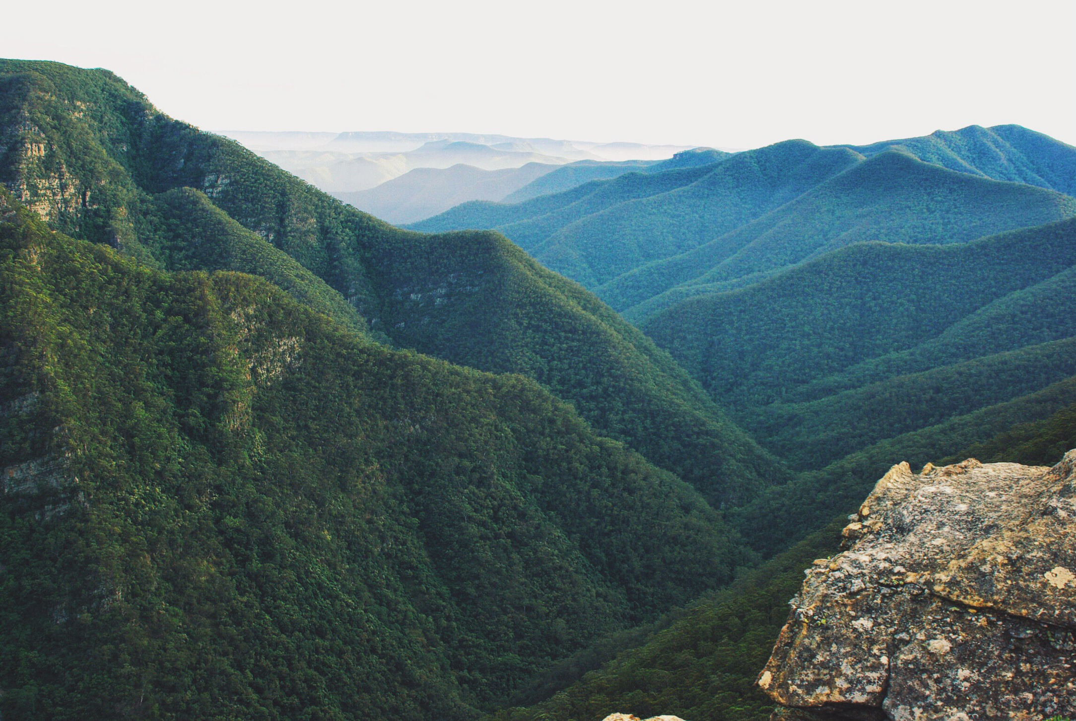
Yerranderie is a ghost town located near Kanangra-Boyd National Park of New South Wales, Australia in Wollondilly Shire. History Yerranderie was formerly a silver mining town of 2000 people, but the mining industry collapsed in 1927, and the town was cut off from direct access from Sydney by the establishment of the Warragamba Dam and Lake Burragorang in 1959. Country singer Frank Ifield immortalised the event with his song “Yerranderie”. The Yerranderie Post Office opened on 1 November 1899 and closed in 1958. The town is now divided into two sections, the residential township adjacent to a private airstrip and the historic site one kilometre further west. The area is surrounded by abandoned mine shafts and mining relics. Accessible mainly by dirt road from Oberon, New South Wales 70 km to the west; another route passes through Oakdale, New South Wales to the east, but that road is closed to public access as it passes through a water catchment area. Aircraft also occa ... [...More Info...] [...Related Items...] OR: [Wikipedia] [Google] [Baidu] |
Lake Burragorang
Lake Burragorang is a man-made reservoir in the lower Blue Mountains of New South Wales, Australia, serving as a major water supply for greater metropolitan Sydney. The dam impounding the lake, the Warragamba Dam, is located approximately southwest of the Sydney central business district. Lake Burragorang is within the World Heritage Site of the Greater Blue Mountains Area. The reservoir collects water from the converged flows of the Coxs, Kowmung, Nattai, Wingecarribee, Wollondilly, and Warragamba rivers and their associated tributaries, all within the Nepean and Hawkesbury River catchment. Pre-lake history Before the construction of the dam, Burragorang Valley had been inhabited by white settlers since the 19th century, and for thousands of years before, the Burragorang valley was part of the tribal lands of the Gundungarra nation, an indigenous tribe that called the Burragorang valley, along with the Blue Mountains and Megalong Valley, their tribal land. A number of ... [...More Info...] [...Related Items...] OR: [Wikipedia] [Google] [Baidu] |
Wollondilly Shire
Wollondilly Shire is a periurban local government area adjacent to the south-western fringe of Sydney Sydney ( ) is the capital city of the state of New South Wales, and the most populous city in both Australia and Oceania. Located on Australia's east coast, the metropolis surrounds Sydney Harbour and extends about towards the Blue Mountain ..., parts of which fall into the Macarthur, New South Wales, Macarthur, Blue Mountains (New South Wales), Blue Mountains and Central Tablelands regions in the state of New South Wales, Australia. Wollondilly Shire was created by proclamation in the NSW Government Gazette on 7 March 1906, following the passing of the Local Government (Shires) Act 1905, and amalgamated with the Municipality of Picton on 1 May 1940. Wollondilly Shire is named after the Wollondilly River. The area is traversed by the Hume Highway and the Southern Highlands railway line, New South Wales, Southern Highlands railway line. Wollondilly Shire contains several ... [...More Info...] [...Related Items...] OR: [Wikipedia] [Google] [Baidu] |
Kanangra-Boyd National Park
The Kanangra-Boyd National Park is a protected national park that is located in the Central Tablelands region, west of the Southern Highlands and Macarthur regions, in New South Wales, in eastern Australia. The national park is situated approximately south-west of Sydney and is contiguous with the Blue Mountains National Park and the Nattai National Park. The park was established in 1969. The Kanangra-Boyd National Park is one of the eight protected areas that, in 2000, was inscribed to form part of the UNESCO World Heritagelisted Greater Blue Mountains Area. The Kanangra-Boyd National Park is the most southwesterly of the eight protected areas within the World Heritage Site. The national park forms part of the Great Dividing Range. Notable features of the national park include the Thurat Spires, Kanangra Walls, Mount Colong, and three waterfall systems – the Kalang, the twotiered drop Kanangara and the Morong falls. The park also features a series of karst landforms that ... [...More Info...] [...Related Items...] OR: [Wikipedia] [Google] [Baidu] |
Ghost Town
Ghost Town(s) or Ghosttown may refer to: * Ghost town, a town that has been abandoned Film and television * Ghost Town (1936 film), ''Ghost Town'' (1936 film), an American Western film by Harry L. Fraser * Ghost Town (1956 film), ''Ghost Town'' (1956 film), an American Western film by Allen H. Miner * Ghost Town (1988 film), ''Ghost Town'' (1988 film), an American horror film by Richard McCarthy (as Richard Governor) * Ghost Town (2008 film), ''Ghost Town'' (2008 film), an American fantasy comedy film by David Koepp * ''Ghost Town'', a 2008 TV film featuring Billy Drago * ''Derek Acorah's Ghost Towns'', a 2005–2006 British paranormal reality television series * Ghost Town (CSI: Crime Scene Investigation), "Ghost Town" (''CSI: Crime Scene Investigation''), a 2009 TV episode Literature * Ghost Town (Lucky Luke), ''Ghost Town'' (''Lucky Luke'') or ''La Ville fantôme'', a 1965 ''Lucky Luke'' comic *''Ghost Town'', a Beacon Street Girls novel by Annie Bryant *''Ghost Town'', a 199 ... [...More Info...] [...Related Items...] OR: [Wikipedia] [Google] [Baidu] |
New South Wales
) , nickname = , image_map = New South Wales in Australia.svg , map_caption = Location of New South Wales in AustraliaCoordinates: , subdivision_type = Country , subdivision_name = Australia , established_title = Before federation , established_date = Colony of New South Wales , established_title2 = Establishment , established_date2 = 26 January 1788 , established_title3 = Responsible government , established_date3 = 6 June 1856 , established_title4 = Federation , established_date4 = 1 January 1901 , named_for = Wales , demonym = , capital = Sydney , largest_city = capital , coordinates = , admin_center = 128 local government areas , admin_center_type = Administration , leader_title1 = Monarch , leader_name1 = Charles III , leader_title2 = Governor , leader_name2 = Margaret Beazley , leader_title3 = Premier , leader_name3 = Dominic Perrottet (Liberal) , national_representation = Parliament of Australia , national_representation_type1 = Senat ... [...More Info...] [...Related Items...] OR: [Wikipedia] [Google] [Baidu] |
Australia
Australia, officially the Commonwealth of Australia, is a Sovereign state, sovereign country comprising the mainland of the Australia (continent), Australian continent, the island of Tasmania, and numerous List of islands of Australia, smaller islands. With an area of , Australia is the largest country by area in Oceania and the world's List of countries and dependencies by area, sixth-largest country. Australia is the oldest, flattest, and driest inhabited continent, with the least fertile soils. It is a Megadiverse countries, megadiverse country, and its size gives it a wide variety of landscapes and climates, with Deserts of Australia, deserts in the centre, tropical Forests of Australia, rainforests in the north-east, and List of mountains in Australia, mountain ranges in the south-east. The ancestors of Aboriginal Australians began arriving from south east Asia approximately Early human migrations#Nearby Oceania, 65,000 years ago, during the Last Glacial Period, last i ... [...More Info...] [...Related Items...] OR: [Wikipedia] [Google] [Baidu] |
Sydney
Sydney ( ) is the capital city of the state of New South Wales, and the most populous city in both Australia and Oceania. Located on Australia's east coast, the metropolis surrounds Sydney Harbour and extends about towards the Blue Mountains to the west, Hawkesbury to the north, the Royal National Park to the south and Macarthur to the south-west. Sydney is made up of 658 suburbs, spread across 33 local government areas. Residents of the city are known as "Sydneysiders". The 2021 census recorded the population of Greater Sydney as 5,231,150, meaning the city is home to approximately 66% of the state's population. Estimated resident population, 30 June 2017. Nicknames of the city include the 'Emerald City' and the 'Harbour City'. Aboriginal Australians have inhabited the Greater Sydney region for at least 30,000 years, and Aboriginal engravings and cultural sites are common throughout Greater Sydney. The traditional custodians of the land on which modern Sydney stands are ... [...More Info...] [...Related Items...] OR: [Wikipedia] [Google] [Baidu] |
Warragamba Dam
Warragamba Dam is a heritage-listed dam in the outer South Western Sydney suburb of Warragamba, New South Wales, Warragamba, Wollondilly Shire in New South Wales, Australia. It is a concrete gravity dam, which creates Lake Burragorang, the primary reservoir for water supply for the city of Sydney. The dam wall is located approximately W of Sydney central business district, 4½ km SW of the town of Wallacia, New South Wales, Wallacia, and 1 km NW of the village of Warragamba. The dam was devised as part of a collective engineering response to Sydney's critical water scarcity, water shortage during World War II and was originally known as the Warragamba Emergency Scheme. Constructed between 1948 and 1960, the dam created capacity for a reservoir of and is fed by a catchment area of . The surface area of the lake covers of the now-flooded Burragorang, New South Wales, Burragorang Valley. It was designed and built by the Sydney Water, Metropolitan Water Sewerage and Drainage Board ... [...More Info...] [...Related Items...] OR: [Wikipedia] [Google] [Baidu] |
Oberon, New South Wales
Oberon is a town located within the Oberon Council local government area, in the central tablelands region of New South Wales, Australia. The main industries are farming, forestry and wood products. The town usually receives snowfall during the winter months, owing to its high elevation. At the 2021 census, Oberon had a population of 3,319 people. It is the birthplace of Greens politician Bob Brown, Ken Sutcliffe, supermotard rider Scott Saul, former Penrith Panthers players Ray Blacklock, Mark Booth, Dr Therese Wales and DJ Tallis O’Neill. Oberon is located near Jenolan Caves and the Kanangra-Boyd National Park. Australian pub rock band Cold Chisel filmed the music video to their hit song "Flame Trees" in and around Oberon. The song's lyrics (written by Cold Chisel keyboardist Don Walker) present the story of a young man returning to his hometown, where he reminisces about the past and his former girlfriend from the region. History The town was permanently settled in 1839, ... [...More Info...] [...Related Items...] OR: [Wikipedia] [Google] [Baidu] |
Oakdale, New South Wales
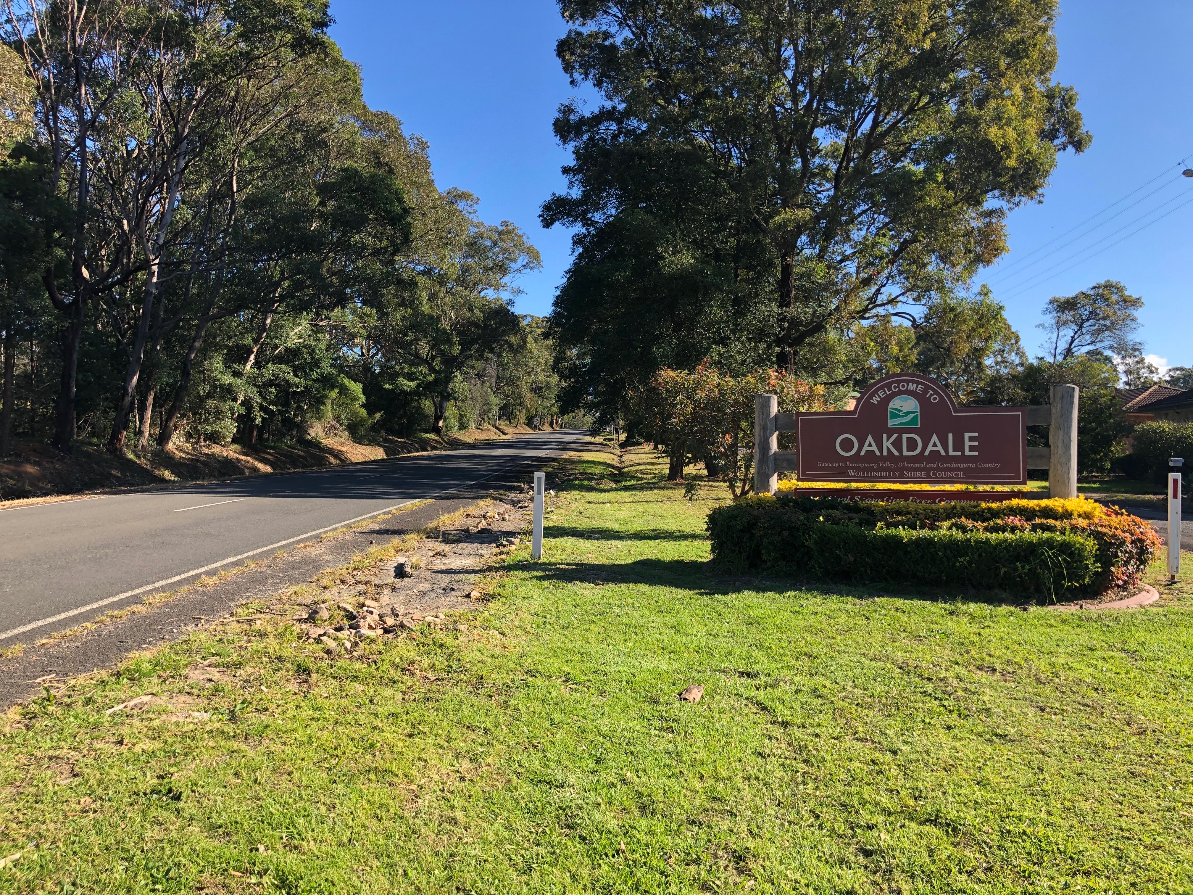
Oakdale is a semi-rural suburb or district in Wollondilly Shire in Sydney Sydney ( ) is the capital city of the state of New South Wales, and the most populous city in both Australia and Oceania. Located on Australia's east coast, the metropolis surrounds Sydney Harbour and extends about towards the Blue Mountain ...'s southwest in New South Wales, Australia. At the , Oakdale had a population of 1,843. Notes and references Towns in the Macarthur (New South Wales) Wollondilly Shire {{Sydney-geo-stub ... [...More Info...] [...Related Items...] OR: [Wikipedia] [Google] [Baidu] |
Camden Airport (Sydney)
Camden Airport is an aerodrome located on the outskirts of Sydney northwest of Camden, New South Wales, Australia. The airport is located approximately from Sydney's central business district. Camden is used as a general aviation overflow airport for the busier Bankstown Airport; and provides facilities for gliding and ballooning. The aerodrome has one grass- and one paved runway and two glider airstrips. It is in the south-west corner of the designated Sydney flight training area. History Early history A racecourse owned by prominent local grazier Arthur Macarthur-Onslow originally occupied the site of the Camden aerodrome. The shooting of the film '' Silks and Saddles'' at the track involved an Avro 504K biplane piloted by Edgar Percival landing on the set, and the occasion led to Macarthur-Onslow's sons Edward, Denzil and Andrew displaying a keen interest in aviation. By 1935, the Macarthur-Onslow family owned several aircraft including a de Havilland Hornet Moth and a ... [...More Info...] [...Related Items...] OR: [Wikipedia] [Google] [Baidu] |

.jpg)


.jpg)

