|
Yarra Ranges National Park
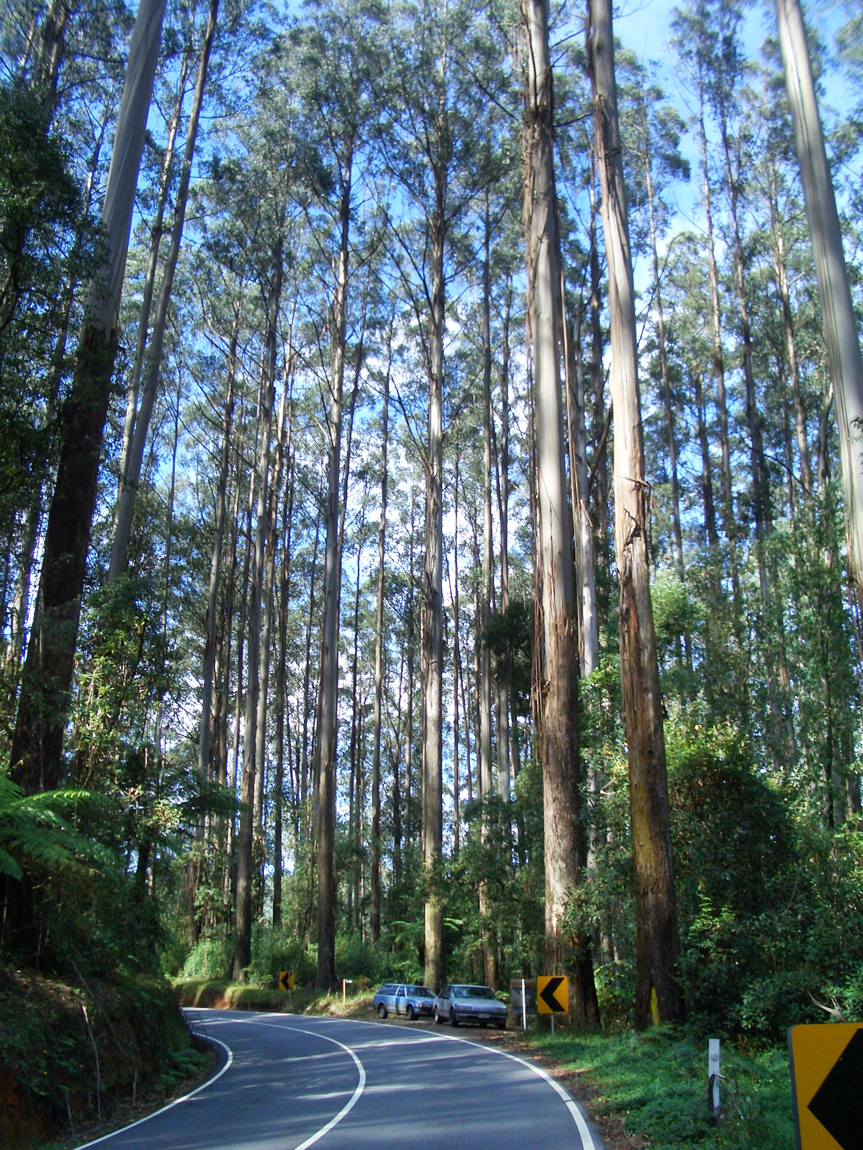
Yarra Ranges National Park is located in the Central Highlands of Australia's southeastern state Victoria, 107 km northeast of Melbourne. Established in 1995 and managed by the statutory authority Parks Victoria, the park features a carbon-rich, temperate rainforest and a subalpine eucalypt forest on its northern plateau. It is home to large stands of mountain ash, the tallest tree species in Australia and among the tallest in the world. A wide diversity of fauna make their home across the park's 76,003 hectares, including kangaroos, wallabies, wombats, platypuses and 120 species of native birds. Among the conservation challenges facing Yarra Ranges National Park are climate change and invasive species of weeds. In winter, Lake Mountain, located on the plateau at the northern end of the park, provides cross-country skiing on groomed and ungroomed ski trails. Description The Yarra Ranges National Park was created in December 1995, and spans 76,003 hectares within Victoria ... [...More Info...] [...Related Items...] OR: [Wikipedia] [Google] [Baidu] |
Marysville, Victoria
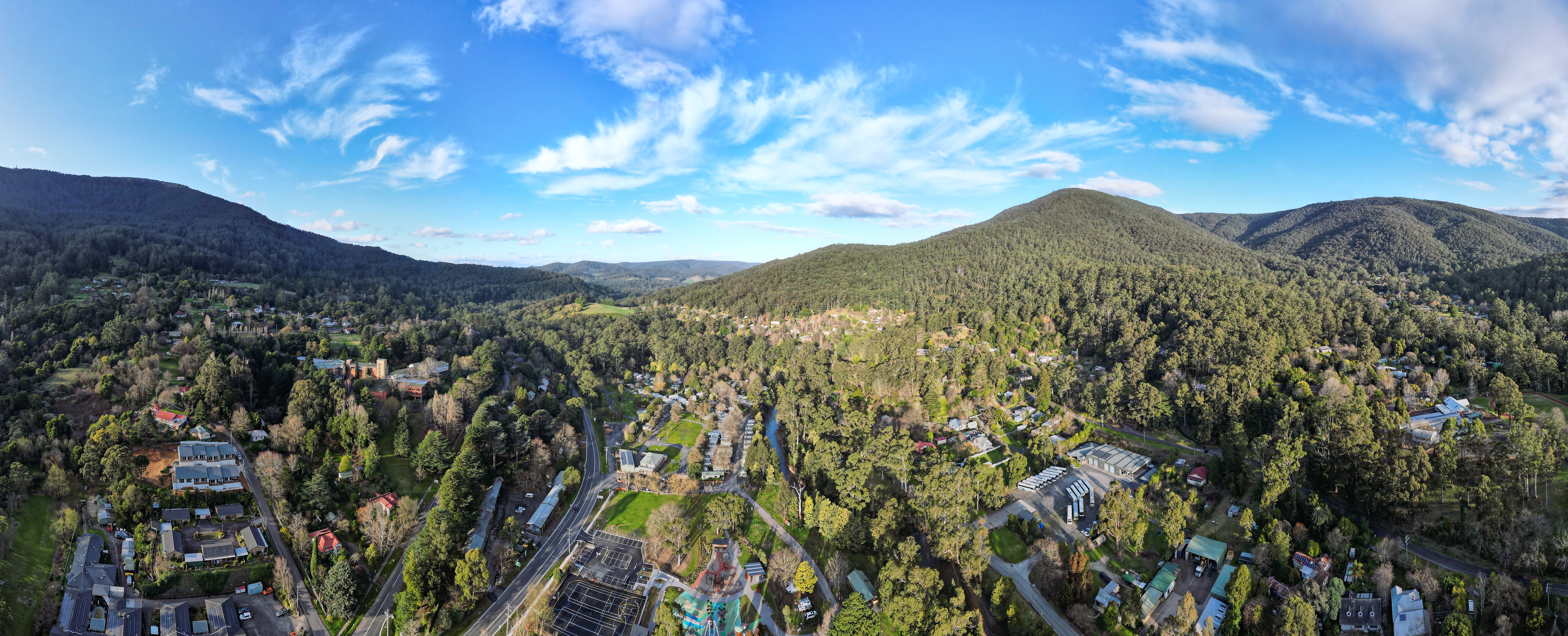
Marysville is a town, 34 kilometres north-east of Healesville and 41 kilometres south of Alexandra, in the Shire of Murrindindi in Victoria, Australia. The town, which previously had a population of over 500 people, was devastated by the Murrindindi Mill bushfire on 7 February 2009. On 19 February 2009 the official death toll was 45. Around 90% of the town's buildings were destroyed. Prior to the Black Saturday fire the population in 2006 was 519. At the 2011 Census, the population had reduced to 226, by the 2016 census it had risen to 394. History The city was established as a stopping point on the Yarra Track, the route to the Woods Point and Upper Goulburn goldfields, with a butcher's shop and store in existence by the time the town was surveyed in 1864. It prospered following the reconstruction of the Yarra Track as an all weather dray and coach road under engineer Clement Wilks in the 1870s. It was named after Mary Steavenson, the wife of Assistant Commissioner of Road ... [...More Info...] [...Related Items...] OR: [Wikipedia] [Google] [Baidu] |
Cross-country Skiing
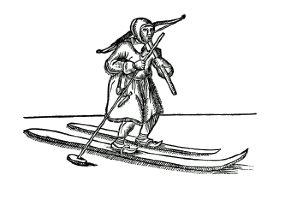
Cross-country skiing is a form of skiing where skiers rely on their own locomotion to move across snow-covered terrain, rather than using ski lifts or other forms of assistance. Cross-country skiing is widely practiced as a sport and recreational activity; however, some still use it as a means of transportation. Variants of cross-country skiing are adapted to a range of terrain which spans unimproved, sometimes mountainous terrain to groomed courses that are specifically designed for the sport. Modern cross-country skiing is similar to the original form of skiing, from which all skiing disciplines evolved, including alpine skiing, ski jumping and Telemark skiing. Skiers propel themselves either by striding forward (classic style) or side-to-side in a skating motion (skate skiing), aided by arms pushing on ski poles against the snow. It is practised in regions with snow-covered landscapes, including Europe, Canada, Russia, the United States, Australia and New Zealand. Competiti ... [...More Info...] [...Related Items...] OR: [Wikipedia] [Google] [Baidu] |
Australian National University
The Australian National University (ANU) is a public research university located in Canberra, the capital of Australia. Its main campus in Acton encompasses seven teaching and research colleges, in addition to several national academies and institutes. ANU is regarded as one of the world's leading universities, and is ranked as the number one university in Australia and the Southern Hemisphere by the 2022 QS World University Rankings and second in Australia in the ''Times Higher Education'' rankings. Compared to other universities in the world, it is ranked 27th by the 2022 QS World University Rankings, and equal 54th by the 2022 ''Times Higher Education''. In 2021, ANU is ranked 20th (1st in Australia) by the Global Employability University Ranking and Survey (GEURS). Established in 1946, ANU is the only university to have been created by the Parliament of Australia. It traces its origins to Canberra University College, which was established in 1929 and was integrated into ... [...More Info...] [...Related Items...] OR: [Wikipedia] [Google] [Baidu] |
Biomass
Biomass is plant-based material used as a fuel for heat or electricity production. It can be in the form of wood, wood residues, energy crops, agricultural residues, and waste from industry, farms, and households. Some people use the terms biomass and biofuel interchangeably, while others consider biofuel to be a ''liquid'' or ''gaseous'' fuel used for transportation, as defined by government authorities in the US and EU. The European Union's Joint Research Centre defines solid biofuel as raw or processed organic matter of biological origin used for energy, such as firewood, wood chips, and wood pellets. In 2019, biomass was used to produce 57 EJ (exajoules) of energy, compared to 190 EJ from crude oil, 168 EJ from coal, 144 EJ from natural gas, 30 EJ from nuclear, 15 EJ from hydro and 13 EJ from wind, solar and geothermal combined. Approximately 86% of modern bioenergy is used for heating applications, with 9% used for transport and 5% for electricity. Most of the global b ... [...More Info...] [...Related Items...] OR: [Wikipedia] [Google] [Baidu] |
Healesville
Healesville is a town in Victoria, Australia, 52 km north-east from Melbourne's central business district, located within the Shire of Yarra Ranges local government area. Healesville recorded a population of 7,589 in the 2021 census. Healesville is situated on the Watts River, a tributary of the Yarra River. History Traffic to the more distant Gippsland and Yarra Valley goldfields in the 1860s resulted in a settlement forming on the Watts River and its survey as a town in 1864. It was named after Richard Heales, the Premier of Victoria from 1860–1861. The post office opened on 1 May 1865. The town became a setting off point for the Woods Point Goldfield with the construction of the Yarra Track in the 1870s. Climate Present Healesville is known for the Healesville Sanctuary, a nature park with hundreds of native Australian animals displayed in a semi-open natural setting and an active platypus breeding program. The Yarra Valley Railway operates from Healesville ... [...More Info...] [...Related Items...] OR: [Wikipedia] [Google] [Baidu] |
Eucalyptus Regnans
''Eucalyptus'' () is a genus of over seven hundred species of flowering trees, shrubs or mallees in the myrtle family, Myrtaceae. Along with several other genera in the tribe Eucalypteae, including ''Corymbia'', they are commonly known as eucalypts. Plants in the genus ''Eucalyptus'' have bark that is either smooth, fibrous, hard or stringy, leaves with oil glands, and sepals and petals that are fused to form a "cap" or operculum over the stamens. The fruit is a woody capsule commonly referred to as a "gumnut". Most species of ''Eucalyptus'' are native to Australia, and every state and territory has representative species. About three-quarters of Australian forests are eucalypt forests. Wildfire is a feature of the Australian landscape and many eucalypt species are adapted to fire, and resprout after fire or have seeds which survive fire. A few species are native to islands north of Australia and a smaller number are only found outside the continent. Eucalypts have been grown ... [...More Info...] [...Related Items...] OR: [Wikipedia] [Google] [Baidu] |
Taggerty River
The Taggerty River, a minor inland perennial river of the Goulburn Broken catchment, part of the Murray-Darling basin, is located in the lower South Eastern Highlands bioregion and Northern Country/North Central regions of the Australian state of Victoria. The headwaters of the Taggerty River rise on the northwestern slopes of the Yarra Ranges, below Lake Mountain and descend to flow into the Steavenson River near . Location and features The river rises below Lake Mountain on the northwestern slopes of the Yarra Ranges, part of the Great Dividing Range, within the Yarra Ranges National Park. The flows generally west, through rugged national park as the river descends, joined by one minor tributary, before reaching its confluence with the Steavenson River near the settlement of Marysville. The river descends over its course. Much of the catchment area of the river was destroyed by the Black Saturday bushfires that passed through the area on 7 February 2009, destroying ... [...More Info...] [...Related Items...] OR: [Wikipedia] [Google] [Baidu] |
O'Shannassy River
The O'Shannassy River is a perennial river of the Port Phillip catchment, located in the north-eastern Greater Metropolitan Melbourne region of the Australian state of Victoria. Location and features The O'Shannassy River rises within the Yarra Ranges National Park on the slopes of the Yarra Ranges, within the Great Dividing Range, below Mount Observation, approximately east of Melbourne. The river flows generally south by southwest, joined by two minor tributaries, before being impounded to create the O'Shannassy Reservoir, part of Melbourne's water supply system. Below the reservoir the natural flow of the river is diverted via the O’Shannassy Aqueduct and then reaches its confluence with the Yarra River west of the locality of . The river descends approximately over its course, before being diverted via the aqueduct. The O’Shannassy River catchment is identified as an Essentially Natural Catchment by the Land Conservation Council. Etymology The river is named aft ... [...More Info...] [...Related Items...] OR: [Wikipedia] [Google] [Baidu] |
Yarra River
The Yarra River or historically, the Yarra Yarra River, (Kulin languages: ''Berrern'', ''Birr-arrung'', ''Bay-ray-rung'', ''Birarang'', ''Birrarung'', and ''Wongete'') is a perennial river in south-central Victoria, Australia. The lower stretches of the Yarra are where Victoria's state capital Melbourne was established in 1835, and today metropolitan Greater Melbourne dominates and influences the landscape of its lower reaches. From its source in the Yarra Ranges, it flows west through the Yarra Valley which opens out into plains as it winds its way through Greater Melbourne before emptying into Hobsons Bay in northernmost Port Phillip Bay. The river has been a major food source and meeting place for Indigenous Australians for thousands of years. Shortly after the arrival of European settlers, land clearing forced the remaining Wurundjeri people into neighbouring territories and away from the river. Originally called ''Birrarung'' by the Wurundjeri, the current name was mis ... [...More Info...] [...Related Items...] OR: [Wikipedia] [Google] [Baidu] |
Warburton, Victoria
Warburton is a town in Victoria (Australia), Victoria, Australia, east of Melbourne, Melbourne's Melbourne city centre, central business district, located within the Shire of Yarra Ranges Local government areas of Victoria, local government area. Warburton recorded a population of 2,020 at the . History The name "Warburton" has been shared between two townships over the years. The mining town of "Yankee Jim's Creek" was located on the gold-bearing slopes of Mount Little Joe. Hostile terrain, fire, drought, flood, steep slopes, unsustainable roads, crime and easier pickings for miners further upstream put an end to "Old Warburton". Land was surveyed and sold in the valley below in 1884. The Post Office opened around 1884. Two earlier offices named Warburton were renamed as Launching Place, Victoria, Launching Place and Hoddles Creek, Victoria, Hoddle's Creek. Warburton railway station, Melbourne, Warburton was connected to Lilydale, Victoria, Lilydale by a Victorian Railways ... [...More Info...] [...Related Items...] OR: [Wikipedia] [Google] [Baidu] |
Mount Donna Buang
Mount Donna Buang is a mountain in the southern reaches of the Victorian Alps of the Great Dividing Range, located in the Australian state of Victoria (Australia), Victoria. Approximately from Melbourne with an elevation of , Mount Donna Buang is the closest snowfield to Melbourne. Location and features In winter, it usually receives snow suitable for snowplay and tobogganing, and during the non-winter months the area is well visited by bushwalkers and cyclists. The summit of Mount Donna Buang is surrounded by alpine ash (or woollybutt) trees and sub-alpine snow gums, and at nearby Cement Creek there is a canopy walkway through Nothofagus cunninghamii, myrtle beech and Eucalyptus regnans, mountain ash trees known as the Mount Donna Buang Skywalk. Mount Donna Buang is part of the Yarra Ranges National Park (established in 1995). The nearest serviced town to the mountain is Warburton, Victoria, Warburton. Flora and fauna The lower and middle slopes of the mountain are charac ... [...More Info...] [...Related Items...] OR: [Wikipedia] [Google] [Baidu] |


