|
Yokohane Route
The , signed as Route K1, is one of the tolled routes of the Shuto Expressway system serving the Greater Tokyo Area and is one of seven of the routes in the system serving Kanagawa Prefecture. The route is a long radial highway running southwest from the southern terminus of the Haneda Route in Ōta, Tokyo, Ōta near Haneda International Airport in Tokyo to the Kariba Route in Naka-ku, Yokohama in Kanagawa Prefecture. Alongside the Haneda Route, it connects Tokyo's Inner Circular Route (Shuto Expressway), Inner Circular Route in central Tokyo to Yokohama. Route description Route K1 begins at the Haneda interchange in Ōta as a continuation south for the Haneda Route into Kanagawa Prefecture. From this northern terminus, it travels southwest out of Tokyo, crossing in to the eastern part of the city of Kawasaki, Kanagawa, Kawasaki in Kanagawa Prefecture. The largest junction along the Yokohane Route in Kawasaki is at Daishi Junction where the highway meets the Kawasaki Route at its ... [...More Info...] [...Related Items...] OR: [Wikipedia] [Google] [Baidu] |
Shuto Urban Expwy Sign K1
Shuto or variants may refer to: *A knifehand strike, known in Japanese as ''shutō-uchi'' *Shutō (seafood), Japanese tuna liver seafood pickle *Shuto Expressway (首都高速道路, Shuto Kōsoku-dōro) network of toll expressways *Šuto Orizari Municipality (Macedonian: Шуто Оризари) municipality *Shuuto, long "shootball" pitch in Japanese baseball People with the name *, Japanese footballer *Shuto Ando (1994) Japanese basketball player *Shuto Inaba (1990) Japanese footballer *Shuto Kawai (1993) Japanese footballer *Shuto Kono (1993) Japanese footballer *Shuto Machino (1999) Japanese footballer *, Japanese professional baseball player *Shuto Yamamoto (1985) Japanese footballer *, Japanese professional baseball player {{disambiguation, given name Japanese masculine given names ... [...More Info...] [...Related Items...] OR: [Wikipedia] [Google] [Baidu] |
Daikoku Route
The , signed as Route K5, is one of the tolled routes of the Shuto Expressway system serving the Greater Tokyo Area and is one of seven of the routes in the system serving Kanagawa Prefecture. Junction list The entire expressway lies within Yokohama in Kanagawa Prefecture References External links * Shuto Expressway, K5 1989 establishments in Japan Roads in Kanagawa Prefecture {{Japan-road-stub ... [...More Info...] [...Related Items...] OR: [Wikipedia] [Google] [Baidu] |
Kawasaki Station
Kawasaki station may refer to: *Kawasaki-juku ( ja, 川崎宿, Kawasaki-shuku, Kawasaki lodging), a Tōkaidō waystation in Kawasaki-ku, Kawasaki, Kanagawa, Japan *Kawasaki Station ( ja, 川崎駅, Kawasaki-eki, Kawasaki Station, a train station of JR East line in Kawasaki, Kanagawa, Japan *Shin-Kawasaki Station ( ja, (新川崎駅, shin-Kawasaki-eki, New Kawasaki Station), Saiwai, Kawasaki, Kanagawa, Japan; a train station *Kawasaki-Daishi Station ( ja, 川崎大師駅, Kawasaki-Daishi-eki, Grand Kawasaki Station), Kawasaki-ku, Kawasaki, Kanagawa Prefecture, Japan; a train station on the Keikyu Line *Keikyū Kawasaki Station ( ja, 京急川崎駅, Keikyū Kawasaki-eki, Keikyuu Line station Kawasaki, a train station on the Keikyuu Line in Kawasaki, Kanagawa, Japan *Hama-Kawasaki Station ( ja, 浜川崎駅, Hama-Kawasaki-eki, Kawasaki Beach Station), a train station of JR East line in Kawasaki-ku, Kawasaki, Kanagawa, Japan *Kawasakishimmachi Station ( ja, 川崎新町駅, Kawasaki-Sh ... [...More Info...] [...Related Items...] OR: [Wikipedia] [Google] [Baidu] |
Japan National Route 409
National Route 409 is a national highway of Japan connecting Takatsu-ku, Kawasaki and Narita, Chiba in Japan, with a total length of 119.3 km (74.13 mi). See also * Tokyo Bay Aqua-Line The , also known as the Trans-Tokyo Bay Expressway, is an expressway that is mainly made up of a bridge–tunnel combination across Tokyo Bay in Japan. It connects the city of Kawasaki in Kanagawa Prefecture with the city of Kisarazu in Chiba ...—part of Japan National Route 409 References External links 409 Roads in Chiba Prefecture Roads in Kanagawa Prefecture {{Japan-road-stub ... [...More Info...] [...Related Items...] OR: [Wikipedia] [Google] [Baidu] |
Tokyo Metropolitan Road And Kanagawa Prefectural Road Route 6
is a principle local road that stretches from Ōta in Tokyo to Tsurumi-ku, Yokohama in Kanagawa is a Prefectures of Japan, prefecture of Japan located in the Kantō region of Honshu. Kanagawa Prefecture is the List of Japanese prefectures by population, second-most populous prefecture of Japan at 9,221,129 (1 April 2022) and third-dens .... Route description Tokyo Metropolitan Road and Kanagawa Prefectural Road Route 6 has a total length of . The Tokyo, Kawasaki and Yokohama sections of the road have a length of 763, 6,540, and 3,520 m respectively. References {{reflist Roads in Tokyo Roads in Kanagawa Prefecture Prefectural roads in Japan ... [...More Info...] [...Related Items...] OR: [Wikipedia] [Google] [Baidu] |
Japanese National Route Sign 0409
Japanese may refer to: * Something from or related to Japan, an island country in East Asia * Japanese language, spoken mainly in Japan * Japanese people, the ethnic group that identifies with Japan through ancestry or culture ** Japanese diaspora, Japanese emigrants and their descendants around the world * Japanese citizens, nationals of Japan under Japanese nationality law ** Foreign-born Japanese, naturalized citizens of Japan * Japanese writing system, consisting of kanji and kana * Japanese cuisine, the food and food culture of Japan See also * List of Japanese people * * Japonica (other) * Japonicum * Japonicus * Japanese studies Japanese studies (Japanese: ) or Japan studies (sometimes Japanology in Europe), is a sub-field of area studies or East Asian studies involved in social sciences and humanities research on Japan. It incorporates fields such as the study of Japanese ... {{disambiguation Language and nationality disambiguation pages ... [...More Info...] [...Related Items...] OR: [Wikipedia] [Google] [Baidu] |
Inner Circular Route
The , signed as Route C1, is one of the routes of the Shuto Expressway system serving the central part of the Greater Tokyo Area. The route is a complete loop around the central Tokyo wards of Chiyoda, Chūō, and Minato, with a total length of . In addition to serving areas of central Tokyo, the Inner Circular Route also serves as the origin of the radial routes of the Shuto Expressway. A section of the expressway is built above the Shibuya River. History The expressway was built between 1962 and 1967, partly in preparation for the 1964 Summer Olympics. In 2009, Tokyo private industries proposed funding a project to dismantle the elevated expressway and put them underground. In May 2020, the Shuto Expressway Company received approval for plans to relocate 1.8 kilometers of the expressway underground between Kandabashi and Edobashi Junctions, in the area where the Nihonbashi Bridge is located. Construction will commence with the permanent closure of the Edobashi and Gofukuba ... [...More Info...] [...Related Items...] OR: [Wikipedia] [Google] [Baidu] |
Shuto Urban Expwy Sign C1
Shuto or variants may refer to: *A knifehand strike, known in Japanese as ''shutō-uchi'' *Shutō (seafood), Japanese tuna liver seafood pickle *Shuto Expressway (首都高速道路, Shuto Kōsoku-dōro) network of toll expressways *Šuto Orizari Municipality (Macedonian: Шуто Оризари) municipality *Shuuto, long "shootball" pitch in Japanese baseball People with the name *, Japanese footballer *Shuto Ando (1994) Japanese basketball player *Shuto Inaba (1990) Japanese footballer *Shuto Kawai (1993) Japanese footballer *Shuto Kono (1993) Japanese footballer *Shuto Machino (1999) Japanese footballer *, Japanese professional baseball player *Shuto Yamamoto is a Japanese football player currently playing for Shonan Bellmare. Club statistics ''Updated to 5 November 2022''.Nippon Sports Kikaku Publishing inc./日本スポーツ企画出版社"J1&J2&J3選手名鑑 2014 (NSK MOOK)" 14 February 2014, ... (1985) Japanese footballer *, Japanese professional baseball player {{ ... [...More Info...] [...Related Items...] OR: [Wikipedia] [Google] [Baidu] |
Kamata, Tokyo
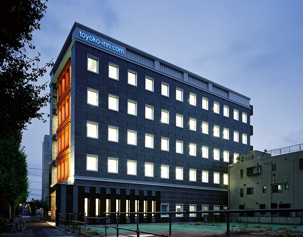
is a district of Ōta, Tokyo, Japan. Features include the Kamata Station, Kamata High School, and the headquarters of Toyoko Inn. History The name "Kamata" has been used to refer to the area since at least the 900s AD. Historically, the area was famous for Japanese apricots(''ume''). Kamata was first linked to Tokyo by rail in 1901 with the opening of Kamata Station (now Keikyu Kamata Station) on the Keikyu Main Line. This was followed in 1904 by the opening of a separate Kamata Station on the Tokaido Line. Kamata became a ward of Tokyo City in October 1932, incorporating the historical towns of Kamata, Yaguchi, Rokugo and Haneda. Kamata merged with the neighboring ward of Omori to form the ward (city) of Ota in March 1947. Education Ota operates the public elementary and junior high schools in Kamata. Kamata Elementary School (蒲田小学校) serves Kamata 1-3-chome and parts of 4 and 5-chome. Shinshuku Elementary School ( 新宿小学校) serves parts of 4 and ... [...More Info...] [...Related Items...] OR: [Wikipedia] [Google] [Baidu] |
Haneda Airport
, officially , and sometimes called as Tokyo Haneda Airport or Haneda International Airport , is one of two international airports serving the Greater Tokyo Area, the other one being Narita International Airport (NRT). It serves as the primary base of Japan's two major domestic airlines, Japan Airlines (Terminal 1) and All Nippon Airways (Terminal 2), as well as Air Do, Skymark Airlines, Solaseed Air, and StarFlyer. It is located in Ōta, Tokyo, south of Tokyo Station. Haneda was the primary international airport serving Tokyo until 1978; from 1978 to 2010, Haneda handled almost all domestic flights to and from Tokyo as well as "scheduled charter" flights to a small number of major cities in East and Southeast Asia, while Narita International Airport handled the vast majority of international flights from further locations. In 2010, a dedicated international terminal, currently Terminal 3, was opened at Haneda in conjunction with the completion of a fourth runway, allowing l ... [...More Info...] [...Related Items...] OR: [Wikipedia] [Google] [Baidu] |
Tama River
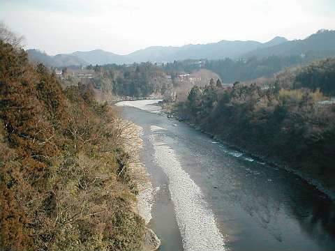
The is a major river in Yamanashi, Kanagawa and Tokyo Prefectures on Honshū, Japan. It is officially classified as a Class 1 river by the Japanese government. Its total length is , and the total of the river's basin area spans . The river flows through Tokyo, on the dividing line between Tokyo and Kanagawa. In the city, its banks are lined with parks and sports fields, making the river a popular picnic spot. Course The Tama's source is located at Mt. Kasatori in Koshu in Yamanashi Prefecture. From there, it flows eastward into mountainous western Tokyo, where the Ogōchi Dam forms Lake Okutama. Below the dam, it takes the name Tama and flows eastwards through Chichibu Tama Kai National Park towards Ōme, Tokyo. It then flows southeast between Tama Hills and Musashino Terrace. At Hamura is the source of the historic Tamagawa Aqueduct built by the Tamagawa brothers in 1653 to supply water to Edo (present day Tokyo). Further downstream, the river forms the boundary betw ... [...More Info...] [...Related Items...] OR: [Wikipedia] [Google] [Baidu] |
Metropolitan Expressway
is a network of toll expressways in the Greater Tokyo Area of Japan. It is operated and maintained by the . Most routes are grade-separated (elevated roads or tunnels) and central routes have many sharp curves and multi-lane merges that require caution to drive safely. The speed limit is 60 km/h on most routes, but 80 km/h on the Bayshore Route, and 50 km/h on the Inner Circular Route. All trips on the expressway require a toll be paid. As of 2014, the cash toll for a standard-size car is ¥1300 regardless of distance traveled. Vehicles using the ETC toll-collection system pay a distance-based toll ranging from ¥300 to ¥1300 for ordinary vehicles (setoll price – in some cases substantially less than the previous fixed-rate toll. Lower cash rates exist for certain radial routes (where there are only a few kilometers of expressway remaining) and ETC users have various time-of-day discounts. For large vehicles, the toll is doubled. Routes There are 24 route ... [...More Info...] [...Related Items...] OR: [Wikipedia] [Google] [Baidu] |


