|
Wyandanch
Wyandanch (, ) is a hamlet and census-designated place (CDP) in the Town of Babylon in Suffolk County, New York. The population was 12,990 at the 2020 census. In the past, some or all of Wyandanch was proposed to become part of the never-realized Incorporated Village of Half Hollow Hills and later on proposed incorporating itself as the Incorporated Village of Wyandanch. However, those plans failed and Wyandanch has never been incorporated. History Native settlement This hamlet is named after Chief Wyandanch, a leader of the Montaukett Native American tribe during the 17th century. Formerly known as Half Way Hollow Hills, West Deer Park (1875), and Wyandance (1893), the area of scrub oak and pine barrens south of the southern slope of Half Hollow terminal moraine was named Wyandanch in 1903 by the Long Island Rail Road (LIRR) to honor Chief Wyandanch and end confusion between travelers getting off at the West Deer Park and Deer Park railroad stations. The history of the hamlet h ... [...More Info...] [...Related Items...] OR: [Wikipedia] [Google] [Baidu] |
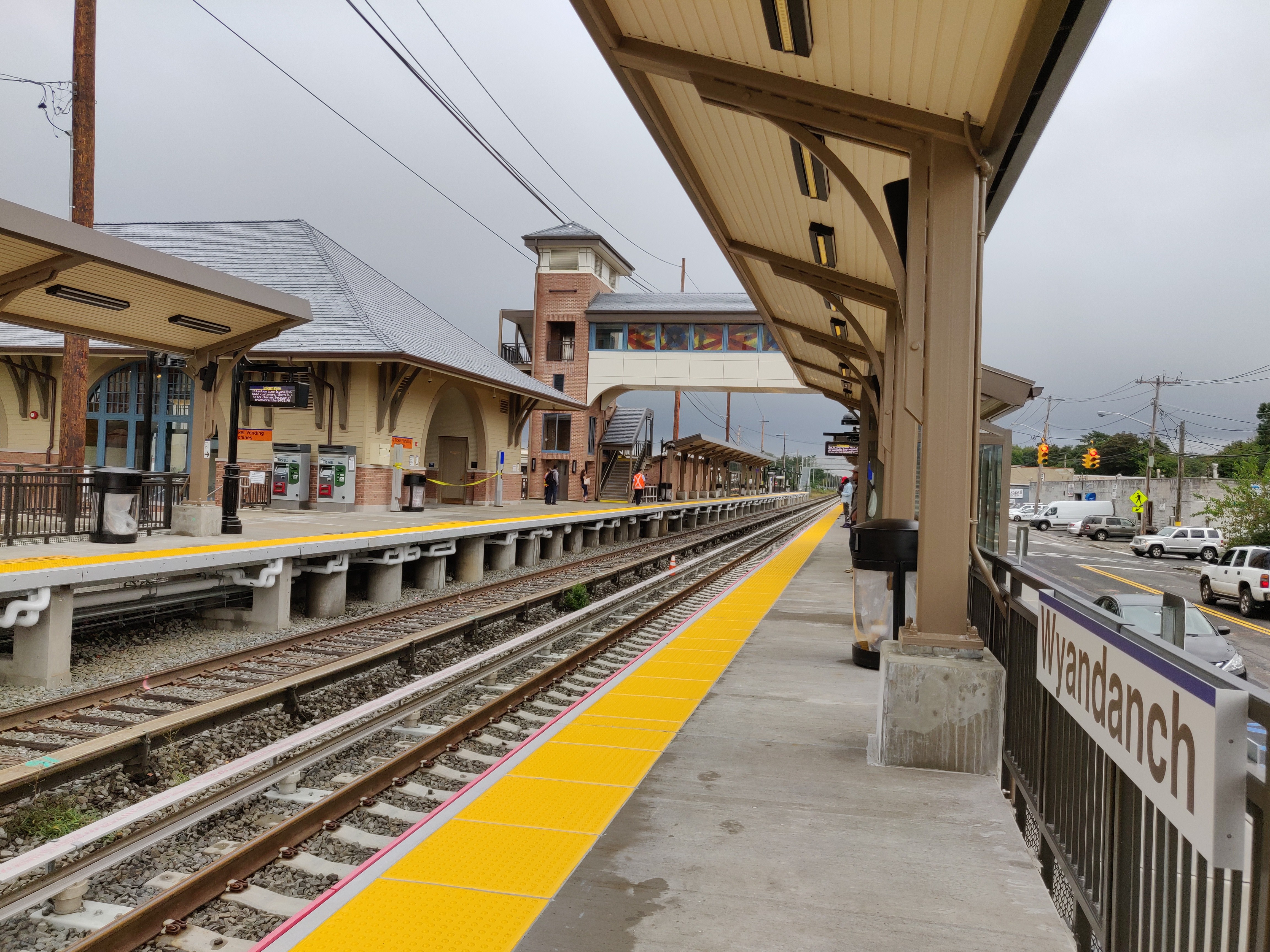
Wyandanch (LIRR Station)
Wyandanch is a station along the Main Line (Ronkonkoma Branch) of the Long Island Rail Road. It is located on Straight Path ( Suffolk CR 2) and Long Island Avenue, off Acorn Avenue in Wyandanch, New York. All parking near the station is free, and maintained either by Suffolk County or the Town of Babylon. History Wyandanch station was originally built in May 1875 as "West Deer Park". The station and tracks have always been at ground level. During the 1920s and 1930s, the vicinity of the station became the site of numerous horrific accidents involving crashes with trains at the unguarded grade-level rail crossings at Straight Path, 18th Street and Little East Neck Road. In 1935, after repeated protests from the people of Wyandanch, the Public Service Commission (PSC) ordered the LIRR to provide crossing guards at the 18th Street and Straight Path crossings during school hours on school days, so that school children living north of the LIRR to safely walk across the railroad on the ... [...More Info...] [...Related Items...] OR: [Wikipedia] [Google] [Baidu] |
Chief Wyandanch
Wyandanch (''c''. 1620 – 1659 was a sachem of the Montaukett Indians in the mid-17th century on eastern Long Island.Strong, pg. 48 Initially he was a minor chief among the Montaukett,Strong, pg. 54 but due to his skillful manipulation of various alliances and his accommodating stance towards the European colonists who gave him substantial military and economic support, he eventually became an influential "alliance chief" (a sachem who was responsible for maintaining friendly relations between his tribe and the settlers). Early life Wyandanch (sometimes spelled as Wyandance or Wayandance) was born on Long Island roughly at the time of the pilgrims' arrival at Plymouth in present-day Massachusetts. While still young, in the second half of the 1630s Wyandanch heard about the almost total destruction of the Pequot in the Pequot War. He concluded that it was best to come to an understanding with the English colonists in southern New England and on Long Island.Wyckoff, pg. 12 Thr ... [...More Info...] [...Related Items...] OR: [Wikipedia] [Google] [Baidu] |
Wheatley Heights, New York
Wheatley Heights is a census-designated place (CDP) in Suffolk County, New York. The population was 5,130 at the 2010 census. The CDP, located in the Town of Babylon, is named after the hamlet in the same general vicinity. In the past, some or all Wheatley Heights was proposed to become part of the never-realized Incorporated Village of Half Hollow Hills. History Wheatley Heights historically was part of the hamlet of Wyandanch, and shares a ZIP code and fire brigade with it. The name Wyandanch was changed to Wheatley Heights by the Postmaster of Wyandanch Thomas A. Brown. ''Circa'' 2001, Wheatley Heights and its neighbors Dix Hills, East Farmingdale, and Melville (all partially or wholly within the Half Hollow Hills Central School District) proposed incorporating as a single village called the Incorporated Village of Half Hollow Hills. These plans failed and each remain unincorporated hamlets to this day. Geography According to the United States Census Bureau, the CDP has a ... [...More Info...] [...Related Items...] OR: [Wikipedia] [Google] [Baidu] |
Deer Park (LIRR Station)
Deer Park is a station along the Main Line (Ronkonkoma Branch) of the Long Island Rail Road. It is officially located at Pineaire Drive, Executive (formerly Grant) Avenue, and Long Island Avenue near Deer Park, New York. The actual location is in Baywood, New York, directly over the Deer Park border. History Deer Park, sometimes mentioned as Deerpark, station was previously located at the bridge over New York State Route 231, until it was moved as part of a major reconstruction project of the line at Ronkonkoma, Central Islip, Brentwood, Deer Park, and Wyandanch. The original station was built in 1842, then rebuilt in 1884, and again 1936 for the bridge over Deer Park Avenue (NY 231 did not exist at the time). The 1987-built station was built close to the former Pine Aire station near the Pilgrim State Psychiatric Center (see below), served as a replacement for both stations, and was also originally planned also to replace Brentwood Station until public opposition from Brentwood ... [...More Info...] [...Related Items...] OR: [Wikipedia] [Google] [Baidu] |
Babylon, New York
The Town of Babylon is one of ten towns in Suffolk County, New York, United States. Its population was 218,223 as of the 2020 census. Parts of Jones Beach Island, Captree Island and Fire Island are in the southernmost part of the town. It borders Nassau County to the west and the Atlantic Ocean to the south. At its westernmost point, it is about from New York City at the Queens border, and about from Manhattan. The village of Babylon is also within the town. History The region was once called Huntington South. Nathaniel Conklin moved his family to the area, and around 1803 named it New Babylon, after the ancient city of Babylon. The town was officially formed in 1872 by a partition of the Town of Huntington. Communities and locations The following communities and locations are within the Town of Babylon: Villages *Amityville, in the southwestern part of the town. * Babylon, in the southeastern section of the town. * Lindenhurst, in the southern part of the town, betwee ... [...More Info...] [...Related Items...] OR: [Wikipedia] [Google] [Baidu] |
Montaukett
= Montauketts = An indigenous Native American People. Name and Identifications The Montaukett ("Metoac" or Matouwac), currently more commonly known as Montauk. The meaning of the name ''Montauk'' is unknown. Native Americans living on Long Island are often known in colonial writings by the place name of their geographic territories, such as the Montauk and the Shinnecock, which may or may not be the same as their name for themselves. European colonists tended to mistakenly assume that the different bands they encountered were different tribes, even in cases where the bands clearly shared the same culture and language. Language The Montauks are an Algonquian-speaking Native American people from the eastern and central sections of Long Island, New York. The Montauk spoke an Eastern Algonquian language. Prior to the 17th century, Montauk people spoke the Mohegan-Pequot language, also known as the Algonquian "N" dialect of the Algonquin language until about 1600, they th ... [...More Info...] [...Related Items...] OR: [Wikipedia] [Google] [Baidu] |
Long Island Rail Road
The Long Island Rail Road , often abbreviated as the LIRR, is a commuter rail system in the southeastern part of the U.S. state of New York (state), New York, stretching from Manhattan to the eastern tip of Suffolk County, New York, Suffolk County on Long Island. With an average weekday ridership of 354,800 passengers in 2016, it is the List of United States commuter rail systems by ridership, busiest commuter railroad in North America. It is also one of the world's few commuter systems that runs 24/7 year-round. It is Government-owned corporation, publicly owned by the Metropolitan Transportation Authority, which refers to it as MTA Long Island Rail Road. In , the system had a ridership of , or about per weekday as of . The LIRR logo combines the circular MTA logo with the text ''Long Island Rail Road'', and appears on the sides of trains. The LIRR is one of two commuter rail systems owned by the MTA, the other being the Metro-North Railroad in the northern suburbs of the New ... [...More Info...] [...Related Items...] OR: [Wikipedia] [Google] [Baidu] |
Suffolk County, New York
Suffolk County () is the easternmost county in the U.S. state of New York. It is mainly located on the eastern end of Long Island, but also includes several smaller islands. According to the 2020 United States census, the county's population was 1,525,920 making it the fourth-most populous county in the State of New York, and the most populous excluding the five counties of New York City. Its county seat is Riverhead, though most county offices are in Hauppauge. The county was named after the county of Suffolk in England, from where its earliest European settlers came. Suffolk County incorporates the easternmost extreme of the New York City metropolitan area. The geographically largest of Long Island's four counties and the second-largest of the 62 counties in the State of New York, Suffolk measures in length and in width at its widest (including water). Most of the island is near sea level, with over 1,000 miles of coastline. Like other parts of Long Island, the high ... [...More Info...] [...Related Items...] OR: [Wikipedia] [Google] [Baidu] |
Huntington, New York
The Town of Huntington is one of ten towns in Suffolk County, New York. Founded in 1653, it is located on the north shore of Long Island in northwestern Suffolk County, with Long Island Sound to its north and Nassau County adjacent to the west. Huntington is part of the New York metropolitan area. As of the 2020 census, the town population was 204,127. Huntington is the only township in the United States to ban self-service gas stations at the township level and among the few places in the U.S. where full-service gas stations are compulsory and no self-service is allowed; the entire state of New Jersey and the western-Mid Valley portion of Oregon are the only other places in the country with similar laws. History In 1653, three men from Oyster Bay, Richard Holbrook, Robert Williams and Daniel Whitehead, purchased a parcel of land from the Matinecock tribe. This parcel has since come to be known as the "First Purchase" and included land bordered by Cold Spring Harbor on t ... [...More Info...] [...Related Items...] OR: [Wikipedia] [Google] [Baidu] |
German-American
German Americans (german: Deutschamerikaner, ) are Americans who have full or partial German ancestry. With an estimated size of approximately 43 million in 2019, German Americans are the largest of the self-reported ancestry groups by the United States Census Bureau in its American Community Survey. German Americans account for about one third of the total population of people of German ancestry in the world. Very few of the German states had colonies in the new world. In the 1670s, the first significant groups of German immigrants arrived in the British colonies, settling primarily in Pennsylvania, New York and Virginia. The Mississippi Company of France moved thousands of Germans from Europe to Louisiana and to the German Coast, Orleans Territory between 1718 and 1750. Immigration ramped up sharply during the 19th century. There is a "German belt" that extends all the way across the United States, from eastern Pennsylvania to the Oregon coast. Pennsylvania, with 3.5 millio ... [...More Info...] [...Related Items...] OR: [Wikipedia] [Google] [Baidu] |
Roman Catholic Diocese Of Brooklyn
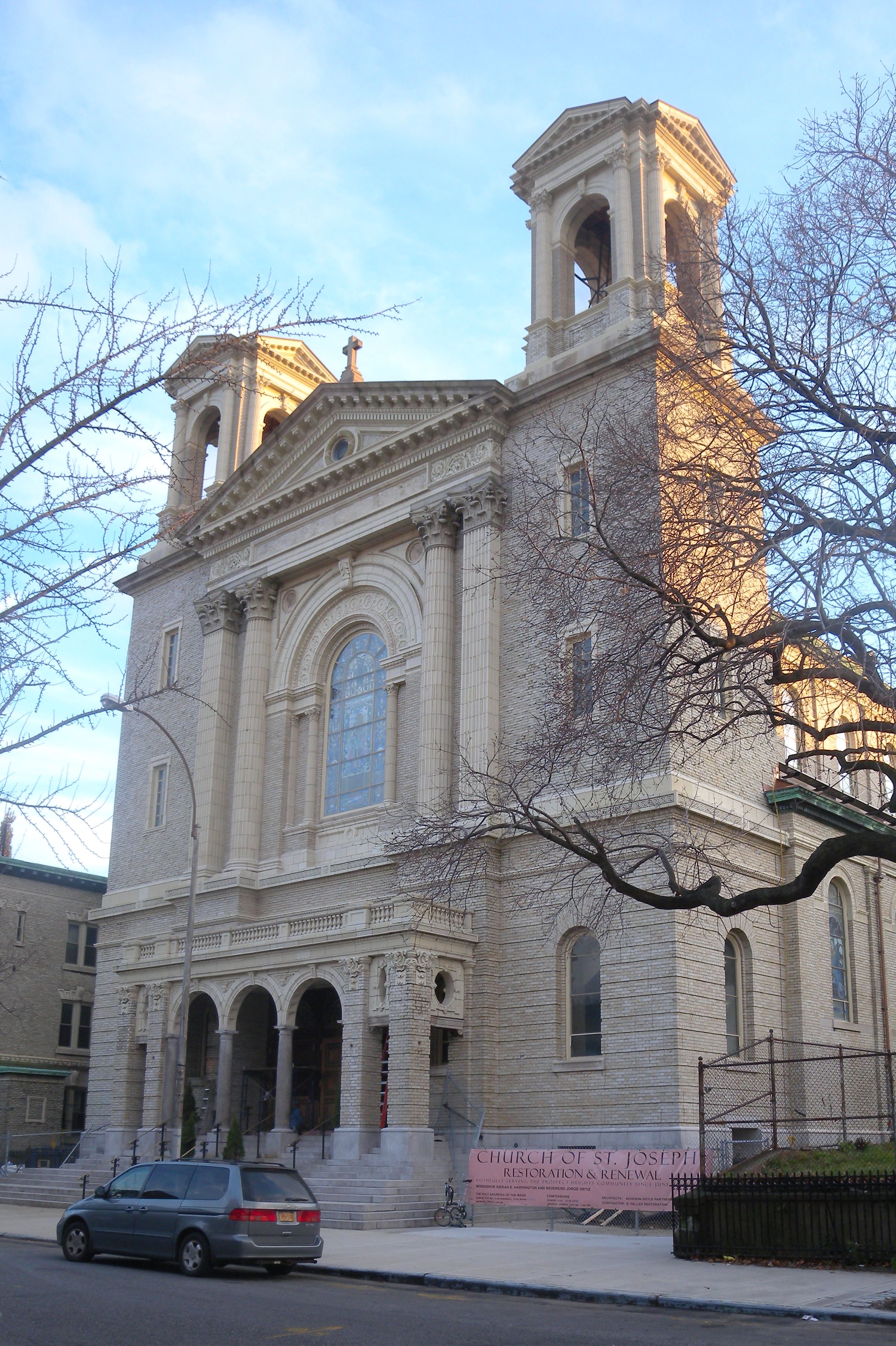
The Diocese of Brooklyn is a Latin Church ecclesiastical territory or diocese of the Catholic Church in the U.S. state of New York. It is headquartered in Brooklyn and its territory encompasses the New York City boroughs of Brooklyn and Queens. The Diocese of Brooklyn is a suffragan diocese in the ecclesiastical province of the metropolitan Archdiocese of New York. The diocesan cathedral is the Cathedral Basilica of St. James in Downtown Brooklyn and its co-cathedral is the Co-Cathedral of St. Joseph in Prospect Heights. The current Bishop of Brooklyn is Robert J. Brennan. Brooklyn is one of the few dioceses in the United States that is made up of 100% urban territory.Coen, Joseph W.; McNamara, Patrick, J.; Vaccari, Peter I. ''Diocese of Immigrants: The Brooklyn Catholic Experience 1853-2003'', Éditions du Signe, 2004. . p. 120 The Bishop of the Diocese of Brooklyn, presides from both the Cathedral Basilica of St. James and the Co-Cathedral of St. Joseph. This atypical arra ... [...More Info...] [...Related Items...] OR: [Wikipedia] [Google] [Baidu] |
Austrian-American
Austrian Americans (, ) are Americans of Austrian descent, chiefly German-speaking Catholics and Jews. According to the 2000 U.S. census, there were 735,128 Americans of full or partial Austrian descent, accounting for 0.3% of the population. The states with the largest Austrian American populations are New York (93,083), California (84,959), Pennsylvania (58,002) (most of them in the Lehigh Valley), Florida (54,214), New Jersey (45,154), and Ohio (27,017). This may be an undercount since many German Americans, Czech Americans, Polish Americans, Slovak Americans, and Ukrainian Americans, and other Americans with Central European ancestry can trace their roots from the Habsburg territories of Austria, the Austrian Empire, or Cisleithania in the Austro-Hungarian Empire, regions which were major sources of immigrants to the United States before World War I, and whose inhabitants often assimilated into larger immigrant and ethnic communities throughout the United States. Migration Hi ... [...More Info...] [...Related Items...] OR: [Wikipedia] [Google] [Baidu] |


