|
Wrose
Wrose is a village and civil parish in the City of Bradford metropolitan borough of West Yorkshire, England, about three miles north of Bradford city centre, and south-east of Shipley. The civil parish population taken at the 2011 Census was 7,518. History Although the name Wrose was established as a place name within the Manor of Idle by the time of Elizabeth I of England, it is not mentioned in the Poll Tax returns of 1379. The name probably existed as a place name for some time before then. Rapid house expansion took place in Wrose in the 1930s. Many houses dating from the time of Charles II were demolished to make way for these new semi-detached properties. Close to the old quarries to the north west of Wrose was the former Wrose Hill brickworks created for the manufacture of bricks and sanitary tubes. Geography Wrose sits on top of a hillside at a height of around above sea level, overlooking the Aire valley and Bradford valley. Wrose is surrounded by ... [...More Info...] [...Related Items...] OR: [Wikipedia] [Google] [Baidu] |
Listed Buildings In Windhill And Wrose
Windhill and Wrose is a ward, and Wrose is a civil parish, both in the metropolitan borough of the City of Bradford, West Yorkshire, England. The ward and parish contain ten listed buildings that are recorded in the National Heritage List for England The National Heritage List for England (NHLE) is England's official database of protected heritage assets. It includes details of all English listed buildings, scheduled monuments, register of historic parks and gardens, protected shipwrecks, an .... Of these, two are listed at Grade II*, the middle of the three grades, and the others are at Grade II, the lowest grade. The listed buildings consist of houses and cottages, a school later used for other purposes, and a public house. __NOTOC__ Key Buildings References Citations Sources * * * * * * * * * * * * {{DEFAULTSORT:Windhill and Wrose Lists of listed buildings in West Yorkshire ... [...More Info...] [...Related Items...] OR: [Wikipedia] [Google] [Baidu] |
Idle, West Yorkshire
Idle is a residential suburban area in the city of Bradford, West Yorkshire, in England and was a separate village, and before that it was the Manor of Idle. Idle is loosely bordered by the areas of Eccleshill, Wrose, Thackley, Apperley Bridge, and Greengates, in the north-east of the city. History The Manor of Idle contained the villages of Idle and Windhill and hamlets of Thackley, Thorpe-Green, Parkhill, Cross-Keys, Buckmill, and Wrose. The Manor of Idle was bounded by the River Aire in the north and in the east Pighill Beck (now named Haigh Beck) up to Blakehill Tongue and across westwards down a small beck to Bradford Beck. The name is thought to be a corruption of ''Idlawe'' meaning Ide's Hill, where Ida is supposed to be an Anglo Saxon settler. Thorpe middle school is in the centre of the village. Church history Idle was once part of the parish of Calverley but in 1584 a chapel of ease was built on Town Lane and later in 1630 rebuilt on the same site. The buildin ... [...More Info...] [...Related Items...] OR: [Wikipedia] [Google] [Baidu] |
City Of Bradford
The City of Bradford () is a local government district of West Yorkshire, England, with the status of a city and metropolitan borough. It is named after its largest settlement, Bradford, but covers a large area which includes the towns and villages of Keighley, Shipley, Bingley, Ilkley, Haworth, Silsden, Queensbury, Thornton and Denholme. Bradford has a population of 528,155, making it the fourth-most populous metropolitan district and the sixth-most populous local authority district in England. It forms part of the West Yorkshire Urban Area conurbation which in 2011 had a population of 1,777,934, and the city is part of the Leeds-Bradford Larger Urban Zone (LUZ), which, with a population of 2,393,300, is the fourth largest in the United Kingdom after London, Birmingham and Manchester. The city is situated on the edge of the Pennines, and is bounded to the east by the City of Leeds, the south by the Metropolitan Borough of Kirklees and the south west by the Metropolitan ... [...More Info...] [...Related Items...] OR: [Wikipedia] [Google] [Baidu] |
Shipley, West Yorkshire
Shipley is a historic market town and civil parish in the City of Bradford, West Yorkshire, England, by the River Aire and the Leeds and Liverpool Canal, north of Bradford. The population of the Shipley ward on Bradford City Council taken at the 2011 Census was 15,483. Before 1974 Shipley was an urban district in the West Riding of Yorkshire. The town forms a continuous urban area with Bradford. It has a population of approximately 28,162. History Toponymy The place-name ''Shipley'' derives from two words: the Old English ('sheep', a Northumbrian dialect form, contrasting with the Anglian dialect form which underlies modern English ''sheep'') and meaning either 'a forest, wood, glade, clearing' or, later, 'a pasture, meadow'. It has therefore been variously defined as 'forest clearing used for sheep' or 'sheep field'. Early history Shipley appears to have first been settled in the late Bronze Age and is mentioned in the ''Domesday Book'' of 1086, in the form . I ... [...More Info...] [...Related Items...] OR: [Wikipedia] [Google] [Baidu] |
Eccleshill, West Yorkshire
Eccleshill is an area, former village, and ward within the City of Bradford Metropolitan District Council in the county of West Yorkshire, England. The ward population of Eccleshill is 17,540, increasing at the 2011 Census to 17,945. Eccleshill is a more or less completely residential urban area with very little open space although there is substantial open land directly to the east. The origins of the name Eccleshill are uncertain. At the time of the ''Domesday Book'' the area was known as Egleshill either meaning 'eagles hill' or perhaps named after a Saxon landlord called Aikel or Eckil—alternatively it could mean Ecclesiastical Hill. History In Roman times the Eccleshill area was crossed by two lanes. One lane was along what is now Norman Lane and the other to Apperley Bridge down the road now known as Bank. After the Norman Conquest the lands of Eccleshill were given to William, Earl of Warren. In 1274 ownership of lands passed to the Sheffields and in 1407 to the B ... [...More Info...] [...Related Items...] OR: [Wikipedia] [Google] [Baidu] |
Bradford
Bradford is a city and the administrative centre of the City of Bradford district in West Yorkshire, England. The city is in the Pennines' eastern foothills on the banks of the Bradford Beck. Bradford had a population of 349,561 at the 2011 census; the second-largest population centre in the county after Leeds, which is to the east of the city. It shares a continuous built-up area with the towns of Shipley, Silsden, Bingley and Keighley in the district as well as with the metropolitan county's other districts. Its name is also given to Bradford Beck. It became a West Riding of Yorkshire municipal borough in 1847 and received its city charter in 1897. Since local government reform in 1974, the city is the administrative centre of a wider metropolitan district, city hall is the meeting place of Bradford City Council. The district has civil parishes and unparished areas and had a population of , making it the most populous district in England. In the century leadin ... [...More Info...] [...Related Items...] OR: [Wikipedia] [Google] [Baidu] |
Beagle
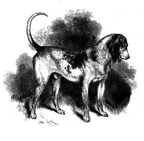
The beagle is a breed of small scent hound, similar in appearance to the much larger foxhound. The beagle was developed primarily for hunting hare, known as beagling. Possessing a great sense of smell and superior tracking instincts, the beagle is the primary breed used as a detection dog for prohibited agricultural imports and foodstuffs in quarantine around the world. The beagle is intelligent and is a popular pet due to its size, good temper, and a lack of inherited health problems. The modern breed was developed in Great Britain around the 1830s from several breeds, including the Talbot Hound, the North Country Beagle, the Southern Hound, and possibly the Harrier. Beagles have been depicted in popular culture since Elizabethan times in literature and paintings and more recently in film, television, and comic books. History The origin of the beagle is not known. In the 11th century, William the Conqueror brought the St. Hubert Hound and the Talbot hound to Br ... [...More Info...] [...Related Items...] OR: [Wikipedia] [Google] [Baidu] |
Areas Of Bradford
Area is the quantity that expresses the extent of a region on the plane or on a curved surface. The area of a plane region or ''plane area'' refers to the area of a shape or planar lamina, while ''surface area'' refers to the area of an open surface or the boundary of a three-dimensional object. Area can be understood as the amount of material with a given thickness that would be necessary to fashion a model of the shape, or the amount of paint necessary to cover the surface with a single coat. It is the two-dimensional analogue of the length of a curve (a one-dimensional concept) or the volume of a solid (a three-dimensional concept). The area of a shape can be measured by comparing the shape to squares of a fixed size. In the International System of Units (SI), the standard unit of area is the square metre (written as m2), which is the area of a square whose sides are one metre long. A shape with an area of three square metres would have the same area as three such squares. ... [...More Info...] [...Related Items...] OR: [Wikipedia] [Google] [Baidu] |
Frizinghall
Frizinghall is a district in the Heaton ward of the City of Bradford, West Yorkshire, lying north of the city centre close to the town of Shipley, itself a part of the City of Bradford Metropolitan District along with such other nearby towns as Keighley and Ilkley. Frizinghall derives its name from a type of rough woollen cloth made in the area (''frieze''), and the hall was somewhere in the settlement (''ing'') where the frieze was made. Others believe the name comes from Old English; ''The Frisian's nook of land'' (Frisian being a personal name) or from ''Furze-covered Haugh (haugh being an enclosure). Frizinghall is notable as the birthplace of famous cricketer (and later commentator) Jim Laker. Frizinghall is served by a railway station on the Airedale line which has frequent services to , , , , and . The fictitious town of Frizinghall in Wilkie Collins' book ''The Moonstone'' is near the Yorkshire coast. See also *Listed buildings in Bradford (Heaton Ward) ... [...More Info...] [...Related Items...] OR: [Wikipedia] [Google] [Baidu] |
Thackley
Thackley is a small suburb near Bradford, West Yorkshire in England. The village is loosely bordered by the village of Idle to the south, to the west by the West Royd area of Shipley and elsewhere by the Leeds and Liverpool Canal. Thackley is the northernmost part of Bradford south of the River Aire. History Prehistory An archaeological project during 2009 funded by the Heritage Lottery Fund, revealed the site in Buck Wood of an enclosure that was in use as a settlement from Neolithic to post-Roman times. The work, undertaken by the Friends of Buck Wood led by a professional archaeologist, showed that in the past a substantial boundary wall had been built of local unworked stone, enclosing a natural terrace of level ground now surrounded by woods. This formed an oval enclosure, roughly 82 m by 78 m in size. The remains of a quern stone for grinding grain was found within this central area, as was a single cup marked carved rock. Leading away from the enclosur ... [...More Info...] [...Related Items...] OR: [Wikipedia] [Google] [Baidu] |
Baildon
Baildon is a town and civil parish in the Bradford Metropolitan Borough in West Yorkshire, England and within the historic boundaries of the West Riding of Yorkshire. It lies north of Bradford city centre. The town forms a continuous urban area with Shipley and Bradford, and is part of the West Yorkshire Built Up Area. Other nearby suburbs include Shipley to the south and Saltaire to the west. As of the 2011 census, the Baildon ward has a population of 15,360. History Baildon is known to have been inhabited for many centuries; several cup-and-ring stones on Baildon Moor has shown evidence of Bronze Age inhabitation. Baildon Moor has a number of gritstone outcrops with numerous prehistoric cup and ring marks. A denuded and mutilated bank represents the remains of an Iron Age settlement known as Soldier's Trench, sometimes mistaken for a Bronze Age stone circle. A Bronze Age cup-marked rock is incorporated in the bank. Baildon is recorded as ''Beldone'' and ''Beldune'' ... [...More Info...] [...Related Items...] OR: [Wikipedia] [Google] [Baidu] |
Richard Corbett
Richard Graham Corbett CBE (born 6 January 1955) is a former British politician who served as the final Leader of the European Parliamentary Labour Party (EPLP), from 2017 to 2020. He was a Member of the European Parliament (MEP) for Merseyside West from 1996 to 1999 (under the system that predated the proportional representation regional system) and then for Yorkshire and the Humber from 1999 to 2009, when he lost his seat, and again from 2014 to 2020. He attended Shadow Cabinet meetings and was a member of the Labour Party's National Executive Committee. Between January 2010 and February 2014, Corbett was an advisor to the first full-time and long-term President of the European Council, Herman Van Rompuy. In this capacity, and as a frequent writer and commentator on European affairs, he was voted by a panel of retired diplomats, journalists, academics and think-tankers on 14 November 2012 as the fourth most influential Briton on EU policy, ahead of the Prime Minister. In ... [...More Info...] [...Related Items...] OR: [Wikipedia] [Google] [Baidu] |
Jul2005.jpg)


