|
Wrexham, Mold And Connah's Quay Railway
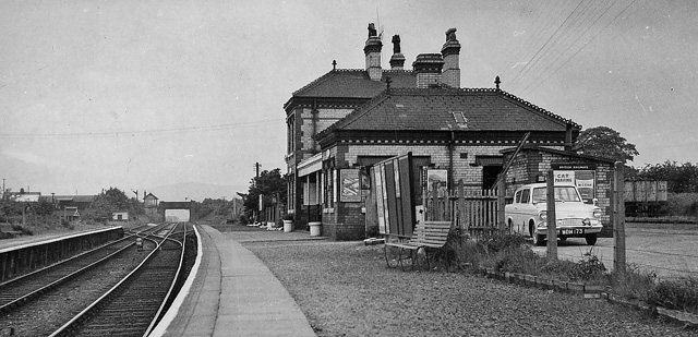
The Buckley Railway was opened from Buckley to a connection with the Chester to Holyhead main line on 7 June 1862, to convey coal and finished brickworks products from the Buckley area. Numerous short tramroads had existed in the area from the 1700s. The line was steeply graded (1 in 28 between Northop Hall and Connah's Quay) and sharply curved. The Wrexham, Mold and Connah's Quay Railway (WM&CQR) was incorporated in 1862 to build a line from Wrexham to Buckley, continuing to the C&HR main line via the Buckley Railway, which it joined at Ashton's Branch Junction. It later bought the Buckley Railway. The WM&CQR had plans for extensions but was unable to raise money to bring all of them into being. Short branches to mineral workings around Brymbo were opened. The WM&CQR allied itself with the Manchester, Sheffield and Lincolnshire Railway (later the Great Central Railway) which provided the finance to cross the River Dee and connect to Chester and its own system over the Chesh ... [...More Info...] [...Related Items...] OR: [Wikipedia] [Google] [Baidu] |
Mold Railway
The Mold Railway was a railway company that built a line in north-east Wales. The line linked Mold to Chester and it opened on 14 August 1849. The company built a mineral branch line to Ffrith, opened in November 1849. Mold itself was an important regional centre, and contained considerable mineral resources. The London and North Western Railway took over the company in 1859. As the mineral industry developed, steelmaking at Brymbo became dominant, and the LNWR arranged with the Great Western Railway to connect to that place. The passenger service closed in 1962, and in 1972 all rail activity ceased except for serving the Synthite factory just north of Mold; total closure followed in 1983. Formation The Chester and Holyhead Railway opened its route in 1848 as far as Bangor, and throughout in 1850.Peter E Baughan, ''A Regional History of the Railways of Great Britain: 14: North and Mid Wales'', David St John Thomas, Nairn, 1991, , pages 22 and 24 Its promoters saw the Irish ... [...More Info...] [...Related Items...] OR: [Wikipedia] [Google] [Baidu] |
Wrexham And Minera Railway
The Wrexham and Minera Railway or Wrexham and Minera Branch was a railway line in North Wales between the city of Wrexham, the village of Brymbo where it served the Brymbo Steelworks, and the lead mines and limeworks at Minera. A further branch ran from Brymbo to Coed Talon, where it connected with lines to Mold. The system was constructed in several stages between 1844 and 1872, while the various lines making up the system closed in 1952, 1972 and 1982. A directly competing route to Brymbo was opened by the Wrexham, Mold and Connah's Quay Railway in the 1880s. It closed in stages between 1954 and 1970. History The railway was one of several constructed to serve the intensive quarrying, mining and iron founding operations in the area west of Wrexham, which were undergoing considerable expansion in the mid 19th century thanks to exploitation of the underlying Middle Coal Measures. Construction The section of line between Brymbo and Minera had originally been part of the for ... [...More Info...] [...Related Items...] OR: [Wikipedia] [Google] [Baidu] |
Hawarden Bridge, Hawarden Bridge Railway Station (geograph 4032396)
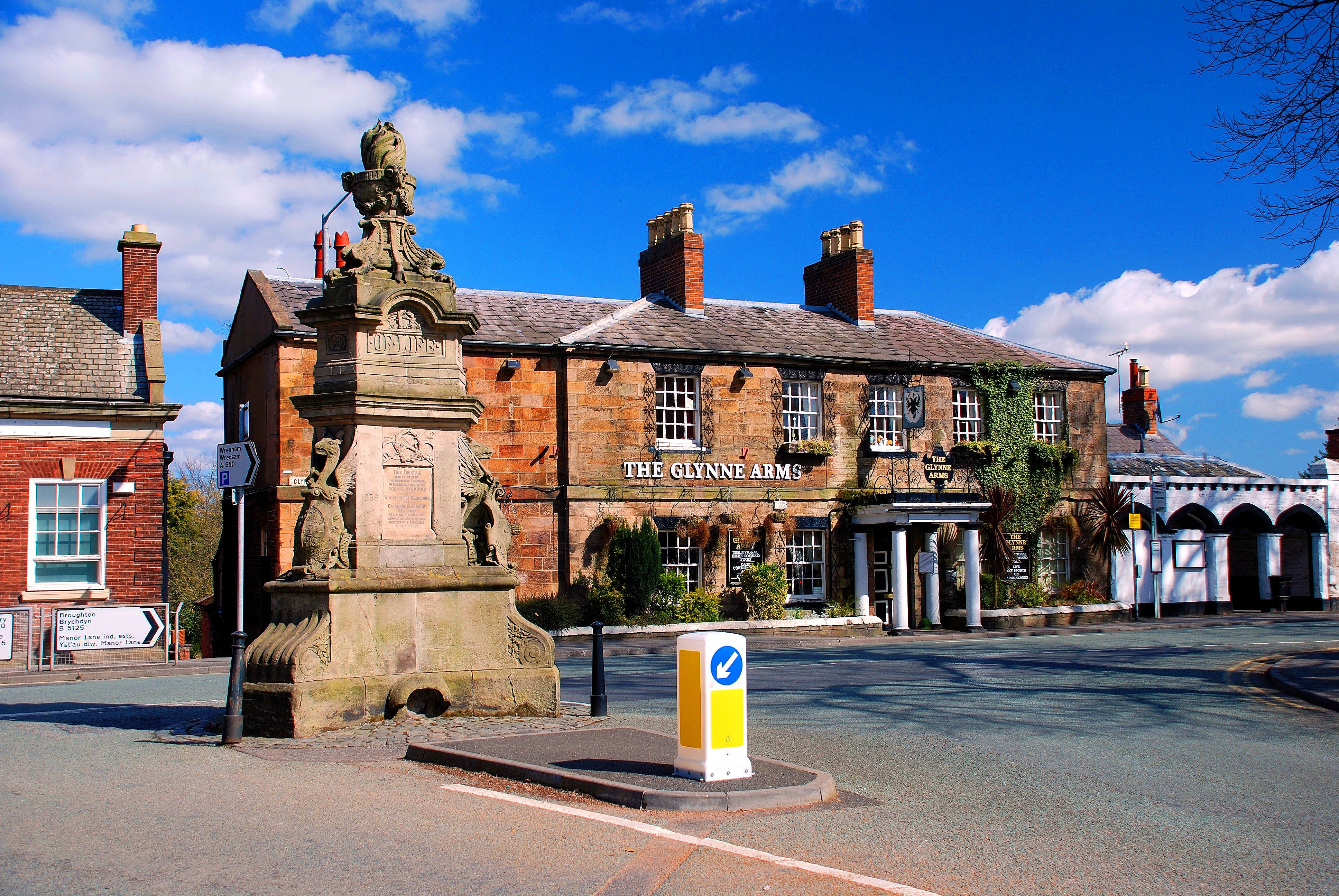
Hawarden (; cy, Penarlâg) is a village, community and electoral ward in Flintshire, Wales. It is part of the Deeside conurbation on the Wales-England border and is home to Hawarden Castle. In the 2011 census the ward of the same name had a population of 1,887, whereas the community of the same name, which also includes Ewloe (which also has a castle) Mancot and Aston had a population of 13,920. The scenic wooded Hawarden Park abuts the clustered settlement in the south. Hawarden Bridge consists of distribution and industrial business premises beyond Shotton/ Queensferry and the Dee. The west of the main street is called The Highway, its start marked by the crossroads with a fountain in the middle, near which are public houses, some with restaurants. The large village is west and north-west of England and is from Chester. In 2014 it was named in ''The Sunday Times'' annual Best Places To Live List. The highest temperature in Wales was recorded in Hawarden on 18 Jul ... [...More Info...] [...Related Items...] OR: [Wikipedia] [Google] [Baidu] |
Buckley Junction Station 1932832 14cdd1b9
Buckley may refer to: Businesses and organizations * Buckley's, a Canadian pharmaceutical corporation * Buckley Aircraft, an American aircraft manufacturer * Buckley Broadcasting, an American broadcasting company * Buckley School (California), U.S. * Buckley School (New York City), U.S. * Buckley Country Day School, Roslyn, New York, U.S. Places Antarctica * Buckley Bay (Antarctica) Australia * Buckley, Victoria * Buckley River Important Bird Area, Queensland Canada * Buckley Bay, British Columbia, Canada ** Buckley Bay station United Kingdom * Buckley, Greater Manchester, England * Buckley, Flintshire, Wales United States * Buckley, Illinois * Buckley, Michigan * Buckley Creek, a river in Nebraska * Buckley, Washington * Buckley Island, an island on the Ohio River in West Virginia People * Buckley Belanger (born 1960), Canadian politician in Saskatchewan * Buckley Machin (1901–1963), Australian politician * Buckley Roderick (1862–1908), Welsh solici ... [...More Info...] [...Related Items...] OR: [Wikipedia] [Google] [Baidu] |
Wrexham Central Railway Station
, symbol_location = gb , symbol = rail , image = Wrexham Central station (2).JPG , borough = Wrexham, Wrexham , country = Wales , coordinates = , grid_name = Grid reference , grid_position = , manager = Transport for Wales , platforms = 1 , code = WXC , classification = DfT category F1 , original = Wrexham, Mold and Connah's Quay Railway , pregroup = Great Central Railway , postgroup = London and North Eastern Railway , years = 1 November 1887 , events = Original station opened , years1 = 2 November 1895 , events1 = Route to Ellesmere opened , years2 = 10 September 1962 , events2 = Route to Ellesmere closed , years3 = 23 November 1998 , events3 = Station resited , mpassengers = , footnotes ... [...More Info...] [...Related Items...] OR: [Wikipedia] [Google] [Baidu] |
Shotton, Flintshire
Shotton is a town and community in Flintshire, Wales, within the Deeside conurbation along the River Dee, joined with Connah's Quay, near the border with England. It is located 5 miles (8 km) west of Chester and can be reached by road from the A548. In the 2011 census Shotton had a population of 6,663. The Ordnance Survey Grid Reference is SJ305685. Etymologies The town's name is first recorded in Old English as ''Cyllingas''. This name derives from the Welsh language word Celyn (meaning Holly) and has persisted in one form or another throughout the town's history. By 1822 Richard Willett recorded the name as ''Kyllins'', which he says contains "one of the parish's most notable ancient houses". Even today, ''Killin's Farm'' and ''Killin's Lane'' may still be found in the oldest part of town. The town's modern English name is shared with three other towns in Britain. These towns (all on the English side of the Scottish border) derive their names from ''Town of Scots'' ... [...More Info...] [...Related Items...] OR: [Wikipedia] [Google] [Baidu] |
Whitchurch, Shropshire
Whitchurch is a market town in the north of Shropshire, England. It lies east of the Welsh border, 2 miles south of the Cheshire border, north of the county town of Shrewsbury, south of Chester, and east of Wrexham. At the 2011 Census, the population of the town was 9,781. Whitchurch is the oldest continuously inhabited town in Shropshire. Notable people who have lived in Whitchurch include the composer Sir Edward German, and illustrator Randolph Caldecott. History Early times There is evidence from various discovered artefacts that people lived in this area about 3,000 BC. Flakes of flint from the Neolithic era were found in nearby Dearnford Farm. Roman times Originally a settlement founded by the Romans about AD 52–70 called Mediolanum ( "Midfield" or "Middle of the Plain"), it stood on a major Roman road between Chester and Wroxeter. It was listed on the Antonine Itinerary but is not the Mediolanum of Ptolemy's ''Geography'', which was in central Wales. Lo ... [...More Info...] [...Related Items...] OR: [Wikipedia] [Google] [Baidu] |
Board Of Trade
The Board of Trade is a British government body concerned with commerce and industry, currently within the Department for International Trade. Its full title is The Lords of the Committee of the Privy Council appointed for the consideration of all matters relating to Trade and Foreign Plantations, but is commonly known as the Board of Trade, and formerly known as the Lords of Trade and Plantations or Lords of Trade, and it has been a committee of the Privy Council of the United Kingdom. The board has gone through several evolutions, beginning with extensive involvement in colonial matters in the 17th century, to powerful regulatory functions in the Victorian Era and early 20th century. It was virtually dormant in the last third of 20th century. In 2017, it was revitalised as an advisory board headed by the International Trade Secretary who has nominally held the title of President of the Board of Trade, and who at present is the only privy counsellor of the board, the other m ... [...More Info...] [...Related Items...] OR: [Wikipedia] [Google] [Baidu] |
Mold, Flintshire
Mold ( cy, Yr Wyddgrug) is a town and community in Flintshire, Wales, on the River Alyn. It is the county town and administrative seat of Flintshire County Council, as it was of Clwyd from 1974 to 1996. According to the 2011 UK Census, it had a population of 10,058. A 2019 estimate puts it at 10,123. Origin of the name The original Welsh-language place name, ''Yr Wyddgrug'' was recorded as ''Gythe Gruc'' in a document of 1280–1281, and means "The Mound of the Tomb/Sepulchre". The name "Mold" originates from the Norman-French ''mont-hault'' ("high hill"). The name was originally applied to the site of Mold Castle in connection with its builder Robert de Montalt, an Anglo-Norman lord. It is recorded as ''Mohald'' in a document of 1254. History A mile west of the town is Maes Garmon, ("The Field of Germanus"), the traditional site of the "Alleluia Victory" by a force of Romano-Britons led by Germanus of Auxerre against the invading Picts and Scots, which occurred shortly a ... [...More Info...] [...Related Items...] OR: [Wikipedia] [Google] [Baidu] |
Penyffordd
Penyffordd is a village, community and electoral ward in Flintshire, Wales, situated to the south east of Buckley and to the west of Chester. The name is derived from the Welsh ''Pen Y Ffordd'' – roughly translated as "the highest or furthest point of the road". The resident population of Penyffordd, as measured in the 2001 Census, was 3,715, increasing to 3,874 at the 2011 census. Penyffordd lies to the east of A550, south of its junction with the A55 (North Wales Expressway). The ward consists of the neighbouring villages of Penyffordd and Penymynydd, which are a ribbon development along the line of the former major road. There's also a zebra crossing which has been instated because former resident Adam Livingstone was hit by a car there. A hamlet named Pen-y-ffordd is also in Flintshire, Wales. It is located between Holywell and Prestatyn, near Mostyn. Community Local amenities and landmarks include a village hall and war memorial. Penyffordd has its own Village ... [...More Info...] [...Related Items...] OR: [Wikipedia] [Google] [Baidu] |


.jpg)