|
Witherslack
Witherslack is a small village and former civil parish, now in the parish of Witherslack, Meathop and Ulpha, in the south of Cumbria. It lies on the north eastern side of Morecambe Bay, England. The eastern side of the village borders Whitbarrow Scar with Yewbarrow, which is a small limestone hill, located in the centre of the village. In the 2001 census the former parish had a population of 482, increasing at the 2011 census to 499. Witherslack is quite scattered with four distinct areas. Townend, Mill Side, Beck Head and the school/church. Townend is traditionally considered the centre of the village and contains the local pub, The Derby Arms, and the Community Shop. Mill Side is the location of the old Mill and still contains the mill pond. Beck Head lies to the north of Mill Side and is where a small river emerges from the limestone escarpment adjacent to Whitbarrow. The area of the village with the Dean Barwick School and St. Paul's church lies to the west of Yewbarrow ... [...More Info...] [...Related Items...] OR: [Wikipedia] [Google] [Baidu] |
Listed Buildings In Witherslack
Witherslack is a former civil parish, now in the parish of Witherslack, Meathop and Ulpha, in the South Lakeland district of Cumbria, England. It contained 15 listed buildings that are recorded in the National Heritage List for England. Of these, one is listed at Grade II*, the middle of the three grades, and the others are at Grade II, the lowest grade. The parish is in the Lake District National Park, it is mainly rural, and contains the village of Witherslack and the surrounding countryside. The listed buildings consist of farmhouses, farm buildings, houses and associated structures, a church with items in the churchyard, a bridge, a war memorial, and two limekiln A lime kiln is a kiln used for the calcination of limestone ( calcium carbonate) to produce the form of lime called quicklime (calcium oxide). The chemical equation for this reaction is : CaCO3 + heat → CaO + CO2 This reaction can take pla ...s. __NOTOC__ Key Buildings References Citation ... [...More Info...] [...Related Items...] OR: [Wikipedia] [Google] [Baidu] |
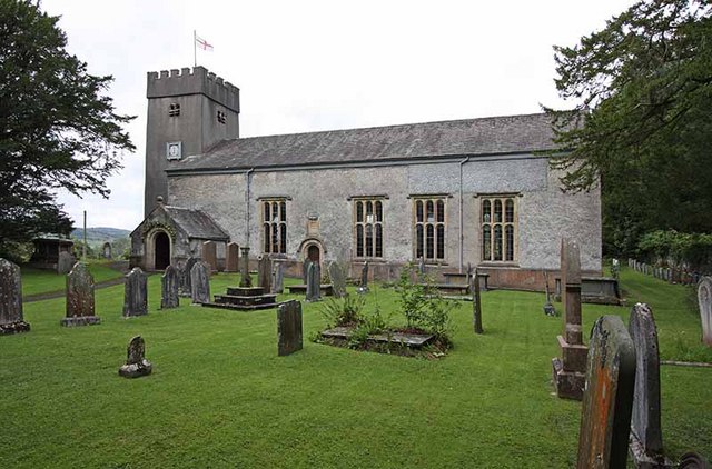
Witherslack Church
Witherslack is a small village and former civil parish, now in the parish of Witherslack, Meathop and Ulpha, in the south of Cumbria. It lies on the north eastern side of Morecambe Bay, England. The eastern side of the village borders Whitbarrow Scar with Yewbarrow, which is a small limestone hill, located in the centre of the village. In the 2001 census the former parish had a population of 482, increasing at the 2011 census to 499. Witherslack is quite scattered with four distinct areas. Townend, Mill Side, Beck Head and the school/church. Townend is traditionally considered the centre of the village and contains the local pub, The Derby Arms, and the Community Shop. Mill Side is the location of the old Mill and still contains the mill pond. Beck Head lies to the north of Mill Side and is where a small river emerges from the limestone escarpment adjacent to Whitbarrow. The area of the village with the Dean Barwick School and St. Paul's church lies to the west of Yewbarrow ... [...More Info...] [...Related Items...] OR: [Wikipedia] [Google] [Baidu] |
St Paul's Church, Witherslack
St Paul's Church is in the village of Witherslack, Cumbria, England. It is an active Anglican parish church in the deanery of Kendal, the archdeaconry of Westmorland and Furness, and the diocese of Carlisle. It is recorded in the National Heritage List for England as a designated Grade II* listed building. The authors of the ''Buildings of England'' series describe it as "an almost perfect example of a plain Gothic church of that date, honest and unpretentious". History The church was built between 1668 and 1669. It resulted from a bequest made by John Barwick, dean of St Paul's Cathedral, who died in 1664, to provide a burial place in the village of his birth, rather than the dead having to be carried across the tidal estuary of the river Kent for burial at St Michael's Church in Beetham. There had previously been a church in the village dedicated to Saint Mary, but this was ruined in the Civil War. John Barwick's brother, Peter, who was physician to Charles II ... [...More Info...] [...Related Items...] OR: [Wikipedia] [Google] [Baidu] |
Oversands School
Oversands School (formerly Witherslack Hall School) is an independent special school with specialist SEN status situated in the village of Witherslack near Grange-over-Sands, Cumbria, England. It was opened in 1973 as a residential and day school for boys aged 11–19 with special educational needs, including complex learning, communication, behavioural, emotional and social difficulties. The school has now been renamed to Oversands School and is a coeducational school for pupils aged 8 to 19. Witherslack Hall The school's central building, Witherslack Hall, was built in 1874 by Lancaster architects Paley and Austin and is recorded in the National Heritage List for England as a designated Grade II listed building. It gave its name to a steam locomotive in the GWR Modified Hall Class, 6990 Witherslack Hall. See also *Listed buildings in Witherslack *List of non-ecclesiastical works by Paley and Austin Paley and Austin were the surnames of two architects working fro ... [...More Info...] [...Related Items...] OR: [Wikipedia] [Google] [Baidu] |
Witherslack, Meathop And Ulpha
Witherslack, Meathop and Ulpha is a civil parish in the South Lakeland district of the English county of Cumbria. Historically in Westmorland, it is located north east of Grange-over-Sands and south west of Kendal, between the confluence of the River Kent estuary and the River Winster. It was created following the amalgamation of former civil parishes Witherslack and Meathop and Ulpha on 1 April 2015. In 2011 there was a total population of 653. It includes the villages of Witherslack and Meathop. See also *Listed buildings in Meathop and Ulpha *Listed buildings in Witherslack Witherslack is a former civil parish, now in the parish of Witherslack, Meathop and Ulpha, in the South Lakeland district of Cumbria, England. It contained 15 listed buildings that are recorded in the National Heritage List for England. Of these ... References External links Cumbria County History Trust: Witherslack(nb: provisional research only – see Talk page) Cumbria County History Trust: Me ... [...More Info...] [...Related Items...] OR: [Wikipedia] [Google] [Baidu] |
Meathop And Ulpha
Meathop and Ulpha is a former civil parish, now in the parish of Witherslack, Meathop and Ulpha, in the South Lakeland district of the English county of Cumbria. Historically in Westmorland, it is located north east of Grange-over-Sands, south west of Kendal and south of Carlisle, between the confluence of the River Kent estuary and the River Winster. In 2001 it had a population of 143, increasing slightly to 154 at the Census 2011. It included the village of Meathop. There were two Sites of Special Scientific Interest in the parish: * Meathop Moss is a raised peat-bog designated an SSSI for its biological interest. Leased by the Society for the Promotion of Nature Reserves in 1919, it now belongs to the Cumbria Wildlife Trust. * Meathop Woods and Quarry, which consists of woodland and a disused quarry on the side of a hill, has biological and geological interest. History Meathop and Ulpha was formerly a township in Beetham parish, from 1866 Meathop and Ulpha was a civil ... [...More Info...] [...Related Items...] OR: [Wikipedia] [Google] [Baidu] |
Whitbarrow
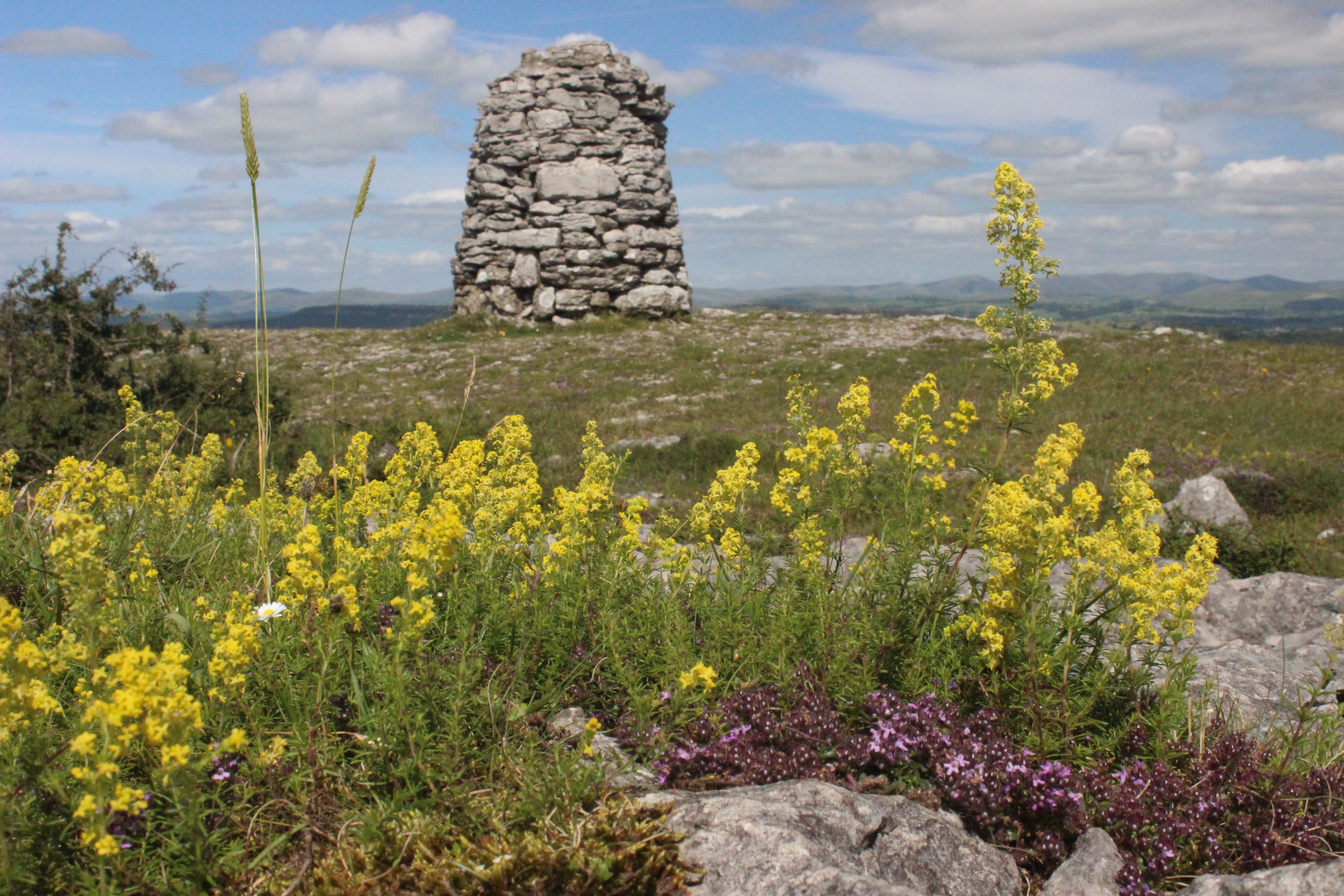
Whitbarrow is a hill in Cumbria, England. Designated a biological Site of Special Scientific Interest and national nature reserve, it forms part of the Morecambe Bay Pavements Special Area of Conservation due to its supporting some of the best European examples of natural limestone habitats. Also known as Whitbarrow Scar (though properly that term applies to the cliffs lining its western edge), the hill lies about south-west of Kendal, just north of the A590 road, close to the village of Witherslack. Part of the site is a local nature reserve called Whitbarrow Scar. It is a mixture of woodland, grassland and limestone pavement. The hill is prominent from the A590 road with its steep limestone cliffs, laid down in the Carboniferous period some 350 million years ago. The main cliff faces are made up of rocks known as Dalton Beds, above which are Urswick Limestones, of which the limestone pavement (here and elsewhere around Morecambe Bay, including Hutton Roof Crags) has been fo ... [...More Info...] [...Related Items...] OR: [Wikipedia] [Google] [Baidu] |
Witherslack Mosses
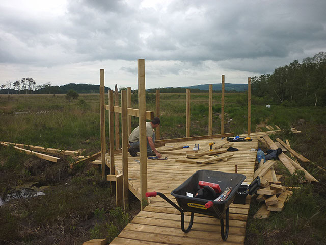
Witherslack Mosses are a fragmented wetland west of the Kent estuary in Cumbria, England, within the Lake District National Park. They consist of three raised bogs, the remnants of a formerly extensive, estuarine bog, which have been protected under the Habitats Directive as a Special Area of Conservation. * Foulshaw Moss, with an area of 350 ha, the largest of the three.Foulshaw Moss Cumbria Wildlife Trust. Retrieved November 2013 *, 82 ha, *Nichols Moss, 7 haNichols Moss Cumbria Wildlife Trust. Re ... [...More Info...] [...Related Items...] OR: [Wikipedia] [Google] [Baidu] |
Meathop
Meathop is a village in the South Lakeland district of Cumbria, England. Historically in Westmorland, it is located north east of Grange over Sands, between the confluence of the River Kent estuary and the River Winster on the edge of Morecambe Bay. Westmorland Sanatorium, later known as Meathop Hospital, was a sanatorium for patients with tuberculosis. It opened in 1891 and closed in 1991 when it was converted into apartments and renamed as Meathop Grange. See also *Listed buildings in Meathop and Ulpha Meathop and Ulpha is a former civil parish, now in the parish of Witherslack, Meathop and Ulpha, in the South Lakeland district of Cumbria, England. It contained four listed buildings that are recorded in the National Heritage List for England ... References External links A Vision of Britain Through TimeBritish History OnlineBritish Listed BuildingsGenukiGeograph Villages in Cumbria South Lakeland District Tuberculosis sanatoria in the United Kingdom {{Cum ... [...More Info...] [...Related Items...] OR: [Wikipedia] [Google] [Baidu] |
Chapelry
A chapelry was a subdivision of an ecclesiastical parish in England and parts of Lowland Scotland up to the mid 19th century. Status It had a similar status to a township but was so named as it had a chapel of ease (chapel) which was the community's official place of worship in religious and secular matters, and the fusion of these matters — principally tithes — initially heavily tied to the main parish church. The church's medieval doctrine of subsidiarity when the congregation or sponsor was wealthy enough supported their constitution into new parishes. Such chapelries were first widespread in northern England and in largest parishes across the country which had populous outlying places. Except in cities the entire coverage of the parishes (with very rare extra-parochial areas) was fixed in medieval times by reference to a large or influential manor or a set of manors. A lord of the manor or other patron of an area, often the Diocese, would for prestige and public ... [...More Info...] [...Related Items...] OR: [Wikipedia] [Google] [Baidu] |
Villages In Cumbria
A village is a clustered human settlement or community, larger than a hamlet but smaller than a town (although the word is often used to describe both hamlets and smaller towns), with a population typically ranging from a few hundred to a few thousand. Though villages are often located in rural areas, the term urban village is also applied to certain urban neighborhoods. Villages are normally permanent, with fixed dwellings; however, transient villages can occur. Further, the dwellings of a village are fairly close to one another, not scattered broadly over the landscape, as a dispersed settlement. In the past, villages were a usual form of community for societies that practice subsistence agriculture, and also for some non-agricultural societies. In Great Britain, a hamlet earned the right to be called a village when it built a church. [...More Info...] [...Related Items...] OR: [Wikipedia] [Google] [Baidu] |
Lindale, Cumbria
Lindale - traditionally Lindale in Cartmel - is a village in the south of Cumbria. It lies on the north-eastern side of Morecambe Bay, England. It was part of Lancashire from 1182 to 1974. It is in the civil parish of Lindale and Newton-in-Cartmel, in South Lakeland district. History Lindale's most famous resident was John "Iron-Mad" Wilkinson, an ironworker and inventor who lived in the village from 1750, where he owned the Castle Head estate. He produced the iron for and helped design the world's first iron bridge (at Ironbridge and Broseley) and he made the world's first iron boat in 1787. A large iron obelisk stands in the village as memorial to him. Traditionally a farming village, Lindale's proximity to the A590 road has seen a growth in the number of commuters who live there. It is also a centre for car showrooms. The local tourist boom has largely missed Lindale, with nearby Grange-over-Sands developing into a seaside resort, and villages to the north and west (such as ... [...More Info...] [...Related Items...] OR: [Wikipedia] [Google] [Baidu] |


