|
Wisconsin Highway 136
State Trunk Highway 136 (often called Highway 136, STH-136 or WIS 136) is a state highway in the U.S. state of Wisconsin. It runs east–west in southwest Wisconsin from near Reedsburg to Baraboo. The route was first designated in 1917 but not as WIS 136 until 1935. The route was extended in 2017. Route description The highway begins at an intersection with WIS 23/ WIS 33 east of Reedsburg. From there, it runs south along Copper Creek. Where Copper Creek drains into the Baraboo River, the highway follows the river in a southeasterly direction to Rock Springs, where it intersects WIS 154 and County Trunk Highway DD (CTH-DD). The highway then runs north of the Baraboo River in an easterly direction from Rock Springs. It intersects CTH-I and continues east and then starts running along Linn Street into West Baraboo. It intersects US 12, where it starts running concurrently with WIS 33 until the concurrency ends at Pine Street, on which it runs sou ... [...More Info...] [...Related Items...] OR: [Wikipedia] [Google] [Baidu] |
Reedsburg, Wisconsin
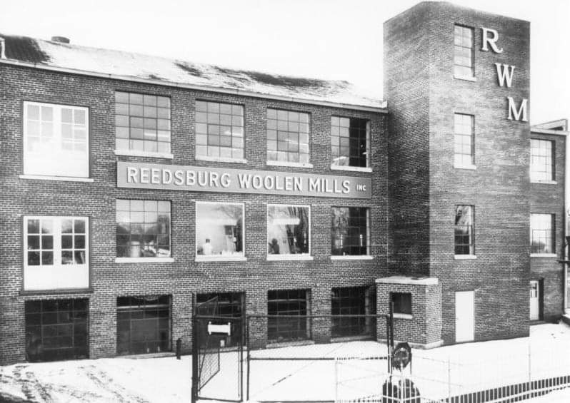
Reedsburg is a city in Sauk County, Wisconsin, United States. Located along the Baraboo River, it was founded in 1868, and was named for early settler David C. Reed. The city is surrounded by the Town of Reedsburg. It is part of the Baraboo Micropolitan Statistical Area. History Early settlement Early settlers came to this area due to the abundance of natural resources, especially lumber. In 1844, the first copper mine was established in this area, but it was soon abandoned. James W. Babb and his wife Rebecca Scarff Babb are the earliest recorded settlers, having brought their family to Wisconsin from Ohio in 1845. At a place 55 miles northeast of Mineral Point (the capital of Wisconsin Territory), long identified by the Winnebago who inhabited these lands as a convenient place to cross the Baraboo River, Babb left a flat-bottomed boat to help move supplies. At "Babb's Ford," in 1847 David C. Reed built a dam and a shanty to house the workers who constructed it. In Jun ... [...More Info...] [...Related Items...] OR: [Wikipedia] [Google] [Baidu] |
West Baraboo, Wisconsin
West Baraboo is a village along the Baraboo River in Sauk County, Wisconsin, United States. The population was 1,627 at the 2020 census. It is part of the Baraboo micropolitan statistical area. West Baraboo was previously known as Lyons.Sauk County Historical Society. ''Baraboo''. Arcadia Publishing, 2017. , 9781467125109. p83 Geography West Baraboo is located at (43.475972, -89.765390). According to the United States Census Bureau, the village has a total area of , of which, of it is land and is water. Demographics 2010 census As of the census of 2010, there were 1,414 people, 595 households, and 365 families living in the village. The population density was . There were 638 housing units at an average density of . The racial makeup of the village was 92.8% White, 1.1% African American, 1.9% Native American, 1.6% Asian, 1.3% from other races, and 1.4% from two or more races. Hispanic or Latino of any race were 5.0% of the population. There were 595 households, of which ... [...More Info...] [...Related Items...] OR: [Wikipedia] [Google] [Baidu] |
Wisconsin Highway 123
State Trunk Highway 123 (often called Highway 123, STH-123 or WIS 123) is a former short state highway in the U.S. state of Wisconsin. It ran north–south in south central Wisconsin from the entrance to Devil's Lake State Park to Baraboo. It was phased out in June 2016 and turned over to local jurisdictions and County DL was extended. Route description Starting at the entrance of Devil's Lake State Park, WIS 123 briefly traveled northeastward. Then, after it began to travel northward, it intersected WIS 159 (now WIS 136). It continued to travel northward towards downtown Baraboo via present-day CTH-DL, Walnut Street, and Parkway. Then, it began to run concurrently with Bus. US 12 for the rest of the route. After that, they ran along South Boulevard for a short distance. After crossing above the Baraboo River, they began to run concurrently with WIS 113. The three then continued north as Broadway before all but Bus. US 12 ended at WIS 33. Histo ... [...More Info...] [...Related Items...] OR: [Wikipedia] [Google] [Baidu] |
Prairie Du Sac, Wisconsin
Prairie du Sac is a village in Sauk County, Wisconsin, United States. The population was 4,420 at the 2020 census. The village is surrounded by the Town of Prairie du Sac, the Wisconsin River, and the village of Sauk City; together, Prairie du Sac and Sauk City are referred to as Sauk Prairie. History Prairie du Sac was so named because it was in the large Wisconsin River Valley where the Sauk Indians had a large settlement. Although the name of the village dates from the early days of French fur traders, Prairie du Sac was established as a village by D.B. Crocker in 1840, largely as a Yankee-English village, in contrast to its neighbor, Sauk City, which was settled largely by Germans. The hydroelectric Prairie du Sac Dam was completed just north of the village in 1914, creating Lake Wisconsin. Geography Prairie du Sac is located at (43.289833, -89.728524). According to the United States Census Bureau, the village has a total area of , of which, of it is land and is water ... [...More Info...] [...Related Items...] OR: [Wikipedia] [Google] [Baidu] |
North Freedom, Wisconsin
North Freedom is a village along the Baraboo River in Sauk County, Wisconsin, United States. The population was 701 at the 2010 census. History North Freedom was named from the American ideal of freedom. Geography North Freedom is located at (43.460843, -89.865862). According to the United States Census Bureau, the village has a total area of , of which, of it is land and is water. Demographics 2010 census As of the census of 2010, there were 701 people, 271 households, and 176 families living in the village. The population density was . There were 293 housing units at an average density of . The racial makeup of the village was 97.1% White, 0.1% African American, 0.3% Native American, 0.4% Asian, 0.9% from other races, and 1.1% from two or more races. Hispanic or Latino of any race were 2.6% of the population. There were 271 households, of which 35.8% had children under the age of 18 living with them, 46.5% were married couples living together, 11.4% had a female ... [...More Info...] [...Related Items...] OR: [Wikipedia] [Google] [Baidu] |
Devil's Lake State Park (Wisconsin)
Devil's Lake State Park is a state park located in the Baraboo Range in eastern Sauk County, just south of Baraboo, Wisconsin. It is around thirty-five miles northwest of Madison, and is on the western edge of the last ice-sheet deposited during the Wisconsin glaciation. The state park encompasses , making it the largest in Wisconsin. The state park is known for its quartzite bluffs along the Devil's Lake, which was created by a glacier depositing terminal moraines that plugged the north and south ends of the gap in the bluffs during the last ice age approximately 12,000 years ago. The sand at the bottom of Devil's Lake is thought to be deposited by glaciers. There are many quartzite rock formations, such as Balanced Rock and Devil's Doorway, throughout the park. Effigy mounds are also located throughout the park. The park contains approximately eleven miles of the Ice Age Trail. Its scenic beauty, along with its proximity to the Wisconsin Dells, has made it one of the most ... [...More Info...] [...Related Items...] OR: [Wikipedia] [Google] [Baidu] |
Concurrency (road)
A concurrency in a road network is an instance of one physical roadway bearing two or more different route numbers. When two roadways share the same right-of-way, it is sometimes called a common section or commons. Other terminology for a concurrency includes overlap, coincidence, duplex (two concurrent routes), triplex (three concurrent routes), multiplex (any number of concurrent routes), dual routing or triple routing. Concurrent numbering can become very common in jurisdictions that allow it. Where multiple routes must pass between a single mountain crossing or over a bridge, or through a major city, it is often economically and practically advantageous for them all to be accommodated on a single physical roadway. In some jurisdictions, however, concurrent numbering is avoided by posting only one route number on highway signs; these routes disappear at the start of the concurrency and reappear when it ends. However, any route that becomes unsigned in the middle of the concurren ... [...More Info...] [...Related Items...] OR: [Wikipedia] [Google] [Baidu] |
Wisconsin Highway 154
State Trunk Highway 154 (often called Highway 154, STH-154 or WIS 154) is a state highway in the U.S. state of Wisconsin. It runs in east–west in south-central Wisconsin from near Loyd to Rock Springs. Route description The highway begins at its intersection with Wisconsin Highway 58 north of the community of Neptune and follows a northeasterly path from it. After a short concurrency with County Highway G, it passes through Hill Point and continues east until it reaches Loganville. In Loganville, the highway becomes concurrent with Highway 23 and heads northwards. After 3.5 miles, the concurrency ends and the highway heads eastwards, passing through Wiedman Memorial Park and intersections with county highways CH and D before terminating in Rock Springs at its intersection with Highway 136 and County Highway DD. Major intersections See also * References External links * 154 Year 154 ( CLIV) was a common year starting on Monday (link will display ... [...More Info...] [...Related Items...] OR: [Wikipedia] [Google] [Baidu] |
Baraboo, Wisconsin
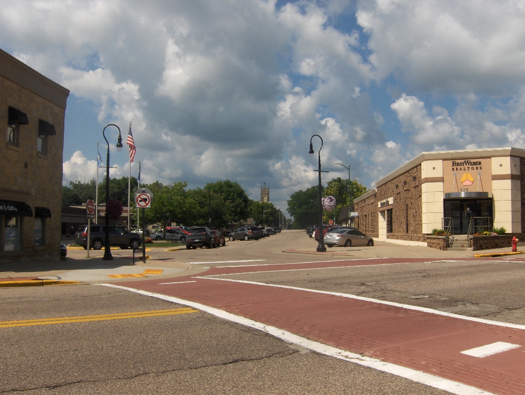
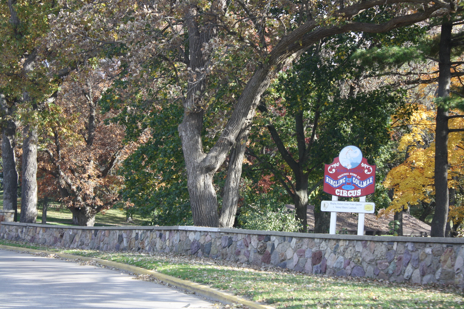
Baraboo is a city in the Midwest and the county seat of Sauk County, Wisconsin, United States. The largest city in the county, Baraboo is the principal city of the Baraboo Micropolitan Statistical Area. Its 2020 population was 12,556. It is situated on the Baraboo River. Baraboo is home to the Circus World Museum, the former headquarters and winter home of the Ringling brothers circus. The Al. Ringling Theatre is an active landmark in the city. Baraboo is also near Devil's Lake State Park, and Aldo Leopold's Shack and Farm. History Early settlement The area around Baraboo was the site of a Kickapoo village as early as 1665. The current community was established by Abe Wood in 1838, and was originally known as the village of Adams. In 1839 several settlers arrived and started building cabins, and a saw mill. In 1846 it became the county seat of Sauk County after a fierce fight with the nearby village of Reedsburg. In 1852, the village was renamed "Baraboo", after the nea ... [...More Info...] [...Related Items...] OR: [Wikipedia] [Google] [Baidu] |
Rock Springs, Wisconsin
Rock Springs is a village in Sauk County, Wisconsin, United States, along the Baraboo River. The population was 362 at the 2010 census. History At the time of its founding, Rock Springs was known as Ableman, after Stephen Van Rensselaer Ableman, who settled there in 1851. The railroad has been a major influence on the village's growth. Surrounded by cliffs of Baraboo Quartzite, the village is two miles south of a notable rock formation located in Ableman Gorge, Van Hise Rock, which was used to explain the processes of structural geology by University of Wisconsin–Madison professor Charles R. Van Hise. Geography Rock Springs is located at (43.477698, −89.917030). According to the United States Census Bureau, the village has a total area of , of which, of it is land and is water. Demographics 2010 census As of the census of 2010, there were 362 people, 137 households, and 99 families living in the village. The population density was . There were 150 housing units at ... [...More Info...] [...Related Items...] OR: [Wikipedia] [Google] [Baidu] |
Baraboo River
The Baraboo River is a tributary of the Wisconsin River, about 70 mi (115 km) long, in south-central Wisconsin in the United States. Via the Wisconsin River, it is part of the watershed of the Mississippi River. The Baraboo River was probably named after a French trader in the area, Francois Barbeau, although it may also be a corruption of a French word or phrase. Course The Baraboo River rises in southeastern Monroe County and flows generally southeastwardly through Juneau, Sauk and Columbia Counties, past Kendall, Elroy, Union Center, Wonewoc, La Valle, Reedsburg, Rock Springs, North Freedom, West Baraboo and Baraboo. It flows into the Wisconsin River from the west, about 3 mi (5 km) south of Portage. In its upper course above Elroy, the river is paralleled by the Elroy-Sparta Bike Trail. Tributaries *At Union Center, the river collects the West Branch Baraboo River, which rises in eastern Vernon County and flows generally eastwardly past Hi ... [...More Info...] [...Related Items...] OR: [Wikipedia] [Google] [Baidu] |


