|
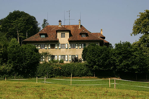
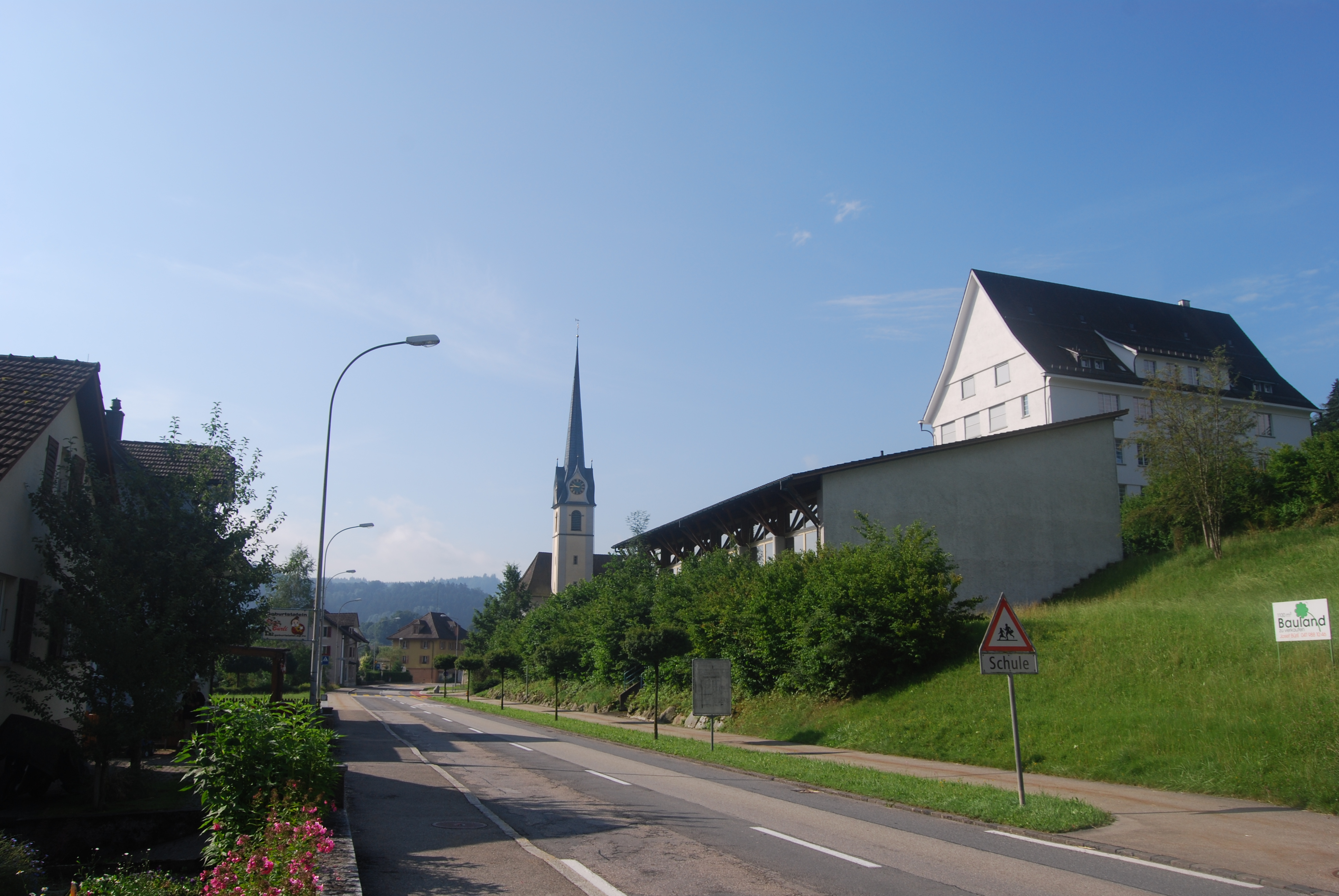
Willisau
Willisau is a municipality in the district of Willisau in the Lucerne canton of Switzerland. It was formed on 1 January 2006 from the municipalities of Willisau Land (W. Country) and Willisau Stadt (W. Town).Amtliches Gemeindeverzeichnis der Schweiz published by the Swiss Federal Statistical Office accessed 19 July 2011 On 1 January 2021 the former municipality of merged into Willisau. History Foundation There were settlements near Willisau by t ...[...More Info...] [...Related Items...] OR: [Wikipedia] [Google] [Baidu] |
Hergiswil Bei Willisau
Hergiswil bei Willisau is a municipality in the district of Willisau in the canton of Lucerne in Switzerland. History Hergiswil bei Willisau is first mentioned in 1246 as ''de Hergosswile''. Geography Hergiswil bei Willisau has an area, , of . Of this area, 59.3% is used for agricultural purposes, while 36.6% is forested. Of the rest of the land, 3.5% is settled (buildings or roads) and the remainder (0.5%) is non-productive (rivers, glaciers or mountains). , 36.66% of the total land area was forested. Of the agricultural land, 56.84% is used for farming or pastures, while 2.42% is used for orchards or vine crops. Of the settled areas, 1.72% is covered with buildings, 0.06% is industrial, 0.19% is classed as special developments, 0.1% is parks or greenbelts and 1.47% is transportation infrastructure. Of the unproductive areas, 0.19% is unproductive flowing water (rivers) and 0.35% is other unproductive land. The municipality is located in the upper valley of the ''Enzi ... [...More Info...] [...Related Items...] OR: [Wikipedia] [Google] [Baidu] |
Willisau (Amt)
Willisau District is one of the five districts (german: Ämter) of the German-speaking Canton of Lucerne, Switzerland. Its capital is the town of Willisau. It has a population of (as of ). In 2013 its name was changed from Amt Willisau to Wahlkreis Willisau as part of a reorganization of the canton. A sixth Wahlkreis was created, but in Willisau everything else remained essentially unchanged. Willisau District consists of the following municipalities: : 1992/97 survey gives a total area of without including certain large lakes, while the 2000 survey includes lakes but due to other changes is slightly lower. Mergers *On 1 January 2020 the former municipality of Ebersecken Ebersecken is a former municipality in the district of Willisau in the canton of Lucerne in Switzerland. On 1 January 2020 the former municipality of Ebersecken merged into Altishofen. History Ebersecken is first mentioned in 1274 as ''Ebersec ... merged into Altishofen. *On 1 January 2021 the former ... [...More Info...] [...Related Items...] OR: [Wikipedia] [Google] [Baidu] |
Willisau (district)
Willisau District is one of the five districts (german: Ämter) of the German-speaking Canton of Lucerne, Switzerland. Its capital is the town of Willisau. It has a population of (as of ). In 2013 its name was changed from Amt Willisau to Wahlkreis Willisau as part of a reorganization of the canton. A sixth Wahlkreis was created, but in Willisau everything else remained essentially unchanged. Willisau District consists of the following municipalities: : 1992/97 survey gives a total area of without including certain large lakes, while the 2000 survey includes lakes but due to other changes is slightly lower. Mergers *On 1 January 2020 the former municipality of Ebersecken merged into Altishofen. *On 1 January 2021 the former municipality of Gettnau Gettnau is a former municipality in the district of Willisau in the canton of Lucerne in Switzerland. On 1 January 2021 the former municipality of Gettnau merged into Willisau. History Gettnau is first mentioned in the 9th Cen ... [...More Info...] [...Related Items...] OR: [Wikipedia] [Google] [Baidu] |
Luthern
Luthern is a municipality in the district of Willisau in the canton of Lucerne in Switzerland. History Luthern is first mentioned in 1275 as ''Lutrun''. Geography Luthern has an area, , of . Of this area, 47.8% is used for agricultural purposes, while 47.6% is forested. Of the rest of the land, 3.5% is settled (buildings or roads) and the remainder (1.1%) is non-productive (rivers, glaciers or mountains). , 47.49% of the total land area was forested. Of the agricultural land, 46.83% is used for farming or pastures, while 1.01% is used for orchards or vine crops. Of the settled areas, 1.56% is covered with buildings, 0.16% is industrial, 0.4% is classed as special developments, 0.03% is parks or greenbelts and 1.4% is transportation infrastructure. Of the unproductive areas, 0.61% is unproductive flowing water (rivers) and 0.53% is other unproductive land. The municipality is located in the upper Luthern valley, in the northern ''Napfgebiet''. It consists of the village ... [...More Info...] [...Related Items...] OR: [Wikipedia] [Google] [Baidu] |
Menznau
Menznau is a municipality in the district of Willisau in the canton of Lucerne in Switzerland. On February 27, 2013, a gunman opened fire in a Kronospan wood-processing plant, killing four. History Menznau is first mentioned in 1185 as ''Menzenowa''. Geography Menznau has an area, , of . Of this area, 59.3% is used for agricultural purposes, while 34.7% is forested. Of the rest of the land, 5.4% is settled (buildings or roads) and the remainder (0.6%) is non-productive (rivers, glaciers or mountains). , 34.71% of the total land area was forested. Of the agricultural land, 56.38% is used for farming or pastures, while 2.79% is used for orchards or vine crops. Of the settled areas, 2.3% is covered with buildings, 0.62% is industrial, 0.33% is classed as special developments, 0.13% is parks or greenbelts and 2.01% is transportation infrastructure. Of the unproductive areas, 0.1% is unproductive standing water (ponds or lakes), 0.39% is unproductive flowing water (rivers) and ... [...More Info...] [...Related Items...] OR: [Wikipedia] [Google] [Baidu] |
Alberswil
Alberswil is a municipality in the district of Willisau in the canton of Lucerne in Switzerland. History Alberswil is first mentioned around 1220 as ''Alberswile''. Geography Alberswil has an area, , of . Of this area, 73.9% is used for agricultural purposes, while 18.3% is forested. Of the rest of the land, 7.6% is settled (buildings or roads) and the remainder (0.3%) is non-productive (classed as other, not water, unproductive land). , 18.16% of the total land area was forested. Of the agricultural land, 70.95% is used for farming or pastures, while 2.79% is used for orchards or vine crops. Of the settled areas, 3.35% is covered with buildings, 0.56% is industrial, 0.56% is classed as special developments, and 3.35% is transportation infrastructure. The municipality is located on the edge of the ''Wauwilermoos'' bog. It consists of the linear village of Alberswil, the hamlet of Burgrain and Schloss (castle) Kasteln. Demographics Alberswil has a population (as of ) of ... [...More Info...] [...Related Items...] OR: [Wikipedia] [Google] [Baidu] |
Ettiswil
Ettiswil is a municipality in the district of Willisau in the canton of Lucerne in Switzerland. On January 1, 2006 the municipality of Kottwil, lying several kilometres to the northeast, was incorporated into Ettiswil. accessed 18 August 2009 History  Ettiswil is first mentioned around 1070-90. It was mentioned between 1217 and 1222 as ''Ettiswile''.
Geography Ettiswil has an area, , of . Of this area, 73.7% is used for agricultural purposes, while 17.3% is forested. Of the rest of the land, 8.3% ...[...More Info...] [...Related Items...] OR: [Wikipedia] [Google] [Baidu] |
Gettnau
Gettnau is a former municipality in the district of Willisau in the canton of Lucerne in Switzerland. On 1 January 2021 the former municipality of Gettnau merged into Willisau. History Gettnau is first mentioned in the 9th Century as ''Kepinhouva''. Geography Gettnau had an area, (as of the 2004/09 survey) of . Of this area, about 52.5% is used for agricultural purposes, while 36.2% is forested. Of the rest of the land, 10.5% is settled (buildings or roads) and 0.8% is unproductive land. Over the past two decades (1979/85-2004/09) the amount of land that is settled has increased by and the agricultural land has decreased by .Swiss Federal Statistical Office - Regional portraits accessed 2 May 2016 , 37.13% of the total land area was forested. Of the agricultural land, ... [...More Info...] [...Related Items...] OR: [Wikipedia] [Google] [Baidu] |
Ufhusen
Ufhusen is a municipality in the district of Willisau in the canton of Lucerne in Switzerland. Geography Ufhusen has an area, , of . Of this area, 73.6% is used for agricultural purposes, while 20.7% is forested. Of the rest of the land, 5.6% is settled (buildings or roads) and the remainder (0.2%) is non-productive land. , 20.65% of the total land area was forested. Of the agricultural land, 71.35% is used for farming or pastures, while 2.2% is used for orchards or vine crops. Of the settled areas, 1.71% is covered with buildings, 0.08% is industrial, 2.2% is classed as special developments, 0.16% is parks or greenbelts and 1.47% is transportation infrastructure. Demographics Ufhusen has a population (as of ) of . , 28 or about 3.3% are not Swiss citizens.LUSTAT-Canton Luc ... [...More Info...] [...Related Items...] OR: [Wikipedia] [Google] [Baidu] |
Zell, Lucerne
Zell is a municipality in the district of Willisau in the canton of Lucerne in Switzerland. Geography Zell has an area, , of . Of this area, 68% is used for agricultural purposes, while 22.8% is forested. Of the rest of the land, 8.9% is settled (buildings or roads) and the remainder (0.4%) is non-productive (rivers, glaciers or mountains). , 22.78% of the total land area was forested. Of the agricultural land, 64.96% is used for farming or pastures, while 3.03% is used for orchards or vine crops. Of the settled areas, 2.96% is covered with buildings, 1.15% is industrial, 2.02% is classed as special developments, 0.22% is parks or greenbelts and 2.52% is transportation infrastructure. Of the unproductive areas, 0.22% is unproductive flowing water (rivers) and 0.14% is other unproductive land. Demographics Zell has a population (as of ) of . , 157 or about 8.2% are not Swiss citizens. [...More Info...] [...Related Items...] OR: [Wikipedia] [Google] [Baidu] |
Battle Of Sempach
The Battle of Sempach was fought on 9 July 1386, between Leopold III, Duke of Austria and the Old Swiss Confederacy. The battle was a decisive Swiss victory in which Duke Leopold and numerous Austrian nobles died. The victory helped turn the loosely allied Swiss Confederation into a more unified nation and is seen as a turning point in the growth of Switzerland. Background During 1383 and 1384, the expansion of the Old Swiss Confederacy collided with Austrian interests. The interests of Austria were further undermined in the Pact of Constance, a union of Zürich, Zug, Solothurn and 51 cities of Swabia. In 1385, there were various attacks, without formal declaration of war or central organization, by forces of Zürich, Zug and Lucerne on the Austrian strongholds of Rapperswil, Rothenburg, Cham and Wolhusen. In 1384 the people of Entlebuch receive the Lucerne citizenry and on Epiphany on the 6 January 1386, Lucerne expanded its sphere of influence by providing the same right als ... [...More Info...] [...Related Items...] OR: [Wikipedia] [Google] [Baidu] |
Lucerne (canton)
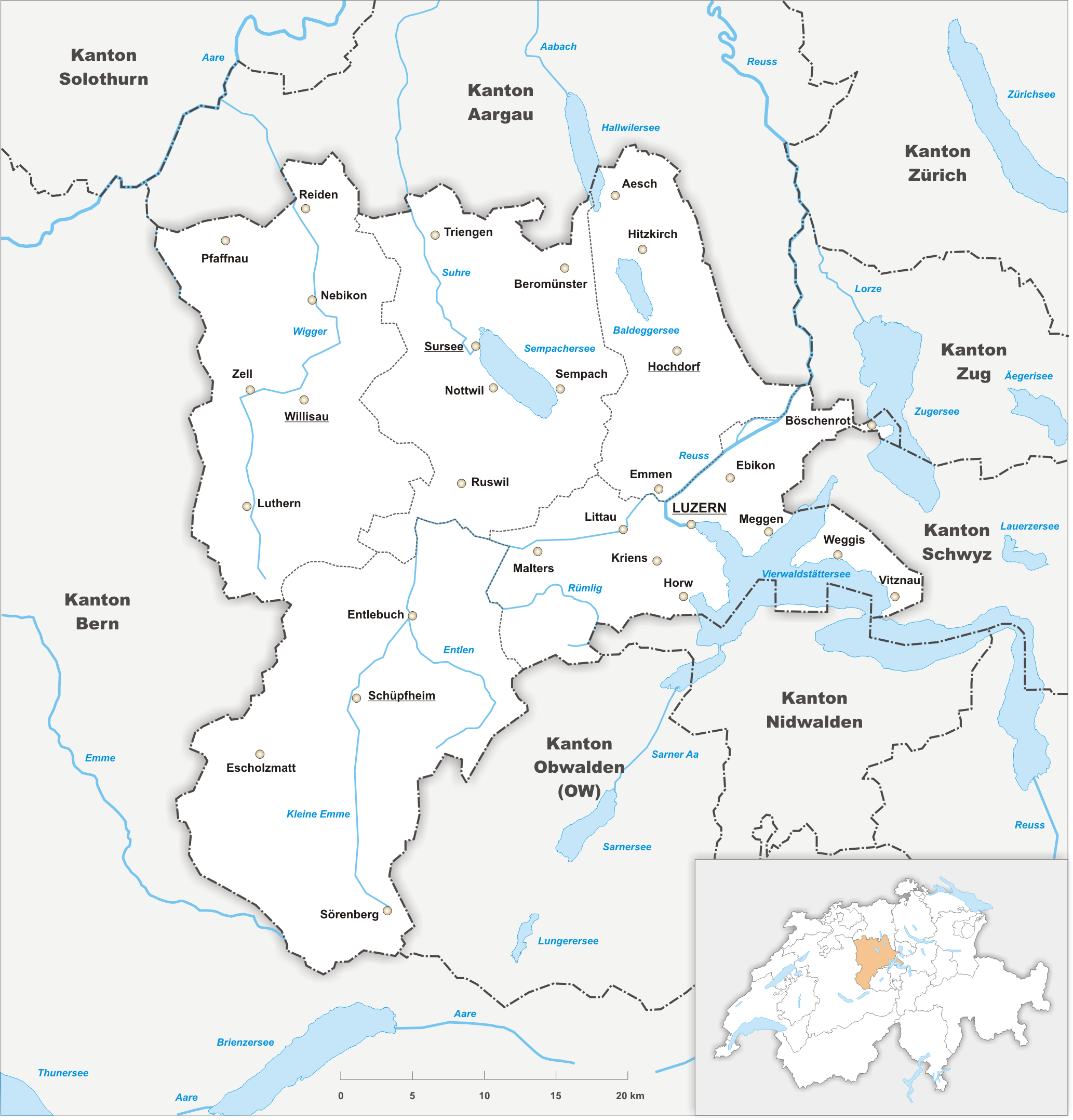
The canton of Lucerne (german: Kanton Luzern rm, Chantun Lucerna french: Canton de Lucerne it, Canton Lucerna) is a canton of Switzerland. It is located in the centre of Switzerland. The population of the canton (as of ) is . , the population included 57,268 foreigners, or about 15.8% of the total population. The cantonal capital is Lucerne. History The canton of Lucerne comprises territories acquired by its capital Lucerne, either by treaty, armed occupation or purchase. The first town acquired was Weggis (in 1380), Rothenburg, Kriens, Horw, Sempach and Hochdorf (all in 1394), Wolhusen and Entlebuch (1405), the so-called "Habsburger region" to the northeast of the town of Lucerne (1406), Willisau (1407), Sursee and Beromünster (1415), Malters (1477) and Littau (1481), while in 1803, in exchange for Hitzkirch, Merenschwand (held since 1397) was given up. Prehistory The oldest traces of humans in the Lucerne area are stone artifacts and cave bear bones found in the St ... [...More Info...] [...Related Items...] OR: [Wikipedia] [Google] [Baidu] |


