|
Wildlife Of Saudi Arabia
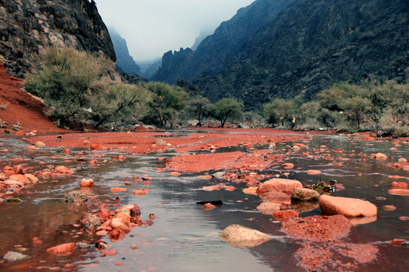
The wildlife of Saudi Arabia is substantial and varied. Saudi Arabia is a very large country forming the bulk of the Arabian Peninsula. It has several geographic regions, each with a diversity of plants and animals adapted to their own particular habitats. The country has several extensive mountain ranges, deserts, highlands, steppes, hills, wadis, volcanic areas, lakes and over 1300 islands. The Saudi Arabian coastline has a combined length of 2640 km and consists of the Gulf of Aqaba and the Red Sea to the west while a shorter eastern coastline can be found along the Persian Gulf. Geography Saudi Arabia has a range of mountains, the Sarawat or Sarat Mountains, which run parallel with the Red Sea coast. These are low at the northern end, have a gap in the middle between Medina and Ta'if, and are higher at the southern end, where Mount Sawda in the Asir Mountains, at just over is the highest point in Saudi Arabia. Between these mountains and the Red Sea is a coastal plain know ... [...More Info...] [...Related Items...] OR: [Wikipedia] [Google] [Baidu] |
Saudi Arabia Topography , the ruling family of Saudi Arabia
{{disambiguation ...
Saudi may refer to: * Saudi Arabia * Saudis, people from Saudi Arabia * Saudi culture, the culture of Saudi Arabia * House of Saud The House of Saud ( ar, آل سُعُود, ʾĀl Suʿūd ) is the ruling royal family of Saudi Arabia. It is composed of the descendants of Muhammad bin Saud, founder of the Emirate of Diriyah, known as the First Saudi state (1727–1818), and ... [...More Info...] [...Related Items...] OR: [Wikipedia] [Google] [Baidu] |
An Nafud
An Nafud or Al-Nefud or The Nefud ( ar, صحراء النفود, ṣahrā' an-Nafūd) is a desert in the northern part of the Arabian Peninsula at , occupying a great oval depression. It is long and wide, with an area of . The Nafud is an erg, a desert region located in north-central Saudi Arabia. It is noted for its sudden violent winds, which account for the large crescent-shaped dunes. The sand in the Nafud is a brick-reddish color. Rain comes once or twice a year. In some lowland areas, namely those near the Hejaz Mountains, there are oases where dates, vegetables, barley, and fruits are grown. The Nefud is connected to the Rub' al Khali by the Dahna, a corridor of gravel plains and sand dunes, long and wide. During the Arab Revolt in 1917, forces led by Auda ibu Tayi attacked the Turkish-held coastal town of Aqaba on its poorly defended eastern flank. The approach was via long and wide desert route, passing close to the edge of the Nafud. Col. T. E. Lawrence asked Aud ... [...More Info...] [...Related Items...] OR: [Wikipedia] [Google] [Baidu] |
Khejri
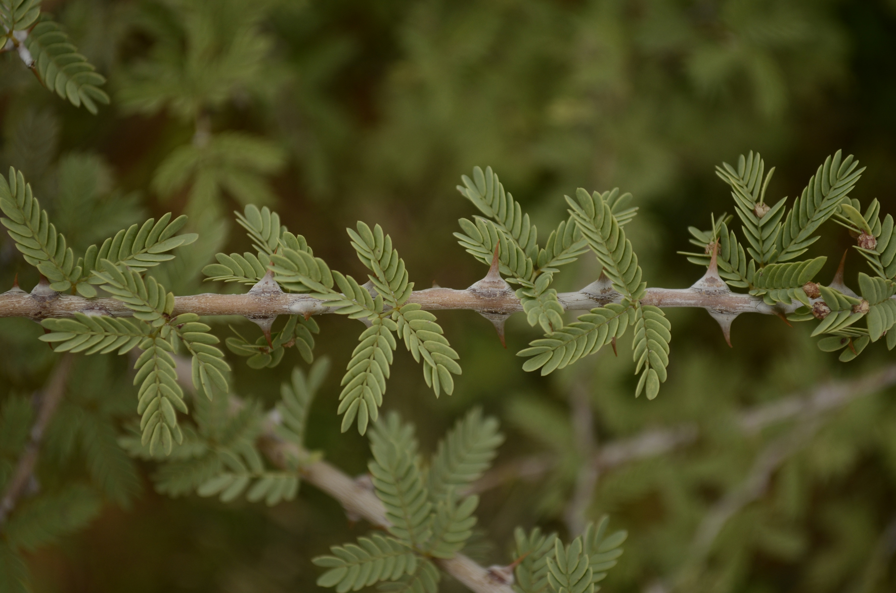
''Prosopis cineraria'', also known as ghaf, is a species of flowering tree in the pea family, Fabaceae. It is native to arid portions of Western Asia and the Indian Subcontinent, including Afghanistan, Bahrain, Iran, India, Oman, Pakistan, Saudi Arabia, the United Arab Emirates and Yemen. Its leaves are shattered and stripy along its branch. It can survive extreme drought. It is an established introduced species in parts of Southeast Asia, including Indonesia. The ʿGhaf is the national tree of the United Arab Emirates. Through the ''Give a Ghaf campaign'' its citizens are urged to plant it in their gardens to combat desertification and to preserve their country's heritage. The desert village of Nazwa in the UAE is home to the Al Ghaf Conservation Reserve. ''Prosopis cineraria'' is also the state tree of Rajasthan (where it is known as Khejri), Western Uttar Pradesh (where it is known as Chhonkara) and Telangana (where it is known as ''Jammi'' ) in India. A large and well-k ... [...More Info...] [...Related Items...] OR: [Wikipedia] [Google] [Baidu] |
Date Palm
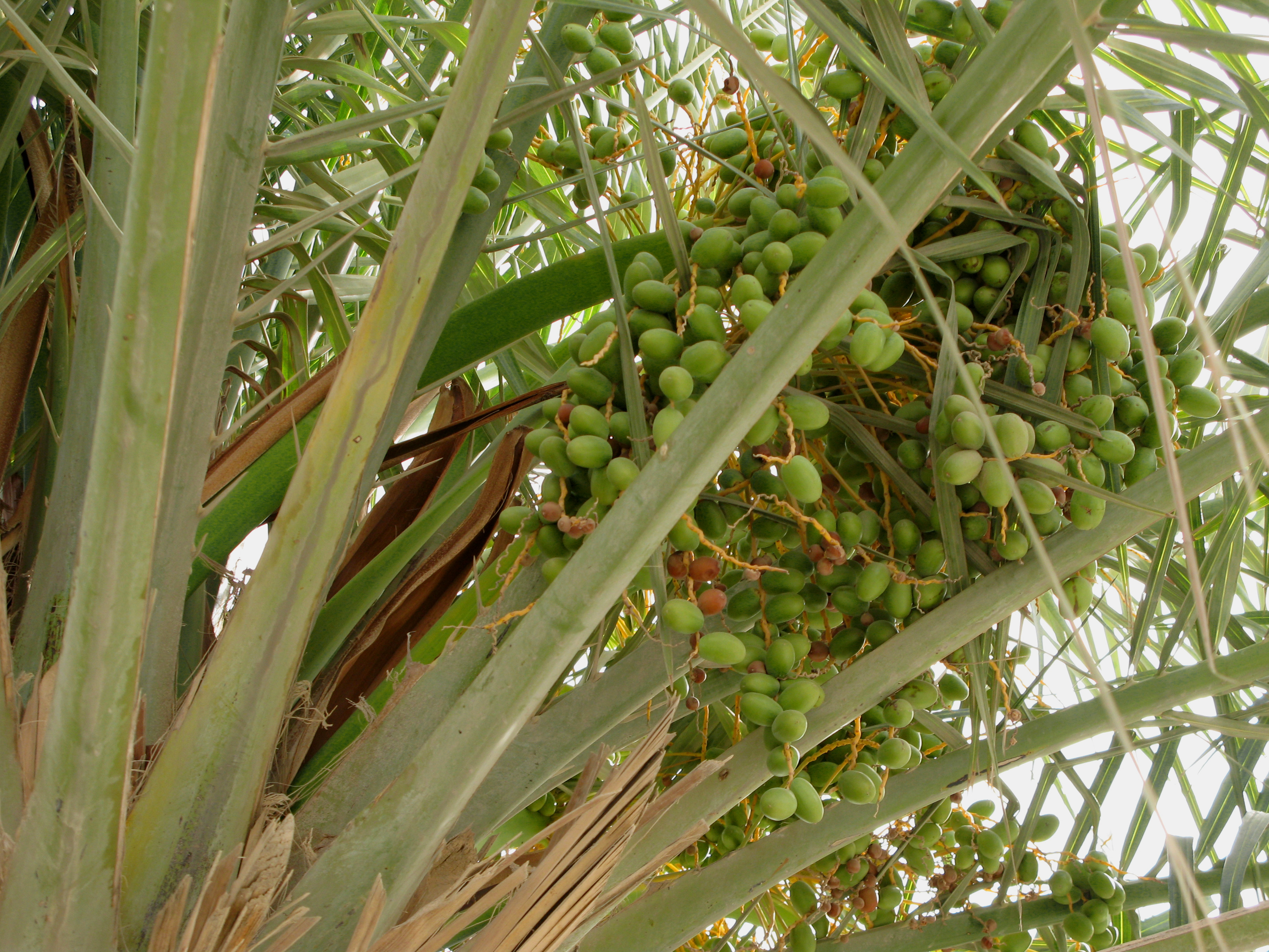
''Phoenix dactylifera'', commonly known as date or date palm, is a flowering plant species in the palm family, Arecaceae, cultivated for its edible sweet fruit called dates. The species is widely cultivated across northern Africa, the Middle East, and South Asia, and is naturalized in many tropical and subtropical regions worldwide. ''P. dactylifera'' is the type species of genus ''Phoenix'', which contains 12–19 species of wild date palms. Date trees reach up to in height, growing singly or forming a clump with several stems from a single root system. Slow-growing, they can reach over 100 years of age when maintained properly. Date fruits (dates) are oval-cylindrical, long, and about in diameter, with colour ranging from dark brown to bright red or yellow, depending on variety. Containing 61–68 percent sugar by mass when dried, dates are very sweet and are enjoyed as desserts on their own or within confections. Dates have been cultivated in the Middle East and the ... [...More Info...] [...Related Items...] OR: [Wikipedia] [Google] [Baidu] |
Xerophyte
A xerophyte (from Ancient Greek language, Greek ξηρός ''xeros'' 'dry' + φυτόν ''phuton'' 'plant') is a species of plant that has adaptations to survive in an environment with little liquid water, such as a desert such as the Sahara or places in the Alps or the Arctic. Popular examples of xerophytes are cactus, cacti, pineapple and some Gymnosperm, Gymnosperm plants. The structural features (morphology (biology), morphology) and fundamental chemical processes (physiology) of xerophytes are variously adapted to conserve water, also common to store large quantities of water, during dry periods. Other species are able to survive long periods of extreme dryness or desiccation of their Tissue (biology)#Plant tissue, tissues, during which their metabolism, metabolic activity may effectively shut down. Plants with such morphological and physiological adaptations are .” Xeromorphic”, The Cambridge Illustrated Glossary of Botanical Terms, Michael Hickey, Clive King, Cambridge U ... [...More Info...] [...Related Items...] OR: [Wikipedia] [Google] [Baidu] |
Relict (biology)
In biogeography and paleontology, a relict is a population or taxon of organisms that was more widespread or more diverse in the past. A relictual population is a population currently inhabiting a restricted area whose range was far wider during a previous geologic epoch. Similarly, a relictual taxon is a taxon (e.g. species or other lineage) which is the sole surviving representative of a formerly diverse group. Definition A relict (or relic) plant or animal is a taxon that persists as a remnant of what was once a diverse and widespread population. Relictualism occurs when a widespread habitat or range changes and a small area becomes cut off from the whole. A subset of the population is then confined to the available hospitable area, and survives there while the broader population either shrinks or evolves divergently. This phenomenon differs from endemism in that the range of the population was not always restricted to the local region. In other words, the species or group did n ... [...More Info...] [...Related Items...] OR: [Wikipedia] [Google] [Baidu] |
Quaternary
The Quaternary ( ) is the current and most recent of the three periods of the Cenozoic Era in the geologic time scale of the International Commission on Stratigraphy (ICS). It follows the Neogene Period and spans from 2.58 million years ago to the present. The Quaternary Period is divided into two epochs: the Pleistocene (2.58 million years ago to 11.7 thousand years ago) and the Holocene (11.7 thousand years ago to today, although a third epoch, the Anthropocene, has been proposed but is not yet officially recognised by the ICS). The Quaternary Period is typically defined by the cyclic growth and decay of continental ice sheets related to the Milankovitch cycles and the associated climate and environmental changes that they caused. Research history In 1759 Giovanni Arduino proposed that the geological strata of northern Italy could be divided into four successive formations or "orders" ( it, quattro ordini). The term "quaternary" was introduced by Jules Desnoye ... [...More Info...] [...Related Items...] OR: [Wikipedia] [Google] [Baidu] |
Tertiary
Tertiary ( ) is a widely used but obsolete term for the geologic period from 66 million to 2.6 million years ago. The period began with the demise of the non-avian dinosaurs in the Cretaceous–Paleogene extinction event, at the start of the Cenozoic Era, and extended to the beginning of the Quaternary glaciation at the end of the Pliocene Epoch. The time span covered by the Tertiary has no exact equivalent in the current geologic time system, but it is essentially the merged Paleogene and Neogene periods, which are informally called the Early Tertiary and the Late Tertiary, respectively. The Tertiary established the Antarctic as an icy island continent. Historical use of the term The term Tertiary was first used by Giovanni Arduino during the mid-18th century. He classified geologic time into primitive (or primary), secondary, and tertiary periods based on observations of geology in Northern Italy. Later a fourth period, the Quaternary, was applied. In the early d ... [...More Info...] [...Related Items...] OR: [Wikipedia] [Google] [Baidu] |
Eocene
The Eocene ( ) Epoch is a geological epoch (geology), epoch that lasted from about 56 to 33.9 million years ago (mya). It is the second epoch of the Paleogene Period (geology), Period in the modern Cenozoic Era (geology), Era. The name ''Eocene'' comes from the Ancient Greek (''ēṓs'', "dawn") and (''kainós'', "new") and refers to the "dawn" of modern ('new') fauna that appeared during the epoch. The Eocene spans the time from the end of the Paleocene Epoch to the beginning of the Oligocene Epoch. The start of the Eocene is marked by a brief period in which the concentration of the carbon isotope Carbon-13, 13C in the atmosphere was exceptionally low in comparison with the more common isotope Carbon-12, 12C. The end is set at a major extinction event called the ''Grande Coupure'' (the "Great Break" in continuity) or the Eocene–Oligocene extinction event, which may be related to the impact of one or more large bolides in Popigai impact structure, Siberia and in what is now ... [...More Info...] [...Related Items...] OR: [Wikipedia] [Google] [Baidu] |
Saudi Geological Survey
The Saudi Geological Survey (SGS; ar, هيئة المساحة الجيولوجية السعودية) is the national geological survey of the Kingdom of Saudi Arabia. History and profile The SGS was established as an independent entity attached to the ministry of petroleum and mineral resources following a council of ministers decision in 1999. It is built from other governmental agencies, including the former directorate general for mineral resources, the US Geological Survey (USGS) mission (1963–1999) and the Bureau de Recherches Géologiques et Minières (BRGM) mission (1972–1999). Activities The Saudi Geological Survey activities covers a broad range of strategic and applied earth science topics, with emphasis on understanding the geologic, economic, and engineering factors that affect sustainable management of mineral and groundwater resources, detection and mitigation of earthquakes and other geohazards, protection and management of the environment, and safe develop ... [...More Info...] [...Related Items...] OR: [Wikipedia] [Google] [Baidu] |
Salma Mountains
The Salma Mountains ( ar, جِبَال سَلْمَى, Jibāl Salmā) is a mountain range in Ha'il Province, Saudi Arabia. Like the Ajā, this range is part of the Shammar range. See also * Adayra Valley * Ha'il * List of mountains in Saudi Arabia * People: ** Al Fadl ** Jarrahids ** Tayy , location = 2nd century CE–10th century: Jabal Tayy and Syrian Desert 10th century–16th century: Jabal Tayy, Syrian Desert, Jibal al-Sharat, al-Balqa, Palmyrene Steppe, Upper Mesopotamia, Northern Hejaz, Najd , parent_tribe = Madh ...' References External links Map showing the study area of Salma MountainsMid of Salma Mountains Mountain ranges of Saudi Arabia {{SaudiArabia-geo-stub ... [...More Info...] [...Related Items...] OR: [Wikipedia] [Google] [Baidu] |
Shammar Mountains
The Shammar Mountains ( ar, جِبَال شَمَّر, Jibāl Shammar) is a mountain range in the northwestern Saudi Arabian province of Ha'il. It includes the Ajā () and Salma subranges. Geology The Aja Mountains are to an extent made up of granite, whereas the Salma are made up of basalt. The phrase "Hadn formation" was used by Chevremont (1982) to refer to volcanic rocks of the area of Ha'il, and was treated by Hadley and Schmidt (1980) as being part of a silicic and volcaniclastic sequence referred to as the "Shammar group", in a broader, regional context. Wildlife The protected area of Jabal Aja is of ecological significance. Two Asiatic cheetahs, the last known in the country, were killed near Ha'il in 1973, and their skins kept near the Imara Palace for a few days. Peaks * Mount Aja ( ar, جَبَل أَجَا, Jabal Ajā) * Mount Samra' ( ar, جَبَل ٱلسَّمْرَاء, Jabal As-Samrā’) Gallery File:Alsamra.jpg, A view of Ha'il City from the to ... [...More Info...] [...Related Items...] OR: [Wikipedia] [Google] [Baidu] |


