|
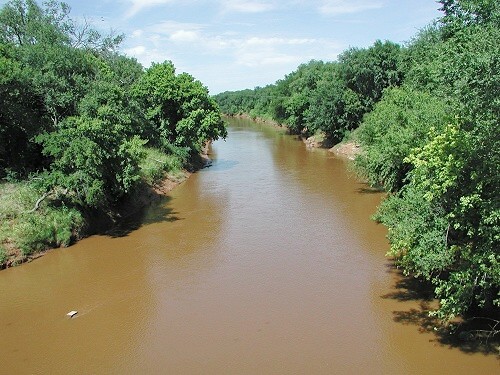
Wildhorse Creek (Oklahoma)
Wildhorse Creek is in Stephens County, Oklahoma. It drains an area of approximately 600 square miles, and flows into the Washita River The Washita River () is a river in the states of Texas and Oklahoma in the United States. The river is long and terminates at its confluence with the Red River, which is now part of Lake Texoma () on the TexasOklahoma border. Geography The .... The Wildhorse Creek Watershed Dam No. 22, also known as Lake Humphreys, was the first multi-purpose dam built under the NRCS Watershed Program. References Rivers of Oklahoma {{Oklahoma-geo-stub ... [...More Info...] [...Related Items...] OR: [Wikipedia] [Google] [Baidu] |
Stephens County, Oklahoma
Stephens County is a county located in the U.S. state of Oklahoma. As of the 2010 census, the population was 45,048. Its county seat is Duncan. The county was created at statehood, partly from the Chickasaw Nation in Indian Territory and partly from Comanche County in Oklahoma Territory. It was named for Texas politician John Hall Stephens.Wilson, Linda D. ''Encyclopedia of Oklahoma History and Culture''. "Stephens County." Retrieved September 21, 2013. Stephens County comprises the Duncan, OK micropolitan statistical area. History Stephens County was created at statehood from portions of both ...[...More Info...] [...Related Items...] OR: [Wikipedia] [Google] [Baidu] |
Washita River
The Washita River () is a river in the states of Texas and Oklahoma in the United States. The river is long and terminates at its confluence with the Red River, which is now part of Lake Texoma () on the TexasOklahoma border. Geography The Washita River forms in eastern Roberts County, Texas (), near the town of Miami in the Texas Panhandle. The river crosses Hemphill County, Texas and enters Oklahoma in Roger Mills County. It cuts through the Oklahoma counties of Roger Mills, Custer, Washita, Caddo, Grady, Garvin, Murray, Carter, and Johnston County, Oklahoma, Johnston before emptying into Lake Texoma Lake Texoma is one of the largest reservoirs in the United States, the 12th largest US Army Corps of Engineers' (USACE) lake, and the largest in USACE Tulsa District. Lake Texoma is formed by Denison Dam on the Red River in Bryan County, Oklaho ..., which is the modern border between Bryan County, Oklahoma, Bryan County and Marshall County, Oklahoma, Marshall County ... [...More Info...] [...Related Items...] OR: [Wikipedia] [Google] [Baidu] |
Lake Humphreys
Lake Humphreys is a reservoir located northeast of the city of Duncan, Oklahoma Oklahoma (; Choctaw language, Choctaw: ; chr, ᎣᎧᎳᎰᎹ, ''Okalahoma'' ) is a U.S. state, state in the South Central United States, South Central region of the United States, bordered by Texas on the south and west, Kansas on the nor ..., United States. It was created in 1958 with an earthen dam. Its normal capacity is of water with an average depth of . The lake covers encompassed by of shoreline. The lake is operated by the city of Duncan. References {{authority control Humphreys Geography of Stephens County, Oklahoma ... [...More Info...] [...Related Items...] OR: [Wikipedia] [Google] [Baidu] |
Natural Resources Conservation Service
Natural Resources Conservation Service (NRCS), formerly known as the Soil Conservation Service (SCS), is an agency of the United States Department of Agriculture (USDA) that provides technical assistance to farmers and other private landowners and managers. Its name was changed in 1994 during the presidency of Bill Clinton to reflect its broader mission. It is a relatively small agency, currently comprising about 12,000 employees. Its mission is to improve, protect, and conserve natural resources on private lands through a cooperative partnership with state and local agencies. While its primary focus has been agricultural lands, it has made many technical contributions to soil surveying, classification, and water quality improvement. One example is the Conservation Effects Assessment Project (CEAP), set up to quantify the benefits of agricultural conservation efforts promoted and supported by programs in the Farm Security and Rural Investment Act of 2002 (2002 Farm Bill). NRCS i ... [...More Info...] [...Related Items...] OR: [Wikipedia] [Google] [Baidu] |

.jpg)