|
White Rock, BC
White Rock is a city in British Columbia, Canada, and a member municipality of the Metro Vancouver Regional District. It borders Semiahmoo Bay to the south and is surrounded on three sides by Surrey. To the southeast across a footbridge lies the Semiahmoo First Nation, which is within the borders of Surrey. Semiahmoo Bay and the Southern Gulf Islands in the Strait of Georgia are also to the south. White Rock is named for a large white boulder on its beach near the promenade, a glacial erratic that migrated south during the last glaciation. The 486-ton granite boulder was kept white by shellfish-eating seabirds whose guano covered the rock so much that 19th-century sailors used it as a beacon. It is now kept white through monthly applications of white paint by the city parks department and has been a graffiti target. The White Rock Pier is located nearby. History Early history The Straits Salish people dominated the region from Boundary Bay in the north to Birch Bay in the sout ... [...More Info...] [...Related Items...] OR: [Wikipedia] [Google] [Baidu] |
List Of Cities In British Columbia
A city is a classification of List of municipalities in British Columbia#Municipalities, municipalities used in the Provinces and territories of Canada, Canadian province of British Columbia. British Columbia's Lieutenant Governor in Council may incorporate a community as a city by letters patent, under the recommendation of the Minister of Communities, Sport and Cultural Development, if its population is greater than 5,000 and the outcome of a vote involving affected residents was that greater than 50% voted in favour of the proposed incorporation. British Columbia has 52 cities that had a cumulative population of 3,327,824 and an average population of 63,997 in the Canada 2016 Census, 2016 census. British Columbia's largest and smallest cities are Vancouver and Greenwood, British Columbia, Greenwood with populations of 631,486 and 665 respectively. The largest city by land area is Abbotsford, British Columbia, Abbotsford, which spans , while the smallest is Duncan, Bri ... [...More Info...] [...Related Items...] OR: [Wikipedia] [Google] [Baidu] |
British Columbia Liberal Party
The British Columbia Liberal Party, often shortened to the BC Liberals, is a Centre-right politics, centre-right provincial political party in British Columbia, Canada. The party currently forms the Official Opposition. Subsequent to the 2020 British Columbia general election, then–party leader Andrew Wilkinson announced his resignation on October 26, 2020, but remained as interim leader until Shirley Bond was chosen as the new interim leader on November 23; the party held 2022 British Columbia Liberal Party leadership election, a leadership election in 2022, which was won by Kevin Falcon. Until the 1940s, British Columbia politics were dominated by the Liberal Party and rival British Columbia Conservative Party. The Liberals formed government from 1916 to 1928 and again from 1933 to 1941. From 1941 to 1952, the two parties governed in a coalition (led by a Liberal leader) opposed to the ascendant British Columbia New Democratic Party, Co-operative Commonwealth Federation. The ... [...More Info...] [...Related Items...] OR: [Wikipedia] [Google] [Baidu] |
Oregon Treaty
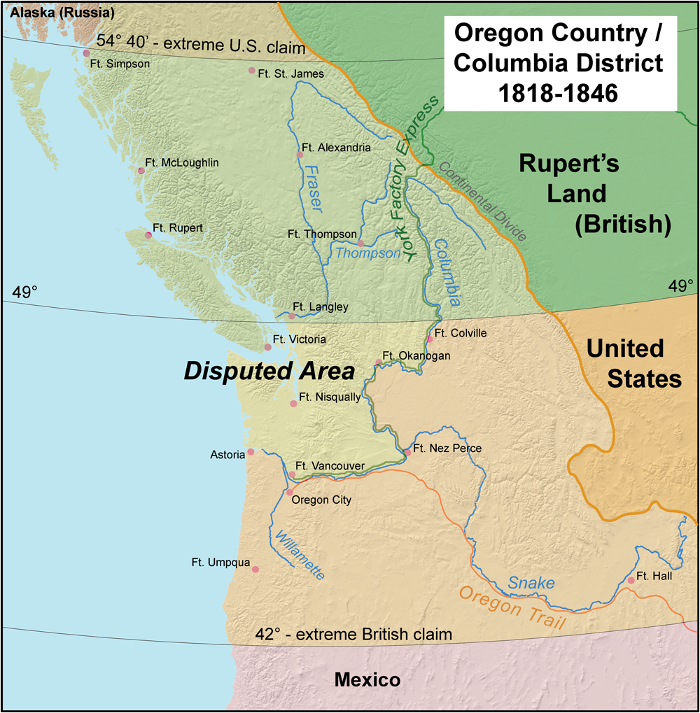
The Oregon Treaty is a treaty between the United Kingdom and the United States that was signed on June 15, 1846, in Washington, D.C. The treaty brought an end to the Oregon boundary dispute by settling competing American and British claims to the Oregon Country; the area had been Condominium (international law), jointly occupied by both Britain and the U.S. since the Treaty of 1818. Background The Treaty of 1818 set the boundary between the United States and British North America along the 49th parallel north, 49th parallel of north latitude from Minnesota to the "Stony Mountains" (now known as the Rocky Mountains). The region west of those mountains was known to the Americans as the Oregon Country and to the British as the Columbia Department or Columbia District of the Hudson's Bay Company. (Also included in the region was the southern portion of another fur district, New Caledonia (Canada), New Caledonia.) The treaty provided for joint control of that land for ten years. ... [...More Info...] [...Related Items...] OR: [Wikipedia] [Google] [Baidu] |
Oregon Boundary Dispute
The Oregon boundary dispute or the Oregon Question was a 19th-century territorial dispute over the political division of the Pacific Northwest of North America between several nations that had competing territorial and commercial aspirations in the region. Expansionist competition into the region began in the 18th century, with participants including the Russian Empire, Great Britain, Spain, and the United States. After the War of 1812, the Oregon dispute took on increased importance for diplomatic relations between the British Empire and the fledgling American republic. In the mid-1820s, the Russians signed the Russo-American Treaty of 1824 and the Russo-British Treaty of 1825, and the Spanish signed the Adams–Onís Treaty of 1819, by which Russia and Spain formally withdrew their respective territorial claims in the region, and the British and the Americans acquired residual territorial rights in the disputed area. But the question of sovereignty over a portion of the North ... [...More Info...] [...Related Items...] OR: [Wikipedia] [Google] [Baidu] |
Boundary Bay
, image = Boundary Bay Regional Park in Tsawwassen.jpg , image_size = 260px , alt = , caption = Looking east across Boundary Bay from Tsawwassen , image_bathymetry = , alt_bathymetry = , caption_bathymetry = , location = British Columbia and Washington , group = , coordinates = , type = Bay , etymology = , part_of = Salish Sea , inflow = , rivers = , outflow = , oceans = , catchment = , basin_countries = Canada and United States , agency = , designation = , date-built = , engineer = , date-flooded = , length = , width = , area = , depth = , max-depth = , volume = , residence_time = , salinity = , shore = , ... [...More Info...] [...Related Items...] OR: [Wikipedia] [Google] [Baidu] |
Clock And Lookout At White Rock
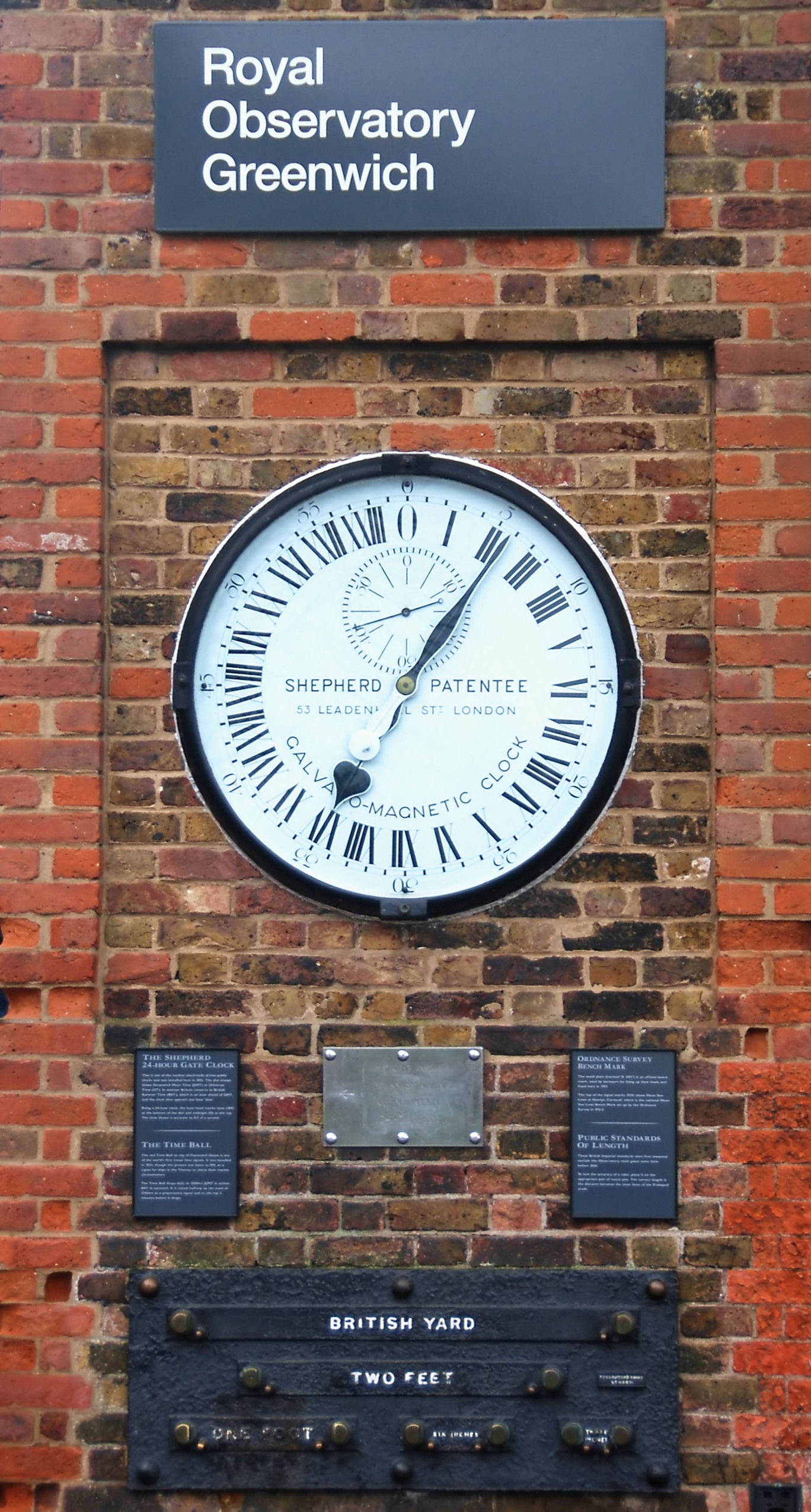
A clock or a timepiece is a device used to measure and indicate time. The clock is one of the oldest human inventions, meeting the need to measure intervals of time shorter than the natural units such as the day, the lunar month and the year. Devices operating on several physical processes have been used over the millennia. Some predecessors to the modern clock may be considered as "clocks" that are based on movement in nature: A sundial shows the time by displaying the position of a shadow on a flat surface. There is a range of duration timers, a well-known example being the hourglass. Water clocks, along with the sundials, are possibly the oldest time-measuring instruments. A major advance occurred with the invention of the verge escapement, which made possible the first mechanical clocks around 1300 in Europe, which kept time with oscillating timekeepers like balance wheels., pp. 103–104., p. 31. Traditionally, in horology, the term ''clock'' was used for a st ... [...More Info...] [...Related Items...] OR: [Wikipedia] [Google] [Baidu] |
White Rock Pier
White Rock Pier is a pier in White Rock, British Columbia. Originally built in 1914, it was a dock for steamships that arrived when the Great Northern Railway began operation. On December 20, 2018, the pier was severely damaged during a wind storm. It is estimated that the cost to rebuild the pier is $16.2 million. The pier was repaired and reopened in 2019. It is often erroneously claimed to be Canada's longest pier. However, there are several longer piers in Canada, the longest of which is the Quai de Portneuf in Portneuf, Quebec Portneuf is a municipality in the Portneuf Regional County Municipality, in the province of Quebec, Canada. It is located on the Saint Lawrence River, between Quebec City and Trois-Rivières. The Portneuf River runs on the east side of the town c .... Gallery White Rock Pier, near Vancouver.jpg, The pier as it appeared in 2015, prior to severe storm damage Whiterockpieronbeach.jpg, A portion of the pier on the beach after the storm, with the de ... [...More Info...] [...Related Items...] OR: [Wikipedia] [Google] [Baidu] |
Guano
Guano (Spanish from qu, wanu) is the accumulated excrement of seabirds or bats. As a manure, guano is a highly effective fertilizer due to the high content of nitrogen, phosphate, and potassium, all key nutrients essential for plant growth. Guano was also, to a lesser extent, sought for the production of gunpowder and other explosive materials. The 19th-century seabird guano trade played a pivotal role in the development of modern input-intensive farming. The demand for guano spurred the human colonization of remote bird islands in many parts of the world. Unsustainable seabird guano mining processes can result in permanent habitat destruction and the loss of millions of seabirds. Bat guano is found in caves throughout the world. Many cave ecosystems are wholly dependent on bats to provide nutrients via their guano which supports bacteria, fungi, invertebrates, and vertebrates. The loss of bats from a cave can result in the extinction of species that rely on their guano. U ... [...More Info...] [...Related Items...] OR: [Wikipedia] [Google] [Baidu] |
Glacial Erratic
A glacial erratic is glacially deposited rock differing from the type of rock native to the area in which it rests. Erratics, which take their name from the Latin word ' ("to wander"), are carried by glacial ice, often over distances of hundreds of kilometres. Erratics can range in size from pebbles to large boulders such as Big Rock () in Alberta. Geologists identify erratics by studying the rocks surrounding the position of the erratic and the composition of the erratic itself. Erratics are significant because: *They can be transported by glaciers, and they are thereby one of a series of indicators which mark the path of prehistoric glacier movement. Their lithographic origin can be traced to the parent bedrock, allowing for confirmation of the ice flow route. *They can be transported by ice rafting. This allows quantification of the extent of glacial flooding resulting from ice dam failure which release the waters stored in proglacial lakes such as Lake Missoula. Erratics ... [...More Info...] [...Related Items...] OR: [Wikipedia] [Google] [Baidu] |
Strait Of Georgia
The Strait of Georgia (french: Détroit de Géorgie) or the Georgia Strait is an arm of the Salish Sea between Vancouver Island and the extreme southwestern mainland coast of British Columbia, Canada and the extreme northwestern mainland coast of Washington, United States. It is approximately long and varies in width from .Environmental History and Features of Puget Sound , NOAA-NWFSC Along with the and , it is a constituent part of the |
Gulf Islands
The Gulf Islands are a group of islands in the Salish Sea between Vancouver Island and the mainland coast of British Columbia. Etymology The name "Gulf Islands" comes from "Gulf of Georgia," the original term used by George Vancouver in his mapping of the southern part of the archipelago and which before the San Juan Island dispute also was taken to include what have since been called the San Juan Islands. Strictly speaking, the Strait of Georgia is only the wide, open waters of the main strait between the mainland and Vancouver Island, and does not officially refer to the adjoining waters between the islands and Vancouver Island but has become a common misnomer for the entire Gulf, which includes waters such as Active Pass (between Galiano Island and Mayne Island), Trincomali Channel (between Galiano Island and Saltspring Island), Sansum Narrows (between Saltspring Island and Vancouver Island), and Malaspina Strait (between Texada Island and the mainland around Powell Rive ... [...More Info...] [...Related Items...] OR: [Wikipedia] [Google] [Baidu] |


