|
Whinlatter Pass
The Whinlatter Pass is a mountain pass in the English Lake District. It is located on the B5292 road linking Braithwaite, to the west of Keswick, with High Lorton to the south of Cockermouth. To the north the pass is flanked by Whinlatter fell, while to the south the Whiteside, Hopegill Head and Grisedale Pike fells borders the pass. From the top of the pass, paths climb Whinlatter and Grisedale Pike. There is also a Forestry Commission tourist centre there. The Whinlatter Pass is one of three passes that link the tourist area around Keswick, including Derwent Water and Borrowdale, with the valley of the River Cocker, including the lakes of Buttermere, Crummock Water and Loweswater. From north to south these passes are the Whinlatter Pass, the Newlands Pass, and the Honister Pass. The Whinlatter Pass can be icy in winter, but it is a less severe route than the other two passes. The Pass was used for the first King of the Mountains climb on the second stage of the 2016 ... [...More Info...] [...Related Items...] OR: [Wikipedia] [Google] [Baidu] |
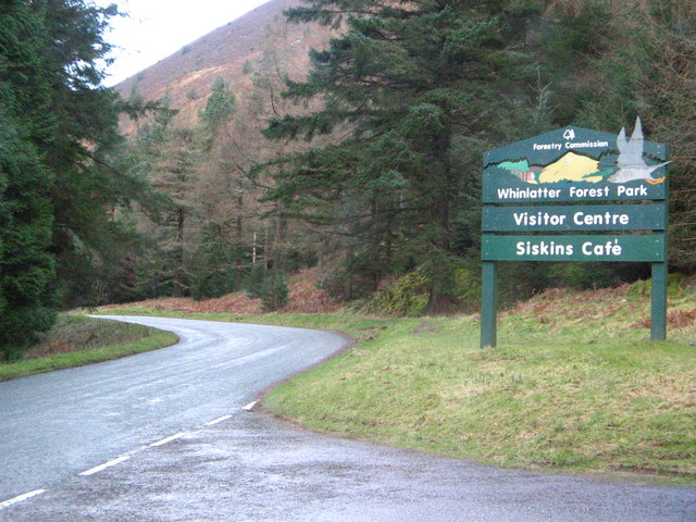
Whinlatter Forest Park Sign
Whinlatter is a small fell in the north west of the English Lake District, just north of the Whinlatter Pass. It is easily climbed from the top of the Whinlatter Pass, through the Forestry England plantations. The Whinlatter Visitor's Centre, a popular tourist attraction, is on the south side of the fell. The hill is part of a horseshoe around the valley of Aiken Beck. The fell's name originates from a combination of the Old Norse and Gaelic languages. With the Old Norse word 'hvin' meaning gorse or furze, and the Gaelic word 'lettir' meaning slope, the name translates as "The Gorse or furze-covered slope.".Place Names of the Lake District. Gives origins and translation of name. Topography The |
Derwent Water
Derwentwater, or Derwent Water, is one of the principal bodies of water in the Lake District National Park in north west England. It lies wholly within the Borough of Allerdale, in the county of Cumbria. The lake occupies part of Borrowdale and lies immediately south of the town of Keswick. It is both fed and drained by the River Derwent. It measures approximately long by wide and is some deep. There are several islands within the lake, one of which is inhabited. Derwentwater is a place of considerable scenic value. It is surrounded by hills (known locally as fells), and many of the slopes facing Derwentwater are extensively wooded. A regular passenger launch operates on the lake, taking passengers between various landing stages. There are seven lakeside marinas, the most popular stops being Keswick, Portinscale and the Lodore Falls, from which boats may be hired. Recreational walking is a major tourist activity in the area and there is an extensive network of foot ... [...More Info...] [...Related Items...] OR: [Wikipedia] [Google] [Baidu] |
List Of Hill Passes Of The Lake District
Hill passes of the Lake District were originally used by people in one valley travelling to another nearby without having to go many miles around a steep ridge of intervening hills. Historically, in the Lake District of northwest England, travel on foot or by pony was difficult because of the region's steep-sided valleys so tracks across the ridges were created taking the easiest route over passes – often, but not always, via a col. Since Roman times long-distance travel had tended to be along ridges. From the 19th century these passes and ridge routes were brought back into use when recreational hill walking become popular. Forty hill passes within the Lake District National Park are listed here, using criteria for selecting the major routes. Background The Lake District National Park was created in 1951 covering an area of over and, although its population is only 42,000, over 10 million visitors arrive each year, mostly attracted by the lakes and fells. Geology Abou ... [...More Info...] [...Related Items...] OR: [Wikipedia] [Google] [Baidu] |
Cumbria County Council
Cumbria County Council is the county council for the non-metropolitan county of Cumbria in the North West of England. Established in April 1974, following its first elections held the previous year, it is an elected local government body responsible for the most significant local services in the area, including schools, roads, and social services. In July 2021 the government announced that in April 2023, the county council will be abolished and its functions transferred to two new unitary authorities: Cumberland Council and Westmorland and Furness Council. Creation In 1974, under the Local Government Act 1972, the administrative counties of Cumberland and Westmorland and the county borough of Carlisle were abolished, and the areas they covered were combined with parts of Lancashire and the West Riding of Yorkshire to form a new non-metropolitan county called Cumbria. Functions Cumbria County Council is responsible for the more strategic local services of the county, includin ... [...More Info...] [...Related Items...] OR: [Wikipedia] [Google] [Baidu] |
2016 Tour Of Britain
The 2016 Tour of Britain was a nine-stage men's professional road cycling race. It was the thirteenth running of the modern version of the Tour of Britain and the 76th British tour in total. The race started on 4 September in Glasgow and finished on 11 September in London. The race was part of the 2016 UCI Europe Tour. rider Steve Cummings became the first British rider to win the Tour overall since Bradley Wiggins in 2013, as well as improving upon two previous runner-up finishes to win the race for the first time. Cummings finished second on the second stage in Cumbria, and assumed the race lead from Belgium's Julien Vermote () at the summit finish at Haytor, and maintained the yellow jersey over the final two days. Cummings eventually won the race by 26 seconds ahead of Australian rider Rohan Dennis of the – who won the circuit race in Bristol on the penultimate day – while the podium was completed by Tom Dumoulin from the Netherlands, riding for , 12 seconds behinds De ... [...More Info...] [...Related Items...] OR: [Wikipedia] [Google] [Baidu] |
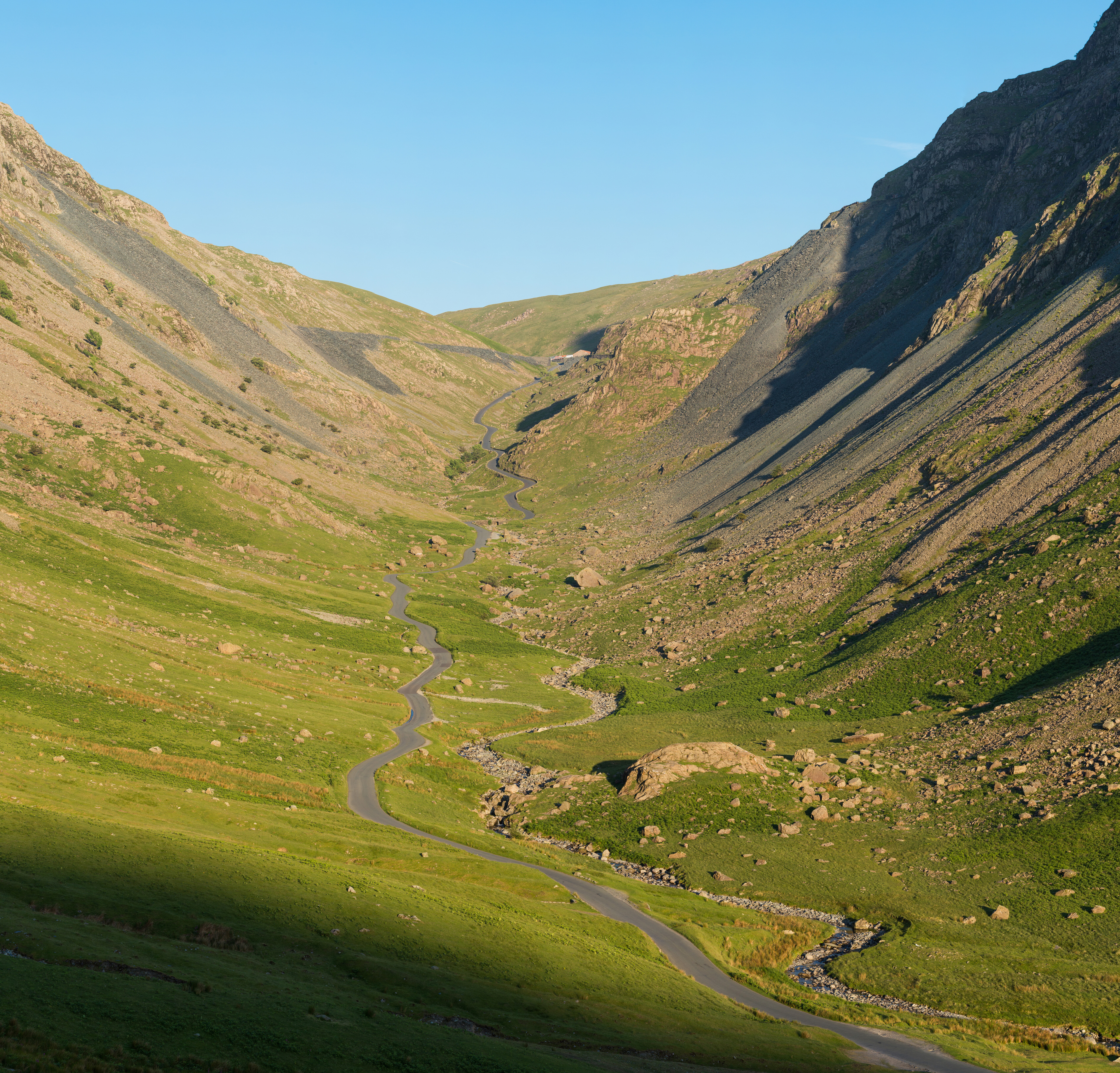
Honister Pass
Honister Pass is a mountain pass in the English Lake District. It is located on the B5289 road, linking Seatoller, in the valley of Borrowdale, to Gatesgarth at the southern end of Buttermere. The pass reaches an altitude of , making it one of the highest in the region, and also one of the steepest, with gradients of up to 1-in-4 (25%). The saddle at the watershed is known as Honister Hause, using the Cumbrian word ''hause'' for such a feature. Honister Pass is one of three passes that link the tourist area around Keswick, including Derwent Water and Borrowdale, with the valley of the River Cocker, including the lakes of Buttermere, Crummock Water and Loweswater. From north to south these passes are Whinlatter Pass, Newlands Pass and Honister Pass. Honister Slate Mine and Honister Hause Youth Hostel are located at the summit of the pass. Footpaths lead from the summit of the pass to Fleetwith Pike to the west, Grey Knotts to the south, and Dale Head to the north. Honis ... [...More Info...] [...Related Items...] OR: [Wikipedia] [Google] [Baidu] |
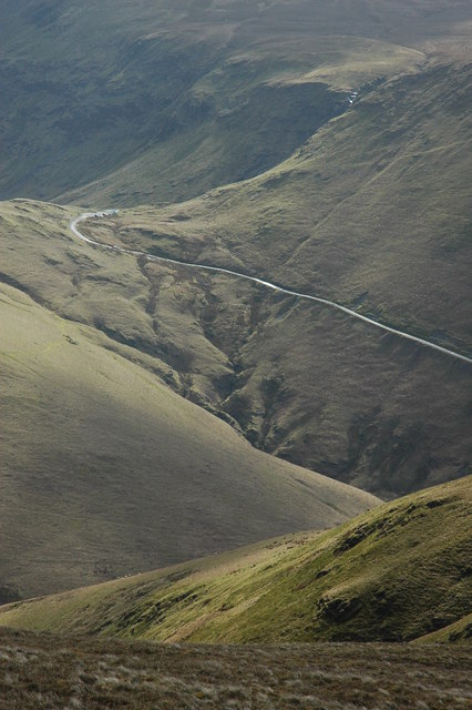
Newlands Pass
The Newlands Pass, also known as Newlands Hause, is a mountain pass in the English Lake District. It is located on an unclassified road linking the Newlands Valley, to the west of Keswick and Derwent Water, with the village of Buttermere. The highest point on the pass is at an altitude of , and it has gradients of 1 in 4 on both sides. The Newlands Pass is one of three passes that link the tourist area around Keswick, including Derwent Water and Borrowdale, with the valley of the River Cocker, including the lakes of Buttermere, Crummock Water and Loweswater. From north to south these passes are the Whinlatter Pass, the Newlands Pass, and the Honister Pass Honister Pass is a mountain pass in the English Lake District. It is located on the B5289 road, linking Seatoller, in the valley of Borrowdale, to Gatesgarth at the southern end of Buttermere. The pass reaches an altitude of , making it .... The Moss Force Waterfall falls down the southern side of Newlands ... [...More Info...] [...Related Items...] OR: [Wikipedia] [Google] [Baidu] |
Loweswater
Loweswater is one of the smaller lakes in the English Lake District. The village of Loweswater is situated to the east of the lake. Geography The lake is not far from Cockermouth and is also easily reached from elsewhere in West Cumbria. The group of fells to the south of Loweswater is known as the Loweswater Fells and consists of Mellbreak, Gavel Fell, Blake Fell, Hen Comb and Burnbank Fell. To the north of the lake lies the Fellbarrow range. The lake is unusual in the radial drainage pattern of the Lake District in draining towards the centre of the Lake District: its outfall, Dub Beck, becomes Park Beck and runs east or south-east into the north end of Crummock Water, close to that lake's exit. By way of the River Cocker and River Derwent, Loweswater's contents eventually reach the sea at Workington. The immediate vicinity of Loweswater consists mainly of rolling hills, in contrast to the rocky mountains found elsewhere in the Lake District (though Mellbreak, part ... [...More Info...] [...Related Items...] OR: [Wikipedia] [Google] [Baidu] |
Crummock Water
Crummock Water is a lake in the Lake District in Cumbria, North West England situated between Buttermere to the south and Loweswater to the north. Crummock Water is long, wide and deep. The River Cocker is considered to start at the north of the lake, before then flowing into Lorton Vale. The hill of Mellbreak runs the full length of the lake on its western side; as Alfred Wainwright described it 'no pairing of hill and lake in Lakeland have a closer partnership than these'. The lake is owned by the National Trust. "The meaning of 'Crummock' seems to be 'Crooked one', from British" ( Brythonic Celtic) "'crumbaco'-'crooked'". This may refer to the winding course of the River Cocker, which flows out of the lake, or refer to the bending nature of the lake itself. The word "'water' is the main Lakeland term for 'lake'". Scale Force, the highest waterfall in the Lake District, feeds the lake and has a drop of . Water from the lake was treated at Cornhow water treatment works, n ... [...More Info...] [...Related Items...] OR: [Wikipedia] [Google] [Baidu] |
Buttermere
Buttermere is a lake in the Lake District in North West England. The adjacent village of Buttermere takes its name from the lake. Historically in Cumberland, the lake is now within the county of Cumbria. Owned by the National Trust, it forms part of its Buttermere and Ennerdale property. Geography The lake is long by wide, and is deep. It has an elevation above sea level of . It is situated towards the head of the valley of the River Cocker and is surrounded by fells, notably the High Stile range to the south west, Robinson to the north-east, Fleetwith Pike and Haystacks to the south-east and Grasmoor to the north-west. The village of Buttermere stands at the north-western end of the lake, and beyond this is Crummock Water. There is a path around the lake which is about long, and at one point runs through a rock tunnel beneath the locality of Hassness. Access is by road, from Cockermouth in the north-west; from Borrowdale via the Honister Pass; or from Braithwaite and ... [...More Info...] [...Related Items...] OR: [Wikipedia] [Google] [Baidu] |
River Cocker, Cumbria
The River Cocker is a river in the Lake District in North West England, in the county of Cumbria. Its source is at the head of the Buttermere valley. It flows north through Buttermere and then Crummock Water, through Lorton Vale, to the town of Cockermouth, where it joins the River Derwent. It is roughly long. The river takes its name from the Brythonic Celtic word ''kukrā'', meaning 'the crooked one.' The river supports a range of wildlife; the predominant fish species include salmon, sea trout, brown trout, eels, minnows, sticklebacks and the stone loach. The small river came to national prominence in the 2009 Great Britain and Ireland floods. The county of Cumbria was the hardest hit area during the floods, when the River Cocker and River Derwent both burst their banks, covering the town of Cockermouth in as much as of water, causing extensive damage to houses, shops, workplaces as well as the home of Cockermouth Cricket Club. An important and pioneering pr ... [...More Info...] [...Related Items...] OR: [Wikipedia] [Google] [Baidu] |
Borrowdale
Borrowdale is a valley and civil parish in the English Lake District in the Borough of Allerdale in Cumbria, England. It lies within the historic county boundaries of Cumberland. It is sometimes referred to as ''Cumberland Borrowdale'' to distinguish it from another Borrowdale in the historic county of Westmorland. Geography The valley rises in the central Lake District, and runs north carrying the River Derwent into the lake of Derwentwater. The waters of the river have their origins over a wide area of the central massif of the Lake District north of Esk Hause and Stake Pass. These origins include drains from the northern end of Scafell, Great End, the eastern side of the Dale Head massif, the western part of the Central Fells and all the Glaramara ridge. Near Rosthwaite the side valley of Langstrath joins the main valley from Seathwaite before the combined waters negotiate the narrow gap known as the ''Jaws of Borrowdale''. Here it is flanked by the rocky crags of ... [...More Info...] [...Related Items...] OR: [Wikipedia] [Google] [Baidu] |


.jpg)


