|
Whaleback Lighthouse
Whaleback Light is a historic lighthouse marking the mouth of the Piscataqua River in Kittery, Maine. It is located on a rocky outcrop offshore southwest of Fort Foster and south of Wood Island in Kittery. The present tower was built in 1872. It was listed on the National Register of Historic Places in 1988. History The station (known in early records as "Whales Back") was first established in 1830 for $20,000. The tower was upgraded in 1855 with a new lantern and a fourth order Fresnel lens. A fog bell and tower were installed in 1863. In 1869, storms had caused cracks in the tower and foundation causing the decision to build a new tower in 1872. The new tower, still standing today, was built with dovetailed granite blocks alongside the original tower, which was removed in 1880. The light is above mean sea level, and the tower, also housed the keeper's living quarters and a storage area. At some point the fog bell was replaced with a horn and in 1991, the volume of the ... [...More Info...] [...Related Items...] OR: [Wikipedia] [Google] [Baidu] |
Piscataqua River
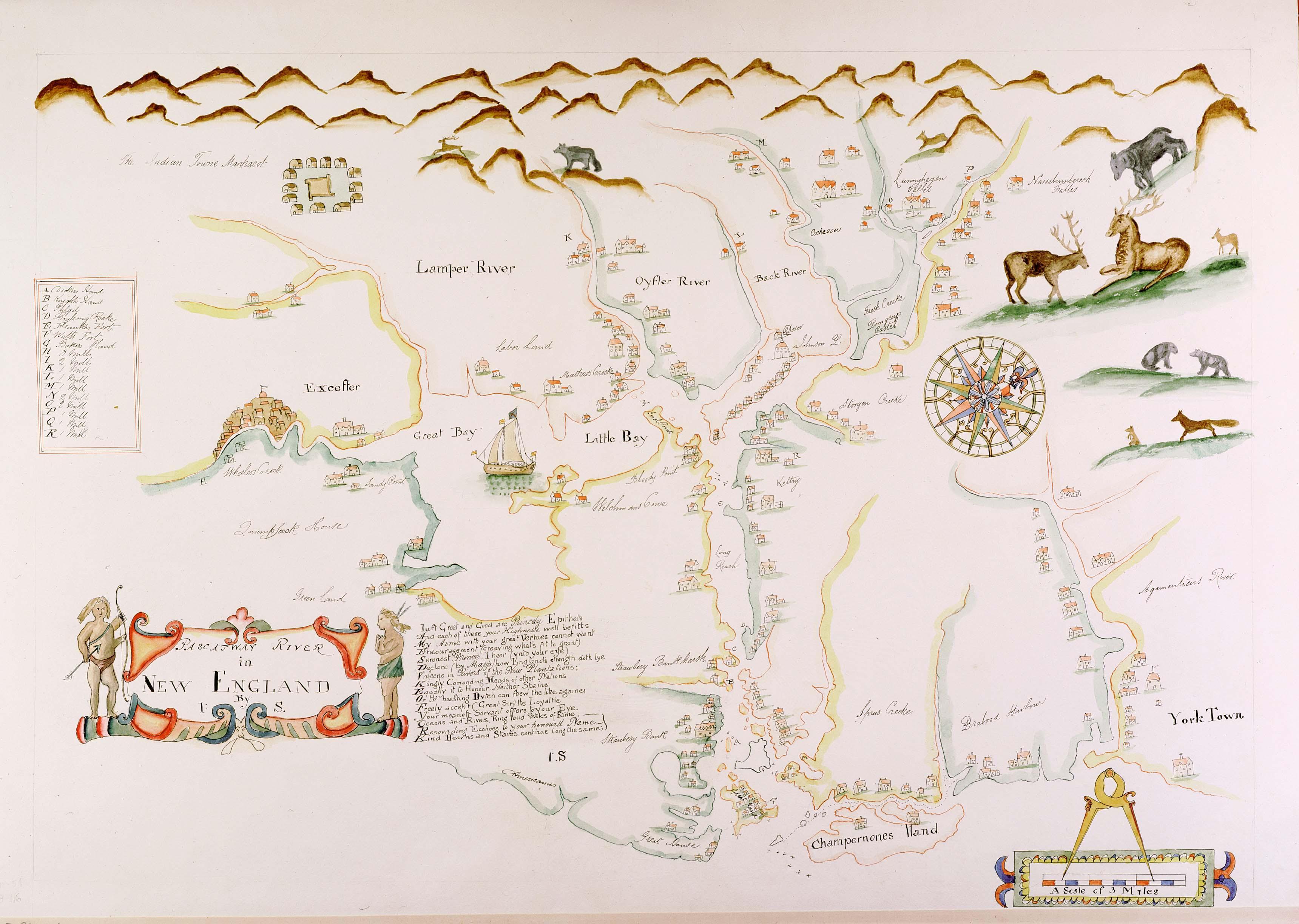
The Piscataqua River (Abenaki: ''Pskehtekwis'') is a tidal river forming the boundary of the U.S. states of New Hampshire and Maine from its origin at the confluence of the Salmon Falls River and Cochecho River. The drainage basin of the river is approximately , including the subwatersheds of the Great Works River and the five rivers flowing into Great Bay: the Bellamy, Oyster, Lamprey, Squamscott, and Winnicut. The river runs southeastward, with New Hampshire to the south and west and Maine to the north and east, and empties into the Gulf of Maine east of Portsmouth, New Hampshire. The last before the sea are known as Portsmouth Harbor and have a tidal current of around . The cities/towns of Portsmouth, New Castle, Newington, Kittery and Eliot have developed around the harbor. History Named by the area's original Abenaki inhabitants, the word ''Piscataqua'' is believed to be a combination of ''peske'' (branch) with ''tegwe'' (a river with a strong current, possibl ... [...More Info...] [...Related Items...] OR: [Wikipedia] [Google] [Baidu] |
Kittery, Maine
Kittery is a town in York County, Maine, United States. Home to the Portsmouth Naval Shipyard on Seavey's Island, Kittery includes Badger's Island, the seaside district of Kittery Point, and part of the Isles of Shoals. The southernmost town in the state, it is a tourist destination known for its many outlet stores. Kittery is part of the Portland– South Portland–Biddeford, Maine metropolitan statistical area. The town's population was 10,070 at the 2020 census. History English settlement around the natural harbor of the Piscataqua River estuary began about 1623. By 1632 the community was protected by Fort William and Mary on today's New Hampshire side of the river; in 1689 defensive works that later became Fort McClary in Kittery Point were added on today's Maine side to the north. Kittery was incorporated in 1647, staking a claim as the "oldest incorporated town in Maine." It was named after the birthplace of a founder, Alexander Shapleigh, from his manor of Kitt ... [...More Info...] [...Related Items...] OR: [Wikipedia] [Google] [Baidu] |
Fresnel Lens
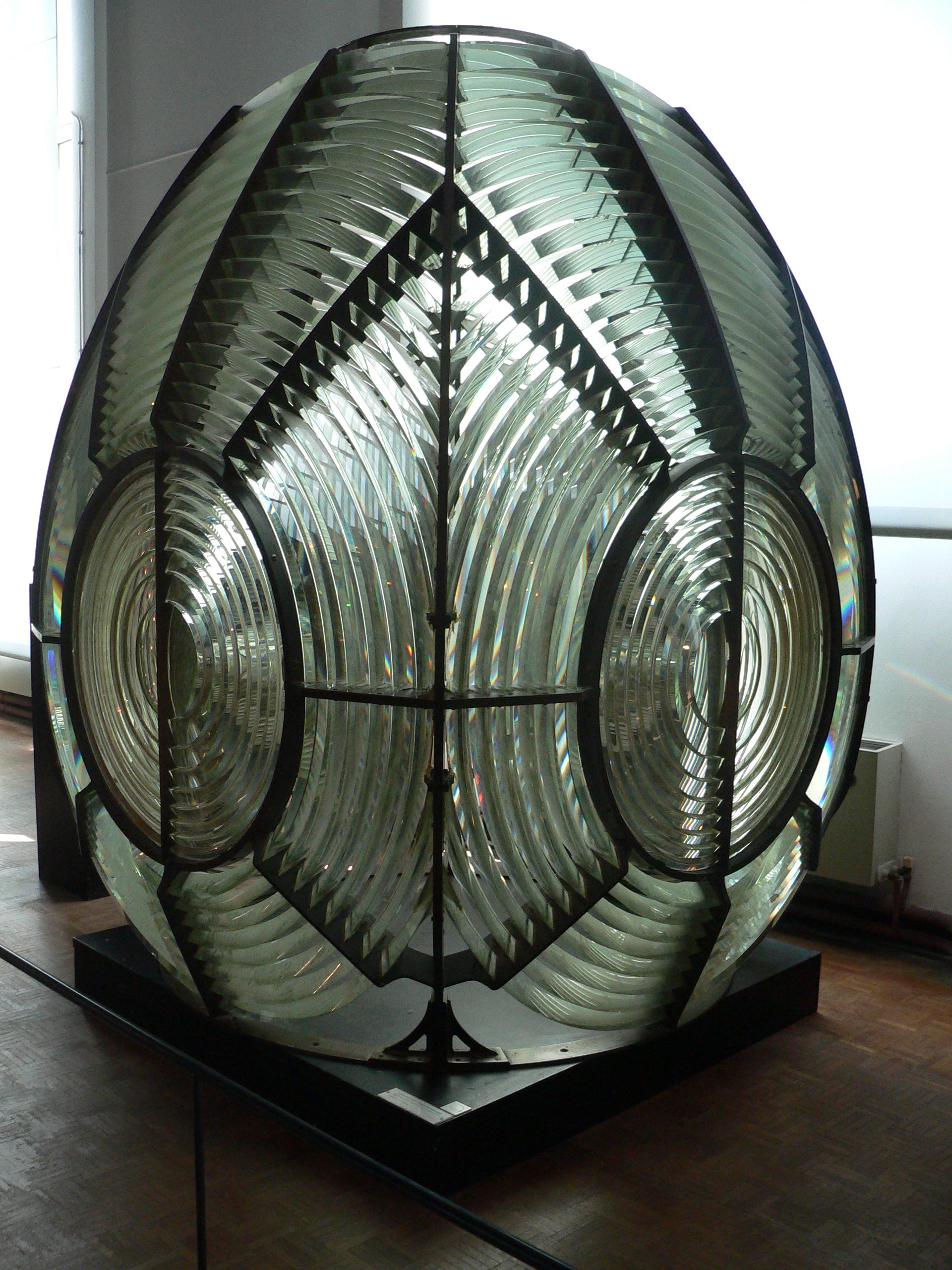
A Fresnel lens ( ; ; or ) is a type of composite compact lens developed by the French physicist Augustin-Jean Fresnel (1788–1827) for use in lighthouses. It has been called "the invention that saved a million ships." The design allows the construction of lenses of large aperture and short focal length without the mass and volume of material that would be required by a lens of conventional design. A Fresnel lens can be made much thinner than a comparable conventional lens, in some cases taking the form of a flat sheet. The simpler dioptric (purely refractive) form of the lens was first proposed by Count Buffon and independently reinvented by Fresnel. The ''catadioptric'' form of the lens, entirely invented by Fresnel, has outer elements that use total internal reflection as well as refraction; it can capture more oblique light from a light source and add it to the beam of a lighthouse, making the light visible from greater distances. Description The Fresnel lens redu ... [...More Info...] [...Related Items...] OR: [Wikipedia] [Google] [Baidu] |
VLB-44
The VRB-25 is a lighthouse optical system designed and built by Vega Industries Ltd. in Porirua, New Zealand. It was originally designed in 1993-95 with the assistance of the United States Coast Guard to meet USCG requirements for a robust mechanism requiring minimum maintenance. It has become the Coast Guard's standard 12 volt rotating beacon. The company's literature says there are more than 400 installations worldwide. More than a quarter of the active lighthouses in Maine have one installed. Components A microprocessor controlled 12 volt DC motor drives an array of six or eight acrylic Fresnel lenses around a bulb at one of 248 speeds ranging from 0.5 to 15.9 revolutions per minute (RPM). In the simplest case, all six lenses are used, so that for Boon Island Light, which shows one flash every five seconds, the mechanism rotates at two RPM. Eight lenses are used only when required to achieve more complex characteristics. Maximum range is achieved by using the slowest ... [...More Info...] [...Related Items...] OR: [Wikipedia] [Google] [Baidu] |
Kittery Point, Maine
Kittery Point is a census-designated place (CDP) in the town of Kittery, York County, Maine, United States. First settled in 1623, Kittery Point traces its history to the first seafarers who colonized the shore of what became Massachusetts Bay Colony and later the State of Maine. Located beside the Atlantic Ocean, it is home to Fort McClary State Historic Site, and Fort Foster Park on Gerrish Island. Cutts Island is home to Seapoint Beach and the Brave Boat Harbor Division of the Rachel Carson National Wildlife Refuge. Kittery Point is part of the Portland– South Portland–Biddeford, Maine Metropolitan Statistical Area. The population was 1,012 at the 2010 census. History Settled as early as 1623, the southern part of Kittery was once called Champernowne's after Sir Francis Champernowne, a prominent merchant adventurer and cousin of Sir Ferdinando Gorges, the prime mover behind settlement north of the Massachusetts Bay Colony. Nicholas Shapleigh built the first hou ... [...More Info...] [...Related Items...] OR: [Wikipedia] [Google] [Baidu] |
National Register Of Historic Places
The National Register of Historic Places (NRHP) is the United States federal government's official list of districts, sites, buildings, structures and objects deemed worthy of preservation for their historical significance or "great artistic value". A property listed in the National Register, or located within a National Register Historic District, may qualify for tax incentives derived from the total value of expenses incurred in preserving the property. The passage of the National Historic Preservation Act (NHPA) in 1966 established the National Register and the process for adding properties to it. Of the more than one and a half million properties on the National Register, 95,000 are listed individually. The remainder are contributing resources within historic districts. For most of its history, the National Register has been administered by the National Park Service (NPS), an agency within the U.S. Department of the Interior. Its goals are to help property owners and inte ... [...More Info...] [...Related Items...] OR: [Wikipedia] [Google] [Baidu] |
National Historic Lighthouse Preservation Act
The National Historic Lighthouse Preservation Act of 2000 (NHLPA; Public Law 106-355; 16 U.S.C. 470w-7) is American legislation creating a process for the transfer of federally owned lighthouses into private hands. It was created as an extension of the National Historic Preservation Act of 1966. Background Maintenance of aids to navigation had been assigned to the federal government from the beginning, first under the Department of the Treasury, and then under the U.S. Lighthouse Board (1852-1910) and its successor, the U.S. Lighthouse Service. In 1939 lighthouses were placed under the authority of the United States Coast Guard, which also took over the manning of lights with keepers. Throughout this period the expense of maintaining and staffing lights was constantly stressed. Automation of lights began early in the twentieth century, and a major push in the early 1960s relieved all but a few lighthouses of their keepers. Lighthouses are fairly high maintenance structures, being ... [...More Info...] [...Related Items...] OR: [Wikipedia] [Google] [Baidu] |
American Lighthouse Foundation
The American Lighthouse Foundation (ALF) is a 501(c)(3) non-profit organization founded in 1994 with a primary mission of lighthouse preservation. ALF's main office and storefront are headquartered in Rockland, Maine, and the organization currently has thirteen chapters that have stewardship responsibility over the following twenty-two lighthouses in Connecticut, Maine, Massachusetts, New Hampshire, and Rhode Island Rhode Island (, like ''road'') is a state in the New England region of the Northeastern United States. It is the smallest U.S. state by area and the seventh-least populous, with slightly fewer than 1.1 million residents as of 2020, but it ...: References External links American Lighthouse Foundation website Lighthouses in the United States Lighthouse organizations {{US-lighthouse-stub ... [...More Info...] [...Related Items...] OR: [Wikipedia] [Google] [Baidu] |
National Register Of Historic Places Listings In York County, Maine
This is a list of the National Register of Historic Places listings in York County, Maine. This is intended to be a complete list of the properties and districts on the National Register of Historic Places in York County, Maine, United States. Latitude and longitude coordinates are provided for many National Register properties and districts; these locations may be seen together in a map. There are 185 properties and districts listed on the National Register in the county, including 5 National Historic Landmarks. Another two properties were once listed but have been removed. Current listings Former listings See also * List of National Historic Landmarks in Maine * National Register of Historic Places listings in Maine References {{York County, Maine York York is a cathe ... [...More Info...] [...Related Items...] OR: [Wikipedia] [Google] [Baidu] |
Lighthouses Completed In 1829
A lighthouse is a tower, building, or other type of physical structure designed to emit light from a system of lamps and lenses and to serve as a beacon for navigational aid, for maritime pilots at sea or on inland waterways. Lighthouses mark dangerous coastlines, hazardous shoals, reefs, rocks, and safe entries to harbors; they also assist in aerial navigation. Once widely used, the number of operational lighthouses has declined due to the expense of maintenance and has become uneconomical since the advent of much cheaper, more sophisticated and effective electronic navigational systems. History Ancient lighthouses Before the development of clearly defined ports, mariners were guided by fires built on hilltops. Since elevating the fire would improve the visibility, placing the fire on a platform became a practice that led to the development of the lighthouse. In antiquity, the lighthouse functioned more as an entrance marker to ports than as a warning signal for reefs and ... [...More Info...] [...Related Items...] OR: [Wikipedia] [Google] [Baidu] |
Lighthouses Completed In 1872
A lighthouse is a tower, building, or other type of physical structure designed to emit light from a system of lamps and lenses and to serve as a beacon for navigational aid, for maritime pilots at sea or on inland waterways. Lighthouses mark dangerous coastlines, hazardous shoals, reefs, rocks, and safe entries to harbors; they also assist in aerial navigation. Once widely used, the number of operational lighthouses has declined due to the expense of maintenance and has become uneconomical since the advent of much cheaper, more sophisticated and effective electronic navigational systems. History Ancient lighthouses Before the development of clearly defined ports, mariners were guided by fires built on hilltops. Since elevating the fire would improve the visibility, placing the fire on a platform became a practice that led to the development of the lighthouse. In antiquity, the lighthouse functioned more as an entrance marker to ports than as a warning signal for reefs a ... [...More Info...] [...Related Items...] OR: [Wikipedia] [Google] [Baidu] |
Lighthouses On The National Register Of Historic Places In Maine
A lighthouse is a tower, building, or other type of physical structure designed to emit light from a system of lamps and lens (optics), lenses and to serve as a beacon for navigational aid, for maritime pilots at sea or on inland waterways. Lighthouses mark dangerous coastlines, hazardous shoals, reefs, rocks, and safe entries to harbors; they also assist in aerial navigation. Once widely used, the number of operational lighthouses has declined due to the expense of maintenance and has become uneconomical since the advent of much cheaper, more sophisticated and effective electronic navigational systems. History Ancient lighthouses Before the development of clearly defined ports, mariners were guided by fires built on hilltops. Since elevating the fire would improve the visibility, placing the fire on a platform became a practice that led to the development of the lighthouse. In antiquity, the lighthouse functioned more as an entrance marker to ports than as a warning signa ... [...More Info...] [...Related Items...] OR: [Wikipedia] [Google] [Baidu] |


