|
Western Sydney Dry Rainforest
The Western Sydney Dry Rainforest and Moist Woodland is a dry rainforest found in small pockets in south-western Sydney, New South Wales, Australia. Mostly featuring sclerophyll vegetation, it is listed as critically endangered under Australia's national environment law, the Environment Protection and Biodiversity Conservation Act 1999 (EPBC Act) as more than 70 per cent of its original extent has been reduced as a result of clearing, logging, weed invasion and heavy grazing.Western Sydney Dry Rainforest and Moist Woodland on Shale: a nationally-protected ecological community epartment of E ... [...More Info...] [...Related Items...] OR: [Wikipedia] [Google] [Baidu] |
Maldon, New South Wales
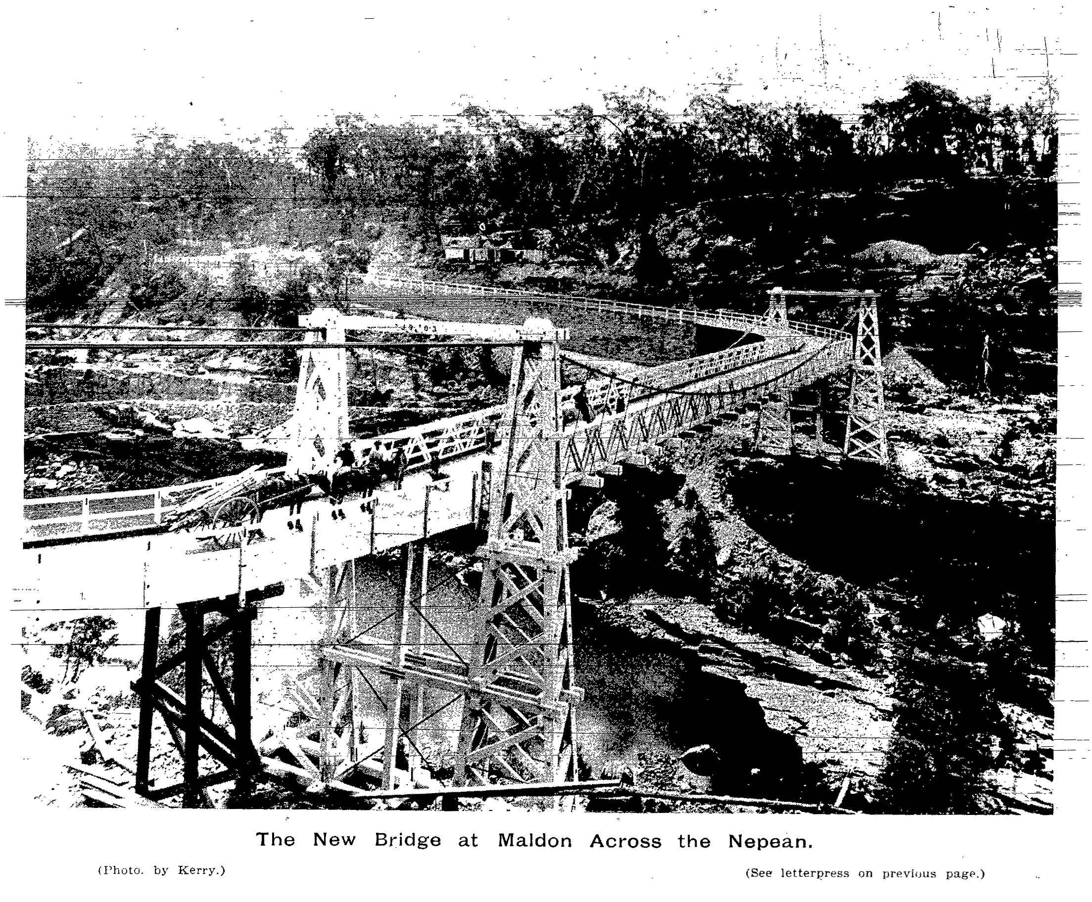
Maldon is a locality in the Macarthur Region of New South Wales, Australia, in the Wollondilly Shire. In the it had a population of 15. History Railway A station was established at Maldon, as part of the Great Southern Railway, in 1879. It was originally named Wilton. The station closed in 1976. Maldon is still an active rail location, having turnouts for freight trains bringing limestone to the cement works, and grain to the flour mill. In 1983, the NSW government commenced construction of an electrified rail link between Maldon and Dombarton (near Wollongong), improving access for coal trains to Port Kembla. The contract for construction of the Avon Tunnel was cancelled in mid-1988: the line was not thought economically viable. An incomplete rail bridge across the Nepean Gorge can be seen just north of the Picton Road bridge. Maldon Suspension Bridge Maldon was also the site of 'Harvey's Crossing', one of two stone causeways over the Upper Nepean River on the Picton ... [...More Info...] [...Related Items...] OR: [Wikipedia] [Google] [Baidu] |
Picton, New South Wales
Picton is a small town in the Macarthur Region of New South Wales, Australia, in the Wollondilly Shire, in south-western Sydney. The town is located approximately 90 kilometres south-west of Sydney, close to Camden and Campbelltown. It is also the administrative centre of Wollondilly Shire. History Picton was first explored by Europeans in 1798 and remained beyond the limits of legal settlement until 1821. Following the discovery of good land in the interior and the settlement of Bong Bong and the Goulburn areas, Governor Macquarie authorised the building of the new Great South Road between Sydney and the Southern Highlands in 1819. This opened up the Picton area to settlers, including Henry Colden Antill, who established a property in 1822. Picton developed when a new line of the Great South Road was cut over the Razorback Range from Camden, and especially after the railway arrived in 1863. Picton is the only town in the Southern Hemisphere that one can pass through t ... [...More Info...] [...Related Items...] OR: [Wikipedia] [Google] [Baidu] |
Acacia Implexa
''Acacia implexa'', commonly known as lightwood or hickory wattle, is a fast-growing Australian tree, the timber of which is used for furniture making. The wood is prized for its finish and strength. The foliage was used to make pulp and dye cloth. Description This long lived small to medium-sized tree with an upright habit and an open crown that typically grows to a height of and a width of . The tree can be have a single or multiple stems with rough greyish bark rough. The branchlets commonly lightly covered in waxy bloom but are not prominently ribbed. It has light green slender sickle shaped phyllodes that have a length of up to and a width of and have three to seven prominent nerves and many other fainter ones that are parallel and branching. Bipinnate leaves may persist on some plants. Young foliage have a purple colour in certain conditions. It blooms in summer and produces spherical cream coloured flowers with a strong perfume. The flowerheads have a diameter of and ... [...More Info...] [...Related Items...] OR: [Wikipedia] [Google] [Baidu] |
Melaleuca Styphelioides
''Melaleuca styphelioides'', known as the prickly-leaved paperbark or prickly paperbark, is a plant native to eastern Australia. It is a tree with spongy bark, prickly leaves and spikes of creamy-white flowers. Description It is a small to medium-sized tree up to high with a dense, rounded canopy and drooping branchlets. The spongy bark is white or light brown and peels off in large strips. The leaves are Sessility (botany), sessile, long and wide. They are slightly twisted, have sharply-pointed tips, are arranged alternately on the branchlets and have between 15 and 30 veins. Flowers appear in summer in cream or white cylindrical "bottlebrush" spikes which are long and in diameter. Often new growth appears at the end of the spikes. Following flowering, grey-brown, woody Capsule (botany), capsules appear in clusters along the branchlets. These are ovoid, stalkless and in diameter Taxonomy The species was first formally described in 1797 by botanist James Edward Smith (b ... [...More Info...] [...Related Items...] OR: [Wikipedia] [Google] [Baidu] |
Eucalypt
Eucalypt is a descriptive name for woody plants with capsule fruiting bodies belonging to seven closely related genera (of the tribe Eucalypteae) found across Australasia: ''Eucalyptus'', '' Corymbia'', '' Angophora'', ''Stockwellia'', ''Allosyncarpia'', ''Eucalyptopsis'' and ''Arillastrum''. Taxonomy For an example of changing historical perspectives, in 1991, largely genetic evidence indicated that some prominent ''Eucalyptus'' species were actually more closely related to ''Angophora'' than to other eucalypts; they were accordingly split off into the new genus ''Corymbia''. Although separate, all of these genera and their species are allied and it remains the standard to refer to the members of all seven genera ''Angophora'', ''Corymbia'', ''Eucalyptus'', ''Stockwellia'', ''Allosyncarpia'', ''Eucalyptopsis'' and ''Arillastrum'' as "eucalypts" or as the eucalypt group. The extant genera ''Stockwellia'', ''Allosyncarpia'', ''Eucalyptopsis'' and ''Arillastrum'' comprise six k ... [...More Info...] [...Related Items...] OR: [Wikipedia] [Google] [Baidu] |
Baulkham Hills
Baulkham Hills is a suburb in the Hills District of Greater Sydney, in the state of New South Wales, Australia. It is 30 kilometres north-west of the Sydney central business district within the local government area of The Hills Shire. Baulkham Hills is the administrative seat of The Hills Shire, an outer metropolitan shire within Greater Sydney. The suburb is also the most populous within the Hills Shire. It is known colloquially as "Baulko". Baulkham Hill’s Norwest Business Park is home to several Fortune 500 companies, a number of shopping centres, high-rise buildings, and industrial and recreational spaces. Geography Baulkham Hills is predominately a residential suburb of the Hills District, with Norwest Business Park in the northern part of the suburb. Baulkham Hills Junction is the intersection of three major roads; Windsor Road, Old Northern Road, and Seven Hills Road. It is also bound by Old Windsor Road and the North-West T-way in the west; and the Hills Motorway ... [...More Info...] [...Related Items...] OR: [Wikipedia] [Google] [Baidu] |
Ryde City Council
The City of Ryde is a local government area in the Northern Sydney region, in the state of New South Wales, Australia. It was first established as the Municipal District of Ryde in 1870, became a municipality in 1906 and was proclaimed as the City of Ryde in 1992. The local government area extends from the Parramatta River to the Lane Cove River which encircles the area in the north, and is bounded in the east by the peninsula of Hunters Hill and the City of Parramatta in the west. The City comprises an area of and as at the had an estimated population of . The Mayor of the City of Ryde since 11 January 2022 is Cr. Sarkis Yedelian OAM a member of the Liberal Party. Suburbs and localities in the local government area The following suburbs and localities are within the City of Ryde: * Chatswood West (shared with City of Willoughby) * Denistone * Denistone East * Denistone West * East Ryde * Eastwood (shared with City of Parramatta Council) * Gladesville (shared with Munic ... [...More Info...] [...Related Items...] OR: [Wikipedia] [Google] [Baidu] |
Parramatta
Parramatta () is a suburb and major Central business district, commercial centre in Greater Western Sydney, located in the state of New South Wales, Australia. It is located approximately west of the Sydney central business district on the banks of the Parramatta River. Parramatta is the administrative seat of the Local government areas of New South Wales, local government area of the City of Parramatta and is often regarded as the main business district of Greater Western Sydney. Parramatta also has a long history as a second administrative centre in the Sydney metropolitan region, playing host to a number of state government departments as well as state and federal courts. It is often colloquially referred to as "Parra". Parramatta, founded as a British settlement in 1788, the same year as Sydney, is the oldest inland European settlement in Australia and is the economic centre of Greater Western Sydney. Since 2000, government agencies such as the New South Wales Police Force ... [...More Info...] [...Related Items...] OR: [Wikipedia] [Google] [Baidu] |
Richmond, New South Wales
Richmond is a town in New South Wales, in the local government area of the City of Hawkesbury. It is located 19 metres above sea level on the alluvial Hawkesbury River flats, at the foot of the Blue Mountains on the Cumberland Plain. It is about 65 km by road from Sydney and about 78 km by road from Lithgow. History The Darug people were the Aboriginal peoples to the area in 1788. The area was originally explored by British settlers in 1789 and the nearby eminence to the west of the Hawkesbury River was known by them as 'Richmond Hill'. The name was given by Governor Arthur Phillip, in honour of Charles Lennox, the third Duke of Richmond who was Master General of Ordnance in the Pitt administration. The local area was the third area to have European settlement in Australia after Sydney and Parramatta. The first 22 European settlers came to the area in 1794. They came to farm a total of in what is now Pitt Town Bottoms. They needed good farming land to help overcome ... [...More Info...] [...Related Items...] OR: [Wikipedia] [Google] [Baidu] |
Abbotsbury, New South Wales
Abbotsbury is a suburb of Sydney, New South Wales, Australia 39 kilometres west of the Sydney central business district in the local government area of the City of Fairfield. Abbotsbury is part of the Greater Western Sydney region. Most of the suburb's estates were built in the late 1980s and early 1990s, although a few acres of undeveloped land in the north-west area was subdivided and developed in the early 2010s. The western border of the suburb is delineated by a line of pine trees, which gives privacy to the homes backing onto the farmlands. History Abbotsbury was named from Major Edward Abbott, a Canadian born soldier who arrived in New South Wales in 1790. Abbott was granted land in what is now Abbotsbury in 1806 although sold it to William Browne in 1810. The estate remained intact until the late 19th century when it was subdivided into small farms and it remained a rural area until the late 20th century when residential subdivision began. The name for the suburb was ap ... [...More Info...] [...Related Items...] OR: [Wikipedia] [Google] [Baidu] |
Razorback, New South Wales
Razorback is a locality and scattered village in the Macarthur Region of New South Wales, Australia, in the Wollondilly Shire. At the , the locality had a population of 1,174. It is in between the main Macarthur towns of Picton (to the south) and Camden (to the north). It is commonly referred to as ''Razorback Range'' as it is part range of high steep hills that make up the Macarthur Region. Furthermore, like most of the Wollondilly Wollondilly Shire is a periurban local government area adjacent to the south-western fringe of Sydney, parts of which fall into the Macarthur, Blue Mountains and Central Tablelands regions in the state of New South Wales, Australia. Wollon ... it is part of the hills that are in between the Blue Mountains and Southern Highlands regions. At the top of Razorback contains a lookout which offers panoramic views of the Campbelltown- Camden urban district as well as the metropolitan Sydney as a whole. References * {{authority con ... [...More Info...] [...Related Items...] OR: [Wikipedia] [Google] [Baidu] |
Campbelltown, New South Wales
Campbelltown is a suburb located on the outskirts of the metropolitan area of Sydney, New South Wales, Australia. It is located in Greater Western Sydney south-west of the Sydney central business district by road. Campbelltown is the administrative seat of the local government area of the City of Campbelltown. It is also acknowledged on the register of the Geographical Names Board of New South Wales as one of only four cities within the Sydney metropolitan area. Campbelltown gets its name from Elizabeth Campbell, the wife of former Governor of New South Wales Lachlan Macquarie. Originally called Campbell-Town, the name was later simplified to the current Campbelltown. History The area that later became Campbelltown was inhabited prior to European settlement by the Tharawal people. Not long after the arrival of the First Fleet in Sydney in 1788, a small herd of six cattle escaped and weren't seen again by the British settlers for seven years. They were spotted, however, ... [...More Info...] [...Related Items...] OR: [Wikipedia] [Google] [Baidu] |

.jpg)


