|
Western Slope, Jersey City
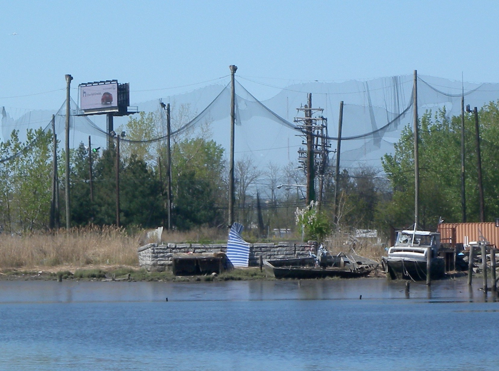
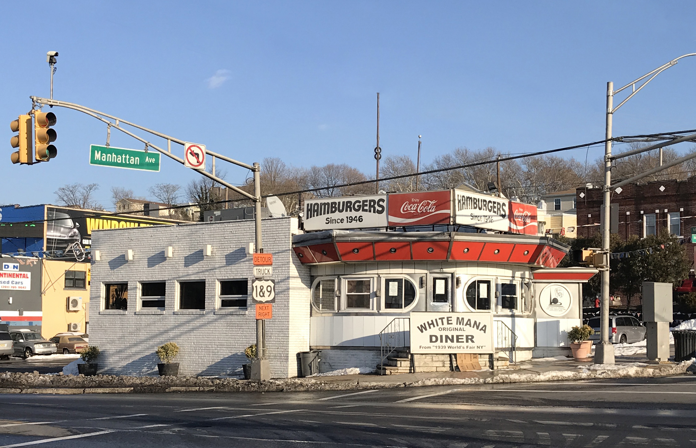
Western Slope is a neighborhood in The Heights, Jersey City, New Jersey on the cuesta, or gradual decline, of the western side of the New Jersey Palisades between The Boulevard and Tonnele Avenue. Its southern border is generally considered to be Beach Street near The Divided Highway and ramp leading to Tonnelle Circle. Its northern border is near Transfer Station, the district of Hudson County, New Jersey where Secaucus Road, Kennedy Boulevard, and Paterson Plank Road, intersect and where the borders of Jersey City Heights, North Bergen, New Jersey, and Union City, New Jersey meet at one point. Some streets of Western Slope keep their names as they cross over the city line into North Bergen. From the Tonnelle Avenue at Route 139, Tonnelle Avenue Avenue through Western Slope is also known as U.S. Route 1/9 between the Holland and Lincoln tunnels, and is dotted with motels and gas stations, and a White Manna White Manna and White Mana are the names of two fast food d ... [...More Info...] [...Related Items...] OR: [Wikipedia] [Google] [Baidu] |
Paterson Plank Road
Paterson Plank Road is a road that runs through Passaic, Bergen and Hudson Counties in northeastern New Jersey. The route, originally laid in the colonial era, connects the city of Paterson and the Hudson River waterfront. It has largely been superseded by Route 3, but in the many towns it passes it has remained an important local thoroughfare, and in some cases been renamed. History Portions of the road were at times called New Barbadoes Turnpike, from New Barbadoes Neck, the name of the peninsula between the rivers it crossed, the Hackensack and the Passaic. Many plank roads in the United States were developed in the nineteenth century. These roads consisted of wooden boards laid adjacently to prevent coach and wagon wheels from getting bogged down in soft or swampy ground, thereby creating an even surface that would facilitate travel. Normally a toll was charged. This technology was applied to the Paterson Plank Road and similar roads, the Hackensack Plank Road and the Newa ... [...More Info...] [...Related Items...] OR: [Wikipedia] [Google] [Baidu] |
White Manna
White Manna and White Mana are the names of two fast food diners in the U.S. state of New Jersey, named after manna, the Biblical food. The restaurants were ranked on America's best burgers list along with White Rose Hamburgers, another New Jersey burger joint. History The establishment was originally opened in Jersey City by Louis Bridges, who purchased the original diner that was introduced in the 1939 New York World's Fair in Flushing Meadows Park, Queens. Both buildings were manufactured by Paramount Diners of Oakland, New Jersey in 1939. Bridges owned five diners, all named "White Manna". It claims to be the home of the invention the Slider. Locations Jersey City, New Jersey The White Mana, located at 470 Tonnele Avenue () in the Western Slope neighborhood of Jersey City was the first White Manna to open, and consists of the original 1939 World's Fair building. When originally introduced, it was called the "diner of the future" and an "Introduction to Fast Food." Accor ... [...More Info...] [...Related Items...] OR: [Wikipedia] [Google] [Baidu] |
Lincoln Tunnel
The Lincoln Tunnel is an approximately tunnel under the Hudson River, connecting Weehawken, New Jersey, to the west with Midtown Manhattan in New York City to the east. It carries New Jersey Route 495 on the New Jersey side and unsigned New York State Route 495 on the New York side. It was designed by Ole Singstad and named after Abraham Lincoln. The tunnel consists of three vehicular tubes of varying lengths, with two traffic lanes in each tube. The center tube contains reversible lanes, while the northern and southern tubes exclusively carry westbound and eastbound traffic, respectively. The Lincoln Tunnel was originally proposed in the late 1920s and early 1930s as the Midtown Hudson Tunnel. The tubes of the Lincoln Tunnel were constructed in stages between 1934 and 1957. Construction of the central tube, which originally lacked sufficient funding due to the Great Depression, started in 1934 and it opened in 1937. The northern tube started construction in 1936, was delayed ... [...More Info...] [...Related Items...] OR: [Wikipedia] [Google] [Baidu] |
Holland Tunnel
The Holland Tunnel is a vehicular tunnel under the Hudson River that connects the New York City neighborhood of Hudson Square in Lower Manhattan to the east with Jersey City in New Jersey to the west. The tunnel is operated by the Port Authority of New York and New Jersey, and carries Interstate 78; the New Jersey side is also designated the eastern terminus of Route 139. The Holland Tunnel is one of three vehicular crossings between Manhattan and New Jersey; the two others are the Lincoln Tunnel and George Washington Bridge. Plans for a fixed vehicular crossing over the Hudson River were first devised in 1906. However, disagreements prolonged the planning process until 1919, when it was decided to build a tunnel under the river. Construction of the Holland Tunnel started in 1920, and it opened in 1927. At the time of its opening, it was the longest continuous underwater vehicular tunnel in the world. The tunnel was originally known as the ''Hudson River Vehicular Tunne ... [...More Info...] [...Related Items...] OR: [Wikipedia] [Google] [Baidu] |
Route 139 (New Jersey)
Route 139 is a state highway in Jersey City, New Jersey in the United States that heads east from the Pulaski Skyway over Tonnele Circle to the state line with New Jersey and New York in the Holland Tunnel, which is under the Hudson River, to New York City. The western portion of the route is a two level highway that is charted by the New Jersey Department of Transportation as two separate roadways: The lower roadway (Route 139) between U.S. Route 1/9 (US 1/9) over Tonnele Circle and Interstate 78 (I-78) at Jersey Avenue, and the upper roadway (Route 139U or Hoboken Avenue) running from County Route 501 (John F. Kennedy Boulevard) and ending where it joins the lower highway as part of the 12th Street Viaduct, which ends at Jersey Avenue. The lower roadway is listed on the federal and NJ state registers of historic places since 2005. The eastern of the route includes the Holland Tunnel approach that runs concurrent with Interstate&n ... [...More Info...] [...Related Items...] OR: [Wikipedia] [Google] [Baidu] |
Tonnelle Avenue
U.S. Route 1/9 (US 1/9) is the long concurrency of US 1 and US 9 from their junction in Woodbridge Township in Middlesex County, New Jersey, north to New York City. The route is a multilane road with some freeway portions that runs through urbanized areas of Northern New Jersey adjacent to New York City. Throughout most of its length in New Jersey, the road runs near the New Jersey Turnpike/Interstate 95 (I-95). In Fort Lee, US 1/9 merges onto I-95 and crosses the Hudson River on the George Washington Bridge, where the two U.S. routes split a short distance into New York. US 1/9 intersects several major roads, including I-278 in Linden, Route 81 in Elizabeth, I-78 and US 22 in Newark, Route 139 in Jersey City, Route 3 and Route 495 in North Bergen, and US 46 in Palisades Park. Between Newark and Jersey City, US 1/9 runs along the Pulaski Skyway. Trucks are banned from this section of road and must use US 1/9 Truck. The concurrency between US 1 and US 9 is commonly re ... [...More Info...] [...Related Items...] OR: [Wikipedia] [Google] [Baidu] |
Union City, New Jersey
Union City is a city in the northern part of Hudson County, New Jersey, United States. According to the 2020 United States Census the city had a total population of 68,589,DP-1 - Profile of General Population and Housing Characteristics: 2010 for Union City city, Hudson County, New Jersey . Accessed January 24, 2012. [...More Info...] [...Related Items...] OR: [Wikipedia] [Google] [Baidu] |
North Bergen, New Jersey
North Bergen is a township in the northern part of Hudson County, New Jersey, United States. As of the 2020 U.S. census, the township had a total population of 63,361. The township was founded in 1843. It was much diminished in territory by a series of secessions. Situated on the Hudson Palisades, it is one of the hilliest municipalities in the United States. Like neighboring North Hudson communities, North Bergen is among those places in the nation with the highest population density and a majority Hispanic population. History Colonial era At the time of European colonization the area was the territory of Hackensack tribe of the Lenape Native Americans, who maintained a settlement, Espatingh, on the west side of the hills and where a Dutch trading post was established after the Peach Tree War. In 1658, Peter Stuyvesant, then Director-General of New Netherland, repurchased from them the area now encompassed by the municipalities of Hudson County east of the Hackensack Ri ... [...More Info...] [...Related Items...] OR: [Wikipedia] [Google] [Baidu] |
Jersey City Heights
The Heights or Jersey City Heights is a district in the north end of Jersey City, New Jersey, atop the New Jersey Palisades overlooking Hoboken to the east and Croxton in the Meadowlands to the west. The southern border of The Heights is generally considered to be north of Bergen Arches and The Divided Highway, while Paterson Plank Road in Washington Park near Transfer Station is its main northern boundary. Its postal area ZIP code is 07307. Neighborhoods and thoroughfares Central Avenue is The Heights' primary commercial thoroughfare, with more than 240 businesses serving the area. Pershing Field (named for General John J Pershing is a memorial park in the center of the district that was built on a military training ground. It offers a green space, baseball fields, a swimming pool and ice-skating rink. The adjacent Jersey City Reservoir No. 3 has been preserved as a state designated wetland and park. Many stately Victorian and Edwardian homes distinguish the Height ... [...More Info...] [...Related Items...] OR: [Wikipedia] [Google] [Baidu] |
Secaucus, New Jersey
Secaucus ( ) is a town in Hudson County, New Jersey, United States. As of the 2010 United States census, the town's population was 16,264,DP-1 – Profile of General Population and Housing Characteristics: 2010 for Secaucus town, Hudson County, New Jersey , . Accessed December 25, 2011. [...More Info...] [...Related Items...] OR: [Wikipedia] [Google] [Baidu] |
Gordon Park (1912–2006), American photographer
{{disambiguation ...
Gordon Park may refer to: Places * Gordon Park, Cleveland, a city park located on the lakefront *Gordon Park, Milwaukee, a county park in Milwaukee, Wisconsin, USA *Gordon Park, Queensland, a suburb of Brisbane, Australia * Gordon Park, Zimbabwe People *Lady in the Lake trial, a 1976 murder and 2005 trial in which Gordon Park (1944–2010) was convicted of murder and jailed for life * Gordon L. Park (1937–2010), petroleum engineer, geologist and politician in Wyoming See also *Gordon Parks Gordon Roger Alexander Buchanan Parks (November 30, 1912 – March 7, 2006) was an American photographer, composer, author, poet, and film director, who became prominent in U.S. documentary photojournalism in the 1940s through 1970s—particu ... [...More Info...] [...Related Items...] OR: [Wikipedia] [Google] [Baidu] |


