|
Western Plains Wine Zone
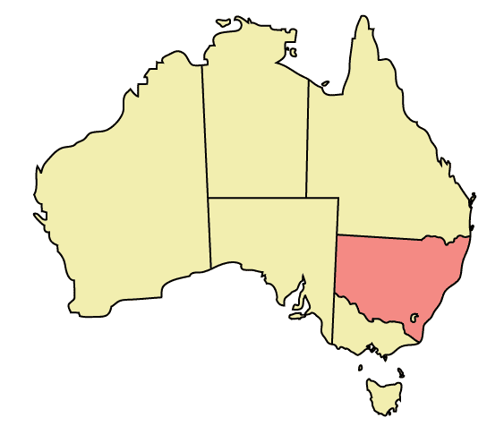
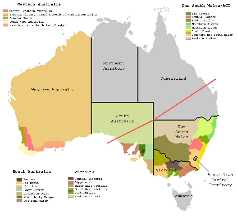
Western Plains is an Australian Geographical Indication for a grape growing zone (larger than a "region") encompassing most of northwestern New South Wales in Australia. It was entered in the Register of Protected Names on 1 May 1996. There are no regions defined in the zone. Most of this zone is arid and unsuitable for grape growing. There are approximately eight commercial wineries in the Western Plains zone. They are all in the eastern part of the zone, near the towns of Dubbo, Narromine, Warren and Coonabarabran Coonabarabran is a town in Warrumbungle Shire that sits on the divide between the Central West and North West Slopes regions of New South Wales, Australia. At the 2016 census, the town had a population of 2,537, Material was copied from this s .... References Wine regions of New South Wales {{wine-stub ... [...More Info...] [...Related Items...] OR: [Wikipedia] [Google] [Baidu] |
Australian Geographical Indication
A geographical indication (GI) is a name or sign used on products which corresponds to a specific geographical location or origin (e.g., a town, region, or country). The use of a geographical indication, as an indication of the product's source, is intended as a certification that the product possesses certain qualities, is made according to traditional methods, or enjoys a good reputation due to its geographical origin. Article 22.1 of the TRIPS Agreement defines geographical indications as ''"...indications which identify a good as originating in the territory of a Member [of the World Trade Organization], or a region or locality in that territory, where a given quality, reputation or other characteristic of the good is essentially attributable to its geographical origin."'' ''Appellation d'origine contrôlée'' ('Appellation of origin') is a sub-type of geographical indication where quality, method, and reputation of a product originate from a strictly defined area specified ... [...More Info...] [...Related Items...] OR: [Wikipedia] [Google] [Baidu] |
New South Wales Wine
New South Wales wine is Australian wine produced in New South Wales, Australia. New South Wales is Australia's most populous state and its wine consumption far outpaces the region's wine production. The Hunter Valley, located north of Sydney, is the most well-known wine region but the majority of the state's production takes place in the Big Rivers zone- Perricoota, Riverina and along the Darling and Murray Rivers. The wines produced from the Big Rivers zone are largely used in box wine and mass-produced wine brands such as Yellow Tail. A large variety of grapes are grown in New South Wales, including Cabernet Sauvignon, Chardonnay, Shiraz and Sémillon.J. Robinson (ed) ''"The Oxford Companion to Wine"'' Third Edition pp. 473–474 Oxford University Press 2006 New South Wales is the second-largest wine-producing state in Australia, accounting for 30 percent of the A$5 billion Australian wine industry In 1994 the various wine regions within New South Wales agreed there was a ... [...More Info...] [...Related Items...] OR: [Wikipedia] [Google] [Baidu] |
New South Wales
) , nickname = , image_map = New South Wales in Australia.svg , map_caption = Location of New South Wales in AustraliaCoordinates: , subdivision_type = Country , subdivision_name = Australia , established_title = Before federation , established_date = Colony of New South Wales , established_title2 = Establishment , established_date2 = 26 January 1788 , established_title3 = Responsible government , established_date3 = 6 June 1856 , established_title4 = Federation , established_date4 = 1 January 1901 , named_for = Wales , demonym = , capital = Sydney , largest_city = capital , coordinates = , admin_center = 128 local government areas , admin_center_type = Administration , leader_title1 = Monarch , leader_name1 = Charles III , leader_title2 = Governor , leader_name2 = Margaret Beazley , leader_title3 = Premier , leader_name3 = Dominic Perrottet (Liberal) , national_representation = Parliament of Australia , national_representation_type1 = Senat ... [...More Info...] [...Related Items...] OR: [Wikipedia] [Google] [Baidu] |
Wine Australia
Wine Australia is an Australian Government statutory corporation that promotes and regulates the Australian wine industry. It was created as the Australian Wine and Brandy Corporation (AWBC) in 1981 to replace the Australian Wine Board by the ''Australian Wine and Brandy Corporation Act 1980'', and had its name changed by the amended ''Wine Corporation Act 1980'', passed in December 2010. Wine Australia is now governed by the superseding law, ''Wine Australia Act 2013''. Wine Australia determines the boundaries of Australia's wine regions and sometimes names them. Wine Australia also regulates wine exports, ensuring the quality and integrity of each shipment of wine exported. Wine Australia has three main departments; Compliance, Market Development and Knowledge Development. Wine Australia has its headquarters in Adelaide. History Wine Australia is a type of statutory authority known as a statutory corporation, established by the Australian Government. It was originally creat ... [...More Info...] [...Related Items...] OR: [Wikipedia] [Google] [Baidu] |
Dubbo, New South Wales
Dubbo () is a city in the Orana Region of New South Wales, Australia. It is the largest population centre in the Orana region, with a population of 43,516 at June 2021. The city is located at the intersection of the Newell, Mitchell, and Golden highways. The nearest city, Orange, is about away. Dubbo is located roughly above sea level, north-west of Sydney ( by road) and is a major road and rail freight hub to other parts of New South Wales. It is linked by national highways north to Brisbane, south to Melbourne, east to Sydney and Newcastle, and west to Broken Hill and Adelaide. Dubbo is included in the rainfall and weather forecast region for the Central West Slopes and in the Central West Slopes and Plains division of the Bureau of Meteorology forecasts. History Evidence of habitation by Wiradjuri Nation, Indigenous Australians dates back over 40,000 years. Explorer and surveyor John Oxley was the first European to report on the area, now known as Dubbo, in 1818. T ... [...More Info...] [...Related Items...] OR: [Wikipedia] [Google] [Baidu] |
Narromine, New South Wales
Narromine ( /næroʊmaɪn/) is a rural Australian town located approximately 40 kilometres (25 mi) west of Dubbo in the Orana region of New South Wales. The town is at the centre of Narromine Shire. The 2016 census recorded a population of 3,528. Narromine holds strong historical ties to the Australian Military, as it was the location of RAAF No.19 Inland Aircraft Fuel Depot (IAFD) during World War II. The base contributed to the preparation of troops through a training organisation known as the Empire Air Training Scheme (EATS). The town was one of twelve locations for the No.5 Elementary Flying Training School RAAF in 1940. The town and its district was formed on traditional Wiradjuri country, one of the largest Indigenous populations in central New South Wales. The Macquarie River passes through the town. The Mitchell Highway, named after the early explorer Sir Thomas Mitchell, is the main road from Dubbo to the West and also passes through Narromine. Prior to settle ... [...More Info...] [...Related Items...] OR: [Wikipedia] [Google] [Baidu] |
Warren, New South Wales
Warren is a town in the Orana Region of New South Wales, Australia. It is located off the Mitchell Highway, 120 kilometres north west of Dubbo, and is the seat of the Warren Shire local government area. At the , Warren had a population of 1,530. Warren is included in the Central West Slopes and Plains division of the Bureau of Meteorology forecasts. History Before European settlement the area is said to have been occupied by the Ngiyambaa Aborigines. Explorer John Oxley camped on the present town site during his investigation of the Macquarie River in 1818. He noted an abundance of kangaroos and emus. Charles Sturt carried out further exploration in 1828-29. Cattle were grazing hereabouts by the late 1830s. Warren station was established in 1845 by Thomas Readford and William Lawson, the son of explorer William Lawson who was a member of the first European party to breach the Blue Mountains in 1813. Some say the name derives from a local Aboriginal word, meaning "stron ... [...More Info...] [...Related Items...] OR: [Wikipedia] [Google] [Baidu] |
Coonabarabran, New South Wales
Coonabarabran is a town in Warrumbungle Shire that sits on the divide between the Central West (New South Wales), Central West and North West Slopes regions of New South Wales, Australia. At the 2016 Australian census, 2016 census, the town had a population of 2,537, Material was copied from this source, which is available under Creative Commons Attribution 4.0 International License.and as of 2021, the population of Coonabarabran and its surrounding area is 3,477. Local and district residents refer to the town as 'Coona'. History and description In 1817 the area was opened up by a Government-sponsored expedition. In 1818 John Oxley found Aboriginal people living here — later identified as the western language reach of the Kamilaroi clans (Gamilaraay is the spelling used by linguists). Kamilaroi people are still well represented in the region, having occupied Coonabarabran for approximately 7,500 years. In 1859 Lewis Gordon first proposed a town plan survey for Coonabarabran. ... [...More Info...] [...Related Items...] OR: [Wikipedia] [Google] [Baidu] |


