|
Western New York
Western New York (WNY) is the westernmost region of the U.S. state of New York. The eastern boundary of the region is not consistently defined by state agencies or those who call themselves "Western New Yorkers". Almost all sources agree WNY includes the cities of Buffalo, Niagara Falls, Jamestown, and the surrounding suburbs, as well as the outlying rural areas of the Great Lakes lowlands and Niagara Frontier, and Chautauqua-Alleghany (or the western Southern Tier). Many would also place Rochester and the Genesee Valley in the region while some would also include the western Finger Lakes within the region. Others would describe the latter three areas as being in a separate Finger Lakes region. The State of New York sometimes defines the WNY region as including just five counties: Allegany, Cattaraugus, Chautauqua, Erie, and Niagara. The state’s Empire State Development Corporation and state health authorities have both mapped the region this way. The state has also use ... [...More Info...] [...Related Items...] OR: [Wikipedia] [Google] [Baidu] |
Buffalo, New York
Buffalo is the second-largest city in the U.S. state of New York (behind only New York City) and the seat of Erie County. It is at the eastern end of Lake Erie, at the head of the Niagara River, and is across the Canadian border from Southern Ontario. With a population of 278,349 according to the 2020 census, Buffalo is the 78th-largest city in the United States. The city and nearby Niagara Falls together make up the two-county Buffalo–Niagara Falls Metropolitan Statistical Area (MSA), which had an estimated population of 1.1 million in 2020, making it the 49th largest MSA in the United States. Buffalo is in Western New York, which is the largest population and economic center between Boston and Cleveland. Before the 17th century, the region was inhabited by nomadic Paleo-Indians who were succeeded by the Neutral, Erie, and Iroquois nations. In the early 17th century, the French began to explore the region. In the 18th century, Iroquois land surrounding Buffalo Creek ... [...More Info...] [...Related Items...] OR: [Wikipedia] [Google] [Baidu] |
Ontario County, New York
Ontario County is a county in the U.S. State of New York. As of the 2020 census, the population was 112,458. The county seat is Canandaigua. Ontario County is part of the Rochester, NY Metropolitan Statistical Area. In 2006, ''Progressive Farmer'' rated Ontario County as the "Best Place to Live" in the U.S., for its "great schools, low crime, excellent health care" and its proximity to Rochester. History This area was long controlled by the Seneca people, one of the Five Nations of the Iroquois Confederacy, or ''Haudenosaunee''. They were forced to cede most of their land to the United States after the American Revolutionary War. When the English established counties in New York Province in 1683, they designated Albany County as including all the northern part of New York State, the present State of Vermont, and, in theory, extending westward to the Pacific Ocean. On July 3, 1766 Cumberland County was organized, and on March 16, 1770 Gloucester County was founded, both c ... [...More Info...] [...Related Items...] OR: [Wikipedia] [Google] [Baidu] |
Canandaigua (city), New York
Canandaigua (; ''Utaʼnaráhkhwaʼ'' in Tuscarora) is a city in Ontario County, New York, United States. Its population was 10,545 at the 2010 census. It is the county seat of Ontario County; some administrative offices are at the county complex in the adjacent town of Hopewell.Google Maps (3019 County Complex Drive, Canandaigua, New York) Retrieved Jan. 14, 2015.Ontario County, New York Retrieved Jan. 14, 2015. The name Canandaigua is derived from the |
Lockport (city), New York
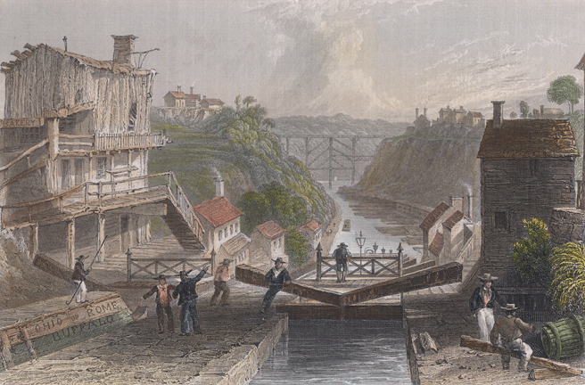
Lockport is both a city and the town that surrounds it in Niagara County, New York. The city is the Niagara county seat, with a population of 21,165 according to 2010 census figures, and an estimated population of 20,305 as of 2019. Its name derives from a set of Erie Canal locks (Lock Numbers 34 and 35) within the city that were built to allow canal barges to traverse the 60-foot natural drop of the Niagara Escarpment. It is part of the Buffalo–Niagara Falls metropolitan area. History The New York State Legislature authorized the Erie Canal's construction in April 1816. The route proposed by surveyors was to traverse an area in central Niagara County, New York, which was then "uncivilized" and free of White settlers. At the time, the nearest settlers were in nearby Cold Springs, New York. Following the announcement, land speculators began to buy large plots along and near the proposed route of the canal. By December 1820, when the exact location of the step locks had bee ... [...More Info...] [...Related Items...] OR: [Wikipedia] [Google] [Baidu] |
Elmira, New York
Elmira () is a city and the county seat of Chemung County, New York, United States. It is the principal city of the Elmira, New York, metropolitan statistical area, which encompasses Chemung County. The population was 26,523 at the 2020 census, down from 29,200 at the 2010 census, a decline of more than 7 percent. The City of Elmira is in the south-central part of the county, surrounded on three sides by the Town of Elmira. It is in the Southern Tier of New York, a short distance north of the Pennsylvania state line. History Early history The region of Elmira was inhabited by the Cayuga nation (also known as the Kanawaholla) of the Haudenosaunee prior to European colonization. Cayuga residing in the region maintained relations with European settlers, primarily related to the fur trade, but were otherwise relatively isolated from encroaching colonial settlements. During the American Revolutionary War, the Sullivan Expedition of 1779 was mounted by the Continental ... [...More Info...] [...Related Items...] OR: [Wikipedia] [Google] [Baidu] |
Jamestown, New York
Jamestown is a city in southern Chautauqua County, in the U.S. state of New York. The population was 28,712 at the 2020 census. Situated between Lake Erie to the north and the Allegheny National Forest to the south, Jamestown is the largest population center in the county. Nearby Chautauqua Lake is a freshwater resource used by fishermen, boaters, and naturalists. Notable people from Jamestown include legendary comedienne Lucille Ball, U.S. Supreme Court justice and Nuremberg chief prosecutor Robert H. Jackson, musician Natalie Merchant, musician Dennis Drew, musician John Lombardo, naturalist Roger Tory Peterson, and NFL Commissioner Roger Goodell. In the 20th century, Jamestown was a thriving industrial area, noted for producing several well-known products. They include the crescent wrench, produced by Karl Peterson's the Crescent Tool Company in Jamestown beginning in 1907. and the automatic lever voting machine, manufactured by the Automatic Voting Machine Company, w ... [...More Info...] [...Related Items...] OR: [Wikipedia] [Google] [Baidu] |
Batavia, New York
Batavia is a city in and the county seat of Genesee County, New York, United States. It is near the center of the county, surrounded by the Town of Batavia, which is a separate municipality. Batavia's population as of the 2020 census was 15,600. The name ''Batavia'' is Latin for the Betuwe region of the Netherlands, and honors early Dutch land developers. In 2006, a national magazine, ''Site Selection'', ranked Batavia third among the nation's micropolitans based on economic development. The New York State Thruway (Interstate 90) passes north of the city. Genesee County Airport (GVQ) is also north of the city. The city hosts the Batavia Muckdogs baseball team of the Perfect Game Collegiate Baseball League, at Dwyer Stadium (299 Bank Street). The Muckdogs formerly were an affiliate of the Miami Marlins. They won the 2008 New York Penn League Championship. The city's UN/LOCODE is USBIA. History The Holland Land Company The current City of Batavia was an early settlement ... [...More Info...] [...Related Items...] OR: [Wikipedia] [Google] [Baidu] |
Niagara Falls, New York
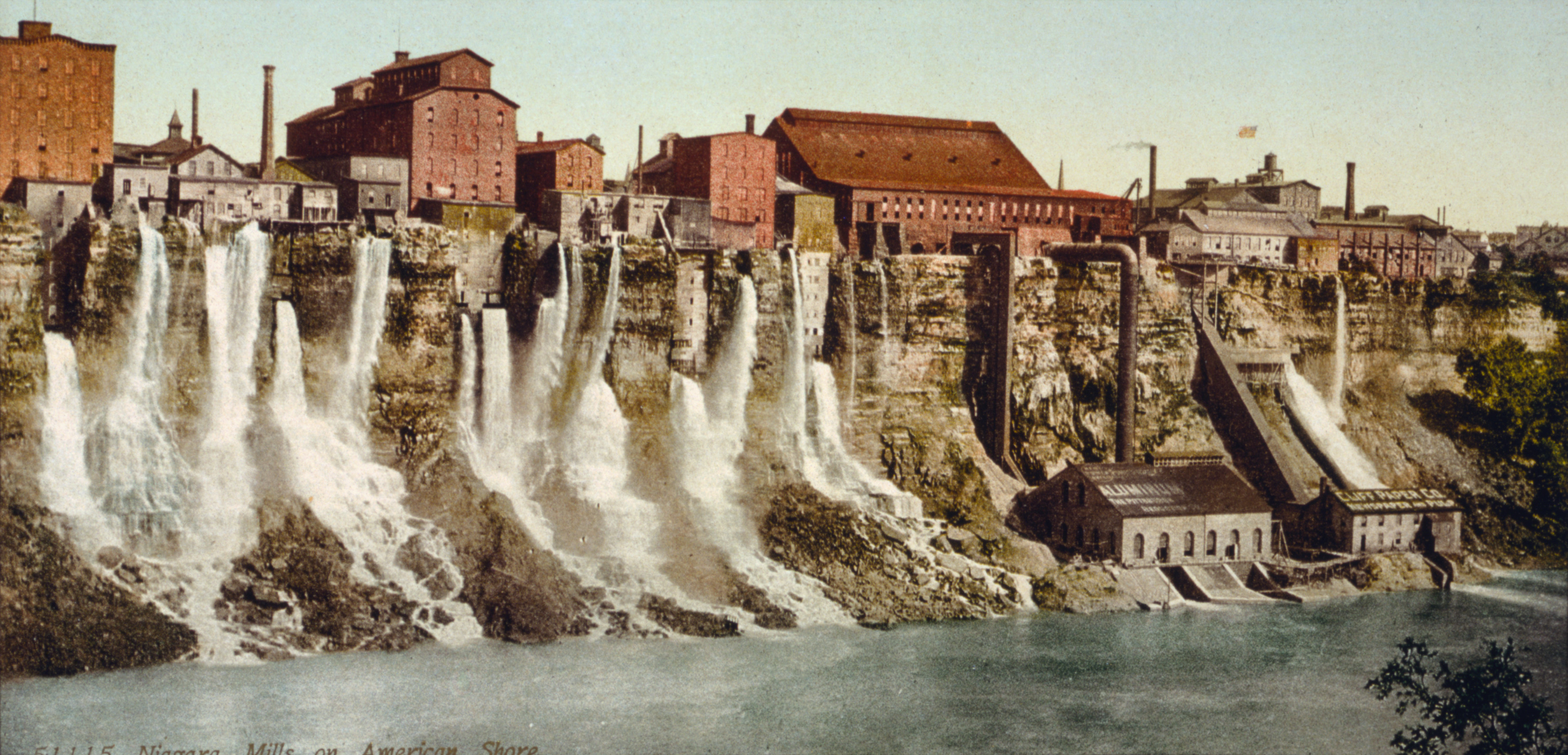
Niagara Falls is a City (New York), city in Niagara County, New York, United States. As of the 2020 United States Census, 2020 census, the city had a total population of 48,671. It is adjacent to the Niagara River, across from the city of Niagara Falls, Ontario, and named after the famed Niagara Falls which they share. The city is within the Buffalo–Niagara Falls metropolitan area and the Western New York region. While the city was formerly occupied by Native Americans, Europeans who migrated to the Niagara Falls in the mid-17th century began to open businesses and develop infrastructure. Later in the 18th and 19th centuries, scientists and businessmen began harnessing the power of the Niagara River for electricity and the city began to attract manufacturers and other businesses drawn by the promise of inexpensive hydroelectric power. After the 1960s, however, the city and region witnessed an economic decline, following an attempt at urban renewal under then Mayor Lackey. Consis ... [...More Info...] [...Related Items...] OR: [Wikipedia] [Google] [Baidu] |
Yates County, New York
Yates County is a county in the U.S. state of New York. As of the 2020 Census, the population was 24,774, making it the third-least populous county in New York. The county seat is Penn Yan. The name is in honor of Joseph C. Yates, who as Governor of New York signed the act establishing the county. Yates County is included in the Rochester, NY Metropolitan Statistical Area. History When counties were established in New York State in 1683, the present Yates County was part of Albany County. This was an enormous county, including the northern part of New York State as well as all of the present State of Vermont and, in theory, extending westward to the Pacific Ocean. This county was reduced in size on July 3, 1766, by the creation of Cumberland County, and again on March 16, 1770, by the creation of Gloucester County, both containing territory now in Vermont. On March 12, 1772, what was left of Albany County was split into three parts, one remaining under the name Albany Count ... [...More Info...] [...Related Items...] OR: [Wikipedia] [Google] [Baidu] |
Wyoming County, New York
Wyoming County is a county in the U.S. state of New York in the state's western area. As of the 2020 census, the population was 40,531. The county seat is Warsaw. The name is modified from a Lenape (Delaware) Native American word meaning "broad bottom lands". Wyoming County was formed from Genesee County in 1841. Wyoming County is one of New York's mostly agricultural counties. With an estimated 47,500 dairy cows in the county, there are more cattle in Wyoming County than people. History As with the rest of Western New York, Wyoming County was part of disputed territory throughout the 17th and 18th centuries, claimed by the Massachusetts Bay Colony, Connecticut Colony, Pennsylvania Colony, New York Colony, and New France. New York's claims were not recognized until the Treaty of Hartford was ratified in 1786 and were not actively asserted until the Holland Purchase. In regard to New York's claim, as of 1683 the present Wyoming County was part of Albany County of the Provi ... [...More Info...] [...Related Items...] OR: [Wikipedia] [Google] [Baidu] |
Wayne County, New York
Wayne County is a county in the U.S. state of New York. As of the 2020 Census, the population was 91,283. The county seat is Lyons. The name honors General Anthony Wayne, an American Revolutionary War hero and American statesman. Wayne County is less than 50 miles west of, and is in the same Congressional District as, Syracuse. Wayne County has been considered to be part of the Rochester, NY Metropolitan Statistical Area and lies on the south shore of Lake Ontario, forming part of the northern border of the United States with Canada. Its location during the early westward expansion of the United States, on an international border and in a fertile farming region, has contributed to a rich cultural and economic history. Two world religions sprung from within its borders, and its inhabitants played important roles in abolitionism in the years leading up to the American Civil War. Nineteenth century War of 1812 skirmishes, Great Lakes sailing ship commerce and Erie Canal barge ... [...More Info...] [...Related Items...] OR: [Wikipedia] [Google] [Baidu] |
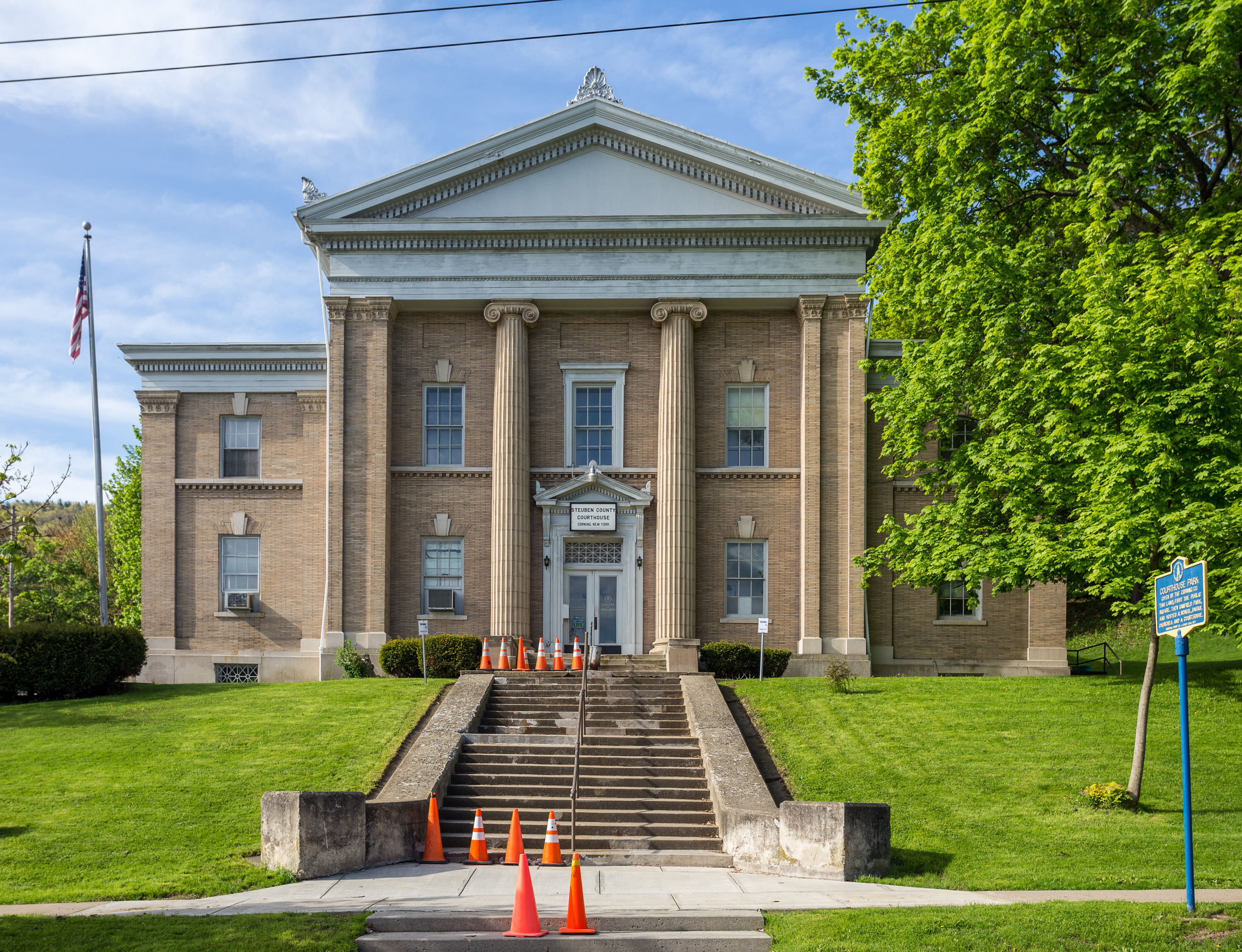
Steuben County, New York
Steuben County (stu-BEN) is a county located in the U.S. state of New York. As of the 2020 census, the population was 93,584. Its county seat is Bath. Its name is in honor of Baron von Steuben, a Prussian general who fought on the American side in the American Revolutionary War, though it is not pronounced the same (). Steuben County comprises the Corning, NY Micropolitan Statistical Area, which is also included in the Elmira-Corning, NY Combined Statistical Area. History Ontario County was established in 1789 to govern lands the state of New York had acquired in the Phelps and Gorham Purchase; at the time it covered the entirety of Western New York. Steuben County, much larger than today, was split off from Ontario County on March 8, 1796. In 1823 a portion of Steuben County was combined with a portion of Ontario County to form Yates County. Steuben County was further reduced in size on April 17, 1854, when a portion was combined with portions of Chemung and Tomp ... [...More Info...] [...Related Items...] OR: [Wikipedia] [Google] [Baidu] |

