|
Western Himalayas
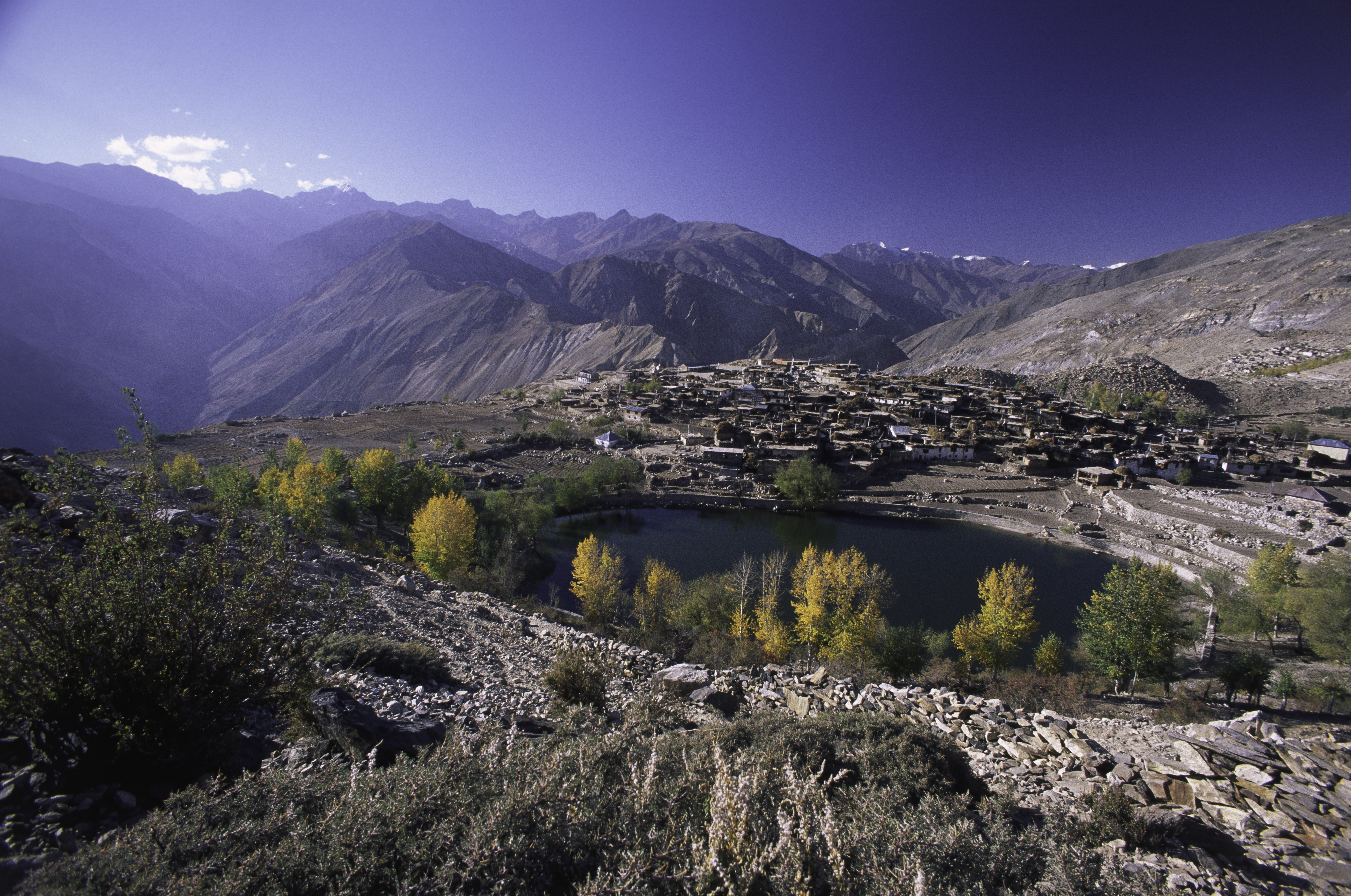
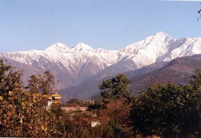
The Western Himalayas refers to the western half of the Himalayas, in northern Pakistan and northwestern India. It is also known as the Punjab Himalayas. Four of the five tributaries of the Indus River in Punjab (Beas, Chenab, Jhelum, and Ravi) rise in the Western Himalayas; while the fifth, the Sutlej cuts through the range after rising in Tibet. Included within the Western Himalayas are the Zanskar Range, the Pir Panjal Range, and the Dhauladhar Range, and western parts of the Sivalik Range and the Great Himalayas. The highest point is Nanga Parbat (26,660 feet or 8,126 metres), at the northwestern end of the region. Rivers The Jhelum river rises in the Pir Panjal Range in Indian-administered Jammu and Kashmir, and flows northwestward through the Vale of Kashmir before entering Pakistani-administered Azad Kashmir and eventually entering the plains near Mirpur. The Chenab river originates in Himachal Pradesh near Chandra Taal and forms the Lahaul Valley in the state and th ... [...More Info...] [...Related Items...] OR: [Wikipedia] [Google] [Baidu] |
Nanga Parbat The Killer Mountain , name of African traditional healer in Zimbabwe
{{disambig ...
Nanga may be: *Nanga (instrument), an Egyptian musical instrument *Nanga (Japanese painting) *Nanga Brook, Western Australia *Nanga of Kongo, second ruler or manikongo of the Central African kingdom of Kongo *Nanga subcaste of the Sial (tribe) in Pakistan *N'anga ''Nganga'' is a Kikongo language term for herbalist or Faith healing, spiritual healer in many African societies and also in many societies of the African diaspora such as those in Haiti, Brazil, and Cuba. It is derived from ''*-ganga'' in Prot ... [...More Info...] [...Related Items...] OR: [Wikipedia] [Google] [Baidu] |
Kinnaur 344 (9527158279)
Kinnaur is one of the twelve administrative districts of the state of Himachal Pradesh in northern India. The district is divided into three administrative areas (Kalpa, Nichar (Bhabanagar), and Pooh) and has six tehsils. The administrative headquarters of the district is at Reckong Peo. The mountain peak of Kinnaur Kailash is found in this district. As of 2011, it is the second least populous district of Himachal Pradesh (out of 12 districts), after Lahaul and Spiti. General Kinnaur is about from the state capital, Shimla, located in the northeast corner of Himachal Pradesh bordering Tibet to the east. It has three high mountain ranges, namely Zanskar and the Himalayas, that enclose the valleys of Baspa, Satluj, and Spiti, as well as their tributaries. The slopes are covered with thick wood, orchards, fields and hamlets. At the peak of Kinnaur Kailash mountain is a natural rock Shivling (Shiva lingam). The district was opened to outsiders in 1989. The old Hindustan-Tibet R ... [...More Info...] [...Related Items...] OR: [Wikipedia] [Google] [Baidu] |
Kangra Valley
Kangra Valley is a river valley situated in the Western Himalayas.Earthquakes '''', v. 1, ''p. 98.'' It lies in the state of in , and is a popular tourist destination. The is spoken there. |
Kullu Valley
Kullu Valley is a broad open valley in Himachal Pradesh, India, formed by the Beas River between Manali and Larji. This valley is famous for its temples, beauty and its majestic hills covered with pine and deodar forest and sprawling apple orchards. The course of the Beas river presents a succession of magnificent, clad with forests of deodar, towering above trees of pine on the lower rocky ridges. Kullu valley is sandwiched between the Pir Panjal, Lower Himalayan and Great Himalayan Ranges. Ski touring is a sport growing in popularity in the Himilayan peaks surrounding the valley. Economy ''See Economy section in Kullu district.'' Tourism ''For places of interest, festivals, and outdoor sports in the Kullu valley, see Attractions section in Kullu district.'' Further reading ''See Further Readings section in Kullu district Kullu is a district in Himachal Pradesh, India. It borders Rampur district to the south, Mandi and Kangra districts to the west, and the La ... [...More Info...] [...Related Items...] OR: [Wikipedia] [Google] [Baidu] |
Chamba, Himachal Pradesh
Chamba is a town in the Chamba district in the Indian state of Himachal Pradesh. According to the 2001 Indian census, Chamba has a population of 20,312 people. Located at an altitude of above mean sea level, the town is situated on the banks of the Ravi River (a major tributary of the Trans- Himalayan Indus River), at its confluence with the Sal River. Though historical records date the history of the Chamba region to the Kolian tribes in the 2nd century BC, the area was formally ruled by the Maru dynasty, starting with the Raju Maru from around 500 AD, ruling from the ancient capital of Bharmour, which is located from the town of Chamba.Sharma & Sethi (1997), p.34 In 920, Raja Sahil Varman (or Raja Sahil Verman) shifted the capital of the kingdom to Chamba, following the specific request of his daughter Champavati (Chamba was named after her). From the time of Raju Maru, 67 Rajas of this dynasty ruled over Chamba until it finally merged with the Indian Union in April 194 ... [...More Info...] [...Related Items...] OR: [Wikipedia] [Google] [Baidu] |
Akhnoor
Akhnoor is a city and municipal committee, near city of Jammu in Jammu district of Indian union territory of Jammu and Kashmir. It lies 28 km away from Jammu city. Akhnoor is on the bank of the Chenab River, just before it enters the Pakistani Punjab. Its border location gives it strategic significance. The Akhnoor area is divided into three administrative sub-divisions - Akhnoor, Chowki Choura and Khour; Seven Tehsils - Akhnoor Khaas, Chowki Choura, Maira Mandrian, Jourian, Kharah Balli, Khour & Pargwal. History The place is believed to be the ancient city of ''Virat Nagar'' mentioned in the Mahabharata however, Bairat, a town in northern Jaipur district of Rajasthan is more established as the ancient ''Virat Nagar''. The place is one of the most important historical sites in Jammu and Kashmir. Excavations by the Archaeological Survey of India have established the fact that Akhnoor was one of the last bastion of the Indus Valley civilization and Manda, Akhnoor is the ... [...More Info...] [...Related Items...] OR: [Wikipedia] [Google] [Baidu] |
Jammu Division
The Jammu division (; ) is a revenue and administrative division within Jammu and Kashmir, a union territory of India. It consists of the districts of Jammu, Doda, Kathua, Ramban, Reasi, Kishtwar, Poonch, Rajouri, Udhampur and Samba. Most of the land is hilly or mountainous, including the Pir Panjal Range which separates it from the Kashmir Valley and part of the Great Himalayas in the eastern districts of Doda and Kishtwar. Its principal river is the Chenab. Jammu city is the largest city in Jammu and the winter capital of Jammu and Kashmir. It is also known as "City of Temples" as it has many temples and shrines, with glittering '' shikhars'' soaring into the sky, which dot the city's skyline, creating the ambiance of a holy and peaceful city. Home to some of the most revered Hindu shrines, such as Vaishno Devi, Jammu is a major pilgrimage centre for Hindus. A majority of Jammu's population practices Hinduism, while Islam and Sikhism enjoy a strong cultural heritage in t ... [...More Info...] [...Related Items...] OR: [Wikipedia] [Google] [Baidu] |
Lahaul And Spiti District
The Lahaul and Spiti district in the Indian state of Himachal Pradesh consists of the two formerly separate districts of Lahaul () and Spiti (; or ). The present administrative centre is Kyelang in Lahaul. Before the two districts were merged, Kardang was the capital of Lahaul, and Dhankar the capital of Spiti. The district was formed in 1960, and is the fourth least populous district in India (out of 640). It is the least densely populated district of India, according to the Census of India 2011. Geography Geologically located on the Tibetan Plateau, Lahaul and Spiti district is connected to Manali through the Rohtang Pass. ''Kunzum la'' or the Kunzum Pass (altitude ) is the entrance pass to the Spiti Valley from Lahaul. It is from Chandra Tal. To the south, Spiti ends from Tabo, at the Sumdo where the road enters Kinnaur and joins National Highway 5. Spiti is barren and difficult to cross, with an average elevation of the valley floor of . It is surrounded by lofty ran ... [...More Info...] [...Related Items...] OR: [Wikipedia] [Google] [Baidu] |
Chandra Taal
Tso Chigma or Chandra Taal (meaning the ''Lake of the Moon''), or Chandra Tal is a lake in the spiti part of the Lahul and Spiti district of Himachal Pradesh, India. Chandra Taal is near the source of the Chandra River. Despite the rugged and inhospitable surroundings, it is in a protected niche with some flowers and wildlife in summer. It is a favourite spot for tourists and high-altitude trekkers. It is usually associated with Spiti,though geographically it is separated from spiti . Kunzum La separates Lahaul and Spiti valleys. Description Chandra Taal lake is on the ''Samudra Tapu'' plateau, which overlooks Chandra river (a source river of the Chenab). The name of the lake originates from its crescent shape. It is at an altitude of about in the Himalayas. Mountains of scree overlook the lake on one side, and a cirque encloses it on the other. Access Chandra Taal is a tourist destination for trekkers and campers. The lake is accessible by road from Batal and by road a ... [...More Info...] [...Related Items...] OR: [Wikipedia] [Google] [Baidu] |
Himachal Pradesh
Himachal Pradesh (; ; "Snow-laden Mountain Province") is a state in the northern part of India. Situated in the Western Himalayas, it is one of the thirteen mountain states and is characterized by an extreme landscape featuring several peaks and extensive river systems. Himachal Pradesh is the northernmost state of India and shares borders with the union territories of Jammu and Kashmir and Ladakh to the north, and the states of Punjab to the west, Haryana to the southwest, Uttarakhand to the southeast and a very narrow border with Uttar Pradesh to the south. The state also shares an international border to the east with the Tibet Autonomous Region in China. Himachal Pradesh is also known as , meaning 'Land of Gods' and which means 'Land of the Brave'. The predominantly mountainous region comprising the present-day Himachal Pradesh has been inhabited since pre-historic times, having witnessed multiple waves of human migrations from other areas. Through its history, the ... [...More Info...] [...Related Items...] OR: [Wikipedia] [Google] [Baidu] |
Mirpur, Azad Kashmir
Mirpur ( phr, , translit=mirpur; ur, , translit=mīrpūr), officially known as New Mirpur City ( ur, , translit=shèhar nayā mīrpur), is the capital of Mirpur district located in Azad Kashmir, Pakistan. It is the second largest city of Azad Kashmir and 74th largest city in Pakistan. A significant portion of the population from the district, the Mirpuri diaspora, migrated to the United Kingdom in the mid-to-late 1950s and in the early 1960s, mostly to West Yorkshire, East and West Midlands, Birmingham, Luton, Peterborough, Derby and East London. Mirpur is thus sometimes known as "Little England". Many British products are found, and many shops in the city accept the pound sterling. The city itself has gone through a process of modernization, but most of the surrounding area relies on agriculture. History The city of Mirpur itself was founded in around 1640 AD or 1050AH by the Ghakhar chief Miran Shah Ghazi. The Imperial Gazetteer of India Provincial Series Kashmir and J ... [...More Info...] [...Related Items...] OR: [Wikipedia] [Google] [Baidu] |


