|
Western Coastal Plains
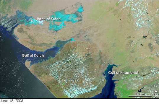
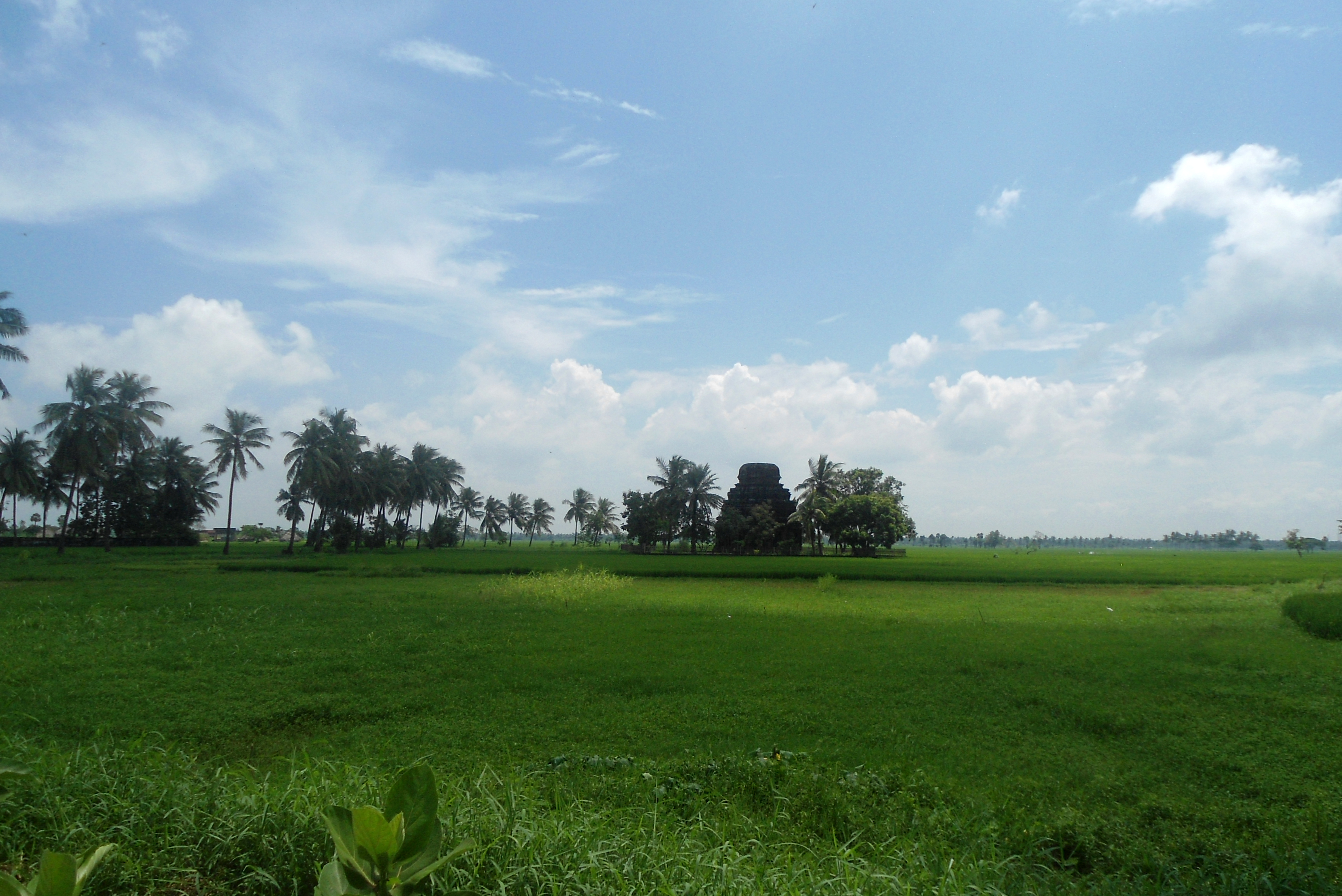
The Western Coastal Plains is a strip of coastal plain 50 kilometres (31 mi) in width between the west coast of India and the Western Ghats hills, which starts near the south of the Tapi River. The plains are located between the Western Ghats and the Arabian Sea. The plains begin at Gujarat in the north and end at Tamil Nadu in the south. It includes the states of Gujarat, Maharashtra, Goa, Karnataka, Kerala, and Tamil Nadu. The region consists of three sections: the Northern part of the coast is called the Konkan (Mumbai to Goa), the central stretch is called the Kanara or the "Karavali", while the southern stretch is referred to as the Malabar Coast. On its northern side there are two gulfs: the Gulf of Khambat and the Gulf of Kutch. The rivers along the coast form estuaries and provide conditions ideal for pisciculture. Because of the presence of less coastal land in this part, it will be affected more by the global warming. The northern portion of the west c ... [...More Info...] [...Related Items...] OR: [Wikipedia] [Google] [Baidu] |
India
India, officially the Republic of India (Hindi: ), is a country in South Asia. It is the seventh-largest country by area, the second-most populous country, and the most populous democracy in the world. Bounded by the Indian Ocean on the south, the Arabian Sea on the southwest, and the Bay of Bengal on the southeast, it shares land borders with Pakistan to the west; China, Nepal, and Bhutan to the north; and Bangladesh and Myanmar to the east. In the Indian Ocean, India is in the vicinity of Sri Lanka and the Maldives; its Andaman and Nicobar Islands share a maritime border with Thailand, Myanmar, and Indonesia. Modern humans arrived on the Indian subcontinent from Africa no later than 55,000 years ago., "Y-Chromosome and Mt-DNA data support the colonization of South Asia by modern humans originating in Africa. ... Coalescence dates for most non-European populations average to between 73–55 ka.", "Modern human beings—''Homo sapiens''—originated in Africa. Then, int ... [...More Info...] [...Related Items...] OR: [Wikipedia] [Google] [Baidu] |
Gulf Of Khambat
The Gulf of Khambhat, historically known as the Gulf of Cambay, is a bay on the Arabian Sea coast of India, bordering the state of Gujarat just north of Mumbai and Diu Island. The Gulf of Khambhat is about long, about wide in the north and up to wide in the south. Major rivers draining Gujarat are the Narmada, Tapti, Mahi and the Sabarmati, that form estuaries in the gulf. It divides the Kathiawar Peninsula from the south-eastern part of Gujarat.Trivedi, P. and Soni, V. C. (2012)Significant bird records and local extinctions in Purna and Ratanmahal Wildlife Sanctuaries, Gujarat, IndiaJhala, Y. V., Qureshi, Q., Sinha, P. R. (Eds.) (2011)''Status of tigers, co-predators and prey in India, 2010.''National Tiger Conservation Authority, Government of India, New Delhi, and Wildlife Institute of India, Dehradun. TR 2011/003. There are plans to construct a dam, Kalpasar Project, across the gulf. Wildlife To the west of the Gulf, Asiatic lions inhabit the Gir Forest National Par ... [...More Info...] [...Related Items...] OR: [Wikipedia] [Google] [Baidu] |
Eastern Coastal Plains
The Eastern Coastal Plains is a wide stretch of landmass of India, lying between the Eastern Ghats and the Bay of Bengal. It is wider and leveled than the Western Coastal Plains and stretches from Tamil Nadu in the south to West Bengal in the north through Andhra Pradesh and Odisha. Chilka Lake is a brackish water lake along the eastern coastal plain. It lies in the state of Odisha and stretches to the south of the Mahanadi Delta. Deltas of many of India's rivers form a major portion of these plains. The Mahanadi, Godavari, Krishna and Kaveri rivers drain these plains. The region receives both the Northeast & Southwest monsoon rains with its annual rainfall averaging between . The width of the plains varies between 100 and 120 km (62 to 80 miles). It is locally known as Utkal Plains in the Northern part between Cossye and Rushikulya Rivers, Northern Circars in the Central part between Rushikulya and Krishna Rivers and, as Coromandel Coast in the Southern part from ... [...More Info...] [...Related Items...] OR: [Wikipedia] [Google] [Baidu] |
Surat
Surat is a city in the western Indian state of Gujarat. The word Surat literally means ''face'' in Gujarati and Hindi. Located on the banks of the river Tapti near its confluence with the Arabian Sea, it used to be a large seaport. It is now the commercial and economic center in South Gujarat, and one of the largest urban areas of western India. It has well-established diamond and textile industry, and is a major supply centre for apparels and accessories. About 90% of the world's diamonds supply are cut and polished in the city. It is the second largest city in Gujarat after Ahmedabad and the eighth largest city by population and ninth largest urban agglomeration in India. It is the administrative capital of the Surat district. The city is located south of the state capital, Gandhinagar; south of Ahmedabad; and north of Mumbai. The city centre is located on the Tapti River, close to Arabian Sea. Surat will be the world's fastest growing city from 2019 to 2035, acco ... [...More Info...] [...Related Items...] OR: [Wikipedia] [Google] [Baidu] |
Cape Comorin
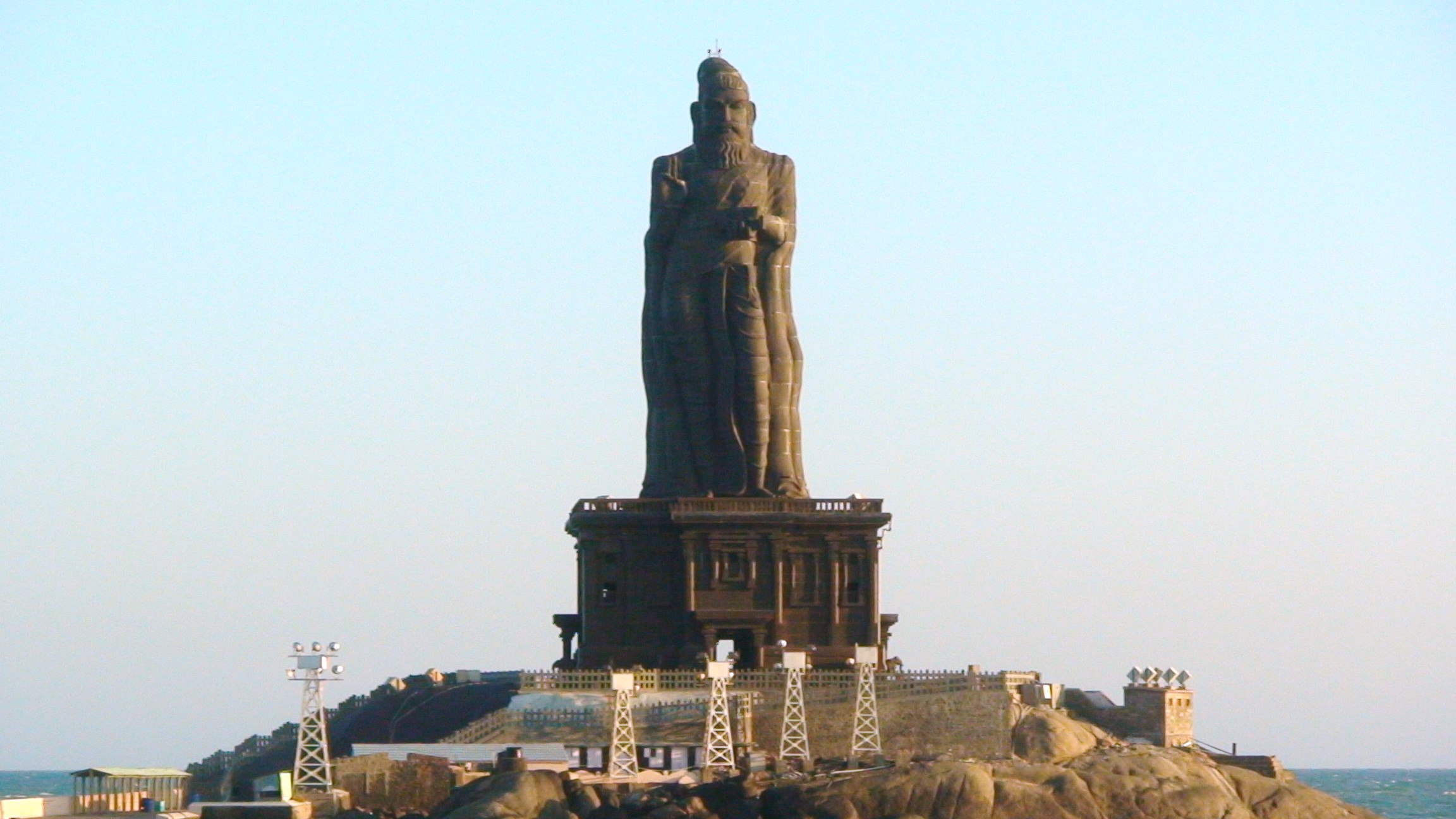
Kanniyakumari (; , referring to Devi Kanya Kumari), also known as Cape Comorin, is a city in Kanniyakumari district in the state of Tamil Nadu, India. It is the southern tip of the Indian subcontinent and the southernmost city in mainland India, thus referred to as 'The Land's End'. The city is situated south of Thiruvananthapuram city, and about south of Nagercoil, the headquarters of Kanniyakumari district. Kanniyakumari is a popular tourist destination and pilgrimage centre in India. Notable tourist spots include its unique sunrise and sunset points, the Thiruvalluvar Statue and Vivekananda Rock Memorial off the coast. Lying at the tip of peninsular India, the town is bordered on the west, south and east by the Laccadive Sea. It has a coastal line of stretched on the three sides. On the shores of the city is a temple dedicated to Goddess Kanniyakumari (the virgin Goddess), after which the town is named.https://thehinduimages.com/details-page.php?id=157918128 ... [...More Info...] [...Related Items...] OR: [Wikipedia] [Google] [Baidu] |
Gersoppa Falls
Jog Falls is a waterfall on the Sharavati river located in the Western Ghats running between Uttara Kannada and Shimoga districts of Karnataka, India. It is the third highest plunge waterfall in India. It is a segmented waterfall which depends on rain and season to become a plunge waterfall. The falls are major attractions for tourists and is ranked 36th in the list of free-falling waterfalls, 490th in the world by list of waterfalls by total height, 128th in the list of single-drop waterfalls in the World by the waterfall database. Description Jog Falls is created by the Sharavati dropping , making it the third-highest waterfall in India after the Nohkalikai Falls with a drop of in Meghalaya and the Dudhsagar Falls with a drop of in Goa. Sharavathi, a river which rises at Ambutirtha, next to Nonabur, in the Thirthahalli taluk takes a northwesterly course by Fatte petta, receives the Haridravati on the right below Pattaguppe and the Yenne Hole on the left above Barangi. Th ... [...More Info...] [...Related Items...] OR: [Wikipedia] [Google] [Baidu] |
Global Warming
In common usage, climate change describes global warming—the ongoing increase in global average temperature—and its effects on Earth's climate system. Climate change in a broader sense also includes previous long-term changes to Earth's climate. The current rise in global average temperature is more rapid than previous changes, and is primarily caused by humans burning fossil fuels. Fossil fuel use, deforestation, and some agricultural and industrial practices increase greenhouse gases, notably carbon dioxide and methane. Greenhouse gases absorb some of the heat that the Earth radiates after it warms from sunlight. Larger amounts of these gases trap more heat in Earth's lower atmosphere, causing global warming. Due to climate change, deserts are expanding, while heat waves and wildfires are becoming more common. Increased warming in the Arctic has contributed to melting permafrost, glacial retreat and sea ice loss. Higher temperatures are also causing m ... [...More Info...] [...Related Items...] OR: [Wikipedia] [Google] [Baidu] |
Pisciculture
upright=1.3, Salmon farming in the sea (mariculture) at Loch Ainort, Isle of Skye">mariculture.html" ;"title="Salmon farming in the sea (mariculture">Salmon farming in the sea (mariculture) at Loch Ainort, Isle of Skye, Scotland Fish farming or pisciculture involves commercial animal husbandry, breeding of fish, usually for food, in fish tanks or artificial pen (enclosure), enclosures such as fish ponds. It is a particular type of aquaculture, which is the controlled cultivation and harvesting of aquatic animals such as fish, crustaceans, molluscs and so on, in natural or pseudo-natural environment. A facility that releases juvenile fish into the wild for recreational fishing or to supplement a species' natural numbers is generally referred to as a fish hatchery. Worldwide, the most important fish species produced in fish farming are carp, catfish, salmon and tilapia. Global demand is increasing for dietary fish protein, which has resulted in widespread overfishing in wild fish ... [...More Info...] [...Related Items...] OR: [Wikipedia] [Google] [Baidu] |
Gulf Of Kutch
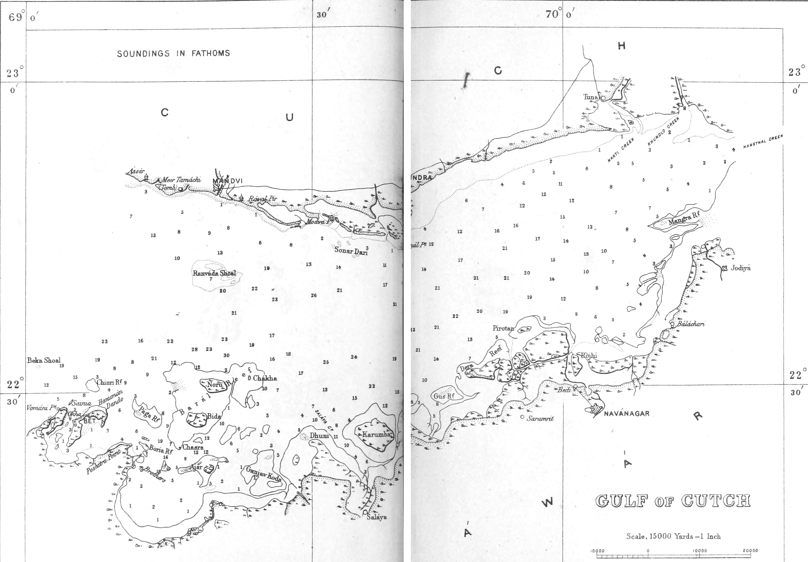
The Gulf of Kutch is located between the peninsula regions of Kutch and Saurashtra, bounded in the state of Gujarat that borders Pakistan. It opens towards the Arabian Sea facing the Osman Gulf. It is about 50 km wide at the entrance before narrowing into marshland, creeks and inlets. The south coast is bordered by islands, mud flats and coral reefs, due to the large amount of marine life found in this region it has large sections of it have become protected as parks and sanctuaries. The northern side is lined with extensive mud flats, the largest of which lie between Mundra and Kuvay. Also, a large portion of the shipping harbours in the region are located on the northern side including Māndvi, Bedi, and Kandla. Maximum depth of the Gulf of Kutch is around 123m (403 ft). Additionally, there are numerous shoals at the mouth of the gulf namely Lushington, Ranwara, Bobby and Gurur. The gulf expands deep into Gujarat with a length of approximately 150 km before becoming ... [...More Info...] [...Related Items...] OR: [Wikipedia] [Google] [Baidu] |
Malabar Coast
The Malabar Coast is the southwestern coast of the Indian subcontinent. Geographically, it comprises the wettest regions of southern India, as the Western Ghats intercept the moisture-laden monsoon rains, especially on their westward-facing mountain slopes. The term is used to refer to the entire Indian coast from the western coast of Konkan to the tip of India at Kanyakumari. The peak of Anamudi, which is also the point of highest altitude in India outside the Himalayas, and Kuttanad, which is the point of least elevation in India, lie on the Malabar Coast. Kuttanad, also known as ''The Rice Bowl of Kerala'', has the lowest altitude in India, and is also one of the few places in the world where cultivation takes place below sea level. The region parallel to the Malabar Coast gently slopes from the eastern highland of Western Ghats ranges to the western coastal lowland. The moisture-laden winds of the Southwest monsoon, on reaching the southernmost point of the Indian Pe ... [...More Info...] [...Related Items...] OR: [Wikipedia] [Google] [Baidu] |
Kanara
Kanara, also known as Karavali is the historically significant stretch of land situated by the southwestern coast of India, alongside the Arabian Sea in the present-day Indian state of Karnataka. The region comprises three civil districts, namely: Uttara Kannada, Udupi, and Dakshina Kannada. Etymology According to historian Severino da Silva, the ancient name for this region is ''Parashurama Srushti'' (creation of Parashurama). According to him and Stephen Fuchs, the name ''Canara'' is the invention of Portuguese, Dutch, and English people who visited the area for trade from the early sixteenth century onwards. The Bednore Dynasty, under whose rule this tract was at that time, was known to them as the Kannada Dynasty, i.e., the dynasty speaking the Kannada language. "Karāvalli", the Kannada word for 'coast', is the term used by Kannada-speakers to refer to this region. The letter 'd' being always pronounced like 'r' by the Europeans, the district was named by them as ... [...More Info...] [...Related Items...] OR: [Wikipedia] [Google] [Baidu] |


