|
Wester Denoon
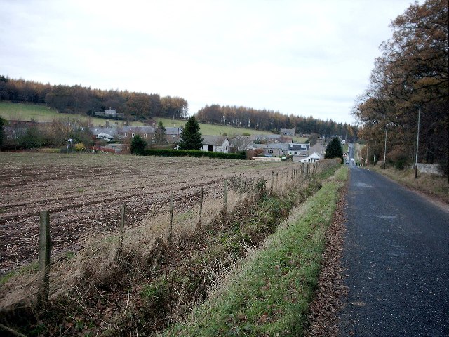
Wester Denoon is a small settlement in Angus, Scotland. Approximately one mile to the north of Wester Denoon is the village of Eassie, where the Eassie Stone is displayed in a ruined church; this carved Pictish stone is dated prior to the Early Middle Ages. Other nearby settlements are Charleston, Balkeerie and Kirkinch. Two fragments of small Pictish cross-slabs have also been found at Wester Denoon itself (preserved in the Meffan Institute, Forfar). One shows the stylised figure of a woman wearing a long dress or mantle fastened on the breast by a large brooch. See also *Ark Hill *Sidlaw Hills The Sidlaws are a range of hills in the counties of Perthshire and Angus in Scotland that extend for 30 miles (45 km) from Kinnoull Hill, near Perth, northeast to Forfar. A continuation of the Ochils, they separate the valley of Strath ... References External linksView of a track outside of Western Denoon from the United Kingdom Geograph Official Site Villages ... [...More Info...] [...Related Items...] OR: [Wikipedia] [Google] [Baidu] |
Angus, Scotland
Angus ( sco, Angus; gd, Aonghas) is one of the 32 local government council areas of Scotland, a registration county and a lieutenancy area. The council area borders Aberdeenshire, Dundee City and Perth and Kinross. Main industries include agriculture and fishing. Global pharmaceuticals company GSK has a significant presence in Montrose in the north of the county. Angus was historically a province, and later a sheriffdom and county (known officially as Forfarshire from the 18th century until 1928), bordering Kincardineshire to the north-east, Aberdeenshire to the north and Perthshire to the west; southwards it faced Fife across the Firth of Tay; these remain the borders of Angus, minus Dundee which now forms its own small separate council area. Angus remains a registration county and a lieutenancy area. In 1975 some of its administrative functions were transferred to the council district of the Tayside Region, and in 1995 further reform resulted in the establishment of the un ... [...More Info...] [...Related Items...] OR: [Wikipedia] [Google] [Baidu] |
Angus (UK Parliament Constituency)
Angus is a county constituency of the House of Commons of the Parliament of the United Kingdom (at Westminster). It elects one Member of Parliament (MP) by the first-past-the-post voting system. It is currently represented by Dave Doogan of the Scottish National Party who has been the MP since 2019. It was created for the 1997 general election, largely replacing East Angus. As a result of boundary changes for the 2005 general election, the boundaries became quite different from those of the Angus Scottish Parliament constituency, which was created in 1999 and abolished in 2011. The constituency is dominated by farmland, and includes the towns of Arbroath, Montrose, Brechin and Forfar. Boundaries 1997–2005: The Angus District electoral divisions of Arbroath Central, Arbroath East, Arbroath North and Central Angus, Carnoustie East and Arbroath West, Carnoustie West, Montrose North, and Montrose South, and the City of Dundee District electoral divisions of Monifieth and ... [...More Info...] [...Related Items...] OR: [Wikipedia] [Google] [Baidu] |
Angus South (Scottish Parliament Constituency)
Angus South (Gaelic: ''Aonghas a Deas'') is a constituency of the Scottish Parliament ( Holyrood) covering part of the council area of Angus. It elects one Member of the Scottish Parliament (MSP) by the first past the post method of election. In addition, it is one of ten constituencies in the North East Scotland electoral region, which elects seven additional members, in addition to the ten constituency MSPs, to produce a form of proportional representation for the region as a whole. The seat was created for the 2011 Scottish Parliament election, and covers areas that were formerly in the seats of Angus and Tayside North, both of which were abolished. It has been held since creation by Graeme Dey of the Scottish National Party. Electoral region The other nine constituencies of the North East Scotland region are Aberdeen Central, Aberdeen Donside, Aberdeen South and North Kincardine, Aberdeenshire East, Aberdeenshire West, Angus North and Mearns, Banffshire and Bu ... [...More Info...] [...Related Items...] OR: [Wikipedia] [Google] [Baidu] |
Eassie
Eassie is a village located along the A94 road in Angus, Scotland. The church in Eassie is dedicated to Saint Fergus, a monk who worked at nearby Glamis. Eassie is noted for the presence of the Eassie Stone, a carved Pictish stone. Other notable prehistorical or historical features in this region include Dunnottar Castle, Fasque House, Glamis Castle, Monboddo House, Muchalls Castle, Raedykes, Stone of Morphie and Stracathro. Famous residents * Prof James Miller (1812–1864) was born in the manse in Eassie and raised in the village. See also *List of places in Angus *Ark Hill * Castleton *Drumtochty Forest Drumtochty Forest is a coniferous woodland in Kincardineshire, Scotland. In earlier times this forest was associated with Drumtochty Castle. Other notable buildings in this part of the Mearns include Fasque House, Fetteresso Castle, and Muchal ... References Villages in Angus, Scotland {{Angus-geo-stub ... [...More Info...] [...Related Items...] OR: [Wikipedia] [Google] [Baidu] |
Eassie Stone
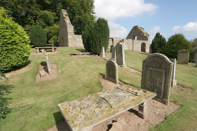
The Eassie Stone is a Class II Pictish stone of about the mid 8th century AD in the village of Eassie, Angus, Scotland. The stone was found in Eassie burn in the late 18th century and now resides in a purpose-built perspex building in the ruined Eassie church. Location The cross slab is housed in a purpose-built shelter with see-through walls within the roofless shell of the old Eassie parish church, on the north side A94 road some west of Glamis and east of Meigle. Description The stone is a cross-slab high and wide, tapering to at the top, and is thick. The slab is carved on both faces in relief and, as it bears Pictish symbols, it falls into John Romilly Allen and Joseph Anderson's classification system as a class II stone. The cross face bears a cross with circular rings in its angles, surrounding a circular central boss decorated with a keywork design. The arms and shaft are decorated with a variety of complex interlaced knotwork designs. The upper quadrants held ... [...More Info...] [...Related Items...] OR: [Wikipedia] [Google] [Baidu] |
Ruined
Ruins () are the remains of a civilization's architecture. The term refers to formerly intact structures that have fallen into a state of partial or total disrepair over time due to a variety of factors, such as lack of maintenance, deliberate destruction by humans, or uncontrollable destruction by natural phenomena. The most common root causes that yield ruins in their wake are natural disasters, armed conflict, and population decline, with many structures becoming progressively derelict over time due to long-term weathering and scavenging. There are famous ruins all over the world, with notable sites originating from ancient China, the Indus Valley and other regions of ancient India, ancient Iran, ancient Israel and Judea, ancient Iraq, ancient Greece, ancient Egypt, Roman sites throughout the Mediterranean Basin, and Incan and Mayan sites in the Americas. Ruins are of great importance to historians, archaeologists and anthropologists, whether they were once individu ... [...More Info...] [...Related Items...] OR: [Wikipedia] [Google] [Baidu] |
Pictish Stone
A Pictish stone is a type of monumental stele, generally carved or incised with symbols or designs. A few have ogham inscriptions. Located in Scotland, mostly north of the Clyde-Forth line and on the Eastern side of the country, these stones are the most visible remaining evidence of the Picts and are thought to date from the 6th to 9th century, a period during which the Picts became Christianized. The earlier stones have no parallels from the rest of the British Isles, but the later forms are variations within a wider Insular tradition of monumental stones such as high crosses. About 350 objects classified as Pictish stones have survived, the earlier examples of which holding by far the greatest number of surviving examples of the mysterious symbols, which have long intrigued scholars. ... [...More Info...] [...Related Items...] OR: [Wikipedia] [Google] [Baidu] |
Early Middle Ages
The Early Middle Ages (or early medieval period), sometimes controversially referred to as the Dark Ages, is typically regarded by historians as lasting from the late 5th or early 6th century to the 10th century. They marked the start of the Middle Ages of European history, following the decline of the Western Roman Empire, and preceding the High Middle Ages ( 11th to 13th centuries). The alternative term ''late antiquity'', for the early part of the period, emphasizes elements of continuity with the Roman Empire, while ''Early Middle Ages'' is used to emphasize developments characteristic of the earlier medieval period. The period saw a continuation of trends evident since late classical antiquity, including population decline, especially in urban centres, a decline of trade, a small rise in average temperatures in the North Atlantic region and increased migration. In the 19th century the Early Middle Ages were often labelled the ''Dark Ages'', a characterization based on t ... [...More Info...] [...Related Items...] OR: [Wikipedia] [Google] [Baidu] |
Charleston, Angus
Charleston is a village in Angus, Scotland near Glamis. The village of Charleston came into being in the 1830s. In 1833, the proprietor of the lands of Rochelhill granted a long tack of land to Alexander Bruce, a hand loom weaver in Glamis, and this land was subsequently, in 1838, feued at a rate of £8 per acre. At least 50 houses were then built, and the village was named Charleston after the proprietor of Rochelhill, Charles Henderson. At that time, there were four main proprietors in the parish of Glamis. The Earl of Strathmore owned the greater part of the land, covering the northern and central areas, while the property belonging to Lord Douglas occupied the Glen of Ogilvie. The estate of Rochelhill lay at the foot of Glen Ogilvie, between the Strathmore and Douglas estates. The Brigtown estate, owned by William Douglas, lay at the eastern side of the central division.Statistical Accounts of Scotland, Glammiss, County of Forfar, NSA, Vol. XI, 1845; p. 346. In the aut ... [...More Info...] [...Related Items...] OR: [Wikipedia] [Google] [Baidu] |
Balkeerie
Balkeerie is a village in Angus, Scotland north of Dundee. It has an elevation of above sea level. It is to the north east of kirkinch and to the west of the village of Eassie. Eassie is noted for the presence of the Eassie Stone, a carved Pictish stone. See also *Wester Denoon Wester Denoon is a small settlement in Angus, Scotland. Approximately one mile to the north of Wester Denoon is the village of Eassie, where the Eassie Stone is displayed in a ruined church; this carved Pictish stone is dated prior to the Early ... References Villages in Angus, Scotland {{Angus-geo-stub ... [...More Info...] [...Related Items...] OR: [Wikipedia] [Google] [Baidu] |
Kirkinch
Kirkinch, meaning 'kirk (church) on the island' in Scots and Gaelic, is a small village in Angus, Scotland.United Kingdom Ordnance Survey Map, Landranger (2005) The 'island' is the knoll on which remains of the medieval church of the parish of Nevay, now united with Eassie, stand. Originally it was an 'island' of slightly higher land surrounded by boggy country. The village houses are adjacent to the knoll, which is encompassed by the wall of the old churchyard. Some of the earliest history of the local area is represented approximately two kilometres northwest at the village of Eassie, where the Eassie Stone is displayed in a modern transparent shelter in the ruined former parish church; this finely carved Pictish cross-slab probably dates to the first half of the 8th century (Historic Scotland; accessible at all times). The church site at Kirkinch is itself probably of early Christian origin. A simple disc-headed cross-slab found here is on display at the Meffan Institute in F ... [...More Info...] [...Related Items...] OR: [Wikipedia] [Google] [Baidu] |
Meffan Institute
The Meffan Institute is a museum and art gallery in Forfar, Angus. It houses a variety of exhibits of local interest in Angus, including a collection of Pictish stones, particularly the Dunnichen Stone and the Kirriemuir Sculptured Stones as well as Roman and Medieval In the history of Europe, the Middle Ages or medieval period lasted approximately from the late 5th to the late 15th centuries, similar to the Post-classical, post-classical period of World history (field), global history. It began with t ... artefacts found in the local area. A reconstruction of historic scenes of Forfar includes representations of daily life as it would have been around the beginning of the 19th century, as well as a depiction of the execution of one of the women accused of witchcraft in the Forfar witch hunts of 1661-1666. Gallery External linksMeffan Museum and Art Galleryon Angus Alive websiteThe Meffan Gallery on Facebook [...More Info...] [...Related Items...] OR: [Wikipedia] [Google] [Baidu] |


