|
West Nanticoke, Pennsylvania
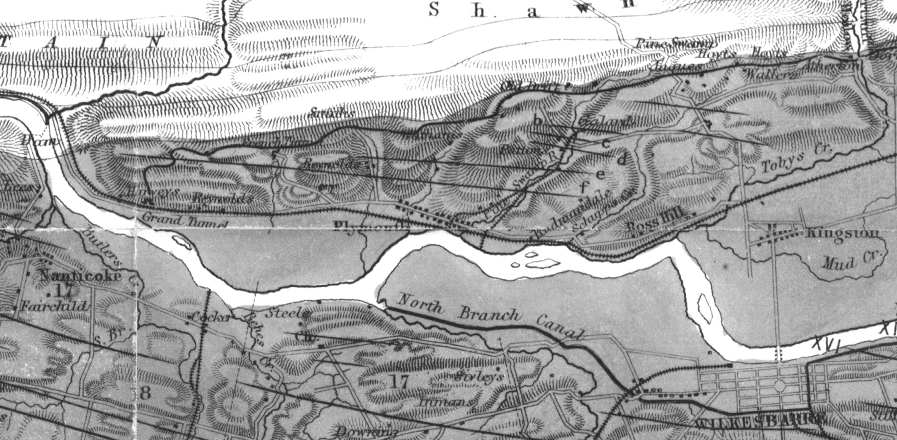
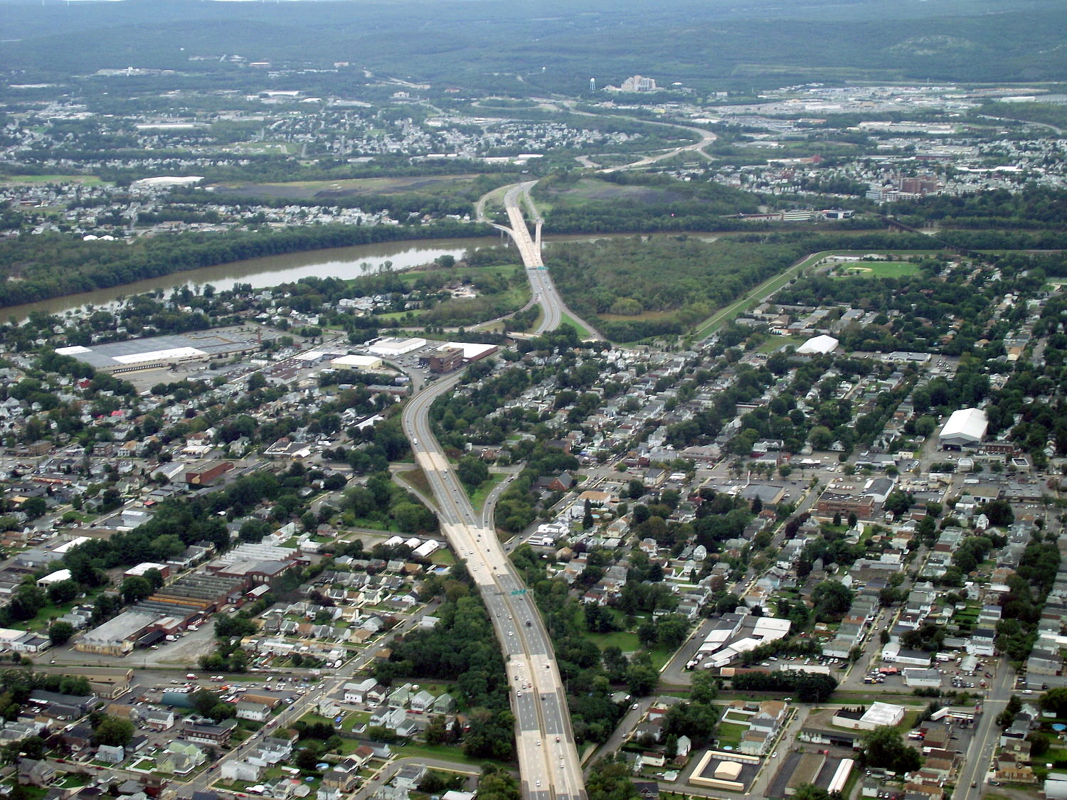
West Nanticoke is a census-designated place (CDP) in Plymouth Township, Luzerne County, Pennsylvania, United States, across the Susquehanna River from the city of Nanticoke. The population of the CDP was 749 at the 2010 census. Geography West Nanticoke is located at , along U.S. Route 11, on the north bank of the Susquehanna River. It is across the river from the city of Nanticoke, to which it is connected by the Lower Broadway Street Bridge. Pennsylvania Route 29 joins U.S. Route 11 in the center of West Nanticoke. To the north, Route 29 leads to Silkworth and Pikes Creek. Just east of West Nanticoke, Route 29 becomes the South Cross Valley Expressway, crossing the Susquehanna River and leading to Interstate 81 south of Wilkes-Barre. U.S. Route 11 heads northeast to Plymouth and Kingston and southwest to Shickshinny and Berwick. According to the United States Census Bureau The United States Census Bureau (USCB), officially the Bureau of the Census, is a principal agen ... [...More Info...] [...Related Items...] OR: [Wikipedia] [Google] [Baidu] |
Census-designated Place
A census-designated place (CDP) is a concentration of population defined by the United States Census Bureau for statistical purposes only. CDPs have been used in each decennial census since 1980 as the counterparts of incorporated places, such as self-governing cities, towns, and villages, for the purposes of gathering and correlating statistical data. CDPs are populated areas that generally include one officially designated but currently unincorporated community, for which the CDP is named, plus surrounding inhabited countryside of varying dimensions and, occasionally, other, smaller unincorporated communities as well. CDPs include small rural communities, edge cities, colonias located along the Mexico–United States border, and unincorporated resort and retirement communities and their environs. The boundaries of any CDP may change from decade to decade, and the Census Bureau may de-establish a CDP after a period of study, then re-establish it some decades later. Most unin ... [...More Info...] [...Related Items...] OR: [Wikipedia] [Google] [Baidu] |
Nanticoke, Pennsylvania
Nanticoke is a city in Luzerne County, Pennsylvania, United States. As of the 2020 census, the population was 10,628, making it the third largest city in Luzerne County. It occupies 3.5 square miles of land. Nanticoke is part of Northeastern Pennsylvania. The city can be divided into several sections: Honey Pot (northwestern Nanticoke), (northern and central Nanticoke), and Hanover Section (southeastern Nanticoke). It was once an active coal mining community. Today, the 167-acre main campus of Luzerne County Community College is located within the city. History Early history The name ''Nanticoke'' was derived from Nentego ("tidewater people"), an Algonquian-speaking Native American people who moved to the Wyoming Valley when their Chesapeake Bay homelands were spoiled for hunting by the European settlers. For quite some time, the tribe maintained a village in the valley before Europeans settled there. The nearby Nanticoke Creek, also named after the tribe, was once known as Muddy ... [...More Info...] [...Related Items...] OR: [Wikipedia] [Google] [Baidu] |
Harveys Creek
Harveys Creek (also known as Harvey Creek or Harvey's Creek) is a tributary of the Susquehanna River in Luzerne County, Pennsylvania, in the United States. It is approximately long and flows through Harveys Lake, Lake Township, Lehman Township, Jackson Township, and Plymouth Township. The creek's watershed has an area of . The creek has four named tributaries, which are known as Bear Hollow Creek, Paint Spring Run, Pikes Creek, and East Fork Harveys Creek. The watershed is designated as a High-Quality Coldwater Fishery and a Migratory Fishery above Pikes Creek and as a Coldwater Fishery and a Migratory Fishery below it. The creek's source is Harveys Lake, the largest natural lake in Pennsylvania. Harveys Creek was used as a water supply as early as the beginning of the 1900s. A number of bridges have been constructed over the creek since the 1920s, and it has been dammed by the Bryant Pond Dam. It is possible to canoe on part of the creek. Rock formations consisting of sand ... [...More Info...] [...Related Items...] OR: [Wikipedia] [Google] [Baidu] |
Berwick, Pennsylvania
Berwick is a borough in Columbia County, Pennsylvania, United States. It is part of Northeastern Pennsylvania and is located southwest of Wilkes-Barre. As of the 2020 census, Berwick had a population of 10,355. It is one of the two principal communities of the Bloomsburg-Berwick, PA Metropolitan Statistical Area, a metropolitan area that covers Columbia and Montour counties, and had a combined population of 85,562 at the 2010 census. History Berwick was founded by Evan Owen, a Welsh Quaker and surveyor. He was the son of Hugh Owen from Trefeglwys, Montgomeryshire, Wales. Berwick was named after Berwick-upon-Tweed, England. Situated on the north bank of the Susquehanna River, the borough was first settled in 1769, founded in 1786, and incorporated in 1818. Light and heavy manufacturing industries, such as American Car and Foundry Company and Wise Potato Chips, have flourished in Berwick, which consolidated with the borough of West Berwick, where 5,512 people lived in 1910, in ... [...More Info...] [...Related Items...] OR: [Wikipedia] [Google] [Baidu] |
Shickshinny, Pennsylvania
Shickshinny is a borough in Luzerne County, Pennsylvania, United States. The population was 630 at the 2020 census. The borough is named after Shickshinny Creek, which runs through the municipality and the surrounding area. According to the book ''Indian Villages and Place Names in Pennsylvania'' (by Dr. George P. Donehoo), the community's name likely means "Fine Stream" in a local Native American language. However, according to the Shickshinny Historical Society, the name ''Shickshinny'' means "Five Mountains" in a Native American language. Five mountains — Newport, Knob, Lee, River, and Rocky — encircle the creek and borough. History Early history In 1782, the families of Austin and Crossley were the first white settlers in Shickshinny. The first permanent settler in the area was Lizzie James . At this time, Shickshinny was under the jurisdiction of Connecticut."The Founding of the Shickshinny Borough", undated. ''Suburban News'' article posted on the website of the Histo ... [...More Info...] [...Related Items...] OR: [Wikipedia] [Google] [Baidu] |
Kingston, Pennsylvania
Kingston is a borough in Luzerne County, Pennsylvania, United States. It is located on the western bank of the Susquehanna River opposite the city of Wilkes-Barre. Kingston was first settled in the early 1770s; it was incorporated as a borough in 1857. As of the 2020 census, the population was 13,349, making it the most populous borough in the county. History Early history In the early 1660s, King Charles II owed Admiral Sir William Penn a large sum of money. To settle this debt, he granted Penn’s son, William, a territory in North America, which later became known as Pennsylvania. However, Connecticut also claimed a portion of this land. Count Zinzendorf was one of the first people to take an interest in the Wyoming Valley. In 1742, he came to the region to convert the Native Americans to Christianity. At the time, the valley was inhabited by several Native American tribes (including the Susquehannock and the Delaware). His reports led a group of Connecticut settlers to ... [...More Info...] [...Related Items...] OR: [Wikipedia] [Google] [Baidu] |
Plymouth, Pennsylvania
Plymouth is a borough (Pennsylvania), borough in Luzerne County, Pennsylvania, United States. It is located west of Wilkes Barre, Pennsylvania, Wilkes-Barre, along the Susquehanna River. The population was 5,763 as of the 2020 census. History Plymouth was first settled in 1769 by the Susquehanna Company of Connecticut, and until its incorporation as a borough in 1866, was part of Plymouth Township, Luzerne County, Pennsylvania, Plymouth Township. The Pennamite-Yankee Wars were fought in the surrounding area. The town is situated in the once rich anthracite coal fields of eastern Pennsylvania. Coal was first shipped in 1807. In the past, the products of its manufacturing establishments included miners’ drilling machines and squibs, silk hosiery, and lumber products. Its population peaked in 1910 at 16,996. Architecture At the beginning of the 19th century, Plymouth's primary industry was agriculture, and many of its residents were the descendants of the Connecticut Yankees wh ... [...More Info...] [...Related Items...] OR: [Wikipedia] [Google] [Baidu] |
Wilkes-Barre, Pennsylvania
Wilkes-Barre ( or ) is a city in the U.S. state of Pennsylvania and the county seat of Luzerne County, Pennsylvania, Luzerne County. Located at the center of the Wyoming Valley in Northeastern Pennsylvania, it had a population of 44,328 in the 2020 census. It is the second-largest city, after Scranton, Pennsylvania, Scranton, in the Scranton–Wilkes-Barre–Hazleton, PA Metropolitan Statistical Area, which had a population of 563,631 as of the 2010 United States census, 2010 census and is the fourth-largest metropolitan area in Pennsylvania after the Delaware Valley, Greater Pittsburgh, and the Lehigh Valley with an urban population of 401,884. Scranton/Wilkes-Barre is the cultural and economic center of a region called Northeastern Pennsylvania, which is home to over 1.3 million residents. Wilkes-Barre and the surrounding Wyoming Valley are framed by the Pocono Mountains to the east, the Endless Mountains to the north and west, and the Lehigh Valley to the south. The Susqu ... [...More Info...] [...Related Items...] OR: [Wikipedia] [Google] [Baidu] |
Interstate 81 In Pennsylvania
Interstate 81 (I-81) is an north–south Interstate Highway, stretching from Dandridge, Tennessee, northeast to Fisher's Landing, New York, at the Canada–United States border. In the state of Pennsylvania, I-81 runs for from the Mason–Dixon line, Maryland state line near Greencastle, Pennsylvania, Greencastle northeast to the New York–Pennsylvania border, New York state line near Hallstead, Pennsylvania, Hallstead and is called the American Legion Memorial Highway. It is the longest north–south Interstate in Pennsylvania. Route description I-81 enters Pennsylvania at the Maryland state line about south of Chambersburg, Pennsylvania, Chambersburg; it also has its first exit at the state line, junctioning with Pennsylvania Route 163 (PA 163) there. In Chambersburg at exit 16, it meets U.S. Route 30 in Pennsylvania, U.S. Route 30 (US 30; the Chambersburg Pike to Gettysburg, Pennsylvania, Gettysburg). About north of Carlisle, Pennsylvania, Carlisle ... [...More Info...] [...Related Items...] OR: [Wikipedia] [Google] [Baidu] |
Cross Valley Expressway
 The Cross Valley Expressway is a pair of freeways in the Wilkes-Barre, Pennsylvania, Wilkes-Barre, Pennsylvania area that span the width of the Wyoming Valley. The pair, designated as North and South, are two distinctly separate freeways, yet share the same name due to their like function and their proximity to each other. Both freeways cross the Susquehanna River while traversing the Valley.
Therefore, Cross Valley Expressway may refer to:
*North Cross Valley Expressway, a freeway in Wilkes-Barre, Pennsylvania, that is part of Pennsylvania Route 309, Pennsylvania Route 309
*South Cross Valley Expressway, a freeway south of Wilkes-Barre, Pennsylvania, that is part of Pennsylvania Route 29, Pennsylvania Route 29
{{Roadindex ...
[...More Info...] [...Related Items...] OR: [Wikipedia] [Google] [Baidu] |
Pikes Creek, Pennsylvania
Pikes Creek is a census-designated place (CDP) in Lake Township, Luzerne County, Pennsylvania, United States. The population was 269 at the 2010 census. Geography Pikes Creek is located at . According to the United States Census Bureau, the CDP has a total area of , all land. It is located at the crossroads of Pennsylvania Route 29 and Pennsylvania Route 118. The borough of Dallas is east along Route 118, and the city of Nanticoke is south along Route 29. The village is named for Pikes Creek, a tributary of Harveys Creek, which flows south to the Susquehanna River The Susquehanna River (; Lenape: Siskëwahane) is a major river located in the Mid-Atlantic region of the United States, overlapping between the lower Northeast and the Upland South. At long, it is the longest river on the East Coast of the ... at West Nanticoke. Demographics References Census-designated places in Luzerne County, Pennsylvania Census-designated places in Pennsylvania ... [...More Info...] [...Related Items...] OR: [Wikipedia] [Google] [Baidu] |
Silkworth, Pennsylvania
Silkworth is a census-designated place (CDP) in Lehman Township, Luzerne County, Pennsylvania, United States. The population was 820 at the 2010 census. Geography Silkworth is located at , along Pennsylvania Route 29 on the west shore of Lake Silkworth, about northwest of the city of Nanticoke. According to the United States Census Bureau The United States Census Bureau (USCB), officially the Bureau of the Census, is a principal agency of the U.S. Federal Statistical System, responsible for producing data about the American people and economy. The Census Bureau is part of t ..., the CDP has a total area of , of which is land and , or 11.0%, is water. References Census-designated places in Luzerne County, Pennsylvania Census-designated places in Pennsylvania {{LuzerneCountyPA-geo-stub ... [...More Info...] [...Related Items...] OR: [Wikipedia] [Google] [Baidu] |


.jpg)
.jpg)


