|
Weardale
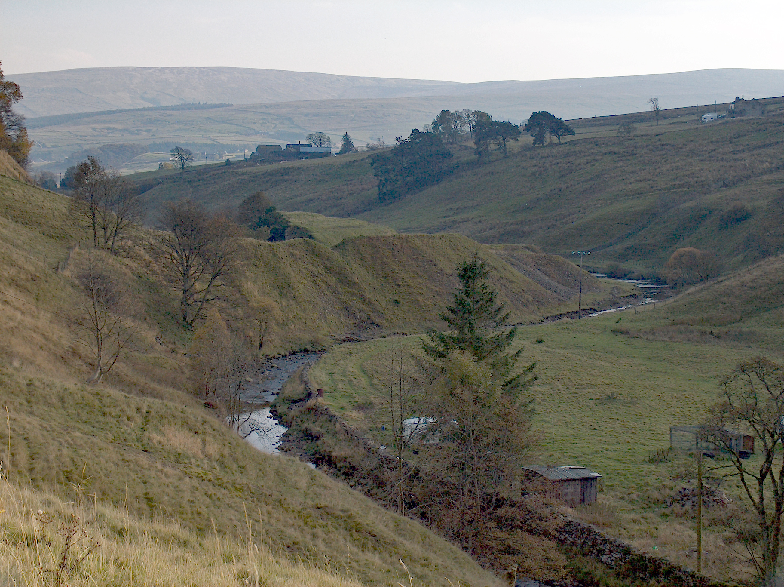
Weardale is a dale, or valley, on the east side of the Pennines in County Durham, England. Large parts of Weardale fall within the North Pennines Area of Outstanding Natural Beauty (AONB) – the second-largest AONB in England and Wales. The upper dale is surrounded by high fells (up to O.D. at Burnhope Seat) and heather grouse moors. The River Wear flows through Weardale before reaching Bishop Auckland and then Durham, meeting the sea at Sunderland. The Wear Valley local government district covered the upper part of the dale, including Weardale, between 1974 and 2009, when it was abolished on County Durham's becoming a unitary authority. (From 1894 to 1974 there was a Weardale Rural District.) Upper Weardale is in the parliamentary constituency of North West Durham. The dale's principal settlements include St John's Chapel and the towns of Crook, Stanhope and Wolsingham. Local climate Weardale's winters are typically harsh and prolonged with regular snow, nowadays ta ... [...More Info...] [...Related Items...] OR: [Wikipedia] [Google] [Baidu] |
Wolsingham
Wolsingham is a market town in Weardale, County Durham, England. It is situated by the River Wear, between Crook and Stanhope. History Wolsingham sits at the confluence of the River Wear and Waskerley Beck. It is a small settlement and one of the first market towns in County Durham, deriving its name from Waelsingas, or Sons of Wael, an ancient Saxon family that once lived there. The earliest known record of the town is to be found in Reginald of Durham's ''Life of Godric'' where it is stated that the saint lived there for almost two years about 1120 AD with Elric the hermit. Wolsingham was then a thriving community, holding land by servile tenure. There were shepherds, plough-makers, beekeepers, forest keepers, wood turners, carters, etc. They toiled for two purposes – producing corn and other foodstuffs for themselves and supplying the larder of the Bishop's Castle. The bishop and his friends indulged in hawking, but hunting for red deer in the parks of Wolsingham and Sta ... [...More Info...] [...Related Items...] OR: [Wikipedia] [Google] [Baidu] |
River Wear
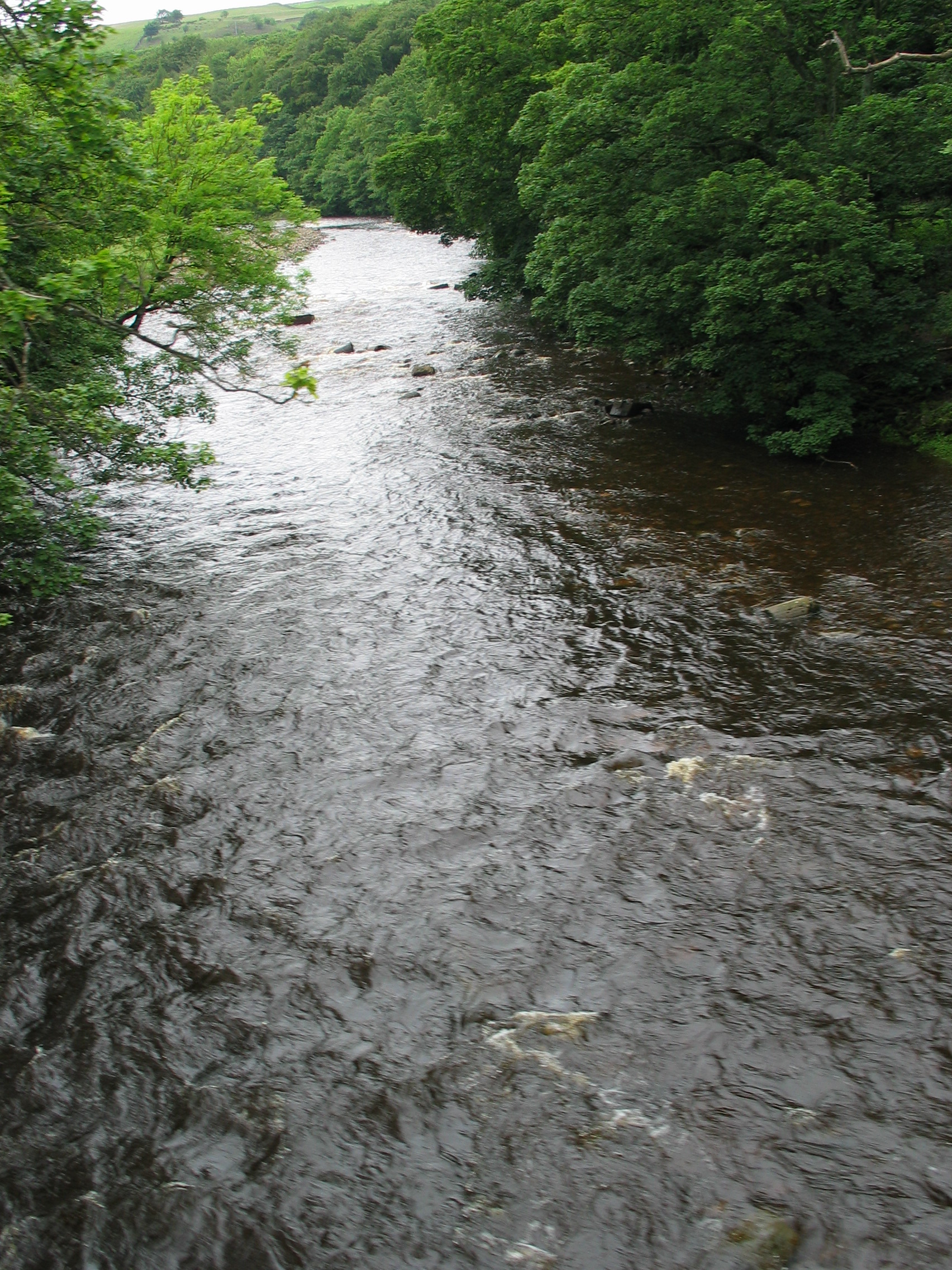
The River Wear (, ) in North East England rises in the Pennines and flows eastwards, mostly through County Durham to the North Sea in the City of Sunderland. At long, it is one of the region's longest rivers, wends in a steep valley through the cathedral city of Durham and gives its name to Weardale in its upper reach and Wearside by its mouth. Etymology The origin behind the hydronym ''Wear'' is uncertain but is generally understood to be Celtic. The ''River Vedra'' on the Roman Map of Britain may very well be the River Wear. The name may be derived from Brittonic ''*wejr'' (<''*wẹ:drā''), which meant "a bend" (c.f ''-gwair-''). An alternative but very problematic etymology might involve ''*wẹ:d-r-'', from a lengthened form of the |
Crook, County Durham
Crook is a market town in the County Durham (district), district and County Durham, ceremonial county of County Durham, Northern England. The town is located on the edge of Weardale, therefore is sometimes referred to as the "Gateway to Weardale". The town is in an unparished area, until 1974 it was in Crook and Willington Urban District and was parished. It is located a couple of miles north of the River Wear, Crook lies about 9 miles (14.5 km) south-west of the historic city of Durham, England, Durham, 5 miles (8 km) north-west of Bishop Auckland and 2 miles (3.5 km) from Willington, County Durham, Willington. The A690 road from Durham turns into the A689 leading up through Wolsingham and Stanhope, County Durham, Stanhope into the upper reaches of Weardale (an Area of Outstanding Natural Beauty). The centre of Crook, a designated conservation area, features a variety of shops and businesses with the market held on Tuesdays and a few stalls on a Saturday. There ... [...More Info...] [...Related Items...] OR: [Wikipedia] [Google] [Baidu] |
County Durham
County Durham ( ), officially simply Durham,UK General Acts 1997 c. 23Lieutenancies Act 1997 Schedule 1(3). From legislation.gov.uk, retrieved 6 April 2022. is a ceremonial county in North East England.North East Assembly �About North East England. Retrieved 30 November 2007. The ceremonial county spawned from the historic County Palatine of Durham in 1853. In 1996, the county gained part of the abolished ceremonial county of Cleveland.Lieutenancies Act 1997 . Retrieved 27 October 2014. The county town is the of |
St John's Chapel, County Durham
St John's Chapel is a village in County Durham, in England. It is situated in Weardale, on the south side of the River Wear on the A689 road between Daddry Shield and Ireshopeburn. The 2001 census reported a population of 307, of whom only 43 were children under 16. In 1980 there were 160 children in the village. The village has its own primary school, which in 2014 was graded at "outstanding" by Ofsted. The nearest secondary schools are in Alston (12 miles) and Wolsingham (14 miles). The nearest swimming pool is 14 miles away and the nearest library is 22 miles away. This population makes the village marginal in terms of thresholds for service provision. Although the population of the ward (1,446, including surrounding hamlets) has remained fairly stable for 30 years, this masks the out-migration mainly of the younger generation affecting the population structure. Although this area has a high quality of life with low pollution and crime rates, in 2001 16 residents were unem ... [...More Info...] [...Related Items...] OR: [Wikipedia] [Google] [Baidu] |
Stanhope, County Durham
Stanhope is a market town and civil parish in the County Durham district, in the ceremonial county of Durham, England. It lies on the River Wear between Eastgate and Frosterley, in the north-east of Weardale. The main A689 road over the Pennines is crossed by the B6278 between Barnard Castle and Shotley Bridge. In 2001 Stanhope had a population of 1,633, in 2019 an estimate of 1,627, and a figure of 1,602 in the 2011 census for the ONS built-up-area which includes Crawleyside. In 2011 the parish population was 4,581. Civil parish The civil parish includes the settlements of Cornriggs, Cowshill, Daddry Shield, Eastgate, Frosterley, Ireshopeburn, Lanehead, St John's Chapel, Wearhead and Westgate, all on the A689 road, and also Bollihope, Bridge End, Brotherlee, Copthill, Crawleyside, East Blackdene, Hill End, Lintzgarth, New House, Rookhope and West Blackdene. Other places it includes are Killhope, Shittlehope, Unthank and White Kirkley. This gives it the lar ... [...More Info...] [...Related Items...] OR: [Wikipedia] [Google] [Baidu] |
North West Durham
North West Durham is a constituency represented in the House of Commons of the UK Parliament since 12 December 2019 by Richard Holden of the Conservative Party. Constituency profile The constituency is in the north west of County Durham, in the North East England region. It currently consists of the western part of the former Derwentside district (including Consett and Lanchester) and the northern part of the former Wear Valley district (including Weardale, Crook and Willington). The majority of the electorate live in former mining or steel towns, where Labour traditionally have polled higher than other parties, with the remainder in rural farms and villages throughout valleys cleft from the eastern, rocky part of the Pennines. History 1885–1918 The constituency was first created for the 1885 general election by the Redistribution of Seats Act 1885 as one of eight new single-member divisions of the county of Durham, replacing the two 2-member seats of No ... [...More Info...] [...Related Items...] OR: [Wikipedia] [Google] [Baidu] |
Bishop Auckland
Bishop Auckland () is a market town and civil parish at the confluence of the River Wear and the River Gaunless in County Durham, northern England. It is northwest of Darlington and southwest of Durham. Much of the town's early history surrounds the Bishops of Durham and the establishment of Auckland Castle's predecessor, a hunting lodge, which became the main residence of Durham Bishops. This is reflected in the first part of the town's name. During the Industrial Revolution, the town grew rapidly as coal mining took hold as an important industry. Decline in the coal mining industry during the late twentieth century has changed the largest sector of employment to manufacturing. Since 1 April 2009, the town's local authority has been Durham County Council. The unitary authority replaced the previous Wear Valley District and Durham County councils. The parliamentary constituency of Bishop Auckland is named after the town. The town is twinned with the French town of Ivry-sur ... [...More Info...] [...Related Items...] OR: [Wikipedia] [Google] [Baidu] |
Wear Valley
Wear Valley was, from 1974 to 2009, a local government district in County Durham, England. Its council and district capital was Crook. The district covered much of the Weardale area. In the west it was parished and rural, whereas in the east it was more urban. Crook and Willington are unparished. The district was formed on 1 April 1974, under the Local Government Act 1972, by the merger of the Bishop Auckland, Crook and Willington and Tow Law urban districts, along with Weardale Rural District. The district was abolished as part of the 2009 structural changes to local government in England, becoming part of the Durham County Council Durham County Council is a local authority administering all significant local government functions in the unitary authority area of County Durham in North East England. The council area covers part of the ceremonial county of County Durham, e ... unitary authority. Wear Valley had a population of around 65,000 in 2001. Electoral divis ... [...More Info...] [...Related Items...] OR: [Wikipedia] [Google] [Baidu] |
Weardale Rural District
Weardale was a rural district in County Durham, England from 1894 to 1974. It was formed under the Local Government Act 1894 as a successor to the Weardale rural sanitary district. It originally consisted of the parishes of Edmondbyers, Hunstanworth, Wolsingham. It was expanded in 1937 by taking in parts of parishes in the disbanded Auckland Rural District, and also adding Stanhope which had previously been an independent urban district. The district was abolished in 1974 under the Local Government Act 1972 The Local Government Act 1972 (c. 70) is an Act of the Parliament of the United Kingdom that reformed local government in England and Wales on 1 April 1974. It was one of the most significant Acts of Parliament to be passed by the Heath Gov ..., and its area went to form part of the new Wear Valley district. History of County Durham Districts of England created by the Local Government Act 1894 Districts of England abolished by the Local Government Act ... [...More Info...] [...Related Items...] OR: [Wikipedia] [Google] [Baidu] |
Dale (landform)
A dale is an open valley. ''Dale'' is a synonym of the word ''valley''. The name is used when describing the physical geography of an area. It is used most frequently in the Lowlands of Scotland and in the North of England; the term "fell" commonly refers to the mountains or hills that flank the dale. Etymology The word ''dale'' comes from the Old English word ''dæl'', from which the word " dell" is also derived. It is also related to Old Norse word ''dalr'' (and the modern Icelandic word ''dalur''), which may perhaps have influenced its survival in northern England. The Germanic origin is assumed to be *''dala-''. ''Dal-'' in various combinations is common in placenames in Norway. Modern English valley and French vallée are presumably not related to dale. A distant relative of ''dale'' is currency unit dollar, stemming from German ''thaler'' or ''daler'', short for joachimsthaler coins manufactured in the town of Joachimsthal in Bohemia.Falk, Hjalmar (1991). ''Etymologi ... [...More Info...] [...Related Items...] OR: [Wikipedia] [Google] [Baidu] |
North Pennines
The North Pennines is the northernmost section of the Pennine range of hills which runs north–south through northern England. It lies between Carlisle to the west and Darlington to the east. It is bounded to the north by the Tyne Valley and to the south by the Stainmore Gap. Overview The North Pennines was designated as an Area of Outstanding Natural Beauty (AONB) in 1988 for its moorland scenery, the product of centuries of farming and lead-mining, and is also a UNESCO Global Geopark. At almost , it is the second largest of the 49 AONBs in the United Kingdom. The landscape of the North Pennines AONB is one of open heather moors between deep dales, upland rivers, hay meadows and stone-built villages, some of which contain the legacies of a mining and industrial past. The area has previously been mined and quarried for minerals such as barytes, coal fluorspar, iron, lead, witherite and zinc. Natural England maps Maps for North Pennines – Area of Outstanding Natural Beauty, ... [...More Info...] [...Related Items...] OR: [Wikipedia] [Google] [Baidu] |


