|
Watsessing, New Jersey
Watsessing is a neighborhood and census-designated place (CDP) in Bloomfield Township, Essex County, New Jersey, United States. It is in the southwest corner of the township, bordered to the northwest by Glen Ridge, to the southwest by East Orange, to the southeast by the Ampere North part of Bloomfield, and to the northeast by the rest of Bloomfield. Watsessing Park is in the center of the community, in the valley of the Second River or Watsessing River, part of the Passaic River watershed. The Garden State Parkway runs through the center of the community, on the southeast side of Watsessing Park, with access from Exit 148. The parkway leads north to Clifton and south through East Orange to Irvington. The NJ Transit Montclair-Boonton Line The Montclair-Boonton Line is a commuter rail line of New Jersey Transit Rail Operations in the United States. It is part of the Hoboken Division. The line is a consolidation of three individual lines: the former Delaware, Lackawann ... [...More Info...] [...Related Items...] OR: [Wikipedia] [Google] [Baidu] |
Census-designated Place
A census-designated place (CDP) is a concentration of population defined by the United States Census Bureau for statistical purposes only. CDPs have been used in each decennial census since 1980 as the counterparts of incorporated places, such as self-governing cities, towns, and villages, for the purposes of gathering and correlating statistical data. CDPs are populated areas that generally include one officially designated but currently unincorporated community, for which the CDP is named, plus surrounding inhabited countryside of varying dimensions and, occasionally, other, smaller unincorporated communities as well. CDPs include small rural communities, edge cities, colonias located along the Mexico–United States border, and unincorporated resort and retirement communities and their environs. The boundaries of any CDP may change from decade to decade, and the Census Bureau may de-establish a CDP after a period of study, then re-establish it some decades later. Most unin ... [...More Info...] [...Related Items...] OR: [Wikipedia] [Google] [Baidu] |
Ampere North, New Jersey
Ampere North is an unincorporated community and census-designated place (CDP) in Bloomfield Township, Essex County, in the U.S. state of New Jersey. It is in the southern corner of the township, bordered to the north by the Watsessing CDP, to the northeast by Silver Lake, to the southwest by East Orange East Orange is a city in Essex County, in the U.S. state of New Jersey. As of the 2020 U.S. census, the city's population was 69,612. The city was the state's 20th most-populous municipality in 2010, after having been the state's 14th most-po ..., and to the southeast by Newark. Ampere Parkway runs through the center of the CDP, from Bloomfield Avenue at the northeast border of the community, south into the Ampere neighborhood in East Orange. Ampere North was first listed as a CDP prior to the 2020 census with a population of 5,132. Demographics 2020 census References Census-designated places in Essex County, New Jersey Census-designated places in New Je ... [...More Info...] [...Related Items...] OR: [Wikipedia] [Google] [Baidu] |
2020 United States Census
The United States census of 2020 was the twenty-fourth decennial United States census. Census Day, the reference day used for the census, was April 1, 2020. Other than a pilot study during the 2000 census, this was the first U.S. census to offer options to respond online or by phone, in addition to the paper response form used for previous censuses. The census was taken during the COVID-19 pandemic, which affected its administration. The census recorded a resident population of 331,449,281 in the fifty states and the District of Columbia, an increase of 7.4 percent, or 22,703,743, over the preceding decade. The growth rate was the second-lowest ever recorded, and the net increase was the sixth highest in history. This was the first census where the ten most populous states each surpassed 10 million residents as well as the first census where the ten most populous cities each surpassed 1 million residents. Background As required by the United States Constitution, the U.S. cens ... [...More Info...] [...Related Items...] OR: [Wikipedia] [Google] [Baidu] |
Bloomfield Station
Bloomfield is a New Jersey Transit station in Bloomfield, New Jersey along the Montclair-Boonton Line. The station is located in downtown Bloomfield, the second within the municipality, just west of Bloomfield Avenue. This is the second station within the township served on the line after Watsessing Avenue station. History The current Glen Ridge, Bloomfield and Watsessing Avenue stations along the Montclair Branch were all built in 1912 during a grade separation program by the Delaware, Lackawanna and Western Railroad. Bloomfield Station has been on the New Jersey Register of Historic Places since March 17, 1984 and the National Register of Historic Places since June 22, 1984 and as part of the Operating Passenger Railroad Stations Thematic Resource. The station is the centerpiece of a plan to revitalize Bloomfield's central business district which has been designated a transit-oriented development (TOD) transit village. The former headhouse is privately owned but has not ... [...More Info...] [...Related Items...] OR: [Wikipedia] [Google] [Baidu] |
Watsessing Avenue Station
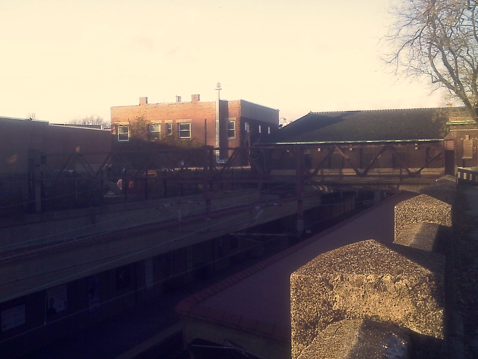
Watsessing Avenue (also known as Watsessing) is a New Jersey Transit rail station in Bloomfield, New Jersey, along the Montclair-Boonton Line. It is located beneath the Bloomfield Police Benevolent Association meeting hall (which formerly served as the station building) near the corner of Watsessing Avenue and Orange Street in Bloomfield. It is one of two stations on the line where the boarding platform is below ground level (the Glen Ridge station, two stops away from it, is the other). The Watsessing station and the Kingsland station in Lyndhurst on the Main Line shared similar designs (both station platforms are located below street level) and were built about the same time. The current Glen Ridge, Bloomfield and Watsessing stations along the Montclair branch were all built in 1912 during a grade separation program by the Delaware, Lackawanna and Western Railroad. During New Jersey Transit's running of the line, two stations between Watsessing and Newark Broad Street were ... [...More Info...] [...Related Items...] OR: [Wikipedia] [Google] [Baidu] |
Montclair-Boonton Line
The Montclair-Boonton Line is a commuter rail line of New Jersey Transit Rail Operations in the United States. It is part of the Hoboken Division. The line is a consolidation of three individual lines: the former Delaware, Lackawanna & Western Railroad's Montclair Branch, which ran from Hoboken Terminal to Bay Street, Montclair; the Erie Railroad's Greenwood Lake Division (segment from Montclair to Mountain View-Wayne), which originally ran from the Erie's Jersey City Terminal to Greenwood Lake, NY; and the former Lackawanna Boonton Line, which ran from Hoboken to Hackettstown, New Jersey. The Montclair-Boonton line was formed when the Montclair Connection opened on September 30, 2002. The line serves 28 active rail stations in New Jersey along with New York Pennsylvania Station. It crosses through six counties, serving six stations in the township of Montclair, two in the town of Bloomfield, and one in the city of Newark. Trains along the Montclair-Boonton Line heading eastw ... [...More Info...] [...Related Items...] OR: [Wikipedia] [Google] [Baidu] |
NJ Transit
New Jersey Transit Corporation, branded as NJ Transit, and often shortened to NJT, is a state-owned public transportation system that serves the U.S. state of New Jersey, along with portions of New York State and Pennsylvania. It operates bus, light rail, and commuter rail services throughout the state, connecting to major commercial and employment centers both within the state and in the adjacent major cities of New York and Philadelphia. In , the system had a ridership of . Covering a service area of , NJT is the largest statewide public transit system and the third-largest provider of bus, rail, and light rail transit by ridership in the United States. NJT also acts as a purchasing agency for many private operators in the state; in particular, buses to serve routes not served by the transit agency. History NJT was founded on July 17, 1979, an offspring of the New Jersey Department of Transportation (NJDOT), mandated by the state government to address many then-pressi ... [...More Info...] [...Related Items...] OR: [Wikipedia] [Google] [Baidu] |
Irvington, New Jersey
Irvington is a Township (New Jersey), township in Essex County, New Jersey, Essex County, New Jersey, United States. Per the 2020 United States census, 2020 census, the population was 61,176. The township had the ninth-highest property tax rate in New Jersey, with an equalized rate of 4.890% in 2020, compared to 2.824% in the county as a whole and a statewide average of 2.279%. History Clinton Township, Essex County, New Jersey, Clinton Township, which included what is now Irvington, Maplewood, New Jersey, Maplewood and parts of Newark and South Orange, New Jersey, South Orange, was created on April 14, 1834. The area was known as ''Camptown'' until the mid-1800s. In 1850, after Stephen Foster published his ballad, ''Camptown Races'', residents were concerned that the activities described in the song would be associated with their community. The town was renamed, ''Irvingtown'', in honor of Washington Irving. Irvington was incorporated as an independent village on March 27, 187 ... [...More Info...] [...Related Items...] OR: [Wikipedia] [Google] [Baidu] |
Clifton, New Jersey
Clifton is a city in Passaic County, in the U.S. state of New Jersey. Criss-crossed by several major highways, the city is a regional commercial hub for North Jersey and is a bedroom suburb of New York City in the New York Metropolitan Area. As of the 2020 United States census, the city had a total population of 90,296,QuickFacts Clifton city, New Jersey . Accessed October 6, 2022. representing a 7.3% increase over the 2010 enumeration of 84,136, ranking the city the 11th-m ... [...More Info...] [...Related Items...] OR: [Wikipedia] [Google] [Baidu] |
Garden State Parkway
The Garden State Parkway (GSP) is a controlled-access toll road that stretches the north–south length of eastern New Jersey from the state's southernmost tip near Cape May to the New York state line at Montvale. Its name refers to New Jersey's nickname, the "Garden State". The parkway is designated by the New Jersey Department of Transportation (NJDOT) as Route 444, although this designation is unsigned. At its north end, the road becomes the Garden State Parkway Connector, a component of the New York State Thruway system that connects to the Thruway mainline in Ramapo. The parkway is the longest highway in the state at approximately , and, according to the International Bridge, Tunnel and Turnpike Association, was the busiest toll road in the United States in 2006. Most of the highway north of the Raritan River runs through heavily populated areas. Between the Raritan River and the township of Toms River, the highway passes through lighter suburban development, whil ... [...More Info...] [...Related Items...] OR: [Wikipedia] [Google] [Baidu] |
Passaic River
Passaic River ( ) is a river, approximately long, in Northern New Jersey. The river in its upper course flows in a highly circuitous route, meandering through the swamp lowlands between the ridge hills of rural and suburban northern New Jersey, called the Great Swamp, draining much of the northern portion of the state through its tributaries. In its lower portion, it flows through the most urbanized and industrialized areas of the state, including along downtown Newark. The lower river suffered from severe pollution and industrial abandonment in the 20th century. In April 2014, the U.S. Environmental Protection Agency (EPA) announced a $1.7 billion plan to remove of toxic mud from the bottom of lower of the river. It is considered one of the most polluted stretches of water in the nation and the project one of the largest clean-ups ever undertaken. Course The Passaic rises in the center of Mendham, in southern Morris County. The river begins at Dubourg Pond located between Sp ... [...More Info...] [...Related Items...] OR: [Wikipedia] [Google] [Baidu] |


