|
Washington State Route 530
State Route 530 (SR 530) is a state highway in western Washington, United States. It serves Snohomish and Skagit counties, traveling from an interchange with (I-5) southwest of Arlington past in Arlington and Darrington to end at in Rockport. Serving the communities of Arlington, Arlington Heights, Oso, Darrington and Rockport, the roadway travels parallel to a fork of the Stillaguamish River from Arlington to Darrington, the Sauk River from Darrington to Rockport and the Whitehorse Trail from Arlington to Darrington. The first segment of SR 530 to appear on a map was a road extending from Arlington to Oso in 1899. The first segment to be state-maintained was (SSH 1E), which ran from Conway to Arlington. SSH 1E was extended to Darrington in 1957 and later renumbered to SR 530 in 1964; the road was extended to Rockport in 1983 and later the route from Conway to I-5 was removed from the system in 1991. A section of the highway was destro ... [...More Info...] [...Related Items...] OR: [Wikipedia] [Google] [Baidu] |
Arlington, Washington
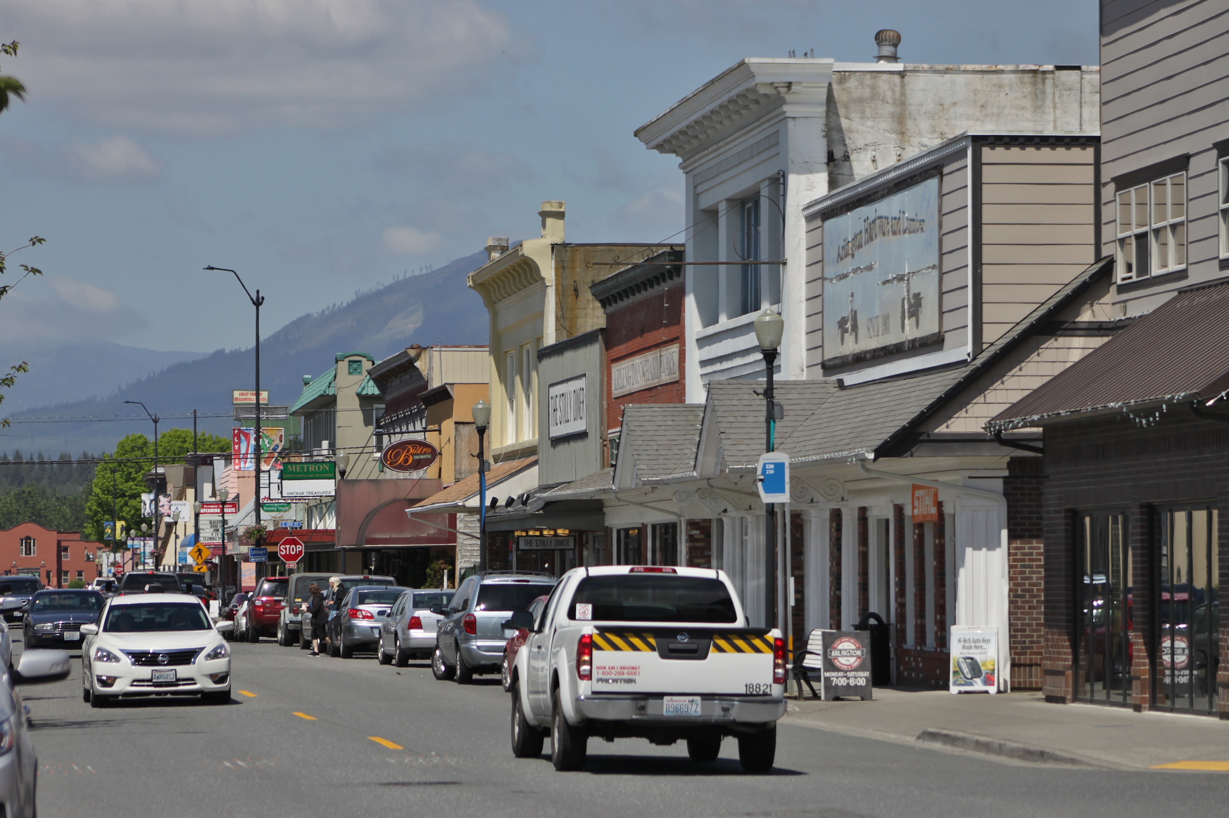
Arlington is a city in northern Snohomish County, Washington, United States, part of the Seattle metropolitan area. The city lies on the Stillaguamish River in the western foothills of the Cascade Range, adjacent to the city of Marysville. It is approximately north of Everett, the county seat, and north of Seattle, the state's largest city. As of the 2020 U.S. census, Arlington had a population of 19,868; its estimated population is 20,075 as of 2021. Arlington was established in the 1880s by settlers and the area was platted as two towns, Arlington and Haller City. Haller City was absorbed by the larger Arlington, which was incorporated as a city in 1903. During the Great Depression of the 1930s, the Arlington area was the site of major projects undertaken for employment under the direction of federal relief agencies, including construction of a municipal airport that would serve as a naval air station during World War II. Arlington began suburbanizing in the 1980s, grow ... [...More Info...] [...Related Items...] OR: [Wikipedia] [Google] [Baidu] |
Conway, Washington
Conway is a census-designated place (CDP) in Skagit County, Washington, United States. First settled in 1873 by Thomas P. Jones and Charles Villeneuves, its population was 91 at the 2010 census. It is included in the Mount Vernon– Anacortes, Washington Metropolitan Statistical Area. Geography Conway is located at (48.340856, -122.343551). According to the United States Census Bureau, the census-designated place of Conway has a total area of 0.3 square miles (0.7 km2), all of it land. Education Children attend school at the Conway Elementary School from Kindergarten through to the 8th grade. The school mascot is the Cougar and school colors are blue and gold. There are 2 teachers per grade level and a teacher to student ratio of roughly 1:30. The Conway school district has no high school; parents are permitted to send their children to any of the surrounding high schools, including Stanwood, Mount Vernon, or LaConner. The majority of high school students residing ... [...More Info...] [...Related Items...] OR: [Wikipedia] [Google] [Baidu] |
Railroad Grade
Grading in civil engineering and landscape architectural construction is the work of ensuring a level base, or one with a specified slope, for a construction work such as a foundation, the base course for a road or a railway, or landscape and garden improvements, or surface drainage. The earthworks created for such a purpose are often called the sub-grade or finished contouring (see diagram). Regrading Regrading is the process of grading for raising and/or lowering the levels of land. Such a project can also be referred to as a regrade. Regrading may be done on a small scale (as in preparation of a house site)Trees and Home Construction: Minimizing the impact of construction activity on trees University of Ohio Extension Bulletin 870-99. Accessed online 16 October 2 ... [...More Info...] [...Related Items...] OR: [Wikipedia] [Google] [Baidu] |
Jim Creek Naval Radio Station
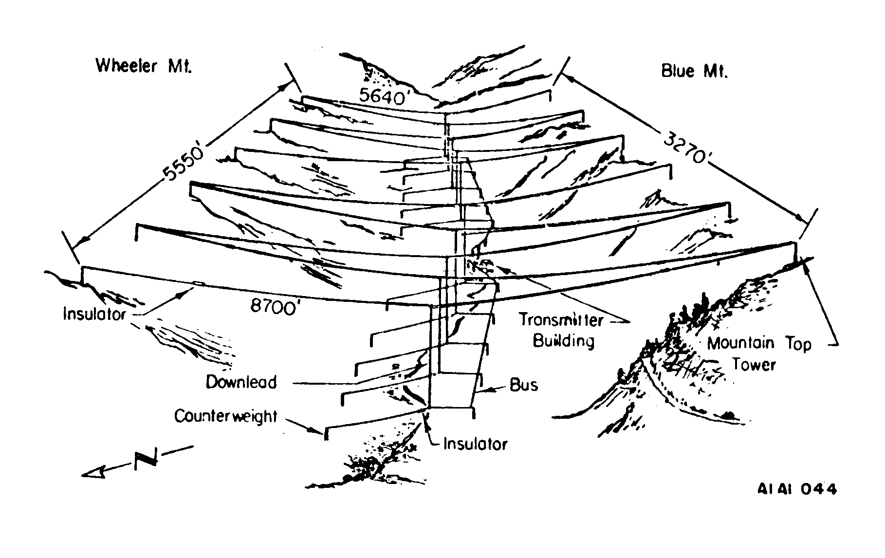
Jim Creek Naval Radio Station is a United States Navy very low frequency (VLF) radio transmitter facility at Jim Creek near Oso, Washington. The primary mission of this site is to communicate orders one-way to submarines of the Pacific fleet. Radio waves in the very low frequency band can penetrate seawater and be received by submerged submarines which cannot be reached by radio communications at other frequencies. Established in 1953, the transmitter radiates on 24.8 kHz with a power of 1.2 megawatts and a callsign of NLK, and is one of the most powerful radio transmitters in the world. Located near Arlington, Washington, in the foothills of the Cascades, north of Seattle, the site has 5,000 largely forested acres. Antenna Much of the site is devoted to the enormous overhead wire antenna array that is necessary to efficiently radiate the VLF waves. The antenna, shown above, consists of ten catenary cables, 5,640–8,700 ft (1,719–2,652 m, 1.1–1.6&nb ... [...More Info...] [...Related Items...] OR: [Wikipedia] [Google] [Baidu] |
Trafton, Washington
Trafton is a small unincorporated community located in Snohomish County, Washington. It is located near the city of Arlington, and although many things in the area are named Trafton (such as the historic Trafton School and Trafton Cemetery), most residents consider themselves residents of Arlington. Etymology The community derives its name from Trafalgar, Indiana. History Before colonization, the Stillaguamish had built a large winter village along the river, next to what is now the current site of Trafton. The village was called ''chuck-kol-che,'' with only the early transliteration of the native Lushootseed Lushootseed (txʷəlšucid, dxʷləšúcid), also Puget Salish, Puget Sound Salish or Skagit-Nisqually, is a language made up of a dialect continuum of several Salish tribes of modern-day Washington state. Lushootseed is one of the Coast Salis ... name being known. There were at least 200 people living at the village, with permanent structures including a large long ... [...More Info...] [...Related Items...] OR: [Wikipedia] [Google] [Baidu] |
Cascade Mountains
The Cascade Range or Cascades is a major mountain range of western North America, extending from southern British Columbia through Washington and Oregon to Northern California. It includes both non-volcanic mountains, such as the North Cascades, and the notable volcanoes known as the High Cascades. The small part of the range in British Columbia is referred to as the Canadian Cascades or, locally, as the Cascade Mountains. The latter term is also sometimes used by Washington residents to refer to the Washington section of the Cascades in addition to North Cascades, the more usual U.S. term, as in North Cascades National Park. The highest peak in the range is Mount Rainier in Washington at . part of the Pacific Ocean's Ring of Fire, the ring of volcanoes and associated mountains around the Pacific Ocean. All of the eruptions in the contiguous United States over the last 200 years have been from Cascade volcanoes. The two most recent were Lassen Peak from 1914 to 1921 and a major ... [...More Info...] [...Related Items...] OR: [Wikipedia] [Google] [Baidu] |
Skagit River 8810s
{{disambiguation ...
Skagit ( ) may refer to: *Skagit peoples, Native American groups in the U.S. state of Washington **Upper Skagit, one of the two Skagit peoples **Lower Skagit, one of the two Skagit peoples **Skagit language, or Lushootseed, the traditional language of the Skagit peoples *Skagit Bay *Skagit County, Washington *Skagit Range *Skagit River *Skagit River Hydroelectric Project *Skagit Valley The Skagit Valley lies in the northwestern corner of the state of Washington, United States. Its defining feature is the Skagit River, which snakes through local communities which include the seat of Skagit County, Mount Vernon, as well as Se ... [...More Info...] [...Related Items...] OR: [Wikipedia] [Google] [Baidu] |
Centennial Trail (Snohomish County)
The Snohomish County Centennial Trail is a rail trail in Snohomish County, Washington, connecting the cities of Snohomish, Lake Stevens, and Arlington to Skagit County along the corridor of Washington State Route 9. The trail, administered by Snohomish County Parks and Recreation, is on the former right-of-way of the Seattle, Lake Shore and Eastern Railway and comprises a non-motorized trail and a equestrian trail. The first segment of the corridor was opened in 1989, the centennial of the statehood of Washington, and the final segment between Arlington and the Skagit County line was opened in 2013. Trail Route The trail begins as a continuation of the Snohomish River Trail at the intersection of Maple Avenue and Pine Street in Snohomish, named the Snohomish trailhead. The route travels northeast along Maple Avenue, which becomes Machias Road past Snohomish city limits, and the Pilchuck River to the Pilchuck trailhead, located south of an underpass of U.S. Route& ... [...More Info...] [...Related Items...] OR: [Wikipedia] [Google] [Baidu] |
Concurrency (road)
A concurrency in a road network is an instance of one physical roadway bearing two or more different route numbers. When two roadways share the same right-of-way, it is sometimes called a common section or commons. Other terminology for a concurrency includes overlap, coincidence, duplex (two concurrent routes), triplex (three concurrent routes), multiplex (any number of concurrent routes), dual routing or triple routing. Concurrent numbering can become very common in jurisdictions that allow it. Where multiple routes must pass between a single mountain crossing or over a bridge, or through a major city, it is often economically and practically advantageous for them all to be accommodated on a single physical roadway. In some jurisdictions, however, concurrent numbering is avoided by posting only one route number on highway signs; these routes disappear at the start of the concurrency and reappear when it ends. However, any route that becomes unsigned in the middle of the concurren ... [...More Info...] [...Related Items...] OR: [Wikipedia] [Google] [Baidu] |
Smokey Point, Washington
Smokey Point is a community and former census-designated place in northern Snohomish County, Washington. The area, developed as a suburban bedroom community in the late 20th century, was annexed into the nearby cities of Arlington and Marysville in the 1990s and 2000s. History Smokey Point was settled in the early 20th century and was originally known as Rex Corner, named in the 1930s after the owner of a restaurant located at U.S. Route 99 and Lakewood Road (present-day Smokey Point Boulevard and 172nd Street NE, respective). The restaurant was sold to Eric and Pearl Shurstad in 1946, who renovated it to a barbecue restaurant and renamed it the "Smokey Point Café". U.S. Route 99 was bypassed by Interstate 5 in the late 1960s, constructing an interchange at Smokey Point and creating the Gissberg Ponds (now Twin Lakes) out of a gravel excavation site. In 1966, the area was proposed as the location of a four-year public college, with offered by the city of Arlington. The st ... [...More Info...] [...Related Items...] OR: [Wikipedia] [Google] [Baidu] |
City Limit
City limits or city boundaries refer to the defined boundary or border of a city. The area within the city limit can be called the city proper. Town limit/boundary and village limit/boundary apply to towns and villages. Similarly, corporate limit is a legal name that refers to the boundary of municipal corporations. In some countries, the limit of a municipality may be expanded through annexation. United Kingdom In the UK, city boundaries are more difficult to define, since British cities are defined as any town or local authority area, regardless of area or population size, that has been granted letters patent as a royal prerogative. In smaller cities, such as Wells (pop. approx. 10,000) or Gloucester (pop. approx. 100,000), the boundary will be that governed by the city council, though in certain cases such as Carlisle, this may include large rural and even uninhabited areas which are largely distinct from the main settlement. In the case of larger cities, such as Birmingh ... [...More Info...] [...Related Items...] OR: [Wikipedia] [Google] [Baidu] |
The Everett Herald
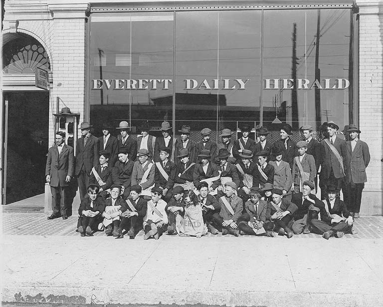
''The Everett Herald'' is a daily newspaper based in Everett, Washington, United States. It is owned by Sound Publishing, Inc. The paper serves residents of Snohomish County. History ''The Daily Herald'' was first published on February 11, 1901, by S. A. Perkins and S. E. Wharton. An earlier newspaper known as the ''Herald'' had been established in 1891 and ceased publication during the Panic of 1893. The second incarnation of the ''Herald'', originally named the ''Everett Independent'', was sold to James B. Best in 1905. The newspaper established a satellite news bureau for southern Snohomish County in May 1954, which later became the ''Western Sun'' edition in 1970. The ''Herald'' moved its offices and printing presses to a building on California Street in 1959. The Best family owned the newspaper until it was sold in 1978 to the Washington Post Company. On April 5, 1981, the ''Herald'' published its first Sunday edition and folded the ''Western Sun'' edition into the countyw ... [...More Info...] [...Related Items...] OR: [Wikipedia] [Google] [Baidu] |


