|
Warren County, Tennessee
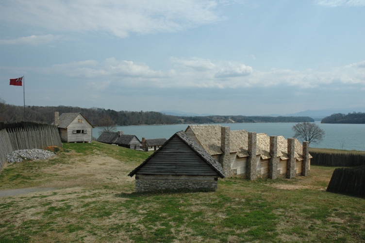
Warren County is a county located on the Cumberland Plateau in Middle Tennessee, one of the three Grand Divisions of the U.S. state of Tennessee. As of the 2010 census, the population was 39,839. Its county seat is McMinnville. Warren County comprises the McMinnville, TN Micropolitan Statistical Area. History Warren County was created in 1807 from a portion of White County, and named for Joseph Warren (1741–1775), a soldier in the American Revolution. The revised Tennessee State Constitution of 1834 stated that no new county could be within of the county seat of the county from which it was formed. The boundaries of five counties formed from Warren— Grundy, Van Buren, Cannon, Coffee and DeKalb— were exactly 12 miles from Warren's county seat, McMinnville, giving the county its distinctive round shape. Warren County was the site of several saltpeter mines. Saltpeter is the main ingredient of gunpowder and was obtained by leaching the earth from sev ... [...More Info...] [...Related Items...] OR: [Wikipedia] [Google] [Baidu] |
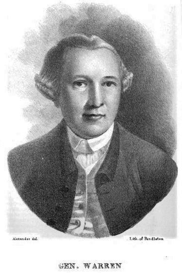
Joseph Warren
Joseph Warren (June 11, 1741 – June 17, 1775), a Founding Father of the United States, was an American physician who was one of the most important figures in the Patriot movement in Boston during the early days of the American Revolution, eventually serving as President of the revolutionary Massachusetts Provincial Congress. Warren enlisted Paul Revere and William Dawes on April 18, 1775, to leave Boston and spread the alarm that the British garrison in Boston was setting out to raid the town of Concord and arrest rebel leaders John Hancock and Samuel Adams. Warren participated in the Battles of Lexington and Concord the following day, the opening engagements of the American Revolutionary War. Warren had been commissioned a major general in the colony's militia shortly before the June 17, 1775 Battle of Bunker Hill. Rather than exercise his rank, Warren chose to participate in the battle as a private soldier, and was killed in combat when British troops stormed the redoubt ... [...More Info...] [...Related Items...] OR: [Wikipedia] [Google] [Baidu] |
John Houston Savage
John Houston Savage (October 9, 1815 – April 5, 1904) was an American politician and a member of the United States House of Representatives for the 4th congressional district of Tennessee. Biography Savage was born in McMinnville, Tennessee on October 9, 1815, son of George and Elizabeth Kenner Savage. He attended the common schools and served as a private in the Seminole War. He studied law, was admitted to the bar, and commenced practice in Smithville, Tennessee. Career After serving as a colonel of the state militia, Savage was the Attorney General of the fourth district of Tennessee from 1841 to 1847. He was commissioned as major of the 14th US Infantry in March 1847, and he was subsequently promoted to lieutenant colonel of the 1847-1848 11th Infantry Regiment (United States) in September of the same year. Savage was elected as a Democrat to the Thirty-first and Thirty-second Congresses, but he declined to be a candidate for re-election. He served from March 4, 1849 ... [...More Info...] [...Related Items...] OR: [Wikipedia] [Google] [Baidu] |
Tennessee 30
Tennessee ( , ), officially the State of Tennessee, is a landlocked U.S. state, state in the Southeastern United States, Southeastern region of the United States. Tennessee is the List of U.S. states and territories by area, 36th-largest by area and the List of U.S. states and territories by population, 15th-most populous of the List of U.S. states, 50 states. It is bordered by Kentucky to the north, Virginia to the northeast, North Carolina to the east, Georgia (U.S. state), Georgia, Alabama, and Mississippi to the south, Arkansas to the southwest, and Missouri to the northwest. Tennessee is geographically, culturally, and legally divided into three Grand Divisions of Tennessee, Grand Divisions of East Tennessee, East, Middle Tennessee, Middle, and West Tennessee. Nashville, Tennessee, Nashville is the state's capital and largest city, and anchors its largest metropolitan area. Other major cities include Memphis, Tennessee, Memphis, Knoxville, Tennessee, Knoxville, Chattanoog ... [...More Info...] [...Related Items...] OR: [Wikipedia] [Google] [Baidu] |
Tennessee State Route 8
State Route 8 (SR 8) is a north–south state highway in East and Middle Tennessee. It connects the cities of Chattanooga and McMinnville via Signal Mountain and Dunlap. Route description Hamilton County SR 8 begins in Hamilton County as the unsigned companion route to US 41/US 76 at the Georgia border in East Ridge, where they continue concurrent with Georgia State Route 3. As Ringgold Road, they head east and have an interchange with I-75 and go through downtown before passing through the Bachman Tubes and entering Chattanooga, where it becomes Westside Drive and having an interchange with I-24. They then come to an intersection and become concurrent with US 11/US 64/ SR 2 (E 23rd Street) and head north on Dodds Avenue. They pass through neighborhoods before US 41/US 76/SR 8 split from US 11/US 64/SR 2 (Dodds Avenue) and continue east along E Main Street. They then become concurrent with SR 17 (S Willow Street) before SR 8 splits off and heads north along Market ... [...More Info...] [...Related Items...] OR: [Wikipedia] [Google] [Baidu] |
Tennessee 8
Tennessee ( , ), officially the State of Tennessee, is a landlocked U.S. state, state in the Southeastern United States, Southeastern region of the United States. Tennessee is the List of U.S. states and territories by area, 36th-largest by area and the List of U.S. states and territories by population, 15th-most populous of the List of U.S. states, 50 states. It is bordered by Kentucky to the north, Virginia to the northeast, North Carolina to the east, Georgia (U.S. state), Georgia, Alabama, and Mississippi to the south, Arkansas to the southwest, and Missouri to the northwest. Tennessee is geographically, culturally, and legally divided into three Grand Divisions of Tennessee, Grand Divisions of East Tennessee, East, Middle Tennessee, Middle, and West Tennessee. Nashville, Tennessee, Nashville is the state's capital and largest city, and anchors its largest metropolitan area. Other major cities include Memphis, Tennessee, Memphis, Knoxville, Tennessee, Knoxville, Chattanoog ... [...More Info...] [...Related Items...] OR: [Wikipedia] [Google] [Baidu] |
US 70S
U.S. Route 70S (US 70S) is an alternative to U.S. Route 70 between the western part of Nashville and Sparta in Tennessee. It runs concurrent with US 70 for several blocks in downtown Nashville. The highway follows Murfreesboro Pike from Nashville to Murfreesboro then heads due east to McMinnville then northeast to Sparta where it ends at its junction with US 70. It was originally designated as U.S. Route 270 in 1926. Route description US 70S begins at a junction with US 70 and SR 24 as the Charlotte Pike, and runs concurrently with SR 1. The road descends to an interchange with I-40, before passing through the community of Bellevue and intersecting SR 251. After this, US 70S enters the urban Nashville area along Harding Pike, intersecting SR 100 and then crossing I-440 as West End Avenue. US 70S and SR 1 merge with US 431 and SR 106 and crosses the I-40 and I-65 freeway as Broadway. At that interchange, the one-way couplet of US 70 and SR 24 meets US 70S, and all these routes c ... [...More Info...] [...Related Items...] OR: [Wikipedia] [Google] [Baidu] |
Sequatchie County, Tennessee
Sequatchie County is a county located in the U.S. state of Tennessee. As of the 2020 census, the population was 15,826. Its county seat is Dunlap. Sequatchie County is part of the Chattanooga, TN– GA Metropolitan Statistical Area. History Sequatchie County was created in 1857 from two districts of Marion County and one district of Bledsoe County. It was named for the Sequatchie Valley, which in turn had been named for a Cherokee chief. The word ''sequachee'' from in Cherokee means 'opossum' or 'he grins.' Settlers began arriving in what is now Sequatchie by the early 19th century, drawn to the area by the fertile land in the valley. At the outset of the Civil War, Sequatchie was divided over the issue of secession. On June 8, 1861, Sequatchie Countians voted in favor of Tennessee's Ordinance of Secession by a vote 153 to 100. In October 1863, Confederate General Joseph Wheeler led a raid into Sequatchie, burning nearly a thousand wagons and capturing livestock. ... [...More Info...] [...Related Items...] OR: [Wikipedia] [Google] [Baidu] |
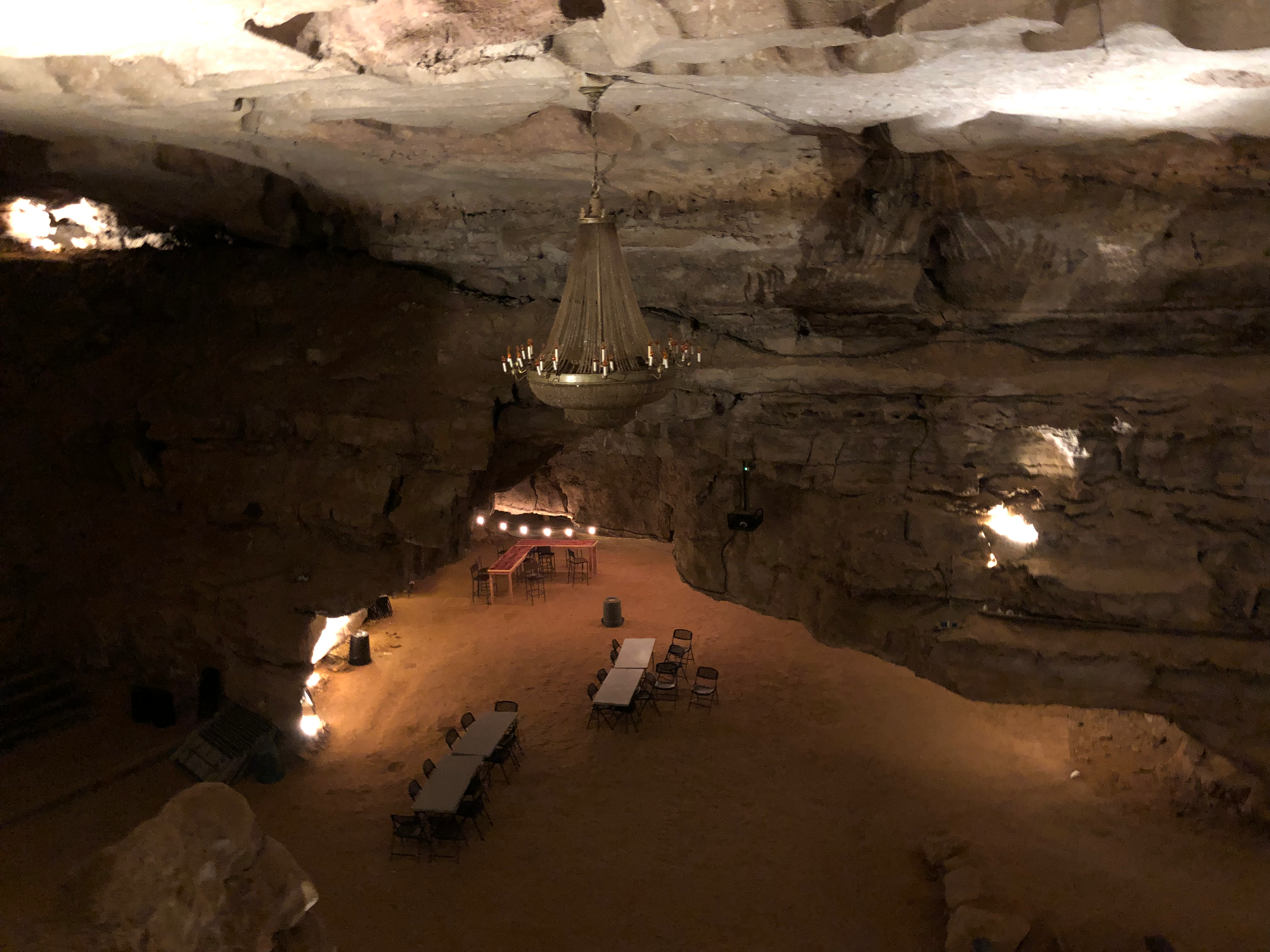
Cumberland Caverns
Cumberland Caverns is a national natural landmark and show cave located in McMinnville, Tennessee. It is the second longest cave in Tennessee and makes the list of longest caves in the United States and in the world. History The main entrance was discovered by Aaron Higgenbotham in 1810 while he was surveying the nearby Chickamauga Trail on Cardwell Mountain in what is now Warren County. According to legend, Higgenbotham was the first man to enter the cave and it was named Higgenbotham Cave in his honor. Another smaller cave, also located on Cardwell Mountain, was also discovered about this time and was named Henshaw Cave. Although not nearly as big as Higgenbotham Cave, Henshaw Cave proved to be a source of saltpeter (the main ingredient of gunpowder) and was operated as a saltpeter mine during perhaps both the War of 1812 and the Civil War. Higgenbotham Cave became a favorite spot for local adventurers during the 19th century and groups would ride out to the entrance in hay ... [...More Info...] [...Related Items...] OR: [Wikipedia] [Google] [Baidu] |
Cumberland Plateau
The Cumberland Plateau is the southern part of the Appalachian Plateau in the Appalachian Mountains of the United States. It includes much of eastern Kentucky and Tennessee, and portions of northern Alabama and northwest Georgia. The terms "Allegheny Plateau" and the "Cumberland Plateau" both refer to the dissected plateau lands lying west of the main Appalachian Mountains. The terms stem from historical usage rather than geological difference, so there is no strict dividing line between the two. Two major rivers share the names of the plateaus, with the Allegheny River rising in the Allegheny Plateau and the Cumberland River rising in the Cumberland Plateau in Harlan County, Kentucky. Geography The Cumberland Plateau is a deeply dissected plateau, with topographic relief commonly of about , and frequent sandstone outcroppings and bluffs. At Kentucky's Pottsville Escarpment, which is the transition from the Cumberland Plateau to the Bluegrass in the north and the Pennyril ... [...More Info...] [...Related Items...] OR: [Wikipedia] [Google] [Baidu] |
Barren Fork (Collins River)
The Barren Fork is a U.S. Geological Survey. National Hydrography Dataset high-resolution flowline dataThe National Map, accessed June 8, 2011 tributary of the Collins River in the U.S. state of Tennessee. Via the Collins River, the Caney Fork, and the Cumberland and Ohio rivers, it is part of the Mississippi River watershed. The Barren Fork rises in western Warren County, Tennessee. It is formed from the confluence of its north and south prongs, which join near the tiny community of Trousdale. Its component streams and their tributaries drain much of the eastern portions of Cannon County and Coffee County. The stream flows generally from west to east until it reaches the town of McMinnville, county seat of Warren County. From there it turns in a more northeasterly direction. From this point it is less than 5 linear miles (8 km) to the mouth of the Barren Fork into the Collins River, but considerably longer by the meandering course taken by the stream in its lower rea ... [...More Info...] [...Related Items...] OR: [Wikipedia] [Google] [Baidu] |
Collins River
The Collins River is a U.S. Geological Survey. National Hydrography Dataset high-resolution flowline dataThe National Map, accessed June 8, 2011 stream in the east-central portion of Middle Tennessee in the United States. It is a tributary of the Caney Fork, and is part of the Cumberland, Ohio and Mississippi watersheds. The river drains the scenic Savage Gulf area, located just below the river's source, and empties into Great Falls Lake at Rock Island State Park. The Collins River passes through Grundy and Warren counties. McMinnville, Altamont, Gruetli-Laager and Beersheba Springs are among the communities located within its watershed. The Savage Gulf section of the Collins River has been designated a "scenic river" by the State of Tennessee.Tennessee Department of Environment and ConservationScenic Rivers Program. Retrieved: 6 July 2013. Course The Collins River rises near the town of Palmer atop the Cumberland Plateau, where the Middle Prong Collins River (which de ... [...More Info...] [...Related Items...] OR: [Wikipedia] [Google] [Baidu] |
Rocky River (Tennessee)
The Rocky River is a U.S. Geological Survey. National Hydrography Dataset high-resolution flowline dataThe National Map accessed June 8, 2011 stream in the east-central portion of Middle Tennessee in the United States. It is a tributary of the Caney Fork River, and is part of the Cumberland, Ohio and Mississippi watersheds. The lower portion of the river is part of the reservoir created by Great Falls Dam, which is located near the river's confluence with the Caney Fork. Course The Rocky River rises on the slopes of Jakes Mountain, a summit north of the Cagle community atop the Cumberland Plateau in Sequatchie County. Just below its source, the stream enters its Studer Lake impoundment as it flows northward through a rugged area of abandoned surface mines. Beyond this lake, the river crosses into Van Buren County, where it continues northward through rugged hills.U.S. Geological Survey 1:24,000 topographical maps: Smartt Mountain, TN, Curtistown, TN, Welchland, TN, and Doyle ... [...More Info...] [...Related Items...] OR: [Wikipedia] [Google] [Baidu] |


