|
Warren County, Mississippi
Warren County is a county located in the U.S. state of Mississippi. As of the 2010 census, the population was 48,773. Its county seat is Vicksburg. Created by legislative act of December 22, 1809, Warren County is named for American Revolutionary War officer Joseph Warren. Part of the Mississippi Delta and the historic cotton culture, Warren County is included in the Vicksburg, MS Micropolitan Statistical Area, which is also included in the Jackson-Vicksburg- Brookhaven, MS Combined Statistical Area. Geography According to the U.S. Census Bureau, the county has a total area of , of which is land and (4.9%) is water. The county exists in two sections, connected only by a narrow 500ft wide section between Madison Parish, Louisiana and Issaquena County, Mississippi along the delta of the Yazoo River. This area was once along the Mississippi River, but has since become an oxbow lake and marsh and no roads traverse this strip of land. The community of Eagle Bend is in this ... [...More Info...] [...Related Items...] OR: [Wikipedia] [Google] [Baidu] |
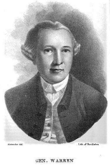
Joseph Warren
Joseph Warren (June 11, 1741 – June 17, 1775), a Founding Father of the United States, was an American physician who was one of the most important figures in the Patriot movement in Boston during the early days of the American Revolution, eventually serving as President of the revolutionary Massachusetts Provincial Congress. Warren enlisted Paul Revere and William Dawes on April 18, 1775, to leave Boston and spread the alarm that the British garrison in Boston was setting out to raid the town of Concord and arrest rebel leaders John Hancock and Samuel Adams. Warren participated in the Battles of Lexington and Concord the following day, the opening engagements of the American Revolutionary War. Warren had been commissioned a major general in the colony's militia shortly before the June 17, 1775 Battle of Bunker Hill. Rather than exercise his rank, Warren chose to participate in the battle as a private soldier, and was killed in combat when British troops stormed the redoubt ... [...More Info...] [...Related Items...] OR: [Wikipedia] [Google] [Baidu] |
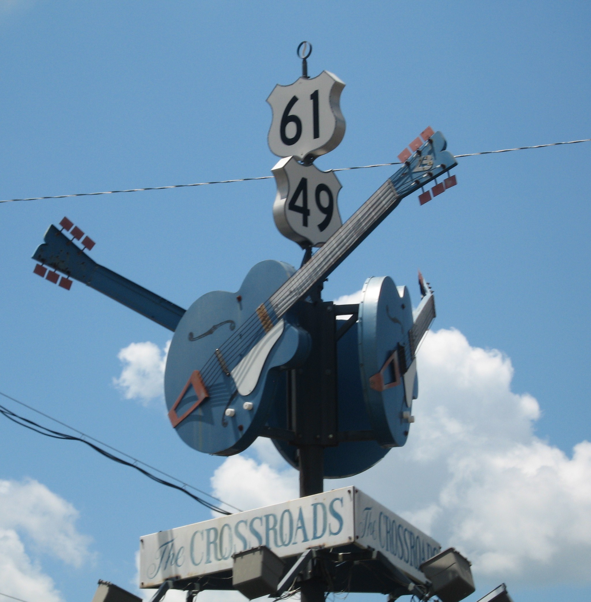
US 61
U.S. Route 61 or U.S. Highway 61 (U.S. 61) is a major United States highway that extends between New Orleans, Louisiana and the city of Wyoming, Minnesota. The highway generally follows the course of the Mississippi River and is designated the Great River Road for much of its route. As of 2004, the highway's northern terminus in Wyoming, Minnesota, is at an intersection with Interstate 35 (I-35). Until 1991, the highway extended north on what is now Minnesota State Highway 61 (MN 61) through Duluth to the Canada–U.S. border near Grand Portage. Its southern terminus in New Orleans is at an intersection with U.S. Route 90 (US 90). The route was an important south–north connection in the days before the interstate highway system. The highway is often called the Blues Highway because of its long history in blues music; Part of the route lies on the Mississippi Blues Trail and is denoted by markers in Vicksburg and Tunica. It is also the subject of numerous musical works, ... [...More Info...] [...Related Items...] OR: [Wikipedia] [Google] [Baidu] |
Vicksburg National Military Park
Vicksburg National Military Park preserves the site of the American Civil War Battle of Vicksburg, waged from March 29 to July 4, 1863. The park, located in Vicksburg, Mississippi (flanking the Mississippi River), also commemorates the greater Vicksburg Campaign which led up to the battle. Reconstructed forts and trenches evoke memories of the 47-day siege that ended in the surrender of the city. Victory here and at Port Hudson, farther south in Louisiana, gave the Union control of the Mississippi River. Battlefield The park includes 1,325 historic monuments and markers, of historic trenches and earthworks, a tour road, a walking trail, two antebellum homes, 144 emplaced cannons, the restored gunboat USS ''Cairo'' (sunk on December 12, 1862, on the Yazoo River), and the Grant's Canal site, where the Union Army attempted to build a canal to let their ships bypass Confederate artillery fire. The ''Cairo'', also known as the "Hardluck Ironclad," was the first U.S. ship in ... [...More Info...] [...Related Items...] OR: [Wikipedia] [Google] [Baidu] |
Theodore Roosevelt National Wildlife Refuge
Established in 2004, the Theodore Roosevelt National Wildlife Refuge is part of the Theodore Roosevelt National Wildlife Refuge Complex in Mississippi Mississippi () is a state in the Southeastern region of the United States, bordered to the north by Tennessee; to the east by Alabama; to the south by the Gulf of Mexico; to the southwest by Louisiana; and to the northwest by Arkansas. Miss .... Although the acquisition boundary for Theodore Roosevelt National Wildlife Refuge has been proposed near Onward, Mississippi, the land exchanges that are prerequisite have not yet been completed. Consequently, the refuge has not been opened for public use. ReferencesRefuge website {{authority control National Wildlife Refuges in Mississippi Protected areas established in 2004 Protected areas of Holmes County, Mississippi Protected areas of Humphreys County, Mississippi Protected areas of Leflore County, Mississippi Protected areas of Sharkey County, Mississippi Protec ... [...More Info...] [...Related Items...] OR: [Wikipedia] [Google] [Baidu] |
Madison Parish, Louisiana
Madison Parish (French language, French: ''Paroisse de Madison'') is a List of parishes in Louisiana, parish located on the northeastern border of the U.S. state of Louisiana, in the delta lowlands along the Mississippi River. As of the 2010 United States Census, 2010 census, the population was 12,093. Its parish seat is Tallulah, Louisiana, Tallulah. The parish was formed in 1839. With a history of cotton plantations and pecan farms, the parish economy continues to be primarily agricultural. It has a majority African-American population. For years a ferry connected Delta, Louisiana (and traffic from the parish) to Vicksburg, Mississippi. The Vicksburg Bridge now carries U.S. Route 80 and Interstate 20 across the river into Madison Parish. History Prehistory Madison Parish was the home to many succeeding Native Americans in the United States, Native American groups in the thousands of years before European settlement. Peoples of the Marksville culture, Troyville culture, Co ... [...More Info...] [...Related Items...] OR: [Wikipedia] [Google] [Baidu] |
Tensas Parish, Louisiana
Tensas Parish (french: Paroisse des Tensas) is a parish located in the northeastern section of the State of Louisiana; its eastern border is the Mississippi River. As of the 2010 census, the population was 5,252. It is the least populated parish in Louisiana. The parish seat is St. Joseph. The name ''Tensas'' is derived from the historic indigenous Taensa people. The parish was founded in 1843 following Indian Removal. The parish was developed for cotton agriculture, which dominated the economy through the early 20th century. There has also been some cattle ranching in the 1930s and timber extraction. History Pre-history Tensas Parish was the home to many successive indigenous groups in the thousands of years before European settlements began. Some village and mound sites once built by these various peoples are preserved today as archaeological sites. One example is the Flowery Mound, a rectangular platform mound just east of St. Joseph. It measures in height and by at ... [...More Info...] [...Related Items...] OR: [Wikipedia] [Google] [Baidu] |
Claiborne County, Mississippi
Claiborne County is a county located in the U.S. state of Mississippi. As of the 2020 census, the population was 9,135. Its county seat is Port Gibson. The county is named after William Claiborne, the second governor of the Mississippi Territory. Claiborne County is included in the Vicksburg, MS Micropolitan Statistical Area as well as the Jackson-Vicksburg- Brookhaven, MS Combined Statistical Area. It is bordered by the Mississippi River on the west and the Big Black River on the north. As of the 2020 Census, this small county has the highest percentage of black or African American residents of any U.S. county, at 88.6% of the population. Located just south of the area known as the Mississippi Delta, this area also was a center of cotton plantations and related agriculture along the river, supported by enslaved African Americans. After emancipation, many generations of African Americans have stayed here because of family ties and having made the land their own. Claiborne ... [...More Info...] [...Related Items...] OR: [Wikipedia] [Google] [Baidu] |
Hinds County, Mississippi
Hinds County is a county located in the U.S. state of Mississippi. With its county seats (Raymond and the state's capital, Jackson), Hinds is the most populous county in Mississippi with a 2020 census population of 227,742 residents. Hinds County is a central part of the Jackson metropolitan statistical area. It is a professional, educational, business and industrial hub in the state. It is bordered on the northwest by the Big Black River and on the east by the Pearl River. It is one county width away from the Yazoo River and the southern border of the Mississippi Delta. In the 19th century, the rural areas of the county were devoted to cotton plantations worked by enslaved African Americans and depended on agriculture well into the 20th century; from 1877 to 1950, this county had 22 lynchings, the highest number in the state. Mississippi has the highest total number of lynchings of any state. * Clinton Public School District * Hinds County School District (Raymond) * Jackso ... [...More Info...] [...Related Items...] OR: [Wikipedia] [Google] [Baidu] |
Yazoo County, Mississippi
Yazoo County is a county located in the U.S. state of Mississippi. As of the 2010 census, the population was 28,065. The county seat is Yazoo City. It is named for the Yazoo River, which forms its western border. Its name is said to come from a Choctaw language word meaning "River of Death." History The area which is now Yazoo County was acquired by the State of Mississippi from the Choctaw Indians in 1820. Yazoo County was established on January 21, 1823. It was the 19th county established in the State of Mississippi, and remains the largest in area. It was developed for cotton plantations, and the first had access to the major river. The first county seat was at Beatties Bluff. In 1829, the county seat was moved to Benton. In 1849 the county seat was moved again, to Yazoo City, where it remains. Yazoo County was a battlefield in 1863 and 1864 during the American Civil War. After the war, there was violence of whites against freedmen. Such violence continued after Reconstruct ... [...More Info...] [...Related Items...] OR: [Wikipedia] [Google] [Baidu] |
Issaquena County, Mississippi
Issaquena County is a county located in the U.S. state of Mississippi. As of the 2010 Census, its population was 1,406, making it the least populous county in the United States east of the Mississippi River. Its county seat is Mayersville. With a per-capita income of $18,598, Issaquena County is, by that measure, the poorest county in the United States. Issaquena County is located in the Mississippi Delta region. The Mississippi River flows along the entire western boundary of the county, and many of the earliest communities were river ports. The county's economy is chiefly based on agriculture, though a number of hunting camps are also located here and contribute to the economy. Mississippi's two most recent records for the heaviest alligator taken by a hunter have both been in Issaquena County, the latest in 2012 when a alligator was killed at a camp near Fitler. History "Issaquena" (''isi okhina'') is a Choctaw word meaning "Deer River"; it is the Indian name for D ... [...More Info...] [...Related Items...] OR: [Wikipedia] [Google] [Baidu] |
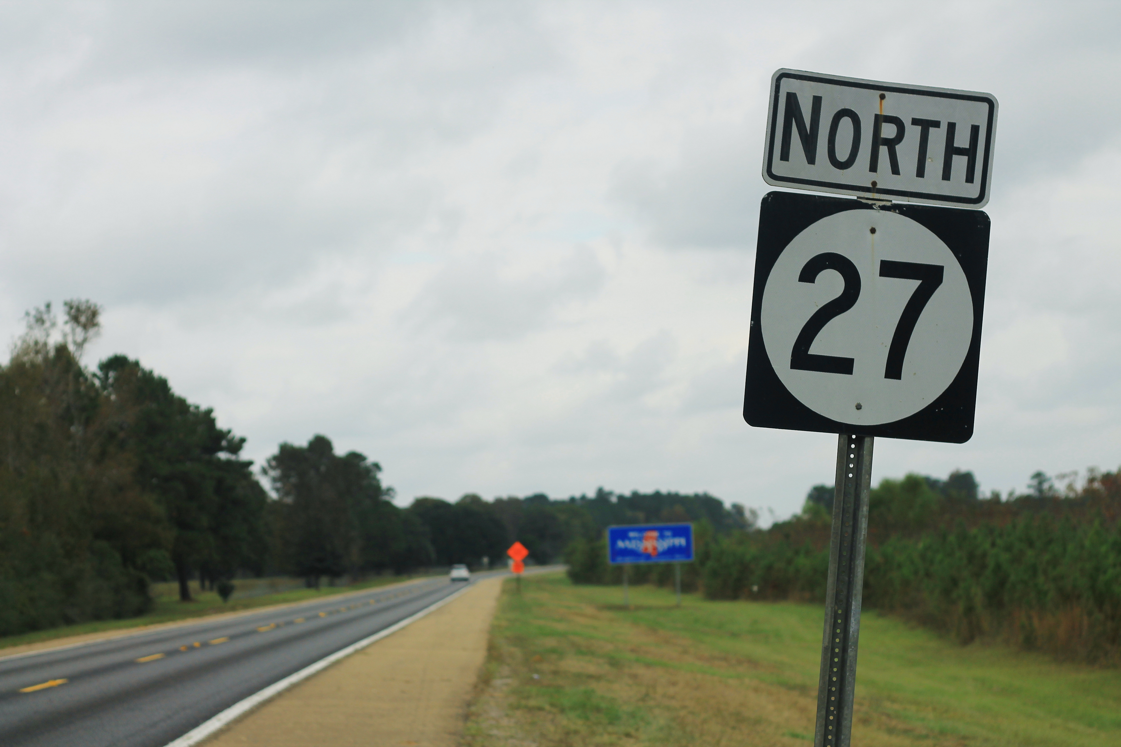
Mississippi Highway 27
Mississippi Highway 27 (MS 27) is a state highway in Mississippi. It runs from south to north for across the western and south-central parts of the state, serving 5 counties: Walthall, Lawrence, Copiah, Hinds, and Warren. The segment between Vicksburg and Crystal Springs is known vernacularly as the " Utica cutoff" because it facilitates a circumvention of Jackson for I-20 / I-55 traffic flowing between Vicksburg and Hammond. Route description MS 27 begins in Walthall County at the Louisiana state line along the banks of the Bogue Chitto River, with the road continuing south toward the town of Franklinton as Louisiana Highway 25 (LA 25). It heads northeast as a two-lane highway to pull away from the Bogue Chitto River as it travels through farmland for several miles, passing through the community of Lexie, before entering the Tylertown city limits. The highway enters town along Franklinton Street, passing by the city cemetery and through neighborhoods before enterin ... [...More Info...] [...Related Items...] OR: [Wikipedia] [Google] [Baidu] |
Circle Sign 27
A circle is a shape consisting of all points in a plane that are at a given distance from a given point, the centre. Equivalently, it is the curve traced out by a point that moves in a plane so that its distance from a given point is constant. The distance between any point of the circle and the centre is called the radius. Usually, the radius is required to be a positive number. A circle with r=0 (a single point) is a degenerate case. This article is about circles in Euclidean geometry, and, in particular, the Euclidean plane, except where otherwise noted. Specifically, a circle is a simple closed curve that divides the plane into two regions: an interior and an exterior. In everyday use, the term "circle" may be used interchangeably to refer to either the boundary of the figure, or to the whole figure including its interior; in strict technical usage, the circle is only the boundary and the whole figure is called a '' disc''. A circle may also be defined as a special ki ... [...More Info...] [...Related Items...] OR: [Wikipedia] [Google] [Baidu] |


.jpg)


