|
Warrego Valles
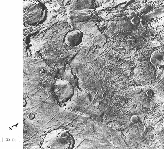
The Warrego Valles are a set of channels in an ancient river valley in the Thaumasia quadrangle of Mars, located at 42.2° south latitude and 93° west longitude. They are 188 km long and were named after a modern Australian River. Mariner 9 and Viking Orbiter images showed a network of branching valleys in Thaumasia called the Warrego Valles. These networks are evidence that Mars may have once been warmer, wetter, and perhaps had precipitation in the form of rain or snow. At first glance they resemble river valleys on Earth. But sharper images from more advanced cameras reveal that the valleys are not continuous. They are very old and may have been eroded. A picture below shows some of these branching valleys. A study with the Mars Orbiter Laser Altimeter, Thermal Emission Imaging System (THEMIS) and the Mars Orbiter Camera (MOC) support the idea that the Warrego Valles were formed from precipitation.Ansan, V and N. Mangold. 2006. New observations of Warrego Valles ... [...More Info...] [...Related Items...] OR: [Wikipedia] [Google] [Baidu] |
Channels Near Warrego In Thaumasia
Channel, channels, channeling, etc., may refer to: Geography * Channel (geography), in physical geography, a landform consisting of the outline (banks) of the path of a narrow body of water. Australia * Channel Country, region of outback Australia in Queensland and partly in South Australia, Northern Territory and New South Wales. * Channel Highway, a regional highway in Tasmania, Australia. Europe * Channel Islands, an archipelago in the English Channel, off the French coast of Normandy * Channel Tunnel or Chunnel, a rail tunnel underneath the English Channel * English Channel, called simply "The Channel", the part of the Atlantic Ocean that separates Great Britain from northern France North America * Channel Islands of California, a chain of eight islands located in the Pacific Ocean off the coast of Southern California, United States * Channel Lake, Illinois, a census-designated place in Lake County, Illinois, United States * Channels State Forest, a state forest in Vi ... [...More Info...] [...Related Items...] OR: [Wikipedia] [Google] [Baidu] |
Surface Runoff
Surface runoff (also known as overland flow) is the flow of water occurring on the ground surface when excess rainwater, stormwater, meltwater, or other sources, can no longer sufficiently rapidly infiltrate in the soil. This can occur when the soil is saturated by water to its full capacity, and the rain arrives more quickly than the soil can absorb it. Surface runoff often occurs because impervious areas (such as roofs and pavement) do not allow water to soak into the ground. Furthermore, runoff can occur either through natural or man-made processes. Surface runoff is a major component of the water cycle. It is the primary agent of soil erosion by water. The land area producing runoff that drains to a common point is called a drainage basin. Runoff that occurs on the ground surface before reaching a channel can be a nonpoint source of pollution, as it can carry man-made contaminants or natural forms of pollution (such as rotting leaves). Man-made contaminants in runoff i ... [...More Info...] [...Related Items...] OR: [Wikipedia] [Google] [Baidu] |
Vallis (planetary Geology)
''Vallis'' or ''valles'' (plural ''valles'' ) is the Latin word for ''valley''. It is used in planetary geology to name landform features on other planets. Scientists used ''vallis'' for old river valleys they discovered when they sent the first probes to Mars. The Viking Orbiters caused a revolution in our ideas about water on Mars; finding huge river valleys in many areas. Space craft cameras showed that floods of water broke through dams, carved deep valleys, eroded grooves into bedrock, and traveled thousands of kilometers. Some valles on Mars (Mangala Vallis, Athabasca Vallis, Granicus Vallis, and Tinjar Valles) clearly begin at graben. On the other hand, some of the large outflow channels begin in rubble-filled low areas, called chaos or chaotic terrain. It has been suggested that massive amounts of water were trapped under pressure beneath a thick cryosphere (layer of frozen ground), then the water was suddenly released, perhaps when the cryosphere was broken by a fault. ... [...More Info...] [...Related Items...] OR: [Wikipedia] [Google] [Baidu] |
Valley Network (Mars)
Valley networks are branching networks of valleys on Mars that superficially resemble terrestrial river drainage basins.Carr, M.H. (2006), The Surface of Mars. Cambridge Planetary Science Series, Cambridge University Press. They are found mainly incised into the terrain of the martian southern highlands, and are typically - though not always - of Noachian age (approximately four billion years old). The individual valleys are typically less than 5 kilometers wide, though they may extend for up to hundreds or even thousands of kilometers across the martian surface. The form, distribution, and implied evolution of the valley networks are of great importance for what they may tell us about the history of liquid water on the martian surface, and hence Mars' climate history. Some authors have argued that the properties of the networks demand that a hydrological cycle must have been active on ancient Mars,Craddock, R.A., and Howard, A.D. (2002), The case for rainfall on a warm, wet earl ... [...More Info...] [...Related Items...] OR: [Wikipedia] [Google] [Baidu] |
Outflow Channels
Outflow channels are extremely long, wide swathes of scoured ground on Mars. They extend many hundreds of kilometers in length and are typically greater than one kilometer in width. They are thought to have been carved by huge outburst floods. Crater counts indicate that most of the channels were cut since the early Hesperian, though the age of the features is variable between different regions of Mars. Some outflow channels in the Amazonis and Elysium Planitiae regions have yielded ages of only tens of million years, extremely young by the standards of Martian topographic features. The largest, Kasei Vallis, is around long, greater than wide and exceeds in depth cut into the surrounding plains. The outflow channels contrast with the Martian channel features known as " valley networks", which much more closely resemble the dendritic planform more typical of terrestrial river drainage basins. Outflow channels tend to be named after the names for Mars in various ancient world ... [...More Info...] [...Related Items...] OR: [Wikipedia] [Google] [Baidu] |
Lunae Palus Quadrangle
The Lunae Palus quadrangle is one of a series of 30 quadrangle maps of Mars used by the United States Geological Survey (USGS) Astrogeology Research Program. The quadrangle is also referred to as MC-10 (Mars Chart-10). Lunae Planum and parts of Xanthe Terra and Chryse Planitia are found in the Lunae Palus quadrangle. The Lunae Palus quadrangle contains many ancient river valleys. The quadrangle covers the area from 45° to 90° west longitude and 0° to 30° north latitude on Mars. The ''Viking 1'' Lander (part of Viking program) landed in the quadrangle on July 20, 1976, at . It was the first robot spacecraft to successfully land on the Red Planet. Results from ''Viking I'' mission What would it look like walking around the landing site The sky would be a light pink. The dirt would also appear pink. Rocks of many sizes would be spread about. One large rock, named Big Joe, is as big as a banquet table. Some boulders would show erosion due to the wind. There would be ... [...More Info...] [...Related Items...] OR: [Wikipedia] [Google] [Baidu] |
Geology Of Mars
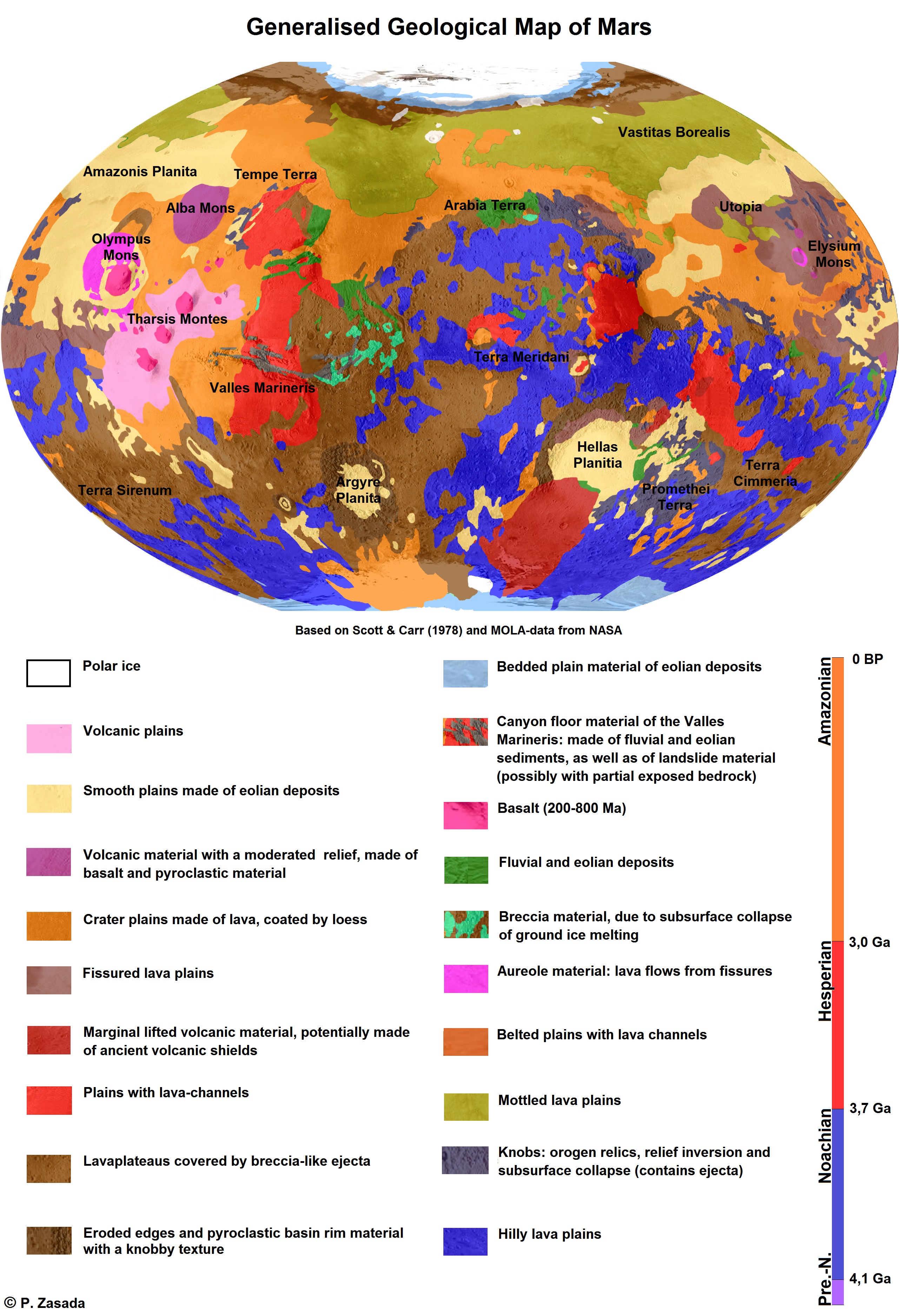
The geology of Mars is the scientific study of the surface, crust, and interior of the planet Mars. It emphasizes the composition, structure, history, and physical processes that shape the planet. It is analogous to the field of terrestrial geology. In planetary science, the term ''geology'' is used in its broadest sense to mean the study of the solid parts of planets and moons. The term incorporates aspects of geophysics, geochemistry, mineralogy, geodesy, and cartography. A neologism, areology, from the Greek word ''Arēs'' (Mars), sometimes appears as a synonym for Mars's geology in the popular media and works of science fiction (e.g. Kim Stanley Robinson, Kim Stanley Robinson's Mars trilogy). The term areology is also used by the Areological Society. Geological map of Mars (2014) File:Geologic Map of Mars figure2.pdf, Figure 2 for the geologic map of Mars Global Martian topography and large-scale features Composition of Mars Mars is a terrestrial planet, whic ... [...More Info...] [...Related Items...] OR: [Wikipedia] [Google] [Baidu] |
Climate On Mars
The climate of Mars has been a topic of scientific curiosity for centuries, in part because it is the only terrestrial planet whose surface can be directly observed in detail from the Earth with help from a telescope. Although Mars is smaller than the Earth, 11% of Earth's mass, and 50% farther from the Sun than the Earth, its climate has important similarities, such as the presence of polar ice caps, seasonal changes and observable weather patterns. It has attracted sustained study from planetologists and climatologists. While Mars' climate has similarities to Earth's, including periodic ice ages, there are also important differences, such as much lower thermal inertia. Mars' atmosphere has a scale height of approximately , 60% greater than that on Earth. The climate is of considerable relevance to the question of whether life is or ever has been present on the planet. The climate briefly received more interest in the news due to NASA measurements indicating increased sublima ... [...More Info...] [...Related Items...] OR: [Wikipedia] [Google] [Baidu] |
Mars Orbiter Camera
The Mars Orbiter Camera and Mars Observer Camera (MOC) were scientific instruments on board the Mars Observer and Mars Global Surveyor spacecraft. The camera was built by Malin Space Science Systems (MSSS) for NASA and the cost of the whole MOC scientific investigation project was about US$44 million, higher than anticipated in the budget. Design Originally named Mars Observer Camera, it was selected by NASA in 1986 for the Mars Observer mission, but it returned only three images of planet Mars before the loss of the spacecraft in 1993. A second camera of the same specifications, renamed to Mars Orbiter Camera (MOC), was built (with assistance by California Institute of Technology) and launched on board the Mars Global Surveyor (MGS) spacecraft in 1996. The camera returned 243,668 images while in orbit around Mars, before the loss of the MGS spacecraft in 2006. Mars Orbiter Camera was operated by its manufacturer, Malin Space Science Systems, from its facilities in San Diego, ... [...More Info...] [...Related Items...] OR: [Wikipedia] [Google] [Baidu] |
THEMIS
In Greek mythology and Ancient Greek religion, religion, Themis (; grc, Θέμις, Themis, justice, law, custom) is one of the twelve Titans, Titan children of Gaia and Uranus (mythology), Uranus, and the second wife of Zeus. She is the goddess and personification of justice, divine order, fairness, law, and custom, and her symbols include the Scales of Justice (symbol), Scales of Justice. She is also associated with oracles and prophecies, including the Pythia, Oracle of Delphi. Name ''Themis'' means "divine law" rather than human ordinance, literally "that which is put in place", from the Greek verb ''títhēmi'' (wikt:τίθημι, τίθημι), meaning "to put." To the ancient Greeks she was originally the organizer of the "communal affairs of humans, particularly assemblies." Moses Finley remarked of ''themis'', as the word was used by Homer in the 8th century BCE, to evoke the social order of the 10th- and 9th-century Greek Dark Ages: Finley adds, "There was ''them ... [...More Info...] [...Related Items...] OR: [Wikipedia] [Google] [Baidu] |
Thermal Emission Imaging System
The Thermal Emission Imaging System (THEMIS) is a camera on board the 2001 Mars Odyssey orbiter. It images Mars in the visible and infrared parts of the electromagnetic spectrum in order to determine the thermal properties of the surface and to refine the distribution of minerals on the surface of Mars as determined by the Thermal Emission Spectrometer (TES). Additionally, it helps scientists to understand how the mineralogy of Mars relates to its landforms, and it can be used to search for thermal hotspots in the Martian subsurface. THEMIS is managed from the Mars Space Flight Facility at Arizona State University and was built by the Santa Barbara Remote Sensing division of Raytheon Technologies Corporation, an American multinational conglomerate headquartered in Waltham, Massachusetts. The instrument is named after Themis, the goddess of justice in ancient Greek mythology. Infrared camera THEMIS detects thermal infrared energy emitted by the Martian surface at nine di ... [...More Info...] [...Related Items...] OR: [Wikipedia] [Google] [Baidu] |
Mars Orbiter Laser Altimeter
260px, MOLA topographic images of the two hemispheres of Mars. This image appeared on the cover of ''Science'' magazine in May 1999. The Mars Orbiter Laser Altimeter (MOLA) was one of five instruments on the ''Mars Global Surveyor'' (MGS) spacecraft, which operated in Mars orbit from September 1997 to November 2006. However, the MOLA instrument transmitted altimetry data only until June 2001. The MOLA instrument transmitted infrared laser pulses towards Mars at a rate of 10 times per second, and measured the time of flight to determine the range (distance) of the MGS spacecraft to the Martian surface. The range measurements resulted in precise topographic maps of Mars. The precision maps are applicable to studies in geophysics, geology and atmospheric circulation. MOLA also functioned as a passive radiometer, and measured the radiance of the surface of Mars at 1064 nanometers. Planetary laser altimetry A laser altimeter is an instrument that measures the distance from an orbiti ... [...More Info...] [...Related Items...] OR: [Wikipedia] [Google] [Baidu] |


